



Forecast, guides, bait and the best times today

Fishing Lake Sakakawea

Lake Sakakawea holds smallmouth bass, walleye, rainbow trout and northern pike, among 14 fish species on record. We list 1 bait shop near the lake and 95 boat ramps to launch from. Today's fishing outlook is good. It is spawning season for cisco. The water is about 41°F (satellite, Nov 16). Lake Sakakawea is at 1,824.12 ft, up 0.4 ft this week and 14.0 ft below normal for the date.

Fish in Lake Sakakawea

Game fish

  • Smallmouth Bass
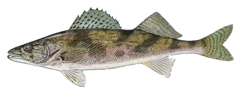
  • Walleye
  • Rainbow Trout
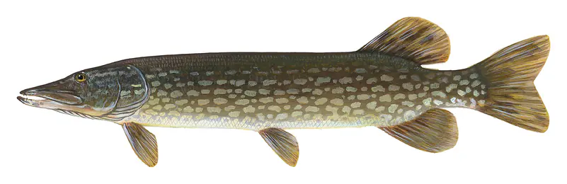
  • Northern Pike
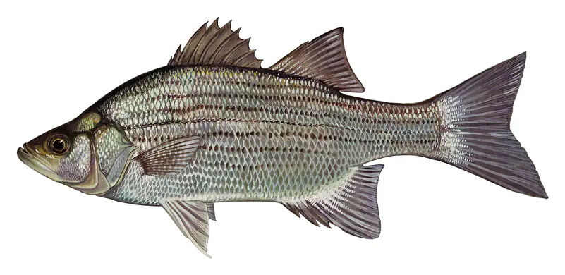
  • White Bass
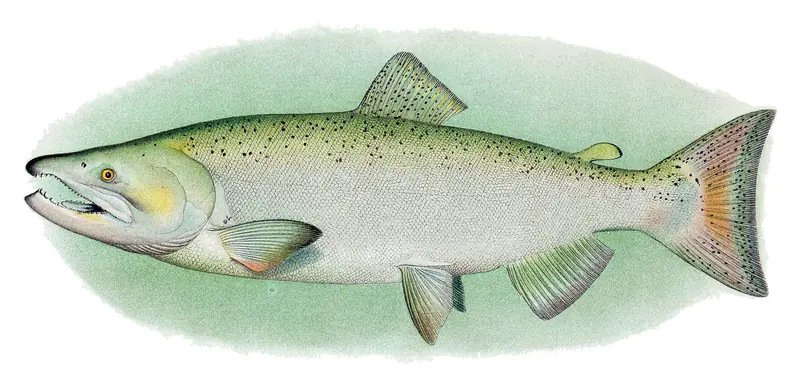
  • Chinook Salmon
  • Sauger
  • Bluegill
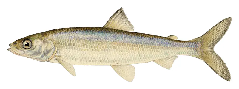
  • Cisco
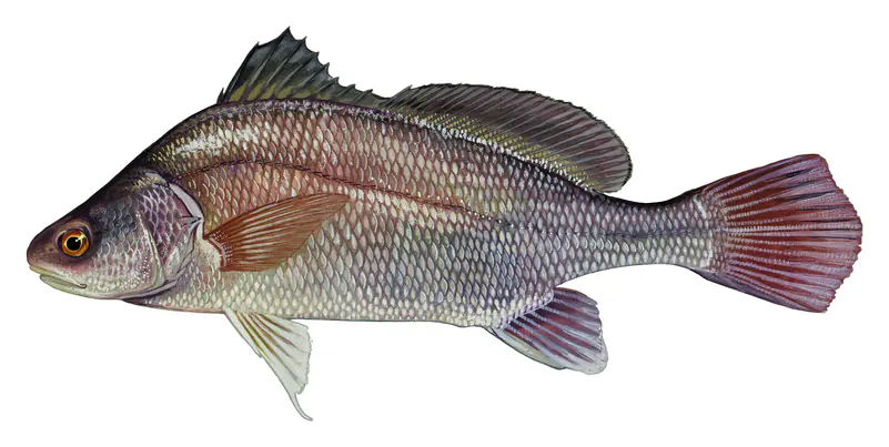
  • Freshwater Drum
  • Common Carp

Other fish recorded

  • Goldeye
  • Black Buffalo
  • Spottail Shiner

Species with open-licensed records inside Lake Sakakawea's outline, from GBIF.org (surveys, museum collections and angler reports). A record shows a fish was found here, not how many there are now.

When the fish spawn at Lake Sakakawea

  1. Smallmouth Bass 58–65°F · May–Jun

    Rocky points, gravel and current breaks; deeper rock piles in summer.

  2. Walleye 42–50°F · Apr–May

    Rocky shorelines at night after ice-out; deep weed edges and humps in summer.

  3. Rainbow Trout 50–60°F · Mar–Jun

    Cool water: near the surface in spring and fall, deep in summer.

  4. Northern Pike 36–48°F · Apr–May

    Shallow, weedy bays right after ice-out; weed edges the rest of the year.

  5. White Bass 54–64°F · Apr–May

    Spring runs up the tributaries; schools busting shad in late summer.

  6. Chinook Salmon 42–55°F · Sep–Oct

    Deep, cold water; fall runs toward the tributaries.

  7. Sauger 40–50°F · Apr–May

    Tailwaters below the dam in late fall and winter.

  8. Bluegill 67–80°F · Jun–Jul

    Beds in shallow, firm bottoms; around docks and weeds all summer.

  9. Cisco 34–43°F · Nov–Dec Spawning season

    Cold water below the thermocline in summer; shallow rocky shoals as ice forms.

  10. Freshwater Drum 65–75°F · May–Jul

    Soft-bottomed flats and deep holes; nightcrawlers or jigs right on the bottom.

Water temperature sets off each spawn; the bars show the usual months at this latitude and elevation, and move with a warm or cold spring. The water is about 41°F now.

7-day fishing forecast

  1. TodayNov 19 Waxing Gibbous 7:16–9:16 AM · 7:38–9:38 PM Good
  2. FriNov 20 Waxing Gibbous 8–10 AM · 8:23–10:23 PM Good
  3. SatNov 21 Waxing Gibbous 8:47–10:47 AM · 9:12–11:12 PM Very good
  4. SunNov 22 Waxing Gibbous 9:38–11:38 AM · 10:06 PM–12:06 AM Very good
  5. MonNov 23 Waxing Gibbous 10:35 AM–12:35 PM Excellent
  6. TueNov 24 Full Moon 11:05 PM–1:05 AM · 11:37 AM–1:37 PM Excellent
  7. WedNov 25 Waning Gibbous 12:10–2:10 AM · 12:43–2:43 PM Excellent

Outlook for Lake Sakakawea: the solunar rating of each day (best around the new and full moon), moved up for a light chop or clouds and down for strong wind, rain or storms (National Weather Service forecast). Major periods are the two hours around the moon overhead and underfoot, local time. How solunar times work

Sun, moon & fishing times

Sun

Sunrise
7:56 AM
Sunset
5:05 PM
First light
7:22 AM
Last light
5:39 PM

Moon

Waxing Gibbous
72% lit
Moonrise
2:26 PM
Moonset
1:51 AM

Fishing times

Good day

  • Minor 1:21 AM – 2:21 AM
  • Major 7:16 AM – 9:16 AM
  • Minor 1:56 PM – 2:56 PM
  • Major 7:38 PM – 9:38 PM

Solunar periods for Lake Sakakawea, local time. How they work

Weather on the lake

Loading the forecast for Lake Sakakawea…
Scott's Bait & Tackle · Bait & tackle Beaver Creek Northwest (low water) · Boat ramp Charging Eagle (low water) · Boat ramp Deepwater Creek · Boat ramp Deepwater Creek (2nd low water) · Boat ramp Deepwater Creek (low water) · Boat ramp Douglas Creek (Ziegler's) · Boat ramp Douglas Creek (low water) · Boat ramp Douglas Creek (north) · Boat ramp Fort Stevenson (low water) · Boat ramp Four Bears Park (low water plank & pcp south) · Boat ramp Four Bears Park (west main ramp) · Boat ramp Government Bay (low water) · Boat ramp Hale Marina (low water) · Boat ramp Hazen Bay (low water) · Boat ramp Hazen Bay East (walleye bay) · Boat ramp Indian Hills (low water) · Boat ramp Little Field Bay · Boat ramp Lund's Landing (1st low water) · Boat ramp Lund's Landing (2nd low water) · Boat ramp Lund's Landing (3rd low water) · Boat ramp Lunds Landing (Main East) · Boat ramp New Town Marina (low water) · Boat ramp Parshall Bay (low water) · Boat ramp Parshall Bay (west primative) · Boat ramp Pouch Point (2nd low water) · Boat ramp Red Butte · Boat ramp Reunion Bay · Boat ramp Reunion Bay (2nd low water) · Boat ramp Sakakawea State Park · Boat ramp Sakakawea State Park (Rodeo Bay) · Boat ramp Sakakawea State Park (low water) · Boat ramp Sanish Bay · Boat ramp Sportsman Center (high water) · Boat ramp Sportsman Center (low water) · Boat ramp Steinke Bay (2nd low water) · Boat ramp Steinke Bay (low water) · Boat ramp Tobacco Garden (2nd low water) · Boat ramp Van Hook (Gull Island low water) · Boat ramp Van Hook (east) · Boat ramp Van Hook (north main) · Boat ramp Van Hook (south main) · Boat ramp Van Hook (west 1st low water) · Boat ramp Van Hook (west 2nd low water) · Boat ramp West Totten · Boat ramp White Earth Bay (low water) · Boat ramp Wolf Creek (Coleharbor) · Boat ramp Wolf Creek (rec area low water) · Boat ramp McKenzie Bay (west main ramp) · Boat ramp Douglas Creek (south) · Boat ramp Pouch Point (3rd low water) · Boat ramp Sanish Bay (Aftems) (Low Water) · Boat ramp Beaver Creek · Boat ramp Spring Creek Cabin Site · Boat ramp Wolf Creek (old) · Boat ramp Hazen Bay · Boat ramp Parshall Bay (west) · Boat ramp New Town Marina · Boat ramp Dakota Waters · Boat ramp Wolf Creek (new) · Boat ramp Beulah Bay · Boat ramp Fort Stevenson (marina ramp) · Boat ramp Four Bears Park (low water plank north) · Boat ramp Camp of the Cross · Boat ramp Lewis & Clark State Park · Boat ramp Steinke Bay · Boat ramp Government Bay · Boat ramp Lund's Landing (main ramp west) · Boat ramp Deepwater Creek (G & F) · Boat ramp Skunk Creek (old) · Boat ramp Garrison Creek (Cabin Site) · Boat ramp Lewis & Clark State Park (low water) · Boat ramp Tobacco Garden · Boat ramp Pouch Point · Boat ramp Charging Eagle · Boat ramp White Earth Bay · Boat ramp Skunk Creek (south ramp) · Boat ramp Little Beaver (main lake) · Boat ramp Parshall Bay (east) · Boat ramp Indian Hills · Boat ramp Four Bears Park (east main ramp) · Boat ramp McKenzie Bay (east ramp) · Boat ramp Little Beaver (mid-bay) · Boat ramp East Totten · Boat ramp Little Beaver · Boat ramp American Legion · Boat ramp Little Missouri East (2nd low water) · Boat ramp Little Missouri Southwest (1st low water) · Boat ramp Little Muddy (Thompsons Landing) · Boat ramp Lewis & Clark Bridge · Boat ramp Boat ramp #1 · Boat ramp Boat ramp #2 · Boat ramp Boat ramp #3 · Boat ramp Boat ramp #4 · Boat ramp Boat ramp #5 · Boat ramp Boat ramp #6 · Boat ramp 25 mi N

Tap a dot for details. Map and lake outline © OpenStreetMap contributors. Places from OpenStreetMap, Overture Maps and Recreation.gov. Not for navigation.

Boat ramps95

  • Beaver Creek Northwest (low water) On the shore
  • Charging Eagle (low water) On the shore
  • Deepwater Creek On the shore
  • Deepwater Creek (2nd low water) On the shore
  • Deepwater Creek (low water) On the shore
  • Douglas Creek (Ziegler's) On the shore
  • Douglas Creek (low water) On the shore
  • Douglas Creek (north) On the shore
  • Fort Stevenson (low water) On the shore
  • Four Bears Park (low water plank & pcp south) On the shore
  • Four Bears Park (west main ramp) On the shore
  • Government Bay (low water) On the shore
  • Hale Marina (low water) On the shore
  • Hazen Bay (low water) On the shore
  • Hazen Bay East (walleye bay) On the shore
  • Indian Hills (low water) On the shore
  • Little Field Bay On the shore
  • Lund's Landing (1st low water) On the shore
  • Lund's Landing (2nd low water) On the shore
  • Lund's Landing (3rd low water) On the shore
  • Lunds Landing (Main East) On the shore
  • New Town Marina (low water) On the shore
  • Parshall Bay (low water) On the shore
  • Parshall Bay (west primative) On the shore
  • Pouch Point (2nd low water) On the shore
  • Red Butte On the shore
  • Reunion Bay On the shore
  • Reunion Bay (2nd low water) On the shore
  • Sakakawea State Park On the shore
  • Sakakawea State Park (Rodeo Bay) On the shore
  • Sakakawea State Park (low water) On the shore
  • Sanish Bay On the shore
  • Sportsman Center (high water) On the shore
  • Sportsman Center (low water) On the shore
  • Steinke Bay (2nd low water) On the shore
  • Steinke Bay (low water) On the shore
  • Tobacco Garden (2nd low water) On the shore
  • Van Hook (Gull Island low water) On the shore
  • Van Hook (east) On the shore
  • Van Hook (north main) On the shore
  • Van Hook (south main) On the shore
  • Van Hook (west 1st low water) On the shore
  • Van Hook (west 2nd low water) On the shore
  • West Totten On the shore
  • White Earth Bay (low water) On the shore
  • Wolf Creek (Coleharbor) On the shore
  • Wolf Creek (rec area low water) On the shore
  • McKenzie Bay (west main ramp) On the shore
  • Douglas Creek (south) On the shore
  • Pouch Point (3rd low water) On the shore
  • Sanish Bay (Aftems) (Low Water) On the shore
  • Beaver Creek On the shore
  • Spring Creek Cabin Site On the shore
  • Wolf Creek (old) On the shore
  • Hazen Bay On the shore
  • Parshall Bay (west) On the shore
  • New Town Marina On the shore
  • Dakota Waters On the shore
  • Wolf Creek (new) On the shore
  • Beulah Bay On the shore
  • Fort Stevenson (marina ramp) 105 ft from the water
  • Four Bears Park (low water plank north) 112 ft from the water
  • Camp of the Cross 128 ft from the water
  • Lewis & Clark State Park 131 ft from the water
  • Steinke Bay 131 ft from the water
  • Government Bay 141 ft from the water
  • Lund's Landing (main ramp west) 141 ft from the water
  • Deepwater Creek (G & F) 144 ft from the water
  • Skunk Creek (old) 148 ft from the water
  • Garrison Creek (Cabin Site) 171 ft from the water
  • Lewis & Clark State Park (low water) 171 ft from the water
  • Tobacco Garden 177 ft from the water
  • Pouch Point 180 ft from the water
  • Charging Eagle 200 ft from the water
  • White Earth Bay 203 ft from the water
  • Skunk Creek (south ramp) 210 ft from the water
  • Little Beaver (main lake) 230 ft from the water
  • Parshall Bay (east) 259 ft from the water
  • Indian Hills 269 ft from the water
  • Four Bears Park (east main ramp) 308 ft from the water
  • McKenzie Bay (east ramp) 345 ft from the water
  • Little Beaver (mid-bay) 0.1 mi from the water
  • East Totten 0.3 mi from the water
  • Little Beaver 0.4 mi from the water
  • American Legion 1.6 mi from the water
  • Little Missouri East (2nd low water) 1.9 mi from the water
  • Little Missouri Southwest (1st low water) 2.2 mi from the water
  • Little Muddy (Thompsons Landing) 8.2 mi from the water
  • Lewis & Clark Bridge 8.3 mi from the water
  • Boat ramp #1 On the shore
  • Boat ramp #2 On the shore
  • Boat ramp #3 On the shore
  • Boat ramp #4 On the shore
  • Boat ramp #5 On the shore
  • Boat ramp #6 184 ft from the water

Bait & tackle shops1

Listings come from OpenStreetMap and Overture Maps and can be out of date. Call ahead, and check posted signs and the lake's operator before you go. Report a wrong or missing place.

Questions

What is the fishing forecast for Lake Sakakawea this week?

By the moon, the best day this week is Mon, Nov 23 (waxing gibbous, excellent). The table on this page adds the National Weather Service forecast for each day: a light chop and clouds help, strong wind, rain and storms hurt. The water is about 41°F.

Is today a good day to fish Lake Sakakawea?

Today's solunar rating at Lake Sakakawea is good (2 of 4), from the moon phase and the times the moon rises, sets and crosses overhead. The best windows are listed on this page. Lake Sakakawea is at 1,824.12 ft, up 0.4 ft this week and 14.0 ft below normal for the date. Wind, fronts and water temperature matter as much: check the forecast.

When do the fish spawn at Lake Sakakawea?

Smallmouth Bass spawn at 58–65°F water, usually May–Jun here; Walleye spawn at 42–50°F water, usually Apr–May here; Rainbow Trout spawn at 50–60°F water, usually Mar–Jun here; Northern Pike spawn at 36–48°F water, usually Apr–May here. A warm or cold spring moves those dates by a few weeks.

Where can I buy bait near Lake Sakakawea?

The closest bait and tackle shops are Scott's Bait & Tackle (Pick City). Call ahead for live bait.

Is there a depth map of Lake Sakakawea for fishing?

Yes: the North Dakota Game and Fish Department publishes lake overview map with depth shading (poster) (2022), a PDF, linked at the top of this page. Depths are measured at a reference level, so subtract how far the lake is below it today.

Do I need a fishing license for Lake Sakakawea?

Anglers 16 and older need a North Dakota fishing license, sold online by the North Dakota Game and Fish Department. Free fishing days: Residents only: first weekend in June and December 26-27. Size and bag limits can be set lake by lake: check the current regulations.