



Forecast, guides, bait and the best times today

Fishing Watts Bar Lake

Watts Bar Lake holds spotted bass, bluegill, smallmouth bass and striped bass, among 40 fish species on record. We list 4 bait shops near the lake and 68 boat ramps to launch from. Today's fishing outlook is good. The water is about 59°F (satellite, Nov 14). Watts Bar Lake is at 737.87 ft, down 1.4 ft this week and 3.1 ft below full pool.

Fish in Watts Bar Lake

Game fish

  • Spotted Bass
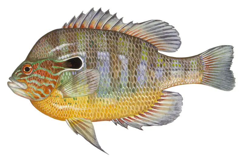
  • Bluegill
  • Smallmouth Bass
  • Striped Bass
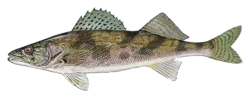
  • Sauger
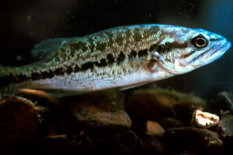
  • Largemouth Bass
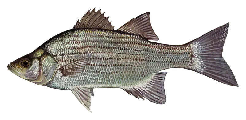
  • White Bass
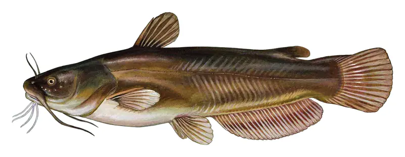
  • Yellow Bullhead
  • Longear Sunfish
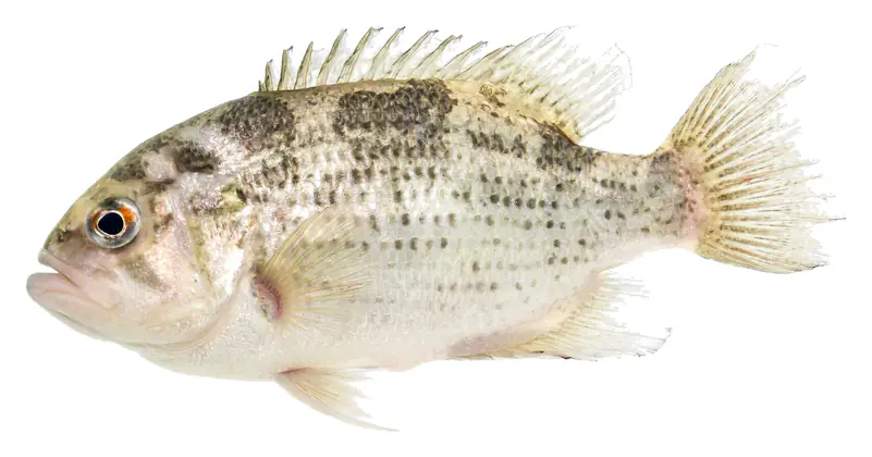
  • Rock Bass
  • Redbreast Sunfish
  • Green Sunfish
  • Yellow Bass

Other fish recorded

  • Striped Shiner
  • Creek Chub
  • Central Stoneroller
  • Banded Sculpin
  • Blacknose Dace
  • Black Darter
  • Golden Redhorse
  • Northern Hog Sucker
  • Bigeye Chub
  • Mississippi Silvery Minnow
  • Emerald Shiner
  • Telescope Shiner
  • River Chub
  • Greenside Darter
  • Spotfin Shiner
  • White Sucker
  • Bluntnose Minnow
  • Mimic Shiner
  • Warpaint Shiner
  • Redline Darter
  • Blueside Darter
  • Blackspotted Topminnow
  • Northern Studfish
  • Western Mosquitofish
  • Silver Redhorse
  • Flame Chub
  • Rainbow Darter

Species with open-licensed records inside Watts Bar Lake's outline, from GBIF.org (surveys, museum collections and angler reports). A record shows a fish was found here, not how many there are now.

When the fish spawn at Watts Bar Lake

  1. Largemouth Bass 60–75°F · Apr–May

    Shallow, protected flats in spring; docks, grass and deep edges in summer heat.

  2. Smallmouth Bass 58–65°F · Apr–May

    Rocky points, gravel and current breaks; deeper rock piles in summer.

  3. Striped Bass 60–68°F · Apr–May

    Run up the river arms in spring; follow shad to cool, deep water near the dam in summer.

  4. Spotted Bass 58–66°F · Apr–May

    Clear water and steep rock; they often suspend deeper than largemouth.

  5. White Bass 54–64°F · Mar–Apr

    Spring runs up the tributaries; schools busting shad in late summer.

  6. Sauger 40–50°F · Mar–Apr

    Tailwaters below the dam in late fall and winter.

  7. Bluegill 67–80°F · May–Jul

    Beds in shallow, firm bottoms; around docks and weeds all summer.

  8. Yellow Bullhead 70–78°F · May–Jun

    Clear, weedy shallows and quiet creek arms; worms or cut bait on the bottom at dusk.

  9. Longear Sunfish 70–82°F · May–Aug

    Clear water over gravel near weeds; creek arms and coves, nests in colonies in summer.

  10. Rock Bass 60–72°F · Apr–Jun

    Rocky shorelines, boulders and docks; the same cover smallmouth bass use.

Water temperature sets off each spawn; the bars show the usual months at this latitude and elevation, and move with a warm or cold spring. The water is about 59°F now.

7-day fishing forecast

  1. TodayNov 19 Waxing Gibbous 7:07–9:07 AM · 7:29–9:29 PM Good
  2. FriNov 20 Waxing Gibbous 7:51–9:51 AM · 8:14–10:14 PM Good
  3. SatNov 21 Waxing Gibbous 8:38–10:38 AM · 9:03–11:03 PM Very good
  4. SunNov 22 Waxing Gibbous 9:29–11:29 AM · 9:57–11:57 PM Very good
  5. MonNov 23 Waxing Gibbous 10:26 AM–12:26 PM · 10:56 PM–12:56 AM Excellent
  6. TueNov 24 Full Moon 11:28 AM–1:28 PM Excellent
  7. WedNov 25 Waning Gibbous 12–2 AM · 12:34–2:34 PM Excellent

Outlook for Watts Bar Lake: the solunar rating of each day (best around the new and full moon), moved up for a light chop or clouds and down for strong wind, rain or storms (National Weather Service forecast). Major periods are the two hours around the moon overhead and underfoot, local time. How solunar times work

Sun, moon & fishing times

Sun

Sunrise
7:18 AM
Sunset
5:29 PM
First light
6:51 AM
Last light
5:57 PM

Moon

Waxing Gibbous
72% lit
Moonrise
2:19 PM
Moonset
1:47 AM

Fishing times

Good day

  • Minor 1:17 AM – 2:17 AM
  • Major 7:07 AM – 9:07 AM
  • Minor 1:49 PM – 2:49 PM
  • Major 7:29 PM – 9:29 PM

Solunar periods for Watts Bar Lake, local time. How they work

Weather on the lake

Loading the forecast for Watts Bar Lake…
Big Fish Outfitters · Bait & tackle M&M Marine · Bait & tackle Pure Poison Jigs · Bait & tackle The Bait Shack · Bait & tackle Bell Cove · Boat ramp Big Springs · Boat ramp Blue Springs Marina · Boat ramp Boat ramp at Campground on the Lakeshore · Boat ramp Boat ramp at Long Island Marina · Boat ramp Boat ramp at Rhea Harbor Inc · Boat ramp Boat ramp at Shelter Cove Marina and Campground · Boat ramp Browns Chapel · Boat ramp Bussell Ferry · Boat ramp Kingston City Park · Boat ramp Kingston Steam Plant · Boat ramp Lakeview · Boat ramp Little Emory · Boat ramp Melton Hill Dam (Downstream) · Boat ramp Rector Branch · Boat ramp Riley Creek · Boat ramp Rockwood Beach · Boat ramp Shady Grove · Boat ramp Spring City Boat Dock · Boat ramp The Landing · Boat ramp Tom Fuller Ramp · Boat ramp Watts Bar Dam · Boat ramp Winton Chapel · Boat ramp Fooshee · Boat ramp Old Kingston Rd · Boat ramp Little Dogwood · Boat ramp Boat ramp near Rhea Harbor Inc · Boat ramp Johnson Creek · Boat ramp Moonlight Bay · Boat ramp City of Loudon · Boat ramp Rockwood Ferry · Boat ramp De Armond · Boat ramp Lakewood · Boat ramp Roddy · Boat ramp Sugar Tree · Boat ramp Boat ramp at Blue Springs Marina · Boat ramp Ladd Landing · Boat ramp Rhea Springs · Boat ramp Highway 72 · Boat ramp Mourneys Cove · Boat ramp Hog Back Ridge · Boat ramp Euchee Marina · Boat ramp Whitestone · Boat ramp Caney Creek · Boat ramp Gravel Pit · Boat ramp Laurel Bluff · Boat ramp Swan Pond · Boat ramp Boat ramp #1 · Boat ramp Boat ramp #2 · Boat ramp Boat ramp #3 · Boat ramp Boat ramp #4 · Boat ramp Boat ramp #5 · Boat ramp Boat ramp #6 · Boat ramp Boat ramp #7 · Boat ramp Boat ramp #8 · Boat ramp Boat ramp #9 · Boat ramp Boat ramp #10 · Boat ramp Boat ramp #11 · Boat ramp Boat ramp #12 · Boat ramp Boat ramp #13 · Boat ramp Boat ramp #14 · Boat ramp Boat ramp #15 · Boat ramp Boat ramp #16 · Boat ramp Boat ramp #17 · Boat ramp Boat ramp #18 · Boat ramp Boat ramp #19 · Boat ramp Boat ramp #20 · Boat ramp Boat ramp #21 · Boat ramp 10 mi N

Tap a dot for details. Map and lake outline © OpenStreetMap contributors. Places from OpenStreetMap, Overture Maps and Recreation.gov. Not for navigation.

Boat ramps68

  • Bell Cove On the shore Free 1 lane Managed by Tennessee Wildlife Resources Agency
  • Big Springs On the shore Free 1 lane Managed by Tennessee Wildlife Resources Agency
  • Blue Springs Marina On the shore Free 2 lanes Managed by Tennessee Wildlife Resources Agency
  • Boat ramp at Campground on the Lakeshore On the shore
  • Boat ramp at Long Island Marina On the shore
  • Boat ramp at Rhea Harbor Inc On the shore
  • Boat ramp at Shelter Cove Marina and Campground On the shore
  • Browns Chapel On the shore Free 1 lane Managed by Tennessee Wildlife Resources Agency
  • Bussell Ferry On the shore Free 2 lanes Managed by Tennessee Valley Authority
  • Kingston City Park On the shore Free 2 lanes
  • Kingston Steam Plant On the shore Free 2 lanes Managed by Tennessee Valley Authority
  • Lakeview On the shore Free 1 lane Managed by Tennessee Wildlife Resources Agency
  • Little Emory On the shore Free 1 lane Managed by Tennessee Wildlife Resources Agency
  • Melton Hill Dam (Downstream) On the shore Free 2 lanes Managed by Tennessee Valley Authority
  • Rector Branch On the shore Free 1 lane Managed by Tennessee Wildlife Resources Agency
  • Riley Creek On the shore Fee 2 lanes
  • Rockwood Beach On the shore Free 1 lane Managed by Tennessee Wildlife Resources Agency
  • Shady Grove On the shore Free 1 lane Managed by Tennessee Wildlife Resources Agency
  • Spring City Boat Dock On the shore Free 1 lane
  • The Landing On the shore Free 2 lanes
  • Tom Fuller Ramp On the shore Free 2 lanes
  • Watts Bar Dam On the shore Free 1 lane Managed by Tennessee Valley Authority
  • Winton Chapel On the shore Free 1 lane Managed by Tennessee Wildlife Resources Agency
  • Fooshee On the shore Free 1 lane Managed by Tennessee Valley Authority
  • Old Kingston Rd On the shore Free 1 lane Managed by Tennessee Wildlife Resources Agency
  • Little Dogwood On the shore Free 1 lane Managed by Tennessee Wildlife Resources Agency
  • Boat ramp near Rhea Harbor Inc On the shore
  • Johnson Creek On the shore Free 1 lane Managed by Tennessee Wildlife Resources Agency
  • Moonlight Bay On the shore Free 1 lane Managed by Tennessee Wildlife Resources Agency
  • City of Loudon On the shore Free 2 lanes
  • Rockwood Ferry On the shore Free 1 lane Managed by Tennessee Wildlife Resources Agency
  • De Armond On the shore Free 1 lane Managed by Tennessee Wildlife Resources Agency
  • Lakewood On the shore Free 1 lane Managed by Tennessee Wildlife Resources Agency
  • Roddy On the shore Free 1 lane Managed by Tennessee Wildlife Resources Agency
  • Sugar Tree On the shore Free 1 lane Managed by Tennessee Wildlife Resources Agency
  • Boat ramp at Blue Springs Marina On the shore
  • Ladd Landing On the shore Free
  • Rhea Springs On the shore Free 1 lane Managed by Tennessee Valley Authority
  • Highway 72 On the shore Free 2 lanes Managed by Tennessee Wildlife Resources Agency
  • Mourneys Cove On the shore Free 1 lane Managed by Tennessee Wildlife Resources Agency
  • Hog Back Ridge On the shore Free 1 lane Managed by Tennessee Wildlife Resources Agency
  • Euchee Marina On the shore Fee 1 lane
  • Whitestone On the shore Free 1 lane Managed by Tennessee Valley Authority
  • Caney Creek On the shore Free
  • Gravel Pit 105 ft from the water Free 2 lanes
  • Laurel Bluff 144 ft from the water Free 1 lane Managed by Tennessee Wildlife Resources Agency
  • Swan Pond 154 ft from the water Free 2 lanes Managed by Tennessee Valley Authority
  • Boat ramp #1 On the shore
  • Boat ramp #2 On the shore
  • Boat ramp #3 On the shore
  • Boat ramp #4 On the shore
  • Boat ramp #5 On the shore
  • Boat ramp #6 On the shore
  • Boat ramp #7 On the shore
  • Boat ramp #8 On the shore
  • Boat ramp #9 On the shore
  • Boat ramp #10 On the shore
  • Boat ramp #11 On the shore
  • Boat ramp #12 On the shore
  • Boat ramp #13 On the shore
  • Boat ramp #14 On the shore
  • Boat ramp #15 On the shore
  • Boat ramp #16 On the shore
  • Boat ramp #17 On the shore
  • Boat ramp #18 On the shore
  • Boat ramp #19 On the shore
  • Boat ramp #20 On the shore
  • Boat ramp #21 On the shore

Bait & tackle shops4

Listings come from OpenStreetMap and Overture Maps and can be out of date. Call ahead, and check posted signs and the lake's operator before you go. Report a wrong or missing place.

Questions

What is the fishing forecast for Watts Bar Lake this week?

By the moon, the best day this week is Mon, Nov 23 (waxing gibbous, excellent). The table on this page adds the National Weather Service forecast for each day: a light chop and clouds help, strong wind, rain and storms hurt. The water is about 59°F.

Is today a good day to fish Watts Bar Lake?

Today's solunar rating at Watts Bar Lake is good (2 of 4), from the moon phase and the times the moon rises, sets and crosses overhead. The best windows are listed on this page. Watts Bar Lake is at 737.87 ft, down 1.4 ft this week and 3.1 ft below full pool. Wind, fronts and water temperature matter as much: check the forecast.

When do the fish spawn at Watts Bar Lake?

Largemouth Bass spawn at 60–75°F water, usually Apr–May here; Smallmouth Bass spawn at 58–65°F water, usually Apr–May here; Striped Bass spawn at 60–68°F water, usually Apr–May here; Spotted Bass spawn at 58–66°F water, usually Apr–May here. A warm or cold spring moves those dates by a few weeks.

Where can I buy bait near Watts Bar Lake?

The closest bait and tackle shops are Big Fish Outfitters (Lenoir City), M&M Marine (Lenoir City), Pure Poison Jigs (Lenoir City). Call ahead for live bait.

Do I need a fishing license for Watts Bar Lake?

Anglers 13 and older need a Tennessee fishing license, sold online by the Tennessee Wildlife Resources Agency. Free fishing days: Free Fishing Day, one Saturday in June; children 15 and under fish free that whole week. Size and bag limits can be set lake by lake: check the current regulations.