Sun
- Sunrise
- 7:18 AM
- Sunset
- 5:29 PM
- First light
- 6:51 AM
- Last light
- 5:57 PM
Reservoir · Meigs County, Tennessee
A reservoir on the Tennessee River in Meigs County, Tennessee, held back by Watts Bar Dam since 1942. Also called Watts Bar Reservoir.

Watts Bar Lake is at 737.96 feet above sea level — 3.04 ft below summer pool, as of Nov 19, 2026, 2:00 AM EST. It has dropped 1.35 ft in the past 7 days.
7th fullest of 23 Tennessee lakes today against full pool · See the ranking
A notification from this browser, once, when the level crosses the line (checked every hour). No account and no email. On an iPhone, add Lake by Lake to your home screen first (Share → Add to Home Screen) and open it from there. Or follow the lake in a feed reader: RSS feed.
Watts Bar Lake is down 1.35 ft over the last 7 days, at 737.96 ft today.
Daily values from the NOAA National Water Prediction Service.
Watts Bar Lake is down 2.80 ft over the last 30 days, at 737.96 ft today.
Daily values from the NOAA National Water Prediction Service. Why lake levels rise and fall
Solunar periods for Watts Bar Lake, local time. How they work
Not detected · as of Nov 9, 2026
The satellite found no cyanobacteria at the surface.
Week of Aug 9Week of Nov 1
Each bar is one week, colored by the worst reading of that week.
From the U.S. EPA's Cyanobacteria Assessment Network (CyAN), which reads the color of lakes from the Sentinel-3 satellites; it sees open water only, not coves or the shoreline. Blooms can be patchy: what you see on the water matters more. Swimming closures and health advisories come from Tennessee health and environment agencies. How to read it
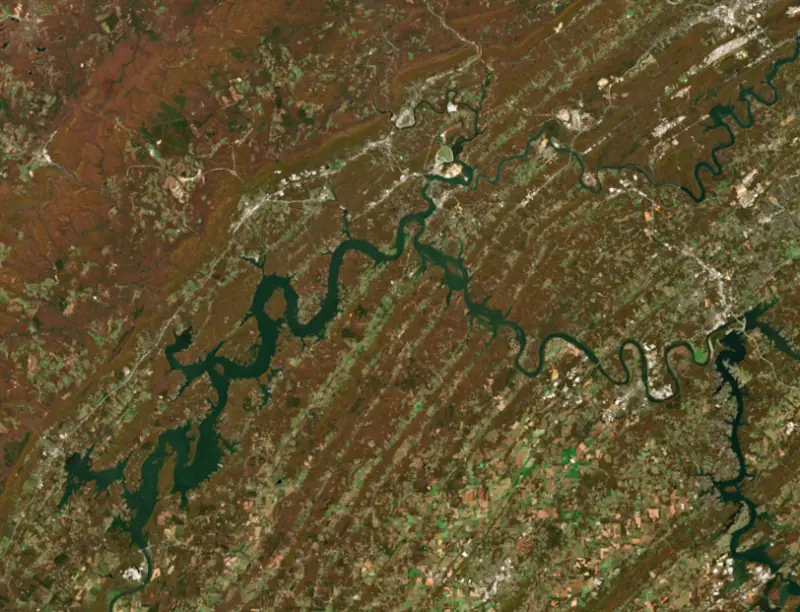
Surface water temperature
59°F on Nov 14, 2026
84°F · Aug 259°F · Nov 14
25°F cooler than on Aug 2, 2026.
Estimated from Landsat 8/9 (USGS) passes on clear days: the top layer of the water, a few degrees either way. Coves and the shallows can be warmer.
Watts Bar Lake water temperature: trend, swimming and the fish →
On or near the shore of Watts Bar Lake: 68 boat ramps, 10 marinas, 1 rental outfit, 29 campgrounds and 7 beaches. The lake has about 609 miles of shoreline, counting its islands.
Tap an icon for details; use two fingers (or Ctrl + scroll) to move the map. Tap a dot for details. Map and lake outline © OpenStreetMap contributors. Places from OpenStreetMap, Overture Maps and Recreation.gov. Not for navigation.
What you’ll find on the shore
← AllBoating 78
← AllRentals & tours 1
← AllFishing spots 4
← AllBeaches 7
← AllCamping 29
← AllLodging 18
← AllParks 20+
← AllDining 19
Zebra mussels have been found in Watts Bar Lake. They clog intakes and engines and spread on boats and trailers: clean, drain and dry everything before you go to another lake.
Tennessee: Tennessee has no statewide clean-drain-dry law; TWRA urges you to remove plants, animals and mud, drain all water, and dry the boat for five days (or hot-wash it) before moving to another lake. Moving live invasive carp is illegal. State rules
Records: USGS Nonindigenous Aquatic Species database. A species not listed may still be present.
Species with open-licensed records inside Watts Bar Lake's outline, from GBIF.org (surveys, museum collections and angler reports). A record shows a fish was found here, not how many there are now.
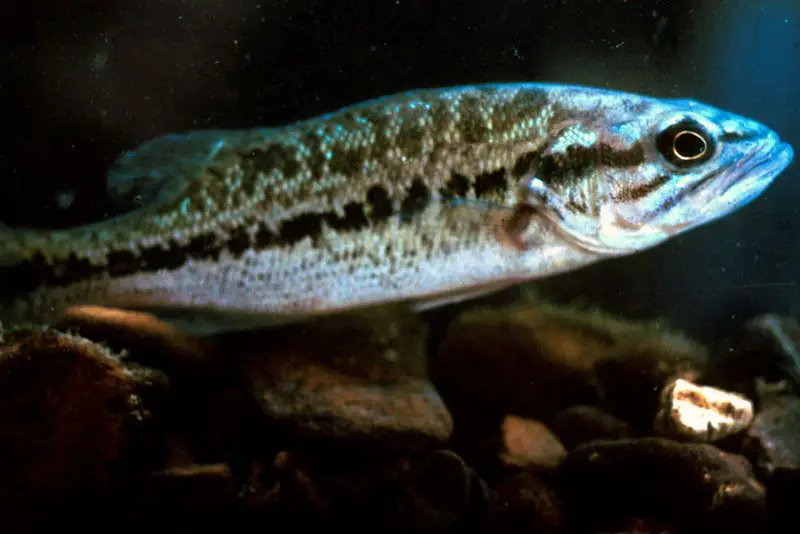
Shallow, protected flats in spring; docks, grass and deep edges in summer heat.
Rocky points, gravel and current breaks; deeper rock piles in summer.
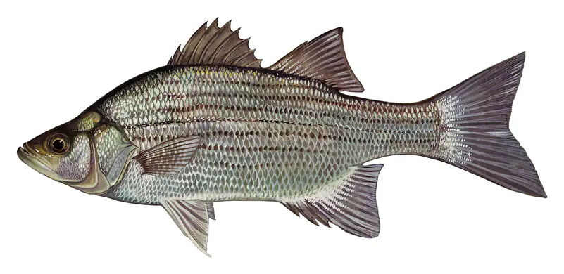
Run up the river arms in spring; follow shad to cool, deep water near the dam in summer.
Clear water and steep rock; they often suspend deeper than largemouth.
Spring runs up the tributaries; schools busting shad in late summer.
Water temperature sets off each spawn; the bars show the usual months at this latitude and elevation, and move with a warm or cold spring. The water is about 59°F now.
Watts Bar Lake is the Tennessee Valley Authority reservoir that fills the Tennessee River for 72 miles between Fort Loudoun Dam at Lenoir City and Watts Bar Dam near Spring City, roughly halfway between Knoxville and Chattanooga. Long arms reach up the Clinch and Emory rivers past Kingston, and the lake touches Meigs, Rhea, Roane and Loudon counties. Its crappie and bass fishing rate near the top of the TVA system.
The site takes its name from Watt Island, a sandbar in the river where the dam now stands. The Army Corps of Engineers built a dike there in the 1870s and recommended a navigation dam in 1930. TVA took over the site in 1936, Congress authorized the dam in March 1939, and construction began that July. The gates closed on January 1, 1942, a few weeks after Pearl Harbor. War demand for electricity led TVA to add two generators to the three first planned. The dam was built for flood control, power and a navigable channel, and its lock, designed by the Corps, opened in February 1942 and lifts boats between Watts Bar and Chickamauga Lake below. Spring City kept growing after the 1930s because of the dam and, later, a TVA nuclear plant, and the Watts Bar facility remains a major employer in Rhea County.
The lake took 832 families, 17 cemeteries and 121 miles of road. One town vanished entirely: Rhea Springs, an old resort on the Piney River first called Sulphur Springs, known for its healing waters and a large hotel. It had already faded after the railroad passed it by, and the rising water covered it in 1941 or 1942, depending on the account. An earthen dike was built to keep the backwater out of downtown Kingston, and the riverfronts at Spring City, Harriman and Loudon were reworked. Today Kingston, Rockwood, Harriman, Spring City and Lenoir City all sit on the water. The Clinch River joins the main lake at Kingston, near Southwest Point, and boats can run 23 miles up the Clinch and 12 miles up the Emory. TVA draws the lake down about 5 to 6 feet each winter.
On December 22, 2008, a dike holding wet coal ash at TVA's Kingston Fossil Plant, on the Emory River near its meeting with the Clinch, gave way. Millions of cubic yards of ash sludge poured into the Emory and Clinch rivers and spread over about 300 acres, destroying three homes, covering roads and a rail line, and forcing a neighborhood to evacuate. TVA carried out the cleanup under the oversight of the EPA and the Tennessee Department of Environment and Conservation. Separately, Tennessee advises against eating some fish from parts of the lake because of PCB contamination, so check the state's posted advisories before keeping fish.
Watts Bar holds largemouth, smallmouth and spotted bass, black and white crappie, white, striped and hybrid striped bass, sauger, walleye, three kinds of catfish, yellow perch and a few muskies. The state stocks striped bass and crappie, and has stocked walleye every year since 2011, replacing sauger stocking. Walleye had been scarce before, though they are native to the Tennessee River. The tailwater below Fort Loudoun Dam is the place for smallmouth, the spawning runs of walleye and sauger, and white bass and stripers in the current. The middle and lower lake are best for smallmouth, Kingston is known for stripers, as are Rockwood and White's Creek in the fall, the Clinch arm for yellow perch, and the Emory and Clinch for the rare muskie. Biologists have found invasive Alabama bass, mostly in the White's Creek embayment, likely from illegal stocking, and they ask anglers never to move bass from one lake to another.
Written by Lake by Lake from Tennessee Wildlife Resources Agency (Watts Bar Reservoir, Walleye Project Being Conducted at Watts Bar), Tennessee Encyclopedia, U.S. Environmental Protection Agency, Region 4 and Wikipedia (Watts Bar Dam, Watts Bar Lake). Checked November 2026.
Watts Bar Dam is a concrete dam 118 feet high and 2,960 feet long on the Tennessee River, completed in 1942. It belongs to the Tennessee Valley Authority and is run for flood control, navigation, recreation and hydropower. At its normal level the reservoir holds 1.01 million acre-ft, drained from 17,310 square miles of land.
From the National Inventory of Dams (U.S. Army Corps of Engineers), NID ID TN12102. Lake or reservoir: what’s the difference?
Where the level comes from: Tennessee River above Watts Bar Dam (NOAA National Water Prediction Service).
| Lake | Miles | Level (ft) | vs full | 7 days |
|---|---|---|---|---|
| Fort Loudoun Lake Slightly below full | 32 | 809.79 | −3.21 | −0.94 |
| Melton Hill Lake At or near full pool | 32 | 794.10 | −0.40 | +0.10 |
| Parksville Lake Slightly below full | 37 | 823.91 | −5.09 | −0.80 |
| Apalachia Lake At or near full pool | 42 | 1277.67 | −0.83 | −0.27 |
| Chickamauga Lake Slightly below full | 44 | 677.23 | −5.27 | −0.29 |
| Calderwood Lake Live reading | 46 | 963.20 | — | +1.69 |
Compare Watts Bar Lake with Fort Loudoun Lake, Melton Hill Lake, Parksville Lake or Apalachia Lake: size, level, ramps and fish side by side.
Watts Bar Lake is about 47 mi from Chattanooga, TN and 52 mi from Knoxville, TN. See all the lakes near each city.
Watts Bar Lake is also known as Watts Bar Reservoir.
Watts Bar Lake is at 737.96 feet above sea level — 3.04 ft below summer pool, as of Nov 19, 2026, 2:00 AM EST. It has dropped 1.35 ft in the past 7 days.
Watts Bar Lake's summer pool is 741.00 ft, according to Tennessee Valley Authority. Today the lake is 3.04 ft below that mark.
Watts Bar Lake has 68 boat ramps on our map, including Bell Cove, Big Springs, Blue Springs Marina, and 10 marinas. Low water can close ramps, so check today's level above and the operator before you go.
Yes. There are 29 campgrounds and RV parks within about a mile of the shore, such as Campground on the Lakeshore, Waters Edge, Sportsmans Club.
Game fish recorded in Watts Bar Lake include spotted bass, bluegill, smallmouth bass, striped bass, sauger, largemouth bass. In all, 40 fish species have open records inside the lake on GBIF.
The surface of Watts Bar Lake was about 59°F on November 14, estimated from a satellite pass on a clear day. It is the top layer of the water, a few degrees either way; coves and shallows run warmer in the sun.
Anglers 13 and older need a Tennessee fishing license, sold online by the Tennessee Wildlife Resources Agency. Free fishing days: Free Fishing Day, one Saturday in June; children 15 and under fish free that whole week. Size and bag limits can be set lake by lake: check the current regulations.
Watts Bar Lake averages about 27 ft deep. Depth changes with the lake level.
In summer a white Secchi disk lowered into Watts Bar Lake stays visible to about 6.4 ft (the median of 17 readings, 2016–2025, by TDEC Division of Water Resources): somewhat murky water. Silt after rain lowers the reading as much as algae do. Clarity drops after storms and during algae blooms.
boating (68 boat ramps and 10 marinas), kayaks, boats & jet skis (1 rental outfit on or near the water), fishing (13 game fish), swimming (7 beaches and swimming areas), camping (29 campgrounds) and cabins & lodging (18 places to stay close to the water), according to our map of the shore.
EPA's CyAN satellite rated cyanobacteria in Watts Bar Lake not detected on November 9. The satellite sees open water only; blooms can be patchy, so avoid water that looks like spilled paint or pea soup and keep dogs out of scum. Swimming advisories come from Tennessee health and environment agencies.
Watts Bar Lake is held back by Watts Bar Dam, completed in 1942 and 118 ft high, according to the National Inventory of Dams.
From the NOAA National Water Prediction Service (Tennessee River above Watts Bar Dam). Lake by Lake checks it every hour; the agency's own figure is always the reference, and provisional readings can be revised.
Lake levels are refreshed every hour. Texas and California reservoirs report once a day; most USGS and NOAA gauges report every 15 to 60 minutes.
Cookies for analytics With your OK we use Google Analytics and Microsoft Clarity to count visits and see how the site is used, so we can make it better. No advertising cookies. Privacy policy