Sun
- Sunrise
- 6:33 AM
- Sunset
- 4:57 PM
- First light
- 6:07 AM
- Last light
- 5:23 PM
Reservoir · Rankin County, Mississippi
A reservoir on the Pearl River in Rankin County, Mississippi, held back by Ross Barnett Reservoir Dam since 1962. Also called Ross R Barnett Reservoir.

Ross Barnett Reservoir is at 295.75 feet above sea level — 1.75 ft below summer pool, as of Nov 19, 2026, 5:15 AM CST. It has dropped 0.13 ft in the past 7 days.
Fullest of 5 Mississippi lakes today against full pool · See the ranking
Record low 292.70 ft (2000), record high 298.55 ft (2022) · Level history since 1998
A notification from this browser, once, when the level crosses the line (checked every hour). No account and no email. On an iPhone, add Lake by Lake to your home screen first (Share → Add to Home Screen) and open it from there. Or follow the lake in a feed reader: RSS feed.
Ross Barnett Reservoir is down 0.13 ft over the last 7 days, at 295.75 ft today.
Daily values from the U.S. Geological Survey.
Ross Barnett Reservoir is down 0.52 ft over the last 30 days, at 295.75 ft today.
Daily values from the U.S. Geological Survey.
Over the past 12 months, Ross Barnett Reservoir ranged from 295.73 ft (Nov 19, 2026) to 298.19 ft (Jun 21, 2026), a swing of 2.5 ft. Today's level is near the bottom of that range. It is 1.11 ft lower than on this date last year.
Daily values from the U.S. Geological Survey. Why lake levels rise and fall
In the U.S. Geological Survey record, which starts in 1998, the lowest level was 292.70 ft on November 6, 2000 and the highest 298.55 ft on August 28, 2022. Today’s 295.75 ft is 3.1 ft above the record low and 2.8 ft below the record high.
Ross Barnett Reservoir level history: every year since 1998, the lowest and highest years →
Solunar periods for Ross Barnett Reservoir, local time. How they work
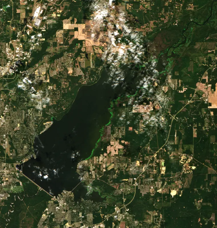
Surface water temperature
62°F on Nov 14, 2026
87°F · Jul 2162°F · Nov 14
26°F cooler than on Jul 21, 2026.
Estimated from MODIS Aqua (NASA) passes on clear days: the top layer of the water, a few degrees either way. Coves and the shallows can be warmer.
Ross Barnett Reservoir water temperature: trend, swimming and the fish →
On or near the shore of Ross Barnett Reservoir: 17 boat ramps, 6 marinas, 5 campgrounds and 3 trails. The lake has about 133 miles of shoreline, counting its islands.
Tap an icon for details; use two fingers (or Ctrl + scroll) to move the map. Tap a dot for details. Map and lake outline © OpenStreetMap contributors. Places from OpenStreetMap, Overture Maps and Recreation.gov. Not for navigation.
What you’ll find on the shore
← AllBoating 23
← AllCamping 5
← AllLodging 2
← AllTrails 3
← AllParks 6
← AllDining 9
These invasive plants and animals have been recorded in Ross Barnett Reservoir: clean, drain and dry everything before you go to another lake.
Mississippi: Mississippi has no clean-drain-dry law; MDWFP asks boaters to clean plants, animals and mud off gear, drain boats, livewells and bait buckets, dry everything, and never move fish or plants between waters. Zebra mussels are a prohibited species and may not be possessed or moved. State rules
Records: USGS Nonindigenous Aquatic Species database. A species not listed may still be present.
Species with open-licensed records inside Ross Barnett Reservoir's outline, from GBIF.org (surveys, museum collections and angler reports). A record shows a fish was found here, not how many there are now.
Shallow, protected flats in spring; docks, grass and deep edges in summer heat.
Brush piles, docks and bridge pilings; shallow for a few weeks in spring.
Run up the river arms in spring; follow shad to cool, deep water near the dam in summer.
Clear water and steep rock; they often suspend deeper than largemouth.
Beds in shallow, firm bottoms; around docks and weeds all summer.
Water temperature sets off each spawn; the bars show the usual months at this latitude and elevation, and move with a warm or cold spring. The water is about 62°F now.
Ross Barnett Reservoir is a dammed stretch of the Pearl River just northeast of Jackson, Mississippi, on the line between Madison and Rankin counties. It is the main source of drinking water for the capital and the largest drinking water supply in the state, and its open water, river backwaters and lakefront neighborhoods draw boaters and anglers from across the Jackson area.
The Army Corps of Engineers had been studying Pearl River floods at Jackson since the 1930s, but the reservoir came from the state, not Washington. In 1956 the Legislature had the Pearl River Industrial Commission study a dam and spillway near the city, and in 1958 it created the Pearl River Valley Water Supply District to build and run what was first called the Pearl River Reservoir. Construction began in 1960, and the lake reached its normal level by 1965. Leaders hoped for new industry, a U.S. 49 bypass on a levee and a straighter river channel, but the main goal was a permanent water supply for Jackson. The final design was not built for flood control.
An earthen dam with a ten-gate spillway forms the southern shore. The district still runs the dam, along with law enforcement, land leases and recreation, and its board includes members from Hinds, Leake, Madison, Rankin and Scott counties. The lake carries the name of Ross Barnett, governor from 1960 to 1964 and a vocal defender of segregation, and there have been repeated calls to rename it.
The broad main lake lies between the dam and Highway 43. Above the highway the reservoir narrows into a long riverine reach that winds past Ratliff Ferry and on into Leake and Scott counties. Pelahatchie Bay is the arm on the Rankin County side, and the Natchez Trace Parkway runs along the western shore. Thousands of homes sit on land the district leases around the water.
The district runs about 16 parks and 22 public ramps. Old Trace Park, Bobby Cleveland Park at Lakeshore and Pelahatchie Shore are day-use parks, and campgrounds include Timberlake, Goshen Springs, Coal Bluff, Low Head Dam and the Leake County Water Park upriver. Walking and biking trails follow parts of the shore.
State biologists manage the lake for crappie, black bass, bream and catfish, and their fall surveys find plenty of bluegill and shad to feed the predators. In spring, crappie anglers work the shoreline vegetation with jigs or minnows, then turn to trolling river channel ledges or jigging the deep stump fields of the main lake in summer and winter. Largemouth hold in vegetation through spring and summer and move to creek and channel ledges with submerged cover in summer and fall. Bream bed in 2 to 4 feet of water. The 1978 Bassmaster Classic was held here, and the reservoir has produced state records for bowfin and smallmouth buffalo.
Trotlines, jugs, limblines and yo-yos are banned in Pelahatchie Bay and Pelahatchie Creek, in the lower lake near the dam, near sandbars and ramps, and in the marked channel between Highway 43 and Ratliff Ferry. Alligator weed is the most common of more than a dozen invasive water plants the district treats.
The 1979 Easter flood at Jackson led to studies of levees below the reservoir and a dry dam above it, and further flood projects have not been approved. In February 2020, more than 8 inches of rain fell on soaked ground in the upper basin over four days, and on February 17 the Pearl crested at Jackson at its highest level since 1983, the fourth highest since records began in 1901.
Written by Lake by Lake from Pearl River Valley Water Supply District, Mississippi Department of Wildlife, Fisheries, and Parks, City of Ridgeland, U.S. Geological Survey and Wikipedia (Ross Barnett Reservoir, Pearl River Valley Water Supply District). Checked November 2026.
Ross Barnett Reservoir Dam is an earthfill dam 64 feet high and 18,400 feet long on the Pearl River, completed in 1962. It belongs to Pearl RIV. VAL. WTR. SUP. Dist and is run for water supply. At its normal level the reservoir holds 360,000 acre-ft, drained from 3,050 square miles of land.
From the National Inventory of Dams (U.S. Army Corps of Engineers), NID ID MS02716. Lake or reservoir: what’s the difference?
Where the level comes from: ROSS BARNETT RESERVOIR NR JACKSON, MS (U.S. Geological Survey).
Ross Barnett Reservoir is also known as Ross R Barnett Reservoir.
Ross Barnett Reservoir is at 295.75 feet above sea level — 1.75 ft below summer pool, as of Nov 19, 2026, 5:15 AM CST. It has dropped 0.13 ft in the past 7 days.
Ross Barnett Reservoir's summer pool is 297.50 ft, according to Pearl River Valley Water Supply District. Today the lake is 1.75 ft below that mark.
Today's level is 0.77 ft below the median for this date (296.52 ft), from the gauge’s long-term daily record.
292.70 ft, on November 6, 2000, in the U.S. Geological Survey record, which starts in 1998. Today the lake is 3.1 ft above that.
298.55 ft, on August 28, 2022, in the U.S. Geological Survey record since 1998. That is 1.1 ft above summer pool.
Ross Barnett Reservoir has 17 boat ramps on our map, including Boat ramp at Brown's Landing, Boat ramp at Main Harbor Development, Boat ramp at Sportsman's Marina, and 6 marinas. Low water can close ramps, so check today's level above and the operator before you go.
Yes. There are 5 campgrounds and RV parks within about a mile of the shore, such as Barnett Reservoir Campgrounds, Goshen Springs Campground, Timberlake Campground.
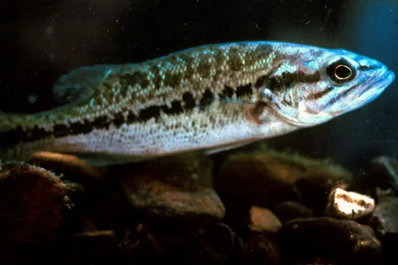
Game fish recorded in Ross Barnett Reservoir include white crappie, bluegill, largemouth bass, black crappie, spotted bass, chain pickerel. In all, 36 fish species have open records inside the lake on GBIF.
The surface of Ross Barnett Reservoir was about 62°F on November 14, estimated from a satellite pass on a clear day. It is the top layer of the water, a few degrees either way; coves and shallows run warmer in the sun.
Anglers 16 and older need a Mississippi fishing license, sold online by the Mississippi Department of Wildlife, Fisheries, and Parks. Free fishing days: First weekend in June and July 4 (Mississippi residents). Size and bag limits can be set lake by lake: check the current regulations.
Ross Barnett Reservoir averages about 11 ft deep. Depth changes with the lake level.
In summer a white Secchi disk lowered into Ross Barnett Reservoir stays visible to about 1.8 ft (the median of 143 readings, 2016–2025, by MISSISSIPPI DEPARTMENT OF ENVIRONMENTAL QUALITY): murky water. With the algae measured too (chlorophyll about 36 µg/L), that makes it eutrophic: rich in nutrients, greener water. Clarity drops after storms and during algae blooms.
boating (17 boat ramps and 6 marinas), fishing (15 game fish), hiking & walking (3 trails along the shore, the longest Natchez Trace Multuse Path (1.2 mi)), camping (5 campgrounds), cabins & lodging (2 places to stay close to the water) and parks & picnics (6 parks on the shore), according to our map of the shore.
Yes. 3 trails run along or near the shore, including Rice Rd Shared Use Path (0.8 mi), Natchez Trace Multiuse Path (0.9 mi) and Natchez Trace Multuse Path (1.2 mi), according to OpenStreetMap.
Ross Barnett Reservoir is held back by Ross Barnett Reservoir Dam, completed in 1962 and 64 ft high, according to the National Inventory of Dams.
From the U.S. Geological Survey (ROSS BARNETT RESERVOIR NR JACKSON, MS). Lake by Lake checks it every hour; the agency's own figure is always the reference, and provisional readings can be revised.
Lake levels are refreshed every hour. Texas and California reservoirs report once a day; most USGS and NOAA gauges report every 15 to 60 minutes.
Cookies for analytics With your OK we use Google Analytics and Microsoft Clarity to count visits and see how the site is used, so we can make it better. No advertising cookies. Privacy policy