Sun
- Sunrise
- 6:17 AM
- Sunset
- 4:38 PM
- First light
- 5:50 AM
- Last light
- 5:05 PM
Lake · Imperial County, California
A lake fed by the Alamo River in Imperial County, California.

Salton Sea is at 243.95 feet below sea level, as of Nov 19, 2026, 12:45 AM PST. The level has held steady over the past week.
3rd lowest of 9 California lakes today against normal for the date · See the ranking
Record low -244.07 ft (2026), record high -226.60 ft (1995) · Level history since 1987
A notification from this browser, once, when the level crosses the line (checked every hour). No account and no email. On an iPhone, add Lake by Lake to your home screen first (Share → Add to Home Screen) and open it from there. Or follow the lake in a feed reader: RSS feed.
Salton Sea has held steady over the last 7 days (within 0.05 ft).
Daily values from the U.S. Geological Survey.
Salton Sea is up 0.10 ft over the last 30 days, at -243.95 ft today.
Daily values from the U.S. Geological Survey.
Over the past 12 months, Salton Sea ranged from -244.07 ft (Oct 29, 2026) to -242.98 ft (Mar 31, 2026), a swing of 1.1 ft. Today's level is near the bottom of that range. It is 0.45 ft lower than on this date last year.
Daily values from the U.S. Geological Survey. Why lake levels rise and fall
In the U.S. Geological Survey record, which starts in 1987, the lowest level was -244.07 ft on October 29, 2026 and the highest -226.60 ft on May 18, 1995. Today’s -243.95 ft is 0.1 ft above the record low and 17.3 ft below the record high.
Salton Sea level history: every year since 1987, the lowest and highest years →
Solunar periods for Salton Sea, local time. How they work
Very high · as of Nov 9, 2026
The satellite sees a strong bloom on part of the lake. Stay out of discolored water, keep pets away and check for state advisories. About 4,530,000 cells/mL at the worst spot, covering less than 1% of the lake.
Week of Aug 16Week of Nov 1
Each bar is one week, colored by the worst reading of that week.
From the U.S. EPA's Cyanobacteria Assessment Network (CyAN), which reads the color of lakes from the Sentinel-3 satellites; it sees open water only, not coves or the shoreline. Blooms can be patchy: what you see on the water matters more. Swimming closures and health advisories come from California health and environment agencies. How to read it
Surface water temperature
71°F on Nov 13, 2026
90°F · Jul 2171°F · Nov 13
20°F cooler than on Jul 21, 2026.
Estimated from MODIS Aqua (NASA) passes on clear days: the top layer of the water, a few degrees either way. Coves and the shallows can be warmer.
Salton Sea water temperature: trend, swimming and the fish →
On or near the shore of Salton Sea: 2 boat ramps, 4 campgrounds and 10 beaches. The lake has about 97 miles of shoreline, counting its islands.
Tap an icon for details; use two fingers (or Ctrl + scroll) to move the map. Tap a dot for details. Map and lake outline © OpenStreetMap contributors. Places from OpenStreetMap, Overture Maps and Recreation.gov. Not for navigation.
No aquatic invasive species are on record for Salton Sea in the USGS database. Keep it that way: clean, drain and dry your boat between lakes.
California: California-registered motorized boats used in fresh water must display a current Mussel Fee sticker. Many lakes and reservoirs run mandatory inspections or quarantines, moving quagga, zebra or golden mussels is illegal, and boaters are asked to clean, drain and dry. Required: Quagga and Zebra Mussel Fee sticker ($42 every two years ($21 if bought in an even-numbered year)). State rules
Records: USGS Nonindigenous Aquatic Species database. A species not listed may still be present.
Species with open-licensed records inside Salton Sea's outline, from GBIF.org (surveys, museum collections and angler reports). A record shows a fish was found here, not how many there are now.
Run up the river arms in spring; follow shad to cool, deep water near the dam in summer.
Shallow, muddy bays and flooded grass in spring; mud flats and inflows in summer.
Water temperature sets off each spawn; the bars show the usual months at this latitude and elevation, and move with a warm or cold spring. The water is about 71°F now.
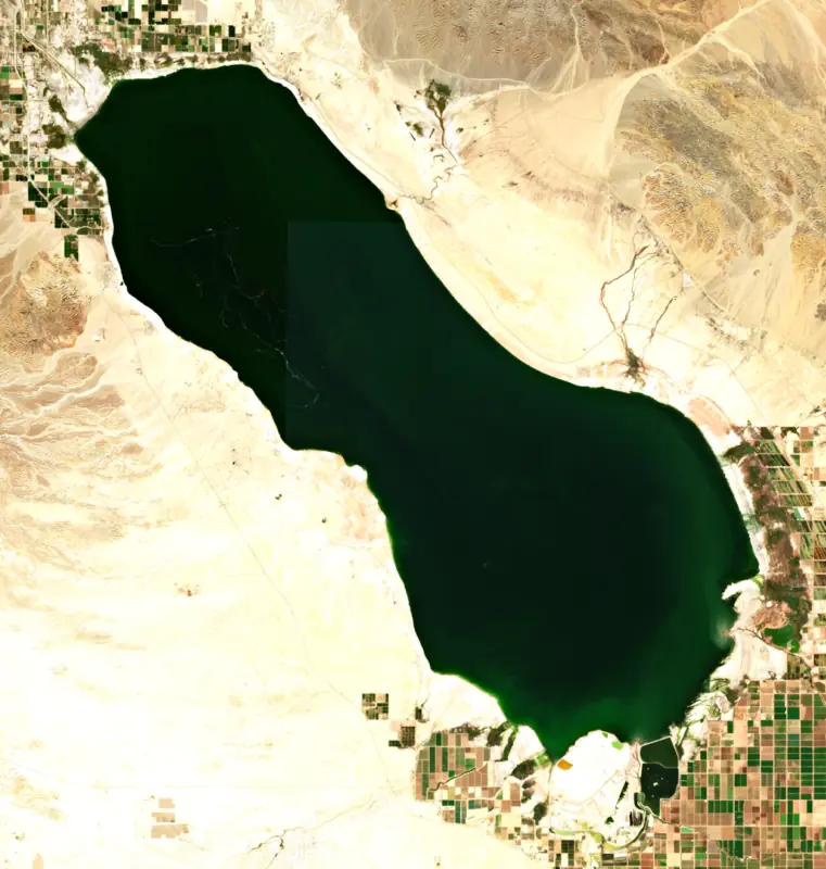
The Salton Sea is a salt lake in a desert basin below sea level, spread across southern Riverside and northern Imperial counties in the far southeast corner of California. It is the largest lake in the state, and it took its present form by accident in 1905, when the Colorado River broke out of an irrigation canal. People know it for its birds, its shrinking shoreline and the long effort to keep the exposed lakebed from turning to dust.
The basin sits in an active rift valley that was once the northern tip of the Gulf of California. Long before the modern sea, the Colorado River now and then swung northwest and filled it, creating Lake Cahuilla, several times larger than the lake of today. People have lived in the basin for some 10,000 years, and it is the ancestral homeland of the Cahuilla, Kumeyaay, Quechan and Cocopah peoples.
A canal first carried Colorado River water to the Imperial Valley in 1901. Silt choked it by 1904, and a temporary cut in Mexico was made to replace it. In 1905 floodwater tore through that cut and the river turned into the sink. The Southern Pacific Railroad finally closed the breach in February 1907. As late as 1909 the federal government expected the new sea to be gone by the 1920s. Instead, in 1924 President Calvin Coolidge set aside the land under the sea as a permanent reservoir for farm drainage.
No river leaves the Salton Sea. Water escapes only by evaporating, and the salt stays behind. The New and Alamo rivers carry drainage north from the Imperial and Mexicali valleys, and the Whitewater River reaches the north shore near Mecca. Salinity passed 40 parts per thousand in 1985 and reached 50 in 2008, about half again as salty as the ocean.
In October 2003 a settlement among federal, state and regional water agencies began moving conserved Imperial Valley farm water to coastal cities. Extra water kept flowing to the sea through 2017 to soften the blow. With less water coming in, the sea has shrunk, and dust blowing off the bare lakebed adds to the poor air of the Imperial Valley. The largest state habitat and dust-control project, the Species Conservation Habitat, filled its first ponds in the spring of 2025 and has grown to more than 9,000 acres of planned ponds, berms and nesting islands.
Starting in 1929, state fish managers released more than 30 ocean species here. Only orangemouth corvina, Gulf croaker and sargo took hold, and corvina, established by 1950, anchored the sport fishery. Tilapia slipped in from farm drains in 1964 and 1965 and dominated by the early 1970s. Rising salt has since wiped out the ocean fish, and tilapia is the only sport fish left.
Birds are the bigger story. More than 400 species have been recorded, about 270 of them fairly regularly, and the sea once held more than 90 percent of the western population of American white pelicans in winter. Die-offs have marked its decline, from 150,000 eared grebes in 1992 to avian botulism in 1996 that killed more than 1,000 endangered brown pelicans. The Sonny Bono Salton Sea National Wildlife Refuge, set up in 1930 and named for the congressman in 1998, sits on the south end near Calipatria, with an observation tower, photo blinds and the Rockhill Trail.
Salton Sea State Recreation Area runs along the northeast shore, 30 miles south of Indio on Highway 111. It opened as a state park in 1955. Salton City was laid out on the west shore in 1958, and the North Shore Beach and Yacht Club Estates opened in 1960. Tropical Storm Kathleen in 1976 and Tropical Storm Doreen in 1977 raised the sea, and wet years that followed flooded shoreline resorts. Summer heat can reach 115 degrees, so October through May is the time to go.
Written by Lake by Lake from U.S. Bureau of Reclamation, Lower Colorado Region, California Department of Fish and Wildlife, Salton Sea Restoration Project (California Department of Fish and Wildlife document library), U.S. Fish and Wildlife Service, California State Parks and Office of the Governor of California. Checked November 2026.
Activities listed by the Fish and Wildlife Service: Ranger programs · Fishing · Hiking · Hunting · Visitor center
Where the level comes from: SALTON SEA NR WESTMORLAND CA (U.S. Geological Survey).
| Lake | Miles | Level (ft) | vs full | 7 days |
|---|---|---|---|---|
| El Capitan Reservoir Live reading | 68 | 638.12 | — | +0.04 |
| San Vicente Reservoir Live reading | 75 | 644.96 | — | −1.55 |
| Vail Lake Live reading | 79 | 1416.68 | — | −0.04 |
Compare Salton Sea with El Capitan Reservoir, San Vicente Reservoir or Vail Lake: size, level, ramps and fish side by side.
Salton Sea is about 79 mi from El Cajon, CA, 86 mi from Chula Vista, CA and 88 mi from San Diego, CA. See all the lakes near each city.
Salton Sea is at 243.95 feet below sea level, as of Nov 19, 2026, 12:45 AM PST. The level has held steady over the past week.
Today's level is 11.85 ft below the median for this date (-232.10 ft), from the gauge’s long-term daily record.
-244.07 ft, on October 29, 2026, in the U.S. Geological Survey record, which starts in 1987. Today the lake is 0.1 ft above that.
-226.60 ft, on May 18, 1995, in the U.S. Geological Survey record since 1987.
Salton Sea has 2 boat ramps on our map. Low water can close ramps, so check today's level above and the operator before you go.
Yes. There are 4 campgrounds and RV parks within about a mile of the shore, such as Mecca Beach Camping Ground, Salt Creek Recreation Area State Beach, Sea View Estates Spa & RV Park.
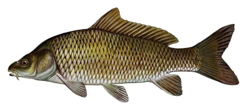
Game fish recorded in Salton Sea include striped bass, common carp. In all, 13 fish species have open records inside the lake on GBIF.
The surface of Salton Sea was about 71°F on November 13, estimated from a satellite pass on a clear day. It is the top layer of the water, a few degrees either way; coves and shallows run warmer in the sun.
Anglers 16 and older need a California fishing license, sold online by the California Department of Fish and Wildlife. Free fishing days: Two Saturdays a year (2027: July 3 and September 4). Size and bag limits can be set lake by lake: check the current regulations.
Salton Sea is about 49 ft deep at its deepest point, and about 29 ft deep on average. Depth changes with the lake level.
Fish and Wildlife Service lists ranger programs, fishing, hiking, hunting and visitor center at Sonny Bono Salton Sea National Wildlife Refuge.
EPA's CyAN satellite rated cyanobacteria in Salton Sea very high on November 9. The satellite sees open water only; blooms can be patchy, so avoid water that looks like spilled paint or pea soup and keep dogs out of scum. Swimming advisories come from California health and environment agencies.
From the U.S. Geological Survey (SALTON SEA NR WESTMORLAND CA). Lake by Lake checks it every hour; the agency's own figure is always the reference, and provisional readings can be revised.
Lake levels are refreshed every hour. Texas and California reservoirs report once a day; most USGS and NOAA gauges report every 15 to 60 minutes.
Cookies for analytics With your OK we use Google Analytics and Microsoft Clarity to count visits and see how the site is used, so we can make it better. No advertising cookies. Privacy policy