Sun
- Sunrise
- 6:53 AM
- Sunset
- 4:43 PM
- First light
- 6:24 AM
- Last light
- 5:12 PM
Lake · Grand County, Colorado
A lake fed by the North Inlet in Grand County, Colorado.

Grand Lake is at 8,366.59 feet above sea level — 0.41 ft below top of active conservation pool, as of Nov 16, 2026. It has dropped 0.05 ft in the past 7 days.
2nd fullest of 34 Colorado lakes today against full pool · See the ranking
Record low 8,363.58 ft (2016), record high 8,366.90 ft (2010) · Level history since 2010
A notification from this browser, once, when the level crosses the line (checked every hour). No account and no email. On an iPhone, add Lake by Lake to your home screen first (Share → Add to Home Screen) and open it from there. Or follow the lake in a feed reader: RSS feed.
Grand Lake is down 0.05 ft over the last 7 days, at 8,366.59 ft today.
Daily values from the Bureau of Reclamation (RISE).
Grand Lake has held steady over the last 30 days (within 0.05 ft).
Daily values from the Bureau of Reclamation (RISE).
Over the past 12 months, Grand Lake ranged from 8,366.24 ft (Jul 25, 2026) to 8,366.82 ft (May 26, 2026), a swing of 0.6 ft. Today's level is in the upper half of that range. It is 0.06 ft higher than on this date last year.
Daily values from the Bureau of Reclamation (RISE). Why lake levels rise and fall
In the Bureau of Reclamation (RISE) record, which starts in 2010, the lowest level was 8,363.58 ft on July 23, 2016 and the highest 8,366.90 ft on June 7, 2010. Today’s 8,366.59 ft is 3.0 ft above the record low and 0.3 ft below the record high.
Grand Lake level history: every year since 2010, the lowest and highest years →
Solunar periods for Grand Lake, local time. How they work
Low · as of Nov 9, 2026
Some cyanobacteria at the surface, under 100,000 cells/mL. About 7,240 cells/mL at the worst spot, covering 3% of the lake.
Week of Aug 16Week of Nov 1
Each bar is one week, colored by the worst reading of that week.
From the U.S. EPA's Cyanobacteria Assessment Network (CyAN), which reads the color of lakes from the Sentinel-3 satellites; it sees open water only, not coves or the shoreline. Blooms can be patchy: what you see on the water matters more. Swimming closures and health advisories come from Colorado health and environment agencies. How to read it
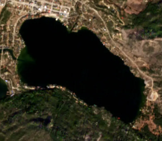
Surface water temperature
44°F on Nov 16, 2026
64°F · Aug 1244°F · Nov 16
20°F cooler than on Aug 12, 2026.
Estimated from Landsat 8/9 (USGS) passes on clear days: the top layer of the water, a few degrees either way. Coves and the shallows can be warmer.
Grand Lake water temperature: trend, swimming and the fish →
On or near the shore of Grand Lake: 3 boat ramps, 1 marina, 1 rental outfit, 1 campground and 4 trails. The lake has about 4 miles of shoreline, counting its islands.
Tap an icon for details; use two fingers (or Ctrl + scroll) to move the map. Tap a dot for details. Map and lake outline © OpenStreetMap contributors. Places from OpenStreetMap, Overture Maps and Recreation.gov. Not for navigation.
What you’ll find on the shore
← AllBoating 4
← AllRentals & tours 1
← AllFishing spots 1
← AllCamping 1
← AllLodging 24+
← AllTrails 4
← AllParks 6
← AllDining 17
No aquatic invasive species are on record for Grand Lake in the USGS database. Keep it that way: clean, drain and dry your boat between lakes.
Colorado: Clean, drain and dry is the law: remove plants and mud, pull the drain plug and drain all water every time you leave the water. Motorboats and sailboats need an ANS stamp, and trailered or motorized boats must pass a state inspection (and decontamination if needed) before launching where required, always when arriving from out of state or from infested waters. Required: Aquatic Nuisance Species (ANS) stamp ($25 a year for Colorado boats (added at registration), $50 for out-of-state boats). State rules
Records: USGS Nonindigenous Aquatic Species database. A species not listed may still be present.
Species with open-licensed records inside Grand Lake's outline, from GBIF.org (surveys, museum collections and angler reports). A record shows a fish was found here, not how many there are now.
Schools at a set depth in summer: trolling at the right depth is everything.
Water temperature sets off each spawn; the bars show the usual months at this latitude and elevation, and move with a warm or cold spring. The water is about 44°F now.
Grand Lake is Colorado's largest and deepest natural lake, lying at the western edge of Rocky Mountain National Park in Grand County, with the town of Grand Lake on its north shore. It sits in the headwaters of the Colorado River. Since the 1940s it has also been a working part of the Colorado-Big Thompson Project, which sends Western Slope water under the Continental Divide to the farms and cities of northeastern Colorado.
The lake formed during the Pinedale glaciation, when a glacier left a ridge of rock and gravel at its end that dammed the valley. Rocky Mountain National Park wraps around the lake on three sides, and its two natural feeders, the North Inlet and the East Inlet, both come down out of the park. The park's west entrance is close by. Left to itself, the lake drained into the valley now flooded by Shadow Mountain Lake and Lake Granby. The Ute knew it as Spirit Lake and held that its cold water was where the souls of the dead lived.
The Grand Lake Yacht Club was incorporated in May 1902 with four members, and its first regatta that summer was sailed in rowboats fitted with homemade sails. The club is recognized as the highest registered yacht club in the world. In 1912 members hosted Sir Thomas Lipton at the Denver Club, where he announced that he would sponsor a trophy, and a sterling silver cup arrived the next summer. Lipton never visited the lake, but his cup is still raced for during Regatta Week each midsummer. The club held its annual meeting of August 1912 in its new clubhouse, designed by the Denver architect Aaron Gove, who took an honorary membership instead of a fee. The building was finished the following summer.
The Colorado-Big Thompson Project won its authorization from Congress in 1937 through a plan known as Senate Document 80, which also called for keeping Grand Lake's fishing, recreation and scenery intact. Crews began boring the Alva B. Adams Tunnel from both ends on June 23, 1940, and met beneath the Continental Divide on June 10, 1944, their alignment off by less than the width of a penny. The tunnel runs 13.1 miles under the national park, from Grand Lake to the Estes Park side. The first Colorado River water reached its east portal on June 23, 1947, and the project was declared substantially complete in 1957.
During the diversion season, the Farr Pump Plant lifts water from Lake Granby into a canal that feeds Shadow Mountain Reservoir and Grand Lake, and from Grand Lake it enters the tunnel for the trip east. The operating rules keep Grand Lake's level within one vertical foot, so it does not see the big drawdowns common on reservoirs.
The only clarity reading taken before the project, in 1941, found visibility of about 30 feet. Shadow Mountain is no more than 9 feet deep, so its water warms quickly and grows algae, and pumping carries that water into Grand Lake. Residents filed their first complaint in 1954, and the town's trustees sent a resolution to Colorado's congressional delegation two years later. In April 2016 the state Water Quality Control Commission adopted a clarity standard for the summer pumping season, and the Bureau of Reclamation began working with 18 partners, including Northern Water and Grand County, on long-term fixes that could include new tunnels to carry the water around the lake. Diversions from these headwaters began long before the project. The Grand River Ditch, started in 1890 high on the side of the Never Summer Range, was the first large one to carry water across the Divide.
Written by Lake by Lake from Northern Water (Grand Lake, C-BT History, Colorado-Big Thompson Project), Aspen Journalism, Grand Lake Yacht Club and Wikipedia. Checked November 2026.
Where the level comes from: Grand Lake (Bureau of Reclamation (RISE)).
| Lake | Miles | Level (ft) | vs full | 7 days |
|---|---|---|---|---|
| Shadow Mountain Lake Live reading | 3 | 8366.69 | — | +0.07 |
| Lake Granby Live reading | 6 | 8233.85 | — | −0.60 |
| Willow Creek Reservoir Live reading | 11 | 8118.50 | — | +0.31 |
| Marys Lake Below full | 16 | 8031.05 | −8.95 | −5.50 |
| Lake Estes Slightly below full | 19 | 7471.82 | −3.18 | +3.02 |
| Pinewood Reservoir Well below full | 29 | 6560.67 | −19.33 | −8.06 |
Compare Grand Lake with Shadow Mountain Lake, Lake Granby, Willow Creek Reservoir or Marys Lake: size, level, ramps and fish side by side.
Grand Lake is about 33 mi from Boulder, CO, 44 mi from Fort Collins, CO and 45 mi from Arvada, CO. See all the lakes near each city.
Grand Lake is at 8,366.59 feet above sea level — 0.41 ft below top of active conservation pool, as of Nov 16, 2026. It has dropped 0.05 ft in the past 7 days.
Grand Lake's top of active conservation pool is 8,367.00 ft, according to U.S. Bureau of Reclamation. Today the lake is 0.41 ft below that mark.
Today's level is 0.01 ft above the median for this date (8,366.58 ft), from the gauge’s long-term daily record.
8,363.58 ft, on July 23, 2016, in the Bureau of Reclamation (RISE) record, which starts in 2010. Today the lake is 3.0 ft above that.
8,366.90 ft, on June 7, 2010, in the Bureau of Reclamation (RISE) record since 2010.
Grand Lake has 3 boat ramps on our map, including Boat ramp at Gene Stover Lakefront Park, West Portal, and 1 marina. Low water can close ramps, so check today's level above and the operator before you go.
Yes. There is 1 campground within about a mile of the shore, such as Timber Creek Campground.
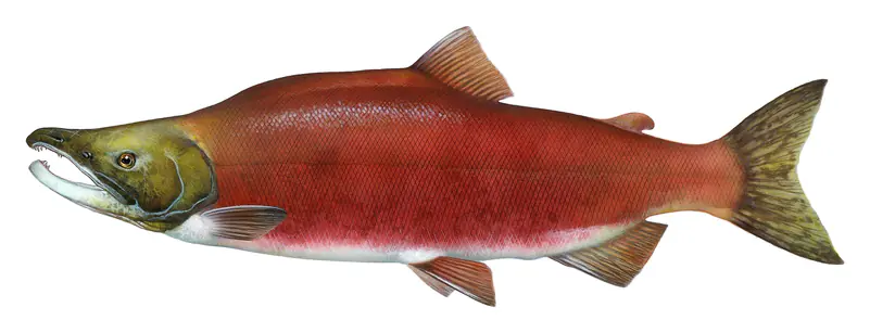
Game fish recorded in Grand Lake include kokanee salmon. In all, 1 fish species have open records inside the lake on GBIF.
The surface of Grand Lake was about 44°F on November 16, estimated from a satellite pass on a clear day. It is the top layer of the water, a few degrees either way; coves and shallows run warmer in the sun.
Anglers 16 and older need a Colorado fishing license, sold online by the Colorado Parks and Wildlife. Free fishing days: First full weekend of June. Size and bag limits can be set lake by lake: check the current regulations.
Grand Lake averages about 44 ft deep. Depth changes with the lake level.
boating (3 boat ramps and 1 marina), kayaks, boats & jet skis (1 rental outfit on or near the water), fishing (1 game fish), hiking & walking (4 trails along the shore, the longest East Inlet Trail (6.7 mi)), camping (1 campground) and cabins & lodging (24+ places to stay close to the water), according to our map of the shore.
EPA's CyAN satellite rated cyanobacteria in Grand Lake low on November 9. The satellite sees open water only; blooms can be patchy, so avoid water that looks like spilled paint or pea soup and keep dogs out of scum. Swimming advisories come from Colorado health and environment agencies.
Yes. 4 trails run along or near the shore, including CDT - Colorado Section, Continental Divide National Scenic Trail - Rocky Mtn Park and Continental Divide Trail East Shore Trail (1.5 mi), according to OpenStreetMap.
From the Bureau of Reclamation (RISE) (Grand Lake). Lake by Lake checks it every hour; the agency's own figure is always the reference, and provisional readings can be revised.
Every day. The Bureau of Reclamation publishes Grand Lake’s level as one reading a day, usually two to seven days after the day it was measured, so the latest reading here is often a few days old; its date is shown next to it.
Cookies for analytics With your OK we use Google Analytics and Microsoft Clarity to count visits and see how the site is used, so we can make it better. No advertising cookies. Privacy policy