Sun
- Sunrise
- 6:56 AM
- Sunset
- 4:59 PM
- First light
- 6:28 AM
- Last light
- 5:27 PM
Reservoir · Montezuma County, Colorado
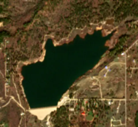
A reservoir on the West Mancos River in Montezuma County, Colorado, held back by Jackson Gulch Dam since 1949.
Jackson Gulch Reservoir is at 7,810.92 feet above sea level — 14.08 ft below top of active conservation pool, as of Nov 16, 2026. It has dropped 0.05 ft in the past 7 days.
14th fullest of 34 Colorado lakes today against full pool · See the ranking
Record low 7,708.00 ft (1979), record high 7,829.40 ft (1962) · Level history since 1960
A notification from this browser, once, when the level crosses the line (checked every hour). No account and no email. On an iPhone, add Lake by Lake to your home screen first (Share → Add to Home Screen) and open it from there. Or follow the lake in a feed reader: RSS feed.
Jackson Gulch Reservoir is down 0.05 ft over the last 7 days, at 7,810.92 ft today.
Daily values from the Bureau of Reclamation (RISE).
Jackson Gulch Reservoir is up 8.36 ft over the last 30 days, at 7,810.92 ft today.
Daily values from the Bureau of Reclamation (RISE).
Over the past 12 months, Jackson Gulch Reservoir ranged from 7,790.34 ft (Sep 14, 2026) to 7,814.98 ft (May 4, 2026), a swing of 24.6 ft. Today's level is near the top of that range. It is 11.47 ft higher than on this date last year.
Daily values from the Bureau of Reclamation (RISE). Why lake levels rise and fall
In the Bureau of Reclamation (RISE) record, which starts in 1960, the lowest level was 7,708.00 ft on August 30, 1979 and the highest 7,829.40 ft on April 27, 1962. Today’s 7,810.92 ft is 102.9 ft above the record low and 18.5 ft below the record high.
Jackson Gulch Reservoir level history: every year since 1960, the lowest and highest years →
Solunar periods for Jackson Gulch Reservoir, local time. How they work
Surface water temperature
50°F on Nov 7, 2026
76°F · Jul 2650°F · Nov 7
27°F cooler than on Jul 26, 2026.
Estimated from Landsat 8/9 (USGS) passes on clear days: the top layer of the water, a few degrees either way. Coves and the shallows can be warmer.
Jackson Gulch Reservoir water temperature: trend, swimming and the fish →
On or near the shore of Jackson Gulch Reservoir: 1 boat ramp and 3 trails. The lake has about 3 miles of shoreline, counting its islands.
Tap an icon for details; use two fingers (or Ctrl + scroll) to move the map. Tap a dot for details. Map and lake outline © OpenStreetMap contributors. Places from OpenStreetMap, Overture Maps and Recreation.gov. Not for navigation.
No aquatic invasive species are on record for Jackson Gulch Reservoir in the USGS database. Keep it that way: clean, drain and dry your boat between lakes.
Colorado: Clean, drain and dry is the law: remove plants and mud, pull the drain plug and drain all water every time you leave the water. Motorboats and sailboats need an ANS stamp, and trailered or motorized boats must pass a state inspection (and decontamination if needed) before launching where required, always when arriving from out of state or from infested waters. Required: Aquatic Nuisance Species (ANS) stamp ($25 a year for Colorado boats (added at registration), $50 for out-of-state boats). State rules
Records: USGS Nonindigenous Aquatic Species database. A species not listed may still be present.
Jackson Gulch Reservoir is a reservoir in Montezuma County, Colorado. Lake by Lake tracks its level from the Bureau of Reclamation (RISE) and compares it with full pool and the readings of the past year.
Recreation at Jackson Gulch Reservoir (Mancos State Park) is managed by the Colorado Division of Parks and Outdoor Recreation under agreement with the Bureau of Reclamation, Western Colorado Area Office - Southern Division, Durango, Colorado. Jackson Gulch Dam was completed in 1950 and is the principal feature of the Mancos Project in southwestern Colorado. An inlet canal from the West Mancos River feeds the small reservoir which is an off-stream storage impoundment with 4 miles of shoreline.
Activities listed by the Bureau of Reclamation: Biking · Boating · Camping · Ranger programs · Fishing · Hiking · Hunting · Picnicking · Winter sports · Water sports
Jackson Gulch Dam is an earthfill dam 180 feet high and 1,900 feet long on the West Mancos River, completed in 1949. It belongs to the Bureau of Reclamation and is run for irrigation, recreation and water supply. At its normal level the reservoir holds 9,950 acre-ft, drained from 1 square miles of land.
From the National Inventory of Dams (U.S. Army Corps of Engineers), NID ID CO01685. Lake or reservoir: what’s the difference?
Where the level comes from: Jackson Gulch Reservoir and Dam (Bureau of Reclamation (RISE)).
| Lake | Miles | Level (ft) | vs full | 7 days |
|---|---|---|---|---|
| McPhee Reservoir Well below full | 20 | 6894.43 | −29.57 | +2.18 |
| Lake Nighthorse At or near full pool | 23 | 6881.67 | −0.33 | +0.03 |
| Lemon Reservoir Below full | 34 | 8135.65 | −12.35 | +0.95 |
| Vallecito Reservoir Below full | 38 | 7656.55 | −8.45 | 0.00 |
| Navajo Lake Below full | 55 | 6073.12 | −11.88 | +2.76 |
| Ridgway Reservoir Below full | 64 | 6860.37 | −10.76 | −0.79 |
Compare Jackson Gulch Reservoir with McPhee Reservoir, Lake Nighthorse, Lemon Reservoir or Vallecito Reservoir: size, level, ramps and fish side by side.
Jackson Gulch Reservoir is at 7,810.92 feet above sea level — 14.08 ft below top of active conservation pool, as of Nov 16, 2026. It has dropped 0.05 ft in the past 7 days.
Jackson Gulch Reservoir's top of active conservation pool is 7,825.00 ft, according to U.S. Bureau of Reclamation. Today the lake is 14.08 ft below that mark.
Today's level is 21.34 ft above the median for this date (7,789.58 ft), from the gauge’s long-term daily record.
7,708.00 ft, on August 30, 1979, in the Bureau of Reclamation (RISE) record, which starts in 1960. Today the lake is 102.9 ft above that.
7,829.40 ft, on April 27, 1962, in the Bureau of Reclamation (RISE) record since 1960. That is 4.4 ft above top of active conservation pool.
Jackson Gulch Reservoir has 1 boat ramp on our map. Low water can close ramps, so check today's level above and the operator before you go.
The surface of Jackson Gulch Reservoir was about 50°F on November 7, estimated from a satellite pass on a clear day. It is the top layer of the water, a few degrees either way; coves and shallows run warmer in the sun.
Anglers 16 and older need a Colorado fishing license, sold online by the Colorado Parks and Wildlife. Free fishing days: First full weekend of June. Size and bag limits can be set lake by lake: check the current regulations.
Jackson Gulch Reservoir averages about 46 ft deep. Depth changes with the lake level.
Bureau of Reclamation lists biking, boating, camping, ranger programs, fishing, hiking, hunting and picnicking at Jackson Gulch Reservoir.
Yes. 3 trails run along or near the shore, including Horseshoe Trail (0.5 mi), Mule Deer Trail (0.9 mi) and Chicken Creek Trail (5.6 mi), according to OpenStreetMap.
Jackson Gulch Reservoir is held back by Jackson Gulch Dam, completed in 1949 and 180 ft high, according to the National Inventory of Dams.
From the Bureau of Reclamation (RISE) (Jackson Gulch Reservoir and Dam). Lake by Lake checks it every hour; the agency's own figure is always the reference, and provisional readings can be revised.
Every day. The Bureau of Reclamation publishes Jackson Gulch Reservoir’s level as one reading a day, usually two to seven days after the day it was measured, so the latest reading here is often a few days old; its date is shown next to it.
Cookies for analytics With your OK we use Google Analytics and Microsoft Clarity to count visits and see how the site is used, so we can make it better. No advertising cookies. Privacy policy