Sun
- Sunrise
- 7:43 AM
- Sunset
- 5:14 PM
- First light
- 7:11 AM
- Last light
- 5:46 PM
Reservoir · Valley County, Idaho
A reservoir on the North Fork Payette River in Valley County, Idaho, held back by Cascade Dam since 1948.

Lake Cascade is at 4,815.58 feet above sea level — 12.42 ft below normal pool, as of Nov 16, 2026. It has risen 0.07 ft in the past 7 days.
5th fullest of 16 Idaho lakes today against full pool · See the ranking
Record low 4,805.15 ft (1979), record high 4,828.70 ft (2010) · Level history since 1979
A notification from this browser, once, when the level crosses the line (checked every hour). No account and no email. On an iPhone, add Lake by Lake to your home screen first (Share → Add to Home Screen) and open it from there. Or follow the lake in a feed reader: RSS feed.
Lake Cascade is up 0.07 ft over the last 7 days, at 4,815.58 ft today.
Daily values from the Bureau of Reclamation (RISE).
Lake Cascade is up 0.12 ft over the last 30 days, at 4,815.58 ft today.
Daily values from the Bureau of Reclamation (RISE).
Over the past 12 months, Lake Cascade ranged from 4,815.34 ft (Oct 4, 2026) to 4,827.41 ft (May 30, 2026), a swing of 12.1 ft. Today's level is near the bottom of that range. It is 1.22 ft lower than on this date last year.
Daily values from the Bureau of Reclamation (RISE). Why lake levels rise and fall
In the Bureau of Reclamation (RISE) record, which starts in 1979, the lowest level was 4,805.15 ft on October 19, 1979 and the highest 4,828.70 ft on June 9, 2010. Today’s 4,815.58 ft is 10.4 ft above the record low and 13.1 ft below the record high.
Lake Cascade level history: every year since 1979, the lowest and highest years →
Solunar periods for Lake Cascade, local time. How they work
Surface water temperature
49°F on Nov 4, 2026
78°F · Jul 2049°F · Nov 4
29°F cooler than on Jul 20, 2026.
Estimated from MODIS Aqua (NASA) passes on clear days: the top layer of the water, a few degrees either way. Coves and the shallows can be warmer.
Lake Cascade water temperature: trend, swimming and the fish →
On or near the shore of Lake Cascade: 8 boat ramps, 24 campgrounds and 1 trail. The lake has about 89 miles of shoreline, counting its islands.
Tap an icon for details; use two fingers (or Ctrl + scroll) to move the map. Tap a dot for details. Map and lake outline © OpenStreetMap contributors. Places from OpenStreetMap, Overture Maps and Recreation.gov. Not for navigation.
What you’ll find on the shore
← AllBoating 8
← AllCamping 24
← AllLodging 10
← AllTrails 1
← AllParks 4
← AllDining 5
No aquatic invasive species are on record for Lake Cascade in the USGS database. Keep it that way: clean, drain and dry your boat between lakes.
Idaho: Stop at every open watercraft inspection station, even with a kayak or paddleboard. Remove plants and mud before leaving the water, pull the drain plug and drain all water before transporting, and keep plugs out on the road. Required: Idaho Invasive Species Fund sticker ($10 a year for Idaho motorboats (in registration), $30 for out-of-state motorboats, $7 for nonmotorized boats). State rules
Records: USGS Nonindigenous Aquatic Species database. A species not listed may still be present.
Species with open-licensed records inside Lake Cascade's outline, from GBIF.org (surveys, museum collections and angler reports). A record shows a fish was found here, not how many there are now.
Channel edges and river arms; best after dark in summer, and after a rain.
Rocky shorelines at night after ice-out; deep weed edges and humps in summer.
Cool water: near the surface in spring and fall, deep in summer.
Low light and cold water; the inflows in fall.
Schools at a set depth in summer: trolling at the right depth is everything.
Water temperature sets off each spawn; the bars show the usual months at this latitude and elevation, and move with a warm or cold spring. The water is about 49°F now.
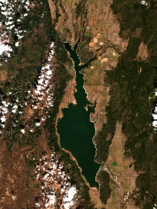
Lake Cascade is a broad, shallow reservoir on the North Fork of the Payette River in Long Valley, in the mountains of west-central Idaho. The town of Cascade sits near its south end and Donnelly near its north end, both on the east side along State Highway 55, and McCall lies farther up the same valley. Long called Cascade Reservoir, it is best known for its big yellow perch, and ice fishing is popular every winter.
Cascade Dam was authorized in 1905 as part of the Payette Division of Reclamation's Boise Project, but money for it did not come until 1941, and World War II stalled the work. The earthfill dam was finished in 1948 and the lake first filled to the top in 1957. It stores water for irrigators downstream and supplies the Cascade powerplant, which Idaho Power runs under a federal license. Long Valley had been homesteaded since the 1880s, and Finnish families had settled near Gold Fork starting in 1895. The water covered some of the valley's best farm and ranch land, State Highway 55 had to be moved, and many families were relocated, some against their will. Several of the old settlements were already fading. When the railroad reached the valley in 1914, towns along the track such as Cascade and Donnelly grew, while places it bypassed, including Crawford and Roseberry, declined. Van Wyck, one of the first settlements, opened its post office in 1888, and its name survives on a state park campground.
The reservoir stretches about 21 miles up the old river valley. The North Fork, the Gold Fork, Boulder Creek and Lake Fork Creek all come in near the north end. Sugarloaf Island, the only island, rises about 140 feet above the high-water line. West Mountain rises on the west side, where most land back from the shore is Boise National Forest, and Tamarack Resort sits on that shore southwest of Donnelly. Lake Cascade State Park has units all around the shore, among them Ridgeview, Poison Creek, Van Wyck, Crown Point, Sugarloaf and Boulder Creek, with campgrounds, boat ramps and the Osprey Point group yurts. Afternoon winds bring out sailboats and windsurfers. In winter the park stays open for ice fishing and Nordic skiing.
The lake is drawn down each year for irrigation, with the lowest water usually in October and the highest in June or July. Since the 1980s Reclamation has kept a large minimum pool to protect water quality and the fishery. That matters in a lake this shallow. A blue-green algae bloom in 1993 was blamed on low water, high phosphorus and hot weather, and a plan to cut phosphorus across the drainage basin brought levels down by more than half between 1995 and 2003.
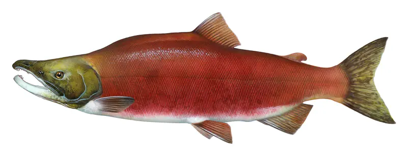
After the perch population collapsed, Idaho Fish and Game overhauled the lake in the early 2000s. Crews took out large numbers of northern pikeminnow and moved about 850,000 adult perch into the lake. The perch rebounded so well that by a 2015 survey more than a quarter of them were longer than 12 inches. The Idaho state record for perch had stood for 38 years before 2014. Since then, Cascade fish have broken it at least four times, every one of them caught in February or March. The lake also holds rainbow trout, coho and kokanee salmon and smallmouth bass.
Written by Lake by Lake from U.S. Bureau of Reclamation, Pacific Northwest Region, Valley County, Idaho, Idaho Department of Parks and Recreation, The Spokesman-Review and Wikipedia. Checked November 2026.
Activities listed by the Bureau of Reclamation: Biking · Boating · Camping · Ranger programs · Fishing · Hiking · Picnicking · Winter sports · Water sports
Cascade Dam is a rockfill dam 110 feet high and 785 feet long on the North Fork Payette River, completed in 1948. It belongs to the Bureau of Reclamation and is run for hydropower and irrigation. Water reaches it from 615 square miles of land.
From the National Inventory of Dams (U.S. Army Corps of Engineers), NID ID ID00283. Lake or reservoir: what’s the difference?
Where the level comes from: Lake Cascade and Cascade Dam (CSC) (Bureau of Reclamation (RISE)).
| Lake | Miles | Level (ft) | vs full | 7 days |
|---|---|---|---|---|
| Deadwood Reservoir Well below full | 25 | 5305.10 | −28.80 | — |
| Payette Lake Live reading | 27 | 4982.81 | — | +0.07 |
| Mann Creek Reservoir Live reading | 43 | 2827.21 | — | +0.55 |
| Black Canyon Reservoir Below full | 45 | 2486.09 | −11.91 | +6.78 |
| Arrowrock Reservoir Well below full | 64 | 3148.08 | −67.67 | — |
| Lucky Peak Lake Well below full | 69 | 2946.20 | −108.80 | +0.40 |
Compare Lake Cascade with Deadwood Reservoir, Payette Lake, Mann Creek Reservoir or Black Canyon Reservoir: size, level, ramps and fish side by side.
Lake Cascade is at 4,815.58 feet above sea level — 12.42 ft below normal pool, as of Nov 16, 2026. It has risen 0.07 ft in the past 7 days.
Lake Cascade's normal pool is 4,828.00 ft, according to U.S. Army Corps of Engineers. Today the lake is 12.42 ft below that mark.
Today's level is 0.60 ft below the median for this date (4,816.18 ft), from the gauge’s long-term daily record.
4,805.15 ft, on October 19, 1979, in the Bureau of Reclamation (RISE) record, which starts in 1979. Today the lake is 10.4 ft above that.
4,828.70 ft, on June 9, 2010, in the Bureau of Reclamation (RISE) record since 1979. That is 0.7 ft above normal pool.
Lake Cascade has 8 boat ramps on our map, including Boat ramp at Cascade Park, Boat ramp near Sugarloaf Campground, Buttercup. Low water can close ramps, so check today's level above and the operator before you go.
Yes. There are 24 campgrounds and RV parks within about a mile of the shore, such as Van Wyck Campground, Crown Point Campground, Poison Creek.
Game fish recorded in Lake Cascade include rainbow trout, Coho salmon, yellow perch, kokanee salmon, brown trout, channel catfish. In all, 10 fish species have open records inside the lake on GBIF.
The surface of Lake Cascade was about 49°F on November 4, estimated from a satellite pass on a clear day. It is the top layer of the water, a few degrees either way; coves and shallows run warmer in the sun.
Anglers 14 and older need an Idaho fishing license, sold online by the Idaho Department of Fish and Game. Free fishing days: Second Saturday in June. Size and bag limits can be set lake by lake: check the current regulations.
In summer a white Secchi disk lowered into Lake Cascade stays visible to about 7.9 ft (the median of 90 readings, 2018–2024, by Idaho Department Of Environmental Quality DEQ and Bureau of Reclamation): clear water. With the algae measured too (chlorophyll about 6 µg/L), that makes it mesotrophic: moderately rich in nutrients. Clarity drops after storms and during algae blooms.
Yes: reservoir survey report with contour maps from the U.S. Bureau of Reclamation (1995). It is linked in the lake facts on this page. Depths on a map are measured at a reference level: subtract how far the lake is below it today.
Bureau of Reclamation lists biking, boating, camping, ranger programs, fishing, hiking, picnicking and winter sports at Lake Cascade. 3 campgrounds can be booked on Recreation.gov.
Yes. A trail runs along or near the shore, including Crown Point Trail (5.1 mi), according to OpenStreetMap.
Lake Cascade is held back by Cascade Dam, completed in 1948 and 110 ft high, according to the National Inventory of Dams.
From the Bureau of Reclamation (RISE) (Lake Cascade and Cascade Dam (CSC)). Lake by Lake checks it every hour; the agency's own figure is always the reference, and provisional readings can be revised.
Every day. The Bureau of Reclamation publishes Lake Cascade’s level as one reading a day, usually two to seven days after the day it was measured, so the latest reading here is often a few days old; its date is shown next to it.