Sun
- Sunrise
- 7:19 AM
- Sunset
- 4:52 PM
- First light
- 6:48 AM
- Last light
- 5:23 PM
Lake · Dickinson County, Iowa
A lake in Dickinson County, Iowa.

West Okoboji Lake is at 1,395.85 feet above sea level, as of Nov 19, 2026, 4:45 AM CST. It has dropped 0.06 ft in the past 7 days.
2nd highest of 3 Iowa lakes today against normal for the date · See the ranking
Record low 1,391.85 ft (1959), record high 1,400.31 ft (1993) · Level history since 1933
A notification from this browser, once, when the level crosses the line (checked every hour). No account and no email. On an iPhone, add Lake by Lake to your home screen first (Share → Add to Home Screen) and open it from there. Or follow the lake in a feed reader: RSS feed.
West Okoboji Lake is down 0.06 ft over the last 7 days, at 1,395.85 ft today.
Daily values from the U.S. Geological Survey.
West Okoboji Lake is up 0.06 ft over the last 30 days, at 1,395.85 ft today.
Daily values from the U.S. Geological Survey.
Over the past 12 months, West Okoboji Lake ranged from 1,395.48 ft (Nov 26, 2025) to 1,396.40 ft (May 27, 2026), a swing of 0.9 ft. Today's level is in the lower half of that range. It is 0.35 ft higher than on this date last year.
Daily values from the U.S. Geological Survey. Why lake levels rise and fall
In the U.S. Geological Survey record, which starts in 1933, the lowest level was 1,391.85 ft on September 20, 1959 and the highest 1,400.31 ft on July 18, 1993. Today’s 1,395.85 ft is 4.0 ft above the record low and 4.5 ft below the record high.
West Okoboji Lake level history: every year since 1933, the lowest and highest years →
Solunar periods for West Okoboji Lake, local time. How they work
The ice usually goes out of West Okoboji Lake around Apr 6 (median of 93 springs on record). The record we have ends in 2008, when the ice went out on Apr 16. The earliest on record was Mar 7, 2000; the latest, Apr 28, 1951.
Each dot is one of the last 30 springs on record; the dashed line is the median of all of them; the orange dot is 2008.
Source: NSIDC Global Lake and River Ice Phenology Database. Ice is never safe everywhere: check local conditions before going out on it. About ice-out
Surface water temperature
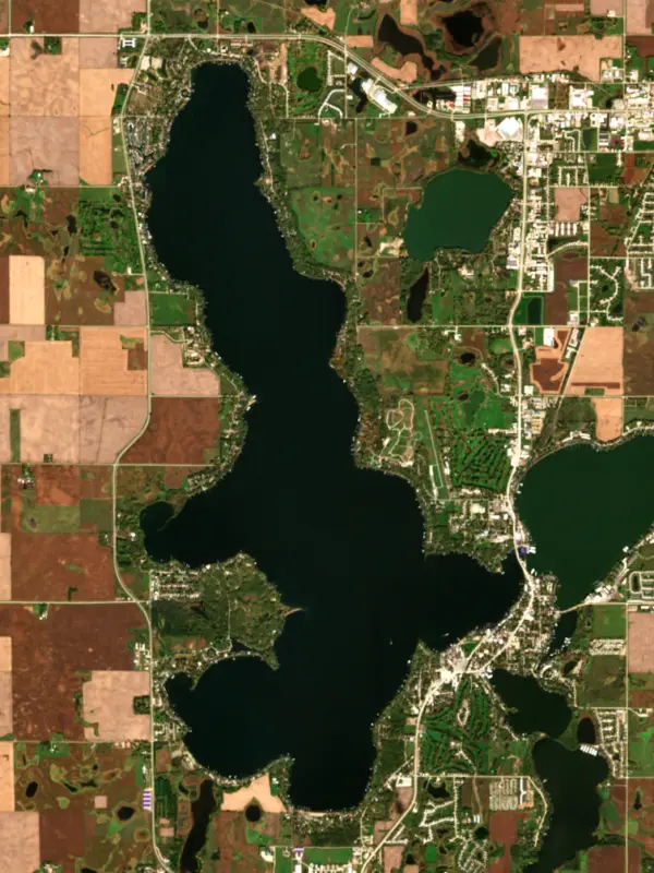
51°F on Nov 15, 2026
78°F · Aug 251°F · Nov 15
28°F cooler than on Aug 2, 2026.
Estimated from Landsat 8/9 (USGS) passes on clear days: the top layer of the water, a few degrees either way. Coves and the shallows can be warmer.
West Okoboji Lake water temperature: trend, swimming and the fish →
On or near the shore of West Okoboji Lake: 2 boat ramps, 5 marinas, 2 rental outfits, 9 campgrounds, 33 beaches and 2 trails. The lake has about 21 miles of shoreline, counting its islands.
Tap an icon for details; use two fingers (or Ctrl + scroll) to move the map. Tap a dot for details. Map and lake outline © OpenStreetMap contributors. Places from OpenStreetMap, Overture Maps and Recreation.gov. Not for navigation.
What you’ll find on the shore
← AllBoating 7
← AllRentals & tours 2
← AllFishing spots 4
← AllBeaches 33
← AllCamping 9
← AllLodging 24+
← AllTrails 2
← AllParks 5
← AllDining 22
Zebra mussels have been found in West Okoboji Lake. They clog intakes and engines and spread on boats and trailers: clean, drain and dry everything before you go to another lake.
Iowa: It's illegal to possess or transport aquatic invasive species, or to carry any aquatic plants on boats, trailers or other water gear. Drain all water (livewells, bait buckets, bilges) before leaving an access, keep drain plugs out while transporting, and don't release live fish other than hooked bait. State rules
Records: USGS Nonindigenous Aquatic Species database. A species not listed may still be present.
Species with open-licensed records inside West Okoboji Lake's outline, from GBIF.org (surveys, museum collections and angler reports). A record shows a fish was found here, not how many there are now.
Shallow, protected flats in spring; docks, grass and deep edges in summer heat.
Brush piles, docks and bridge pilings; shallow for a few weeks in spring.
Rocky points, gravel and current breaks; deeper rock piles in summer.
Rocky shorelines at night after ice-out; deep weed edges and humps in summer.
Shallow, weedy bays right after ice-out; weed edges the rest of the year.
Water temperature sets off each spawn; the bars show the usual months at this latitude and elevation, and move with a warm or cold spring. The water is about 51°F now.
West Okoboji Lake is a natural glacial lake in Dickinson County in far northwestern Iowa, one of the three main lakes of the Iowa Great Lakes along with Big Spirit Lake and East Okoboji. It is the deepest lake in the state, and its clear blue water has drawn summer visitors since the 1800s.
The Iowa Great Lakes formed about 13,500 years ago along the southwest edge of the Des Moines Lobe of the continental ice sheet. When the ice melted it left a scatter of lakes and potholes, and the headwaters of the Little Sioux River begin in the same country. West Okoboji is the deep one of the group. People have praised its color since at least the 1890s, and the state lists it among its Outstanding Iowa Waters for water quality. A popular story holds that it is one of only three blue-water lakes in the world, but that claim has been debunked.
Dakota people knew these lakes long before settlers came, and they used the area mainly for hunting. White settlers began arriving around 1856. In March 1857, after a hard winter of hunger and in revenge for the killing of his brother and his brother's family by a whiskey trader named Henry Lott, the Wahpekute leader Inkpaduta and his band attacked the settlements around the Okoboji lakes and Spirit Lake. An estimated 35 to 40 settlers were killed and four young women were taken captive. The youngest, 14-year-old Abbie Gardner, was ransomed that summer. It is remembered as the last attack by Native Americans on settlers in Iowa.
Abbie Gardner Sharp later bought her family's cabin in 1891 and showed it to visitors until her death in 1921. The state bought it in 1941 and restored it, and it stands today in Arnolds Park beside Pillsbury Point State Park. The town also holds the monument to the settlers that the state put up in 1895.
In 1883 passengers were already arriving at Arnolds Park by boat, and by 1900 nearly 8,000 people lived around the lakes. Arnolds Park, Okoboji, West Okoboji and Wahpeton now ring the shore. The amusement park at Arnolds Park is home to the Legend, a wooden roller coaster that first ran in 1927. To protect the water, the Iowa Great Lakes Sanitary District was created in 1939.
Near Milford, the Iowa Lakeside Laboratory has been a field station for the study of nature since 1909, when Thomas Macbride and colleagues from the University of Iowa founded it. The Civilian Conservation Corps built its stone laboratories and student cabins in the 1930s. The CCC also built the lodge at Gull Point State Park, established in 1933, which is the largest lodge of that era in the Iowa park system. Gull Point has a swimming beach, a campground and a 1.3-mile interpretive trail.
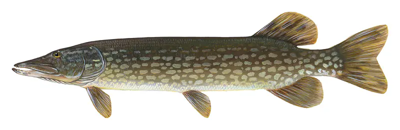
Its depth makes West Okoboji a lake for boating, sailing, water skiing and swimming, and it is one of the better fishing lakes in Iowa. Yellow perch, bluegill and walleye are the main catch. Smallmouth bass, northern pike, muskellunge, crappie and white bass are also present in good numbers, along with catfish and bullheads.
Written by Lake by Lake from Iowa Department of Natural Resources, Iowa Lakeside Laboratory and Wikipedia (West Okoboji Lake, Iowa Great Lakes, Spirit Lake massacre, Arnolds Park, Iowa). Checked November 2026.
Where the level comes from: West Okoboji Lake at Lakeside Lab near Milford, IA (U.S. Geological Survey).
| Lake | Miles | Level (ft) | vs full | 7 days |
|---|---|---|---|---|
| Big Spirit Lake Live reading | 7 | 1401.62 | — | −0.03 |
| Heron Lake Live reading | 29 | 1399.96 | — | −0.02 |
| Storm Lake Live reading | 52 | 1398.86 | — | −0.02 |
| Clear Lake Live reading | 92 | 1226.97 | — | −0.03 |
Compare West Okoboji Lake with Big Spirit Lake, Heron Lake, Storm Lake or Clear Lake: size, level, ramps and fish side by side.
West Okoboji Lake is about 79 mi from Sioux Falls, SD. See all the lakes near each city.
West Okoboji Lake is at 1,395.85 feet above sea level, as of Nov 19, 2026, 4:45 AM CST. It has dropped 0.06 ft in the past 7 days.
Today's level is 0.54 ft above the median for this date (1,395.31 ft), from the gauge’s long-term daily record.
1,391.85 ft, on September 20, 1959, in the U.S. Geological Survey record, which starts in 1933. Today the lake is 4.0 ft above that.
1,400.31 ft, on July 18, 1993, in the U.S. Geological Survey record since 1933.
West Okoboji Lake has 2 boat ramps on our map, including Boat ramp at Emerson Bay Public Beach, Boat ramp at Mau Marine, and 5 marinas. Low water can close ramps, so check today's level above and the operator before you go.
Yes. There are 9 campgrounds and RV parks within about a mile of the shore, such as Camp Okoboji Chapel, Presbyterian Camp, Lakeshore Center at Okoboji.
Game fish recorded in West Okoboji Lake include yellow perch, bluegill, black crappie, walleye, northern pike, largemouth bass. In all, 28 fish species have open records inside the lake on GBIF.
The surface of West Okoboji Lake was about 51°F on November 15, estimated from a satellite pass on a clear day. It is the top layer of the water, a few degrees either way; coves and shallows run warmer in the sun.
Anglers 16 and older need an Iowa fishing license, sold online by the Iowa Department of Natural Resources. Free fishing days: First weekend of June, Friday to Sunday (Iowa residents). Size and bag limits can be set lake by lake: check the current regulations.
West Okoboji Lake averages about 21 ft deep. Depth changes with the lake level.
In summer a white Secchi disk lowered into West Okoboji Lake stays visible to about 15.7 ft (the median of 71 readings, 2016–2024, by Iowa DNR Surface Water Monitoring Data): very clear water. With the algae measured too (chlorophyll about 2 µg/L), that makes it oligotrophic: clear, low in nutrients. Clarity drops after storms and during algae blooms.
Yes: lake map with depth contours from the Iowa Department of Natural Resources (2014). It is linked in the lake facts on this page. Depths on a map are measured at a reference level: subtract how far the lake is below it today.
boating (2 boat ramps and 5 marinas), kayaks, boats & jet skis (2 rental outfits on or near the water), fishing (14 game fish), swimming (33 beaches and swimming areas), hiking & walking (2 trails along the shore, the longest Iowa Great Lakes Trail (18 mi)) and camping (9 campgrounds), according to our map of the shore.
Usually around April 6, the median of 93 springs in the records of NSIDC Global Lake and River Ice Phenology Database.
Yes. 2 trails run along or near the shore, including Iowa Great Lakes Trail (18 mi) and Dickinson County Recreation Trail (1.3 mi), according to OpenStreetMap.
From the U.S. Geological Survey (West Okoboji Lake at Lakeside Lab near Milford, IA). Lake by Lake checks it every hour; the agency's own figure is always the reference, and provisional readings can be revised.
Lake levels are refreshed every hour. Texas and California reservoirs report once a day; most USGS and NOAA gauges report every 15 to 60 minutes.
Cookies for analytics With your OK we use Google Analytics and Microsoft Clarity to count visits and see how the site is used, so we can make it better. No advertising cookies. Privacy policy