Sun
- Sunrise
- 7:27 AM
- Sunset
- 5:03 PM
- First light
- 6:56 AM
- Last light
- 5:34 PM
Reservoir · Cedar County, Nebraska
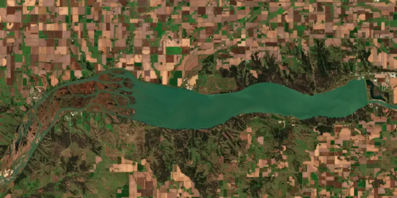
A reservoir on the Missouri River in Cedar County, Nebraska, held back by Gavins Point Dam since 1958.

Lewis and Clark Lake is at 1,207.97 feet above sea level — 0.47 ft above normal pool, as of Nov 19, 2026, 3:00 AM CST. It has risen 0.21 ft in the past 7 days.
3rd fullest of 21 Nebraska lakes today against full pool · See the ranking
Record low 1,199.80 ft (1969), record high 1,212.14 ft (2019) · Level history since 1956
A notification from this browser, once, when the level crosses the line (checked every hour). No account and no email. On an iPhone, add Lake by Lake to your home screen first (Share → Add to Home Screen) and open it from there. Or follow the lake in a feed reader: RSS feed.
Lewis and Clark Lake is up 0.21 ft over the last 7 days, at 1,207.97 ft today.
Daily values from the NOAA National Water Prediction Service.
Lewis and Clark Lake has held steady over the last 30 days (within 0.05 ft).
Daily values from the NOAA National Water Prediction Service.
Over the past 12 months, Lewis and Clark Lake ranged from 1,205.71 ft (May 11, 2026) to 1,208.33 ft (Dec 18, 2025), a swing of 2.6 ft. Today's level is near the top of that range. It is 0.53 ft higher than on this date last year.
Daily values from the NOAA National Water Prediction Service. Why lake levels rise and fall
In the U.S. Army Corps of Engineers record, which starts in 1956, the lowest level was 1,199.80 ft on March 12, 1969 and the highest 1,212.14 ft on March 15, 2019. Today’s 1,207.97 ft is 8.2 ft above the record low and 4.2 ft below the record high.
Lewis and Clark Lake level history: every year since 1956, the lowest and highest years →
Solunar periods for Lewis and Clark Lake, local time. How they work
Not detected · as of Nov 9, 2026
The satellite found no cyanobacteria at the surface.
Week of Aug 9Week of Nov 1
Each bar is one week, colored by the worst reading of that week.
From the U.S. EPA's Cyanobacteria Assessment Network (CyAN), which reads the color of lakes from the Sentinel-3 satellites; it sees open water only, not coves or the shoreline. Blooms can be patchy: what you see on the water matters more. Swimming closures and health advisories come from Nebraska health and environment agencies. How to read it
Surface water temperature
48°F on Nov 16, 2026
77°F · Aug 148°F · Nov 16
29°F cooler than on Aug 1, 2026.
Estimated from MODIS Aqua (NASA) passes on clear days: the top layer of the water, a few degrees either way. Coves and the shallows can be warmer.
Lewis and Clark Lake water temperature: trend, swimming and the fish →
On or near the shore of Lewis and Clark Lake: 11 boat ramps, 2 marinas, 1 rental outfit, 14 campgrounds, 3 beaches and 1 trail. The lake has about 172 miles of shoreline, counting its islands.
Tap an icon for details; use two fingers (or Ctrl + scroll) to move the map. Tap a dot for details. Map and lake outline © OpenStreetMap contributors. Places from OpenStreetMap, Overture Maps and Recreation.gov. Not for navigation.
What you’ll find on the shore
← AllBoating 13
← AllRentals & tours 1
← AllBeaches 3
← AllCamping 14
← AllLodging 5
← AllTrails 1
← AllParks 14
← AllDining 1
Zebra mussels have been found in Lewis and Clark Lake. They clog intakes and engines and spread on boats and trailers: clean, drain and dry everything before you go to another lake.
Nebraska: It is illegal to arrive at a lake with plants or animals on your boat, trailer or gear, with water that is not from a domestic source, or to move live invasive species; pull the boat plug and drain livewells and ballast at the ramp. Out-of-state motorboats must display an AIS stamp. Required: Aquatic Invasive Species stamp (out-of-state motorboats). State rules
Records: USGS Nonindigenous Aquatic Species database. A species not listed may still be present.
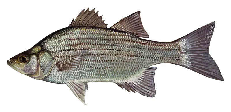
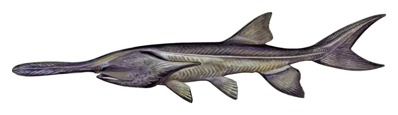
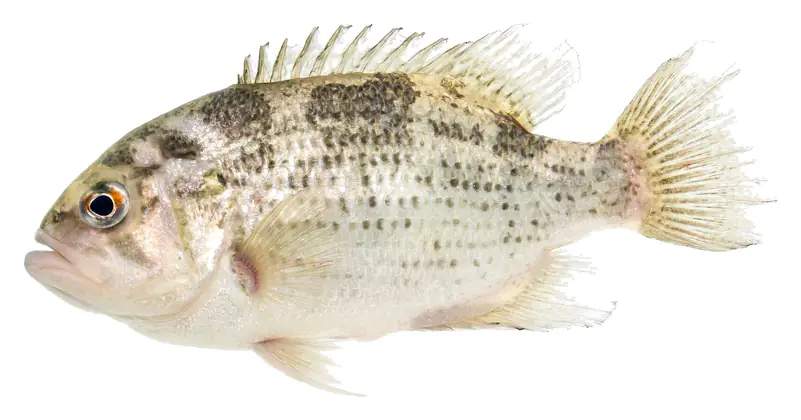
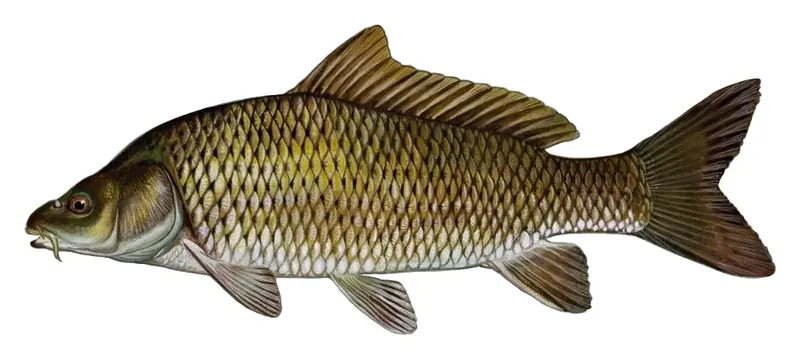
Species with open-licensed records inside Lewis and Clark Lake's outline, from GBIF.org (surveys, museum collections and angler reports). A record shows a fish was found here, not how many there are now.
Channel edges and river arms; best after dark in summer, and after a rain.
Spring runs up the tributaries; schools busting shad in late summer.
Spring runs up the rivers on rising water; snagging seasons are set by the state.
Rocky shorelines, boulders and docks; the same cover smallmouth bass use.
Shallow, muddy bays and flooded grass in spring; mud flats and inflows in summer.
Water temperature sets off each spawn; the bars show the usual months at this latitude and elevation, and move with a warm or cold spring. The water is about 48°F now.
Lewis and Clark Lake is the reservoir behind Gavins Point Dam on the Missouri River, shared by South Dakota and Nebraska just west of Yankton. It is a small, busy lake by Missouri River standards, known for walleye and sauger, for the sandy delta where the Niobrara comes in, and for the bluff where Lewis and Clark met the Yankton Sioux in 1804.
Gavins Point Dam was one of the Missouri River dams authorized by the Flood Control Act of 1944, the Pick-Sloan Plan. Ground was broken on May 18, 1952, with Lt. Gen. Lewis Pick and the governors of both states on hand. The lake began to form in 1955, the powerplant started making electricity in September 1956. The dam takes its name from a point upriver named for Michael J. Gavin, a Yankton-area farmer and businessman.
The south end of the dam rests against Calumet Bluff. Below it, in 1804, Lewis and Clark held a council with the Yankton Sioux, their first meeting with a Sioux tribe on the way upriver. People lived along this stretch of river thousands of years earlier, and in later times it was home to the Ponca, Yankton Sioux and Omaha. The Santee Sioux, removed from Minnesota after 1862, were settled on a reservation in northeastern Nebraska in 1867 and remain there. In 1874 Hutterites founded the Bon Homme Colony by the river, the first Hutterite colony in the United States. Nearby Yankton served as the first capital of Dakota Territory from 1861 to 1883.
The Corps runs Lewis and Clark Lake as a flow-through reservoir. Its level is held within a couple of feet through the year, and its main job is to smooth out the swings in flow caused by power peaking at Fort Randall Dam upstream. The lake is small enough that at maximum releases its whole volume can pass through in a few days. Above the lake, a 39-mile stretch of the Missouri National Recreational River runs down from Fort Randall, and below the dam a 59-mile reach of the same protected river continues downstream.
The Niobrara River drains the Nebraska Sandhills and enters from the southwest, carrying more than half of the roughly 4 million tons of sediment that settle in the lake each year. A broad delta has built up where the Missouri and the Niobrara enter the head of the lake. By 2009 the lake had lost almost 30% of its storage, and Corps data point to half of its design volume being gone by 2045. The river's surface across the delta has risen since 1955, raising flood risk and groundwater levels for nearby towns. The Corps and the Missouri Sedimentation Action Coalition are working on a sediment management plan, and in September 2024 they tested a bedload collector on the Niobrara that pumped sand out of the riverbed.
South Dakota manages the lake mainly for walleye and sauger, and walleye are the fish anglers keep most, followed by white bass and channel catfish. Below the dam, biologists have tagged paddlefish since the early 1990s. The Gavins Point National Fish Hatchery, just east of the dam, raises pallid sturgeon and paddlefish among other species and runs a public aquarium. The Lewis and Clark Visitor Center on Calumet Bluff overlooks the dam and the lake. Small Lake Yankton, just below the dam, limits gas motors and is popular with kayakers.
Zebra mussels are established in the lake and in the river below it, and they have spread west along the Nebraska shore. In Nebraska boaters must drain all water and remove plants and mud before leaving, and the states ask everyone to clean, drain and dry every boat and trailer.
Written by Lake by Lake from U.S. Army Corps of Engineers, Omaha District, Smithsonian Institution and National Park Service, South Dakota Department of Game, Fish and Parks, U.S. Army Corps of Engineers, via DVIDS, Nebraska Game and Parks Commission and U.S. Fish and Wildlife Service. Checked November 2026.
Activities listed by the U.S. Army Corps of Engineers: Scenic drives · Biking · Boating · Historic sites · Camping · Fishing · Hiking · Horseback riding · Picnicking · Visitor center · Water sports · Wildlife viewing
Gavins Point Dam is an earthfill dam 74 feet high and 8,700 feet long on the Missouri River, completed in 1958. It belongs to the U.S. Army Corps of Engineers (Omaha District) and is run for flood control, irrigation, navigation, recreation and hydropower. At its normal level the reservoir holds 375,000 acre-ft, drained from 16,000 square miles of land.
From the National Inventory of Dams (U.S. Army Corps of Engineers), NID ID SD01094. Lake or reservoir: what’s the difference?
Where the level comes from: Missouri River at Gavins Point Dam (NOAA National Water Prediction Service).
Lewis and Clark Lake is at 1,207.97 feet above sea level — 0.47 ft above normal pool, as of Nov 19, 2026, 3:00 AM CST. It has risen 0.21 ft in the past 7 days.
Lewis and Clark Lake's normal pool is 1,207.50 ft, according to U.S. Army Corps of Engineers. Today the lake is 0.47 ft above that mark.
Today's level is 0.44 ft above the median for this date (1,207.53 ft), from the gauge’s long-term daily record.
1,199.80 ft, on March 12, 1969, in the U.S. Army Corps of Engineers record, which starts in 1956. Today the lake is 8.2 ft above that.
1,212.14 ft, on March 15, 2019, in the U.S. Army Corps of Engineers record since 1956. That is 4.6 ft above normal pool.
Lewis and Clark Lake has 11 boat ramps on our map, including Boat ramp at Lewis & Clark Marina, Boat ramp at Sand Creek Recreation Area, Boat ramp near Midway Beach, and 2 marinas. Low water can close ramps, so check today's level above and the operator before you go.
Yes. There are 14 campgrounds and RV parks within about a mile of the shore, such as Weigand Campground - Lewis and Clark Lake, Cogan House B&B and RV Park, Burbach Campground.
Game fish recorded in Lewis and Clark Lake include flathead catfish, paddlefish, white bass, rock bass, common carp. In all, 8 fish species have open records inside the lake on GBIF.
The surface of Lewis and Clark Lake was about 48°F on November 16, estimated from a satellite pass on a clear day. It is the top layer of the water, a few degrees either way; coves and shallows run warmer in the sun.
Anglers 16 and older need a Nebraska fishing license, sold online by the Nebraska Game and Parks Commission. Free fishing days: Saturday before Memorial Day weekend. Size and bag limits can be set lake by lake: check the current regulations.
NOAA's flood categories for the Lewis and Clark Lake gauge: action stage at 1208.0 ft, minor flooding at 1210.0 ft, moderate flooding at 1221.0 ft and major flooding at 1234.0 ft. Today the lake is 2.03 ft below the first flooding level.
Lewis and Clark Lake is about 46 ft deep at its deepest point, usually near the dam, and about 12 ft deep on average. Depth changes with the lake level.
In summer a white Secchi disk lowered into Lewis and Clark Lake stays visible to about 1.6 ft (the median of 55 readings, 2016–2020, by U.S. Army Corps of Engineers Omaha District): murky water. With the algae measured too (chlorophyll about 13 µg/L), that makes it eutrophic: rich in nutrients, greener water. Clarity drops after storms and during algae blooms.
U.S. Army Corps of Engineers lists scenic drives, biking, boating, historic sites, camping, fishing, hiking and horseback riding at Lewis and Clark Lake. 2 campgrounds can be booked on Recreation.gov.
EPA's CyAN satellite rated cyanobacteria in Lewis and Clark Lake not detected on November 9. The satellite sees open water only; blooms can be patchy, so avoid water that looks like spilled paint or pea soup and keep dogs out of scum. Swimming advisories come from Nebraska health and environment agencies.
Yes. A trail runs along or near the shore, including Gavins Point Trail (1.0 mi), according to OpenStreetMap.
Lewis and Clark Lake is held back by Gavins Point Dam, completed in 1958 and 74 ft high, according to the National Inventory of Dams.
From the NOAA National Water Prediction Service (Missouri River at Gavins Point Dam). Lake by Lake checks it every hour; the agency's own figure is always the reference, and provisional readings can be revised.
Lake levels are refreshed every hour. Texas and California reservoirs report once a day; most USGS and NOAA gauges report every 15 to 60 minutes.
Cookies for analytics With your OK we use Google Analytics and Microsoft Clarity to count visits and see how the site is used, so we can make it better. No advertising cookies. Privacy policy