Sun
- Sunrise
- 6:39 AM
- Sunset
- 4:40 PM
- First light
- 6:11 AM
- Last light
- 5:08 PM
Lake · Mineral County, Nevada
A lake fed by the Walker River in Mineral County, Nevada.

Walker Lake is at 3,914.03 feet above sea level, as of Nov 17, 2026, 6:15 PM PST. It has dropped 0.09 ft in the past 7 days.
3rd lowest of 6 Nevada lakes today against normal for the date · See the ranking
Record low 3,907.52 ft (2022), record high 3,923.46 ft (2024) · Level history since 2022
A notification from this browser, once, when the level crosses the line (checked every hour). No account and no email. On an iPhone, add Lake by Lake to your home screen first (Share → Add to Home Screen) and open it from there. Or follow the lake in a feed reader: RSS feed.
Walker Lake is down 0.20 ft over the last 30 days, at 3,914.03 ft today.
Daily values from the U.S. Geological Survey.
Over the past 12 months, Walker Lake ranged from 3,914.03 ft (Nov 17, 2026) to 3,917.45 ft (Nov 21, 2025), a swing of 3.4 ft. Today's level is the lowest of the past 12 months. It is 3.36 ft lower than on this date last year.
Daily values from the U.S. Geological Survey. Why lake levels rise and fall
In the U.S. Geological Survey record, which starts in 2022, the lowest level was 3,907.52 ft on December 30, 2022 and the highest 3,923.46 ft on June 13, 2024. Today’s 3,914.03 ft is 6.5 ft above the record low and 9.4 ft below the record high.
Walker Lake level history: every year since 2022, the lowest and highest years →
Solunar periods for Walker Lake, local time. How they work
Very high · as of Nov 9, 2026
The satellite sees a strong bloom on part of the lake. Stay out of discolored water, keep pets away and check for state advisories. About 4,170,000 cells/mL at the worst spot, covering 93% of the lake.
Week of Aug 16Week of Nov 1
Each bar is one week, colored by the worst reading of that week.
From the U.S. EPA's Cyanobacteria Assessment Network (CyAN), which reads the color of lakes from the Sentinel-3 satellites; it sees open water only, not coves or the shoreline. Blooms can be patchy: what you see on the water matters more. Swimming closures and health advisories come from Nevada health and environment agencies. How to read it
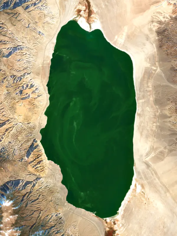
The last 13 satellite passes
81°F · Jul 1957°F · Nov 12
23°F cooler than on Jul 19, 2026.
Estimated from MODIS Aqua (NASA) passes on clear days: the top layer of the water, a few degrees either way. Coves and the shallows can be warmer.
Walker Lake water temperature: trend, swimming and the fish →
On or near the shore of Walker Lake: 1 campground and 1 beach. The lake has about 30 miles of shoreline, counting its islands.
Tap an icon for details; use two fingers (or Ctrl + scroll) to move the map. Tap a dot for details. Map and lake outline © OpenStreetMap contributors. Places from OpenStreetMap, Overture Maps and Recreation.gov. Not for navigation.
No aquatic invasive species are on record for Walker Lake in the USGS database. Keep it that way: clean, drain and dry your boat between lakes.
Nevada: Every boat that can hold water, canoes and kayaks included, must display a Nevada AIS decal, and moving quagga mussels or other invasive species is illegal (wardens can hold the boat). Clean, drain (pull the plug) and dry before going to another lake; Lake Tahoe runs its own separate boat inspections. Required: Nevada AIS decal. State rules
Records: USGS Nonindigenous Aquatic Species database. A species not listed may still be present.
Species with open-licensed records inside Walker Lake's outline, from GBIF.org (surveys, museum collections and angler reports). A record shows a fish was found here, not how many there are now.
Inlets and shorelines in spring; deeper as the lake warms.
Shallow, muddy bays and flooded grass in spring; mud flats and inflows in summer.
Water temperature sets off each spawn; the bars show the usual months at this latitude and elevation, and move with a warm or cold spring. The water is about 55°F now.
Walker Lake lies in the desert of Mineral County, Nevada, beside U.S. 95 about 75 miles south of Fallon, at the end of the Walker River. It is one of the last remnants of prehistoric Lake Lahontan and one of the few natural terminal lakes left in the state. For well over a century, farms upstream have taken most of the river, and the lake's modern story is one of shrinking, growing saltier and, lately, a slow effort to send water back.
The Walker River begins in the Sierra Nevada as two forks, the East Walker and the West Walker. They meet in Mason Valley just south of Yerington, and the river runs on to the lake, nearly 160 miles from its source. Nothing flows out. Evaporation is the only way water leaves, so salts stay behind.
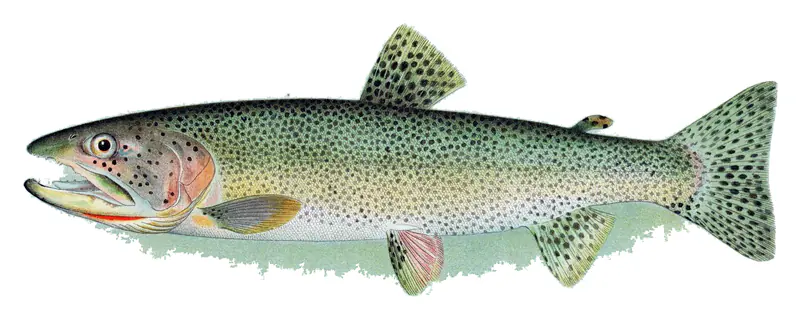
The lake is the traditional home of the Agai Dicutta, the Walker River Paiute Tribe, whose name in the Numu language means trout eater. The river crosses the tribe's reservation on its last stretch, passing through the reservoir behind Weber Dam, which the Bureau of Indian Affairs built in 1935.
Settlers began diverting the river in the 1860s for hay, pasture and other crops, and in time more water rights were handed out than the river carries in an average year. Storage dams went in on the east and west forks in the 1920s, and groundwater pumping for irrigation in Mason and Smith valleys began in the 1960s. Since 1882 the lake has dropped more than 150 feet. Its volume is down by more than 90 percent, and its surface area by more than half. Dissolved solids, about 2,500 milligrams per liter in 1882, have climbed roughly tenfold.
A Lahontan cutthroat trout fishery was built up at the lake in the 1950s, and the town of Hawthorne started a Loon Festival in the same decade. Old-timers recall counting 1,500 loons in a single day. The fishery depended on stocked trout, and the last one reported caught was in May 2009. That same year Hawthorne canceled the festival for lack of birds, and state wildlife officials have said the loons no longer stop because the fish are gone. Hawthorne itself dates to 1881 and the Carson and Colorado Railroad, and in the 1930s the federal government picked it for the ammunition depot that the Army still runs near the lake.
The 2002 Farm Bill set aside $200 million to supply water to at-risk desert terminal lakes, and Congress later created a program to buy Walker basin water rights from willing sellers. The Walker Basin Conservancy, a nonprofit formed in 2015, has led that Walker Basin Restoration Program since 2017, changing purchased rights from irrigation to river flow. The first restoration water, from rights bought in 2010, reached the lake on July 5, 2019, after years in the courts. The target is about 50,000 acre-feet of reliable water a year, enough to bring dissolved solids down to 10,000 to 12,000 milligrams per liter, where native species could thrive again and Lahontan cutthroat could return. By 2023 the Conservancy held just over half the water it needs.
Big winters help too. After a record snowpack in 2023, the lake rose nearly 13 feet by late June.
The Bureau of Land Management runs a recreation area beside the highway, where Sportsman's Beach has developed campsites and a boat ramp area but no drinking water, and Tamarack Beach and Twenty Mile Beach offer primitive camping. The west side of the lake is steep and rocky, and the east side has sandy beaches. Swimming, boating, water skiing and bird watching are the usual pastimes.
Written by Lake by Lake from U.S. Geological Survey, Nevada Water Science Center, Walker Basin Conservancy (History, Walker Lake receives water for restoration purposes for the first time), The Nevada Independent and Bureau of Land Management. Checked November 2026.
Where the level comes from: WALKER LAKE NR HAWTHORNE, NV (U.S. Geological Survey, used on this page) and Walker River at Walker Lake (NOAA National Water Prediction Service).
| Lake | Miles | Level (ft) | vs full | 7 days |
|---|---|---|---|---|
| Weber Reservoir Live reading | 26 | 4201.88 | — | +0.07 |
| Bridgeport Reservoir Live reading | 34 | 6445.11 | — | — |
| Topaz Lake Live reading | 40 | 83.03 | — | +0.52 |
| Lake Lahontan Live reading | 57 | 4125.04 | — | +1.22 |
| Donnell Lake Live reading | 69 | 4774.39 | — | −2.94 |
| Marlette Lake Live reading | 70 | 18.68 | — | +0.14 |
Compare Walker Lake with Weber Reservoir, Bridgeport Reservoir, Topaz Lake or Lake Lahontan: size, level, ramps and fish side by side.
Walker Lake is at 3,914.03 feet above sea level, as of Nov 17, 2026, 6:15 PM PST. It has dropped 0.09 ft in the past 7 days.
Today's level is 6.29 ft below the median for this date (3,920.32 ft), from the gauge’s long-term daily record.
3,907.52 ft, on December 30, 2022, in the U.S. Geological Survey record, which starts in 2022. Today the lake is 6.5 ft above that.
3,923.46 ft, on June 13, 2024, in the U.S. Geological Survey record since 2022.
Yes. There is 1 campground within about a mile of the shore, such as Twenty Mile Beach.
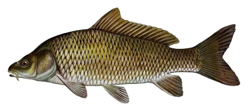
Game fish recorded in Walker Lake include great basin cutthroat trout, common carp. In all, 5 fish species have open records inside the lake on GBIF.
The water at Walker Lake is 55°F, measured 4 hr ago by the USGS sensor in the lake. Surface temperature changes through the day and with depth.
Anglers 12 and older need a Nevada fishing license, sold online by the Nevada Department of Wildlife. Free fishing days: Second Saturday in June. Size and bag limits can be set lake by lake: check the current regulations.
Walker Lake averages about 79 ft deep. Depth changes with the lake level.
Yes: bathymetric map with lake-bottom contours from the U.S. Geological Survey (2007). It is linked in the lake facts on this page. Depths on a map are measured at a reference level: subtract how far the lake is below it today.
fishing (2 game fish), swimming (1 beach or swimming area) and camping (1 campground), according to our map of the shore.
EPA's CyAN satellite rated cyanobacteria in Walker Lake very high on November 9. The satellite sees open water only; blooms can be patchy, so avoid water that looks like spilled paint or pea soup and keep dogs out of scum. Swimming advisories come from Nevada health and environment agencies.
From the U.S. Geological Survey (WALKER LAKE NR HAWTHORNE, NV). Lake by Lake checks it every hour; the agency's own figure is always the reference, and provisional readings can be revised.
Lake levels are refreshed every hour. Texas and California reservoirs report once a day; most USGS and NOAA gauges report every 15 to 60 minutes.