Sun
- Sunrise
- 6:55 AM
- Sunset
- 5:05 PM
- First light
- 6:28 AM
- Last light
- 5:32 PM
Reservoir · Wake County, North Carolina
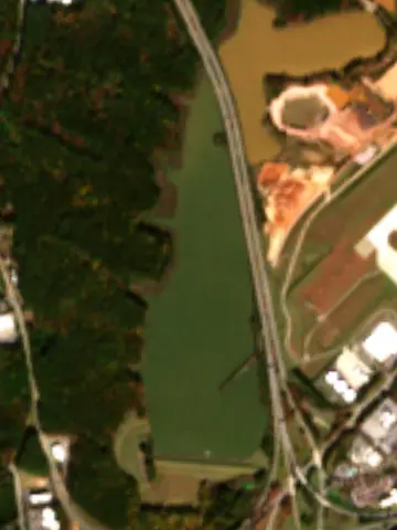
A reservoir on Brier Creek in Wake County, North Carolina, held back by Crabtree Creek WS Dam #20-A since 1977.
Brier Creek Reservoir is at 305.54 feet above sea level, as of Nov 19, 2026, 7:10 AM EST. It has dropped 0.11 ft in the past 7 days.
A notification from this browser, once, when the level crosses the line (checked every hour). No account and no email. On an iPhone, add Lake by Lake to your home screen first (Share → Add to Home Screen) and open it from there. Or follow the lake in a feed reader: RSS feed.
Brier Creek Reservoir is down 0.11 ft over the last 7 days, at 305.54 ft today.
Daily values from the U.S. Geological Survey.
Brier Creek Reservoir is down 0.18 ft over the last 30 days, at 305.54 ft today.
Daily values from the U.S. Geological Survey.
Over the past 12 months, Brier Creek Reservoir ranged from 305.14 ft (Jun 18, 2026) to 307.88 ft (Jul 29, 2026), a swing of 2.7 ft. Today's level is near the bottom of that range. It is 0.25 ft higher than on this date last year.
Daily values from the U.S. Geological Survey. Why lake levels rise and fall
Solunar periods for Brier Creek Reservoir, local time. How they work
Surface water temperature
65°F on Nov 11, 2026
85°F · Jul 2965°F · Nov 11
20°F cooler than on Jul 29, 2026.
Estimated from Landsat 8/9 (USGS) passes on clear days: the top layer of the water, a few degrees either way. Coves and the shallows can be warmer.
Brier Creek Reservoir water temperature: trend, swimming and the fish →
Tap an icon for details; use two fingers (or Ctrl + scroll) to move the map. Tap a dot for details. Map and lake outline © OpenStreetMap contributors. Places from OpenStreetMap, Overture Maps and Recreation.gov. Not for navigation.
What you’ll find on the shore
← AllLodging 7
These invasive plants and animals have been recorded in Brier Creek Reservoir: clean, drain and dry everything before you go to another lake.
North Carolina: North Carolina has no clean-drain-dry law for boaters. The Wildlife Resources Commission urges you to clean off plants, animals and mud, drain all water, dry your gear, and never move fish or plants from one water to another. State rules
Records: USGS Nonindigenous Aquatic Species database. A species not listed may still be present.
Brier Creek Reservoir is a reservoir in Wake County, North Carolina. Lake by Lake tracks its level from the U.S. Geological Survey and compares it with the readings of the past year.
Crabtree Creek WS Dam #20-A is an earthfill dam 40 feet high on Brier Creek, completed in 1977. It belongs to Wake County Community Development Services and is run for flood control and recreation.
From the National Inventory of Dams (U.S. Army Corps of Engineers), NID ID NC04456. Lake or reservoir: what’s the difference?
Where the level comes from: BRIER CREEK RES AT DAM AT RDU AIRPORT, NC (U.S. Geological Survey).
| Lake | Miles | Level (ft) | vs full | 7 days |
|---|---|---|---|---|
| Page Lake Live reading | 1 | 305.39 | — | −0.16 |
| Sorrells Grove Reservoir Live reading | 1 | 303.45 | — | −0.09 |
| Lake Crabtree Live reading | 2 | 275.24 | — | −0.22 |
| Hatchers Grove Reservoir Live reading | 4 | 325.32 | — | −0.11 |
| Coles Branch Reservoir Live reading | 5 | 312.07 | — | −0.08 |
| Richland Lake Live reading | 5 | 300.14 | — | −0.07 |
Compare Brier Creek Reservoir with Page Lake, Sorrells Grove Reservoir, Lake Crabtree or Hatchers Grove Reservoir: size, level, ramps and fish side by side.
Brier Creek Reservoir is about 6 mi from Cary, NC, 9 mi from Durham, NC and 10 mi from Raleigh, NC. See all the lakes near each city.
Brier Creek Reservoir is at 305.54 feet above sea level, as of Nov 19, 2026, 7:10 AM EST. It has dropped 0.11 ft in the past 7 days.
The surface of Brier Creek Reservoir was about 65°F on November 11, estimated from a satellite pass on a clear day. It is the top layer of the water, a few degrees either way; coves and shallows run warmer in the sun.
Anglers 16 and older need a North Carolina fishing license, sold online by the North Carolina Wildlife Resources Commission. Free fishing days: July 4. Size and bag limits can be set lake by lake: check the current regulations.
Brier Creek Reservoir averages about 15 ft deep. Depth changes with the lake level.
Brier Creek Reservoir is held back by Crabtree Creek Ws Dam #20-A, completed in 1977 and 40 ft high, according to the National Inventory of Dams.
From the U.S. Geological Survey (BRIER CREEK RES AT DAM AT RDU AIRPORT, NC). Lake by Lake checks it every hour; the agency's own figure is always the reference, and provisional readings can be revised.
Lake levels are refreshed every hour. Texas and California reservoirs report once a day; most USGS and NOAA gauges report every 15 to 60 minutes.
Cookies for analytics With your OK we use Google Analytics and Microsoft Clarity to count visits and see how the site is used, so we can make it better. No advertising cookies. Privacy policy