Sun
- Sunrise
- 7:07 AM
- Sunset
- 5:21 PM
- First light
- 6:40 AM
- Last light
- 5:48 PM
Reservoir · Oklahoma County, Oklahoma
A reservoir on the Deep Fork River in Oklahoma County, Oklahoma, held back by Arcadia Dam since 1986. Also called Lake Arcadia.

Arcadia Lake is at 1,007.45 feet above sea level — 1.45 ft above top of conservation pool, as of Nov 17, 2026, 8:00 PM CST. It has risen 0.58 ft in the past 7 days.
2nd fullest of 37 Oklahoma lakes today against full pool · See the ranking
Record low 1,003.31 ft (2015), record high 1,019.45 ft (2019) · Level history since 2014
A notification from this browser, once, when the level crosses the line (checked every hour). No account and no email. On an iPhone, add Lake by Lake to your home screen first (Share → Add to Home Screen) and open it from there. Or follow the lake in a feed reader: RSS feed.
Arcadia Lake is up 0.58 ft over the last 7 days, at 1,007.45 ft today.
Daily values from the NOAA National Water Prediction Service.
Arcadia Lake is down 3.00 ft over the last 30 days, at 1,007.45 ft today.
Daily values from the NOAA National Water Prediction Service.
Over the past 12 months, Arcadia Lake ranged from 1,003.89 ft (Sep 29, 2026) to 1,010.46 ft (Oct 17, 2026), a swing of 6.6 ft. Today's level is in the upper half of that range. It is 1.25 ft higher than on this date last year.
Daily values from the NOAA National Water Prediction Service. Why lake levels rise and fall
In the U.S. Army Corps of Engineers record, which starts in 2014, the lowest level was 1,003.31 ft on September 10, 2015 and the highest 1,019.45 ft on May 30, 2019. Today’s 1,007.45 ft is 4.1 ft above the record low and 12.0 ft below the record high.
Arcadia Lake level history: every year since 2014, the lowest and highest years →
Solunar periods for Arcadia Lake, local time. How they work
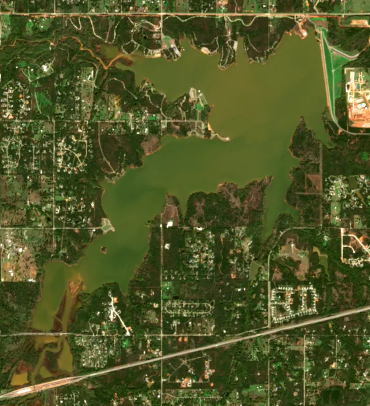
Surface water temperature
73°F on Oct 22, 2026
88°F · Jul 2673°F · Oct 22
15°F cooler than on Jul 26, 2026.
Estimated from Landsat 8/9 (USGS) passes on clear days: the top layer of the water, a few degrees either way. Coves and the shallows can be warmer.
Arcadia Lake water temperature: trend, swimming and the fish →
On or near the shore of Arcadia Lake: 2 boat ramps, 2 campgrounds and 2 trails. The lake has about 21 miles of shoreline, counting its islands.
Tap an icon for details; use two fingers (or Ctrl + scroll) to move the map. Tap a dot for details. Map and lake outline © OpenStreetMap contributors. Places from OpenStreetMap, Overture Maps and Recreation.gov. Not for navigation.
No aquatic invasive species are on record for Arcadia Lake in the USGS database. Keep it that way: clean, drain and dry your boat between lakes.
Oklahoma: Before launching, remove all aquatic plants and zebra or quagga mussels from your boat, trailer and gear (state law); moving aquatic plants between waters is also illegal. Draining, and drying for five days if you can't hot-wash, are recommended but not required. State rules
Records: USGS Nonindigenous Aquatic Species database. A species not listed may still be present.
Species with open-licensed records inside Arcadia Lake's outline, from GBIF.org (surveys, museum collections and angler reports). A record shows a fish was found here, not how many there are now.
Shallow, muddy bays and flooded grass in spring; mud flats and inflows in summer.
Water temperature sets off each spawn; the bars show the usual months at this latitude and elevation, and move with a warm or cold spring.
Arcadia Lake is a flood-control and water-supply reservoir on the Deep Fork River in northern Oklahoma County, about 5 miles east of Edmond and a mile and a half west of the small town of Arcadia. Northeast of Oklahoma City, it is a controlled-access park system that the city of Edmond runs for boating, camping, fishing and trail riding.
The Deep Fork rises in and around northern Oklahoma City and runs east for about 230 miles, through the Deep Fork National Wildlife Refuge near Okmulgee, to Eufaula Lake. Its upper course has been channelized, and the river is prone to floods. The Army Corps of Engineers and the City of Edmond built the dam together as a joint project, a rolled-earth embankment nearly a mile long, and the lake opened in 1987. It holds back floods in the Deep Fork basin and stores water for Edmond, which was growing fast in those years. The city had about 16,600 people in 1970, about 34,600 in 1980 and more than 52,000 in 1990. The Corps keeps a project office at the lake, while Edmond provides and runs the parks around the shore.
The lake shares its name with the town just east of the dam. Arcadia grew up after the Land Run of 1889 on fertile land along the Deep Fork, where white and African American families farmed cotton, and for decades about half the township was Black. The Missouri, Kansas and Texas Railroad came through in 1902 and 1903, and later U.S. Highway 66 brought business to town. The Arcadia Round Barn, built in 1898 by William H. Odor and later restored by local residents, is on the National Register of Historic Places, as is a stretch of the old Route 66 roadbed. The town fended off annexation by Edmond in 1984 and 1985 and incorporated in 1987.
The lake has four parks with campgrounds, picnic areas, swimming beaches, boat ramps and a disc golf course. Three of them, Spring Creek, Edmond and Central State parks, are linked by trail. Spring Creek, which starts south of downtown Edmond, enters the lake at Spring Creek Park. About 13 miles of trails wind through the woods. The multiuse trail, built for mountain biking and also used by hikers and runners, runs about 6.5 miles one way from the park office to Spring Creek Park on a single dirt track with bridges and water crossings. Sandy stretches ride best after a summer rain, some parts can be impassable in wet seasons, and winter is a good time to ride it. A separate 6-mile equestrian trail starts from a trailer lot in the middle of the route, so riders can head out in either direction.
Anglers fish for largemouth bass, bluegill and channel and blue catfish, from boats, from the shore or from a fishing pier. A heated, covered dock stays open all year. Fall brings waterfowl, among them mallards, redheads, canvasbacks, scaup, pintails and wood ducks, and Canada geese and white pelicans rest in the quiet backwaters. White-tailed deer, bobcats, gray foxes and beavers live in the woods and along the shore. Each January the lake hosts an Eagle Watch.
Written by Lake by Lake from U.S. Army Corps of Engineers, Tulsa District, City of Edmond (Arcadia Lake, Arcadia Lake Trails), Oklahoma Historical Society, Encyclopedia of Oklahoma History and Culture (Arcadia, Edmond) and Wikipedia. Checked November 2026.
Activities listed by the U.S. Army Corps of Engineers: Biking · Boating · Fishing · Hiking · Picnicking · Water sports · Wildlife viewing
Arcadia Dam is an earthfill dam 102 feet high and 5,250 feet long on the Deep Fork River, completed in 1986. It belongs to the U.S. Army Corps of Engineers (Tulsa District) and is run for flood control, recreation and water supply. At its normal level the reservoir holds 27,570 acre-ft, drained from 105 square miles of land.
From the National Inventory of Dams (U.S. Army Corps of Engineers), NID ID OK22178. Lake or reservoir: what’s the difference?
Where the level comes from: Deep Fork River at Arcadia Lake (NOAA National Water Prediction Service).
| Lake | Miles | Level (ft) | vs full | 7 days |
|---|---|---|---|---|
| Lake Hefner At or near full pool | 14 | 1199.51 | +0.51 | — |
| Lake Overholser At or near full pool | 20 | 1241.54 | +0.54 | — |
| Lake Stanley Draper Slightly below full | 22 | 1185.30 | −5.70 | — |
| Wes Watkins Reservoir Slightly below full | 23 | 1070.88 | −3.12 | — |
| Lake Thunderbird At or near full pool | 30 | 1037.07 | −1.93 | +0.28 |
| Heyburn Lake At or near full pool | 63 | 760.53 | −0.97 | −0.04 |
Compare Arcadia Lake with Lake Hefner, Lake Overholser, Lake Stanley Draper or Wes Watkins Reservoir: size, level, ramps and fish side by side.
Arcadia Lake is about 15 mi from Oklahoma City, OK and 28 mi from Norman, OK. See all the lakes near each city.
Arcadia Lake is also known as Lake Arcadia.
Arcadia Lake is at 1,007.45 feet above sea level — 1.45 ft above top of conservation pool, as of Nov 17, 2026, 8:00 PM CST. It has risen 0.58 ft in the past 7 days.
Arcadia Lake's top of conservation pool is 1,006.00 ft, according to U.S. Army Corps of Engineers. Today the lake is 1.45 ft above that mark.
Today's level is 1.26 ft above the median for this date (1,006.19 ft), from the gauge’s long-term daily record.
1,003.31 ft, on September 10, 2015, in the U.S. Army Corps of Engineers record, which starts in 2014. Today the lake is 4.1 ft above that.
1,019.45 ft, on May 30, 2019, in the U.S. Army Corps of Engineers record since 2014. That is 13.5 ft above top of conservation pool.
Arcadia Lake has 2 boat ramps on our map, including Boat ramp near Central State Park. Low water can close ramps, so check today's level above and the operator before you go.
Yes. There are 2 campgrounds and RV parks within about a mile of the shore, such as Central State Park at Lake Arcadia, Arcadia Lake Campground.
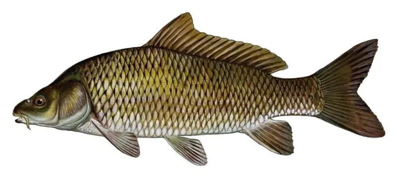
Game fish recorded in Arcadia Lake include common carp. In all, 1 fish species have open records inside the lake on GBIF.
Anglers 18 and older need an Oklahoma fishing license, sold online by the Oklahoma Department of Wildlife Conservation. Free fishing days: First weekend in June. Size and bag limits can be set lake by lake: check the current regulations.
Arcadia Lake averages about 15 ft deep. Depth changes with the lake level.
In summer a white Secchi disk lowered into Arcadia Lake stays visible to about 2.1 ft (the median of 129 readings, 2018–2024, by OWRB Lakes Monitoring): murky water. With the algae measured too (chlorophyll about 28 µg/L), that makes it eutrophic: rich in nutrients, greener water. Clarity drops after storms and during algae blooms.
Yes: hydrographic survey report with contour map from the Oklahoma Water Resources Board (2007). It is linked in the lake facts on this page. Depths on a map are measured at a reference level: subtract how far the lake is below it today.
U.S. Army Corps of Engineers lists biking, boating, fishing, hiking, picnicking, water sports and wildlife viewing at Arcadia Lake.
Yes. 2 trails run along or near the shore, including Education Trail (0.6 mi) and Spring Creek Trail (2.9 mi), according to OpenStreetMap.
Arcadia Lake is held back by Arcadia Dam, completed in 1986 and 102 ft high, according to the National Inventory of Dams.
From the NOAA National Water Prediction Service (Deep Fork River at Arcadia Lake). Lake by Lake checks it every hour; the agency's own figure is always the reference, and provisional readings can be revised.
Lake levels are refreshed every hour. Texas and California reservoirs report once a day; most USGS and NOAA gauges report every 15 to 60 minutes.