Sun
- Sunrise
- 7:01 AM
- Sunset
- 5:16 PM
- First light
- 6:34 AM
- Last light
- 5:43 PM
Reservoir · Chester County, South Carolina
A reservoir on the Catawba River in Chester County, South Carolina, held back by Great Falls-Dearborn Dam since 1923.
Great Falls Reservoir is at 96.14 ft on its local gauge — 3.86 ft below full pond (local datum), as of Nov 19, 2026, 6:00 AM EST. It has dropped 0.62 ft in the past 7 days.
Great Falls Reservoir is down 0.62 ft over the last 7 days, at 96.14 ft today.
Daily values from the NOAA National Water Prediction Service.
Great Falls Reservoir is down 2.01 ft over the last 30 days, at 96.14 ft today.
Daily values from the NOAA National Water Prediction Service. Why lake levels rise and fall
Solunar periods for Great Falls Reservoir, local time. How they work
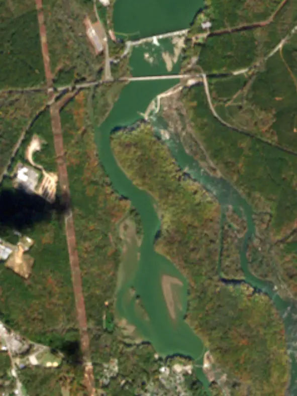
Surface water temperature
66°F on Nov 9, 2026
88°F · Sep 666°F · Nov 9
23°F cooler than on Sep 6, 2026.
Estimated from Landsat 8/9 (USGS) passes on clear days: the top layer of the water, a few degrees either way. Coves and the shallows can be warmer.
Great Falls Reservoir water temperature: trend, swimming and the fish →
Tap an icon for details; use two fingers (or Ctrl + scroll) to move the map. Tap a dot for details. Map and lake outline © OpenStreetMap contributors. Places from OpenStreetMap, Overture Maps and Recreation.gov. Not for navigation.
What you’ll find on the shore
← AllFishing spots 1
No aquatic invasive species are on record for Great Falls Reservoir in the USGS database. Keep it that way: clean, drain and dry your boat between lakes.
South Carolina: South Carolina has no clean-drain-dry law for boats, but it is illegal to possess hydrilla, water hyacinth and other listed aquatic plants or put them in state waters, so strip off all plant fragments. Officials urge boaters to clean, drain and dry before moving to another lake. State rules
Records: USGS Nonindigenous Aquatic Species database. A species not listed may still be present.
Great Falls Reservoir is a reservoir in Chester County, South Carolina. Lake by Lake tracks its level from the NOAA National Water Prediction Service and compares it with full pool and the readings of the past year.
Great Falls-Dearborn Dam is a concrete gravity dam 113 feet high and 950 feet long on the Catawba River, completed in 1923. It belongs to Duke Energy and is run for hydropower. At its normal level the reservoir holds 2,043 acre-ft, drained from 4,140 square miles of land.
From the National Inventory of Dams (U.S. Army Corps of Engineers), NID ID SC00140. Lake or reservoir: what’s the difference?
Where the level comes from: Catawba River at Great Falls Reservoir/Great Falls-Dearborn Dams (NOAA National Water Prediction Service).
| Lake | Miles | Level (ft) | vs full | 7 days |
|---|---|---|---|---|
| Cedar Creek Reservoir At or near full pool | 1 | 98.84* | −1.16 | +0.03 |
| Fishing Creek Reservoir At or near full pool | 3 | 98.64* | −1.36 | +0.37 |
| Lake Wateree Slightly below full | 19 | 97.65* | −2.35 | −0.38 |
| Monticello Reservoir Live reading | 30 | 422.94 | — | +0.44 |
| Parr Reservoir Live reading | 32 | 262.31 | — | −1.03 |
| Neal Shoals Reservoir Live reading | 33 | 330.94 | — | −0.14 |
* Local gauge datum: 100 ft = full pond (Duke Energy lakes).
Compare Great Falls Reservoir with Cedar Creek Reservoir, Fishing Creek Reservoir, Lake Wateree or Monticello Reservoir: size, level, ramps and fish side by side.
Great Falls Reservoir is about 36 mi from Columbia, SC, 45 mi from Charlotte, NC and 59 mi from Concord, NC. See all the lakes near each city.
Great Falls Reservoir is at 96.14 ft on its local gauge — 3.86 ft below full pond (local datum), as of Nov 19, 2026, 6:00 AM EST. It has dropped 0.62 ft in the past 7 days.
Great Falls Reservoir's full pond (local datum) is 100 ft (local datum), according to Duke Energy local datum: 100 ft = full pond. Today the lake is 3.86 ft below that mark.
The surface of Great Falls Reservoir was about 66°F on November 9, estimated from a satellite pass on a clear day. It is the top layer of the water, a few degrees either way; coves and shallows run warmer in the sun.
Anglers 16 and older need a South Carolina fishing license, sold online by the South Carolina Department of Natural Resources. Free fishing days: Memorial Day and July 4 (residents, freshwater only). Size and bag limits can be set lake by lake: check the current regulations.
NOAA's flood categories for the Great Falls Reservoir gauge: action stage at 101.0 ft and minor flooding at 102.0 ft. Today the lake is 5.86 ft below the first flooding level.
Great Falls Reservoir averages about 21 ft deep. Depth changes with the lake level.
Great Falls Reservoir is held back by Great Falls-Dearborn Dam, completed in 1923 and 113 ft high, according to the National Inventory of Dams.
From the NOAA National Water Prediction Service (Catawba River at Great Falls Reservoir/Great Falls-Dearborn Dams). Lake by Lake checks it every hour; the agency's own figure is always the reference, and provisional readings can be revised.
Lake levels are refreshed every hour. Texas and California reservoirs report once a day; most USGS and NOAA gauges report every 15 to 60 minutes.
Cookies for analytics With your OK we use Google Analytics and Microsoft Clarity to count visits and see how the site is used, so we can make it better. No advertising cookies. Privacy policy