Sun
- Sunrise
- 7:18 AM
- Sunset
- 5:02 PM
- First light
- 6:47 AM
- Last light
- 5:32 PM
Lake · Rich County, Utah
A lake fed by the Bear River in Rich County, Utah.

Bear Lake is at 5,918.46 feet above sea level, as of Nov 17, 2026, 7:15 PM MST. The level has held steady over the past week.
3rd lowest of 6 Utah lakes today against normal for the date · See the ranking
Record low 5,916.60 ft (2022), record high 5,927.14 ft (2024) · Level history since 2019
A notification from this browser, once, when the level crosses the line (checked every hour). No account and no email. On an iPhone, add Lake by Lake to your home screen first (Share → Add to Home Screen) and open it from there. Or follow the lake in a feed reader: RSS feed.
Bear Lake is up 0.08 ft over the last 30 days, at 5,918.46 ft today.
Daily values from the U.S. Geological Survey.
Over the past 12 months, Bear Lake ranged from 5,918.36 ft (Oct 10, 2026) to 5,923.37 ft (Apr 27, 2026), a swing of 5.0 ft. Today's level is near the bottom of that range. It is 3.60 ft lower than on this date last year.
Daily values from the U.S. Geological Survey. Why lake levels rise and fall
In the U.S. Geological Survey record, which starts in 2019, the lowest level was 5,916.60 ft on November 5, 2022 and the highest 5,927.14 ft on June 24, 2024. Today’s 5,918.46 ft is 1.9 ft above the record low and 8.7 ft below the record high.
Bear Lake level history: every year since 2019, the lowest and highest years →
Solunar periods for Bear Lake, local time. How they work
Not detected · as of Nov 9, 2026
The satellite found no cyanobacteria at the surface.
Week of Aug 16Week of Nov 1
Each bar is one week, colored by the worst reading of that week.
From the U.S. EPA's Cyanobacteria Assessment Network (CyAN), which reads the color of lakes from the Sentinel-3 satellites; it sees open water only, not coves or the shoreline. Blooms can be patchy: what you see on the water matters more. Swimming closures and health advisories come from Utah health and environment agencies. How to read it
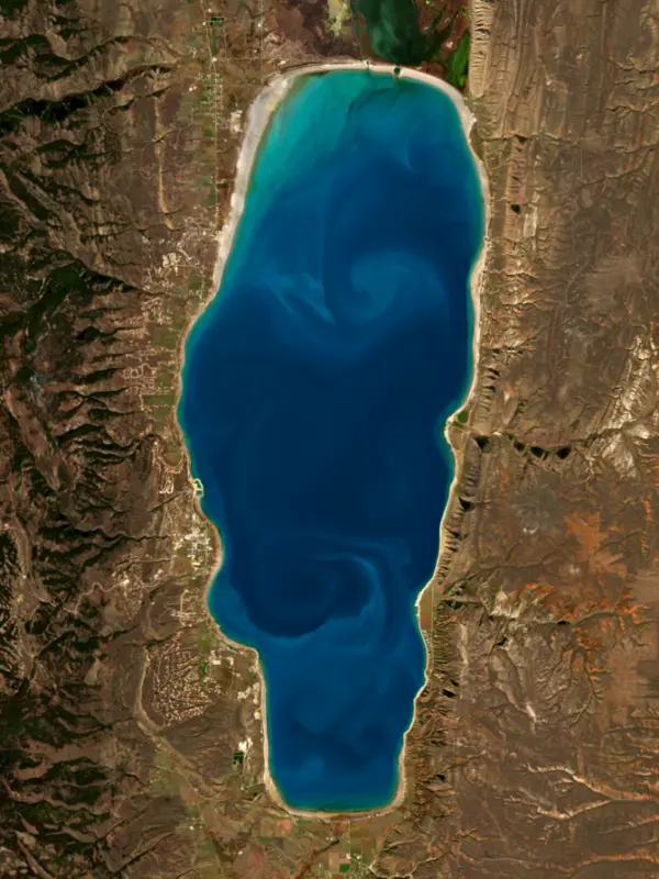
Surface water temperature
52°F on Nov 12, 2026
74°F · Jul 2152°F · Nov 12
22°F cooler than on Jul 21, 2026.
Estimated from Landsat 8/9 (USGS) passes on clear days: the top layer of the water, a few degrees either way. Coves and the shallows can be warmer.
On or near the shore of Bear Lake: 9 boat ramps, 2 marinas, 2 rental outfits, 14 campgrounds, 9 beaches and 1 trail. The lake has about 50 miles of shoreline, counting its islands.
Tap an icon for details; use two fingers (or Ctrl + scroll) to move the map. Tap a dot for details. Map and lake outline © OpenStreetMap contributors. Places from OpenStreetMap, Overture Maps and Recreation.gov. Not for navigation.
What you’ll find on the shore
← AllBoating 11
← AllRentals & tours 2
← AllBeaches 9
← AllCamping 14
← AllLodging 24+
← AllTrails 1
← AllParks 5
← AllDining 1
These invasive plants and animals have been recorded in Bear Lake: clean, drain and dry everything before you go to another lake.
Utah: Every boater, paddlers included, must take the Mussel-Aware Boater course each year, and motorboats need an annual AIS decal; pull drain plugs and sea strainers when leaving any water and while trailering. Boats leaving Lake Powell must be inspected, then professionally decontaminated or dried 7 to 30 days before launching elsewhere. Required: Mussel-Aware Boater course certificate; AIS decal (motorboats) (Course free; AIS decal $20 a year for Utah motorboats, $25 for nonresident motorboats). State rules
Records: USGS Nonindigenous Aquatic Species database. A species not listed may still be present.
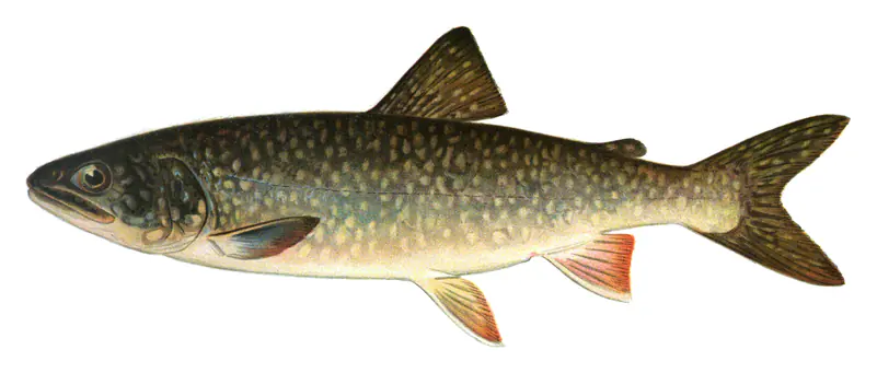
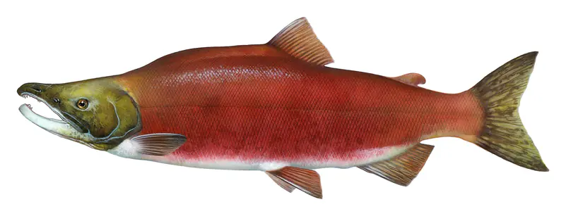
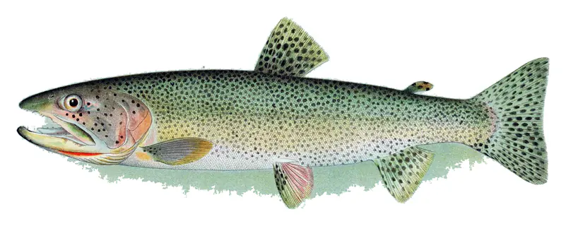
Species with open-licensed records inside Bear Lake's outline, from GBIF.org (surveys, museum collections and angler reports). A record shows a fish was found here, not how many there are now.
Shallow, protected flats in spring; docks, grass and deep edges in summer heat.
Cool water: near the surface in spring and fall, deep in summer.
Deep and cold most of the year; shallow reefs in fall and right after ice-out.
Schools at a set depth in summer: trolling at the right depth is everything.
Inlets and shorelines in spring; deeper as the lake warms.
Water temperature sets off each spawn; the bars show the usual months at this latitude and elevation, and move with a warm or cold spring. The water is about 52°F now.
Bear Lake is a natural lake split almost evenly by the Utah-Idaho line, with Rich County on the Utah side and Garden City and Laketown as its Utah towns. Its milky turquoise water has earned it the nickname Caribbean of the Rockies, and the valley is known for its raspberries and for a small fish that lives nowhere else.
The lake fills a valley that is still dropping along faults on its eastern side, which slowly deepens that part of the basin. It is at least 250,000 years old and may be far older. The color comes from fine particles of calcium carbonate held in the water. For about the last 17,000 years the lake has been making carbonate minerals in large amounts, mostly aragonite, which is rare in a big, cold, nutrient-poor lake like this one.
During the last ice age the Bear River flowed into the lake and laid down red, limy clay. It was cut off about 18,000 years ago and did not flow into the lake again until engineers diverted it back early in the 20th century. Through that long separation the lake's chemistry stayed fairly steady, and it is home to four fish found nowhere else: the Bonneville cisco, Bonneville whitefish, Bear Lake whitefish and Bear Lake sculpin.
Shoshone people are the first known inhabitants of the valley. The fur trader Donald McKenzie named it Black Bear Lake in 1819, and the name was later shortened. In the summers of 1827 and 1828 the trading firm of Smith, Jackson and Sublette held the Rocky Mountain Rendezvous near present Laketown. Jedediah Smith arrived late to the 1827 gathering, back from his trip to California, and the camp greeted him with cannon fire. That same summer a fight broke out when a Blackfeet party entered the camp, and trappers sided with their Snake allies. Rendezvous Beach on the south shore takes its name from those meetings. Mormon settlers led by Charles C. Rich came into the valley in 1863 under an agreement that left most of the Utah end in Native hands, and only gradually moved south to found Garden City and Laketown.
In 1911 a diversion at Wardboro, Idaho, began sending most of the Bear River into the lake through Mud Lake at the north end. An outlet canal finished in 1915 lets the water rejoin the river, and the Lifton Pumping Station, completed in 1917, lifts water out so that the upper 21 feet or so of the lake can store spring runoff for irrigation later in the year. The level therefore swings with snowpack and dry summers. The lake hit its historic low in 1936 and nearly matched it in 2004, then rose more than 11 feet in each of 2011 and 2017.
The Bonneville cisco is a slender fish that grows to about 9 inches. In mid to late January it crowds the rocky southeastern shore known as Cisco Beach for roughly 10 days to spawn, and people come to scoop them up with small hand-held nets; anyone over 12 needs a fishing license to do it. Cisco feed the lake's bigger fish, including cutthroat trout, lake trout and whitefish, and anglers freeze them for bait. Attempts to plant cisco elsewhere have failed.
Summer brings boaters and swimmers. Utah's Bear Lake State Park includes Rendezvous Beach at the south end and Cisco Beach on the east side, and Idaho has a Bear Lake State Park of its own on the north and east shores. Garden City holds Raspberry Days, usually in the first week of August. A virus that struck the original Bear Lake raspberry plants in 2001 wiped out most of them.
Written by Lake by Lake from U.S. Geological Survey, Wikipedia, Intermountain Histories, Utah Public Radio and Bridgerland Audubon Society, Wild About Utah and KSL.com. Checked November 2026.
Activities: Scenic drives · Biking · Boating · Camping · Fishing · Hiking · Off-road vehicles · Winter sports · Water sports · Wildlife viewing · Day use areas · Paddling · Swimming
Where the level comes from: BEAR LAKE AT STATE PARK MARINA NR GARDEN CITY, UT (U.S. Geological Survey).
| Lake | Miles | Level (ft) | vs full | 7 days |
|---|---|---|---|---|
| Newton Reservoir Well below full | 30 | 4735.60 | −38.90 | +1.40 |
| Hyrum Reservoir Well below full | 34 | 4646.92 | −25.08 | +2.14 |
| Causey Reservoir Well below full | 47 | 5665.00 | −27.00 | +2.06 |
| Lost Creek Reservoir Well below full | 54 | 5942.39 | −62.61 | +0.04 |
| Willard Bay Reservoir Below full | 54 | 4216.73 | −9.27 | +0.16 |
| Pineview Reservoir Well below full | 54 | 4832.90 | −67.10 | — |
Compare Bear Lake with Newton Reservoir, Hyrum Reservoir, Causey Reservoir or Lost Creek Reservoir: size, level, ramps and fish side by side.
Bear Lake is at 5,918.46 feet above sea level, as of Nov 17, 2026, 7:15 PM MST. The level has held steady over the past week.
Today's level is 4.52 ft below the median for this date (5,922.98 ft), from the gauge’s long-term daily record.
5,916.60 ft, on November 5, 2022, in the U.S. Geological Survey record, which starts in 2019. Today the lake is 1.9 ft above that.
5,927.14 ft, on June 24, 2024, in the U.S. Geological Survey record since 2019.
Bear Lake has 9 boat ramps on our map, including Boat ramp at Ideal Beach Marina, Boat ramp near Bear Lake North Beach, Rendezvous Beach State Park, and 2 marinas. Low water can close ramps, so check today's level above and the operator before you go.
Yes. There are 14 campgrounds and RV parks within about a mile of the shore, such as Bear Lake Aquatics Base, Rainbow Cove Campground, Camp Hunt.
Game fish recorded in Bear Lake include lake trout, rainbow trout, cutthroat trout, kokanee salmon, largemouth bass, Bonneville cisco. In all, 15 fish species have open records inside the lake on GBIF.
The surface of Bear Lake was about 52°F on November 12, estimated from a satellite pass on a clear day. It is the top layer of the water, a few degrees either way; coves and shallows run warmer in the sun.
Anglers 12 and older need a Utah fishing license, sold online by the Utah Division of Wildlife Resources. Free fishing days: Free Fishing Day, one Saturday in June (2026: June 6). Size and bag limits can be set lake by lake: check the current regulations.
Bear Lake is about 208 ft deep at its deepest point, and about 121 ft deep on average. Depth changes with the lake level.
In summer a white Secchi disk lowered into Bear Lake stays visible to about 19.7 ft (the median of 118 readings, 2016–2024, by Utah Department Of Environmental Quality and North American Lake Management Society): very clear water. With the algae measured too (chlorophyll about 1 µg/L), that makes it oligotrophic: clear, low in nutrients. Clarity drops after storms and during algae blooms.
Yes: bathymetric map (2002 survey) from the U.S. Geological Survey (2003). It is linked in the lake facts on this page. Depths on a map are measured at a reference level: subtract how far the lake is below it today.
Recreation.gov lists scenic drives, biking, boating, camping, fishing, hiking, off-road vehicles and winter sports at Bear Lake State Park.
EPA's CyAN satellite rated cyanobacteria in Bear Lake not detected on November 9. The satellite sees open water only; blooms can be patchy, so avoid water that looks like spilled paint or pea soup and keep dogs out of scum. Swimming advisories come from Utah health and environment agencies.
Yes. A trail runs along or near the shore, including Bear Lake Legacy Pathway (4.8 mi), according to OpenStreetMap.
From the U.S. Geological Survey (BEAR LAKE AT STATE PARK MARINA NR GARDEN CITY, UT). Lake by Lake checks it every hour; the agency's own figure is always the reference, and provisional readings can be revised.
Lake levels are refreshed every hour. Texas and California reservoirs report once a day; most USGS and NOAA gauges report every 15 to 60 minutes.