Sun
- Sunrise
- 7:19 AM
- Sunset
- 4:27 PM
- First light
- 6:45 AM
- Last light
- 5:01 PM
Lake · King County, Washington
A lake fed by Issaquah Creek in King County, Washington.

Lake Sammamish is at 26.34 feet above sea level, as of Nov 18, 2026, 10:15 PM PST. It has risen 0.07 ft in the past 7 days.
6th highest of 13 Washington lakes today against normal for the date · See the ranking
Record low 25.47 ft (2003), record high 31.14 ft (1997) · Level history since 1996
A notification from this browser, once, when the level crosses the line (checked every hour). No account and no email. On an iPhone, add Lake by Lake to your home screen first (Share → Add to Home Screen) and open it from there. Or follow the lake in a feed reader: RSS feed.
Lake Sammamish is up 0.07 ft over the last 7 days, at 26.34 ft today.
Daily values from the U.S. Geological Survey.
Lake Sammamish is up 0.38 ft over the last 30 days, at 26.34 ft today.
Daily values from the U.S. Geological Survey.
Over the past 12 months, Lake Sammamish ranged from 25.68 ft (Aug 27, 2026) to 29.00 ft (Dec 18, 2025), a swing of 3.3 ft. Today's level is near the bottom of that range. It is 0.61 ft lower than on this date last year.
Daily values from the U.S. Geological Survey. Why lake levels rise and fall
In the U.S. Geological Survey record, which starts in 1996, the lowest level was 25.47 ft on September 7, 2003 and the highest 31.14 ft on January 4, 1997. Today’s 26.34 ft is 0.9 ft above the record low and 4.8 ft below the record high.
Lake Sammamish level history: every year since 1996, the lowest and highest years →
Solunar periods for Lake Sammamish, local time. How they work
Not detected · as of Nov 9, 2026
The satellite found no cyanobacteria at the surface.
Week of Aug 16Week of Nov 1
Each bar is one week, colored by the worst reading of that week.
From the U.S. EPA's Cyanobacteria Assessment Network (CyAN), which reads the color of lakes from the Sentinel-3 satellites; it sees open water only, not coves or the shoreline. Blooms can be patchy: what you see on the water matters more. Swimming closures and health advisories come from Washington health and environment agencies. How to read it
Surface water temperature
61°F on Oct 19, 2026
81°F · Jul 2261°F · Oct 19
20°F cooler than on Jul 22, 2026.
Estimated from Landsat 8/9 (USGS) passes on clear days: the top layer of the water, a few degrees either way. Coves and the shallows can be warmer.
Lake Sammamish water temperature: trend, swimming and the fish →
On or near the shore of Lake Sammamish: 3 boat ramps, 1 rental outfit, 2 campgrounds, 9 beaches, 1 fishing pier and 11 trails. The lake has about 20 miles of shoreline, counting its islands.
Tap an icon for details; use two fingers (or Ctrl + scroll) to move the map. Tap a dot for details. Map and lake outline © OpenStreetMap contributors. Places from OpenStreetMap, Overture Maps and Recreation.gov. Not for navigation.
What you’ll find on the shore
← AllBoating 3
← AllRentals & tours 1
← AllFishing spots 4
← AllBeaches 9
← AllCamping 2
← AllLodging 7
← AllTrails 11
← AllParks 16
← AllDining 1
These invasive plants and animals have been recorded in Lake Sammamish: clean, drain and dry everything before you go to another lake.
Washington: Stop at every open watercraft check station (required for motorized and nonmotorized boats), and clean and drain your boat after each use, removing plants, animals and water. Required: Aquatic Invasive Species Prevention Permit (out-of-state boats) ($24 a year for out-of-state boats). State rules
Records: USGS Nonindigenous Aquatic Species database. A species not listed may still be present.
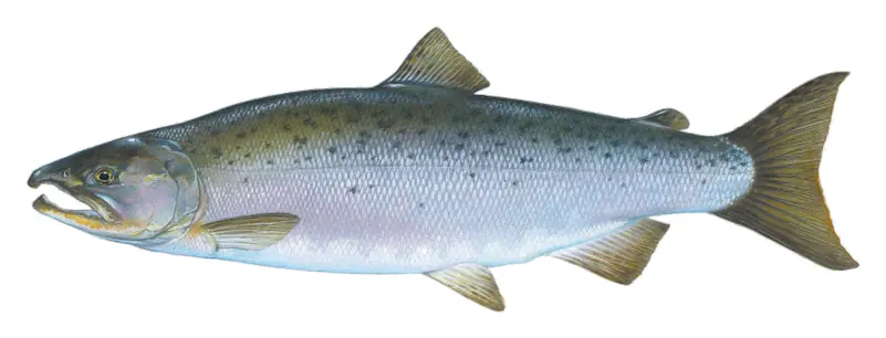
The last stocking on record was on March 26, 2024 (Coho salmon).
Source: Washington Department of Fish and Wildlife stocking records.
Species with open-licensed records inside Lake Sammamish's outline, from GBIF.org (surveys, museum collections and angler reports). A record shows a fish was found here, not how many there are now. marks fish the state stocks here.
Shallow, protected flats in spring; docks, grass and deep edges in summer heat.
Brush piles, docks and bridge pilings; shallow for a few weeks in spring.
Rocky points, gravel and current breaks; deeper rock piles in summer.
Schools near the bottom; a favorite through the ice.
Near the surface in cool months; fall runs to the inlets.
Water temperature sets off each spawn; the bars show the usual months at this latitude and elevation, and move with a warm or cold spring.
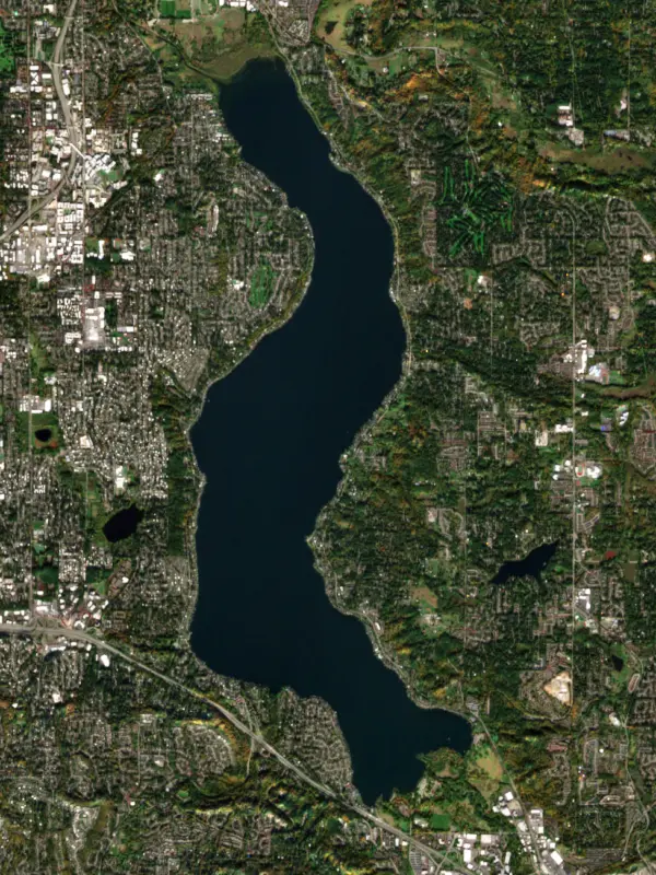
Lake Sammamish is a long, narrow lake in King County, about 8 miles east of Seattle, reaching from Issaquah at its south end to Redmond at its north, with Bellevue and the city of Sammamish along its sides. It is the sixth-largest lake in Washington and draws more than a million visitors a year.
The lake sits in Coast Salish country, and the Snoqualmie Tribe is among the peoples who trace their roots here. Its Lushootseed name means little lake, a fair description next to Lake Washington just to the west. Early settlers called the Sammamish people the Squak, and the name stuck to the land for a while: the valley at the south end was Squak Valley, which became Issaquah, and the outlet river was first known as Squak Slough.
Farms filled the flats at the south end. Albert Giese started a dairy in 1898 near what is now the state park boat launch, and Hans Jensen, a Danish dairyman who arrived in 1904, let the public swim and picnic on his beach. The state bought land there in 1950 and 1951, opened Lake Sammamish State Park in July 1952, and later received 67 acres from Jensen's estate.
About 98 square miles drain to the lake, but one stream dominates. Issaquah Creek, entering at the state park, supplies more than 70 percent of the inflow. The outlet is the Sammamish River, which leaves the lake at Marymoor Park in Redmond and runs about 14 miles north and west through Redmond, Woodinville, Bothell and Kenmore to Lake Washington.
That river changed when the Lake Washington Ship Canal was completed in 1916. Lake Washington dropped about 9 feet, the step down from Lake Sammamish grew to about 12 feet, and the river ran faster. In the 1960s the Army Corps of Engineers deepened and straightened much of the channel and enlarged a weir near the outlet to hold the lake at a steadier level. In 1998 a notch was cut in the weir so fish and small boats could pass. The Sammamish River Trail follows the river from Marymoor to Bothell, and the East Lake Sammamish Trail runs along the east shore.
Suburban growth has shaped the water itself. A 1968 project diverted sewage away from the lake and cut its phosphorus load by about a third, and the water cleared. As forests gave way to roads and roofs, runoff pushed phosphorus up again, and a 1996 water quality plan set targets to bring it back down. King County still monitors the lake closely.
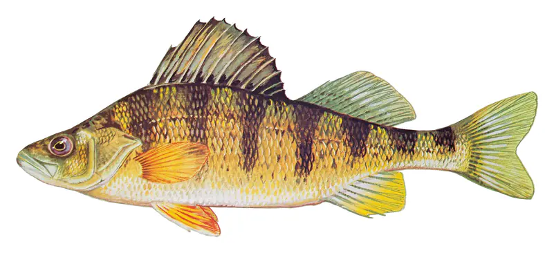
The state's fish agency lists wild coastal cutthroat trout, smallmouth bass and yellow perch as the main draws, with fewer but sizable largemouth bass and brown bullhead. Cutthroat bite best in spring and fall, bass around the spring spawn, and perch all year, with summer the best season and deep schools in winter. Chinook, coho and sockeye also pass through. Public access runs mainly through Lake Sammamish State Park on the south shore, with a multi-lane launch and floats for shore fishing.
Kokanee, the small landlocked sockeye, are closed to fishing. The lake's late-run kokanee have been counted on their spawning streams since 1996, and the numbers have trended down. County scientists point to late-summer conditions, when warm surface water and low oxygen at depth squeeze the fish into a thin band, along with nonnative predators and plankton eaters that now likely make up more than half the fish in the lake. Some returning adults are spawned for a hatchery program that supplements the run.
Written by Lake by Lake from King County Department of Natural Resources and Parks, King County Science and Technical Support Section, Washington State Parks, Washington Department of Fish and Wildlife and Wikipedia (Lake Sammamish, Sammamish River). Checked November 2026.
Where the level comes from: SAMMAMISH LAKE NEAR REDMOND, WA (U.S. Geological Survey).
| Lake | Miles | Level (ft) | vs full | 7 days |
|---|---|---|---|---|
| South Fork Tolt Reservoir Live reading | 21 | 1717.09 | — | −0.45 |
| Lake Tapps Live reading | 23 | 537.51 | — | −0.17 |
| Mud Mountain Lake Live reading | 31 | 917.01 | — | −4.34 |
| Spada Lake Live reading | 34 | 1407.52 | — | +4.10 |
| Keechelus Lake Well below full | 40 | 2433.13 | −83.87 | +0.80 |
| Kachess Lake Well below full | 48 | 2212.86 | −49.14 | +0.04 |
Compare Lake Sammamish with South Fork Tolt Reservoir, Lake Tapps, Mud Mountain Lake or Spada Lake: size, level, ramps and fish side by side.
Lake Sammamish is about 3 mi from Bellevue, WA, 8 mi from Renton, WA and 12 mi from Seattle, WA. See all the lakes near each city.
Lake Sammamish is at 26.34 feet above sea level, as of Nov 18, 2026, 10:15 PM PST. It has risen 0.07 ft in the past 7 days.
Today's level is 0.52 ft below the median for this date (26.86 ft), from the gauge’s long-term daily record.
25.47 ft, on September 7, 2003, in the U.S. Geological Survey record, which starts in 1996. Today the lake is 0.9 ft above that.
31.14 ft, on January 4, 1997, in the U.S. Geological Survey record since 1996.
Lake Sammamish has 3 boat ramps on our map, including Boat ramp near Flintoft's Beach, Boat ramp near Sammamish Landing, Boat ramp at Vasa Park Resort. Low water can close ramps, so check today's level above and the operator before you go.
Yes. There are 2 campgrounds and RV parks within about a mile of the shore, such as Vasa Park Resort, Hans Jensen Group Camp (Youth Programs).
Game fish recorded in Lake Sammamish include largemouth bass, black crappie, smallmouth bass, yellow perch, Coho salmon, brown bullhead. In all, 14 fish species have open records inside the lake on GBIF.
Anglers 16 and older need a Washington fishing license, sold online by the Washington Department of Fish and Wildlife. Free fishing days: First weekend after the first Monday in June. Size and bag limits can be set lake by lake: check the current regulations.
Lake Sammamish is about 115 ft deep at its deepest point, and about 83 ft deep on average. Depth changes with the lake level.
Yes: lake page with bathymetric map from the King County Department of Natural Resources and Parks. It is linked in the lake facts on this page. Depths on a map are measured at a reference level: subtract how far the lake is below it today.
boating (3 boat ramps), kayaks, boats & jet skis (1 rental outfit on or near the water), fishing (9 game fish and 1 fishing pier or spot; stocked by the state), swimming (9 beaches and swimming areas), hiking & walking (11 trails along the shore, the longest Lake to Lake Trail (15 mi)) and camping (2 campgrounds), according to our map of the shore.
EPA's CyAN satellite rated cyanobacteria in Lake Sammamish not detected on November 9. The satellite sees open water only; blooms can be patchy, so avoid water that looks like spilled paint or pea soup and keep dogs out of scum. Swimming advisories come from Washington health and environment agencies.
Yes. Washington Department of Fish and Wildlife stocked Coho salmon in Lake Sammamish; the latest stocking on record was on March 26, 2024.
Yes. 11 trails run along or near the shore, including Issaquah Creek Trail (1.0 mi), Heron Loop Trail (0.6 mi) and East Lake Sammamish Trail (10 mi), according to OpenStreetMap.
From the U.S. Geological Survey (SAMMAMISH LAKE NEAR REDMOND, WA). Lake by Lake checks it every hour; the agency's own figure is always the reference, and provisional readings can be revised.
Lake levels are refreshed every hour. Texas and California reservoirs report once a day; most USGS and NOAA gauges report every 15 to 60 minutes.
Cookies for analytics With your OK we use Google Analytics and Microsoft Clarity to count visits and see how the site is used, so we can make it better. No advertising cookies. Privacy policy