Sun
- Sunrise
- 6:36 AM
- Sunset
- 4:53 PM
- First light
- 6:09 AM
- Last light
- 5:20 PM
Reservoir · Santa Barbara County, California
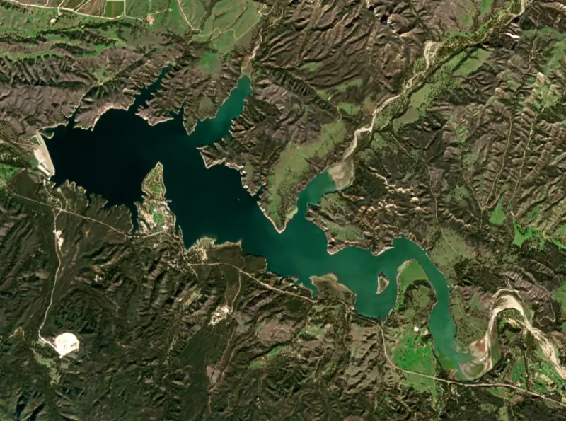
A reservoir on the Santa Ynez River in Santa Barbara County, California, held back by Bradbury Dam since 1953. Also called Lake Cachuma.

Cachuma Lake is at 741.49 feet above sea level — 8.51 ft below top of active conservation pool, 83.0% full, as of Nov 16, 2026. It has dropped 0.33 ft in the past 7 days.
10th fullest of 41 California lakes today by percent full · See the ranking
Record low 646.42 ft (2016), record high 754.43 ft (2026) · Level history since 2007
A notification from this browser, once, when the level crosses the line (checked every hour). No account and no email. On an iPhone, add Lake by Lake to your home screen first (Share → Add to Home Screen) and open it from there. Or follow the lake in a feed reader: RSS feed.
Cachuma Lake is down 1.00 ft over the last 30 days, at 741.49 ft today.
Daily values from the California Data Exchange Center (DWR).
Over the past 12 months, Cachuma Lake ranged from 736.69 ft (Dec 22, 2025) to 754.43 ft (Jan 17, 2026), a swing of 17.7 ft. Today's level is in the lower half of that range. It is 4.95 ft higher than on this date last year.
Daily values from the California Data Exchange Center (DWR). Why lake levels rise and fall
In the California Data Exchange Center (DWR) record, which starts in 2007, the lowest level was 646.42 ft on October 14, 2016 and the highest 754.43 ft on January 17, 2026. Today’s 741.49 ft is 95.1 ft above the record low and 12.9 ft below the record high.
Cachuma Lake level history: every year since 2007, the lowest and highest years →
Solunar periods for Cachuma Lake, local time. How they work
Not detected · as of Nov 9, 2026
The satellite found no cyanobacteria at the surface.
Week of Aug 16Week of Nov 1
Each bar is one week, colored by the worst reading of that week.
From the U.S. EPA's Cyanobacteria Assessment Network (CyAN), which reads the color of lakes from the Sentinel-3 satellites; it sees open water only, not coves or the shoreline. Blooms can be patchy: what you see on the water matters more. Swimming closures and health advisories come from California health and environment agencies. How to read it
Surface water temperature
67°F on Nov 8, 2026
78°F · Jul 2767°F · Nov 8
11°F cooler than on Jul 27, 2026.
Estimated from Landsat 8/9 (USGS) passes on clear days: the top layer of the water, a few degrees either way. Coves and the shallows can be warmer.
Cachuma Lake water temperature: trend, swimming and the fish →
On or near the shore of Cachuma Lake: 1 boat ramp, 3 marinas, 1 rental outfit, 3 campgrounds and 2 trails. The lake has about 42 miles of shoreline, counting its islands.
Tap an icon for details; use two fingers (or Ctrl + scroll) to move the map. Tap a dot for details. Map and lake outline © OpenStreetMap contributors. Places from OpenStreetMap, Overture Maps and Recreation.gov. Not for navigation.
No aquatic invasive species are on record for Cachuma Lake in the USGS database. Keep it that way: clean, drain and dry your boat between lakes.
California: California-registered motorized boats used in fresh water must display a current Mussel Fee sticker. Many lakes and reservoirs run mandatory inspections or quarantines, moving quagga, zebra or golden mussels is illegal, and boaters are asked to clean, drain and dry. Required: Quagga and Zebra Mussel Fee sticker ($42 every two years ($21 if bought in an even-numbered year)). State rules
Records: USGS Nonindigenous Aquatic Species database. A species not listed may still be present.
Species with open-licensed records inside Cachuma Lake's outline, from GBIF.org (surveys, museum collections and angler reports). A record shows a fish was found here, not how many there are now.
Shallow, protected flats in spring; docks, grass and deep edges in summer heat.
Rocky points, gravel and current breaks; deeper rock piles in summer.
Beds in shallow, firm bottoms; around docks and weeds all summer.
On the bottom near snail beds; spawns around the full moon.
Water temperature sets off each spawn; the bars show the usual months at this latitude and elevation, and move with a warm or cold spring. The water is about 67°F now.
Cachuma Lake is a Bureau of Reclamation reservoir on the Santa Ynez River in the Santa Ynez Valley of Santa Barbara County, along the north side of Highway 154 about 10 miles east of Solvang. It supplies most of the water for the South Coast, from Goleta to Carpinteria, and it is also a county park known for camping, winter trout and boat trips to watch bald eagles.
By the 1940s the South Coast was pumping groundwater faster than rain could replace it, and towns turned to rationing and fines. In 1941 the county Board of Supervisors asked the Bureau of Reclamation to study the problem. Goleta voters formed their own water district on November 17, 1944, to have a voice in the debate, and in 1945 the state created the Santa Barbara County Water Agency to sign a master contract with the federal government. A harsh drought in the late 1940s dried up the coast, and voters backed the project by about three to one. Reclamation's 1947 plan called for a dam, a tunnel through the mountains and a coastal conduit, and the Secretary of the Interior authorized it on March 4, 1948.
The dam and the South Coast Conduit were built from 1950 to 1953. The lake takes its name from a Chumash village the Spaniards wrote as Aquitsumu, from a Barbareño Chumash word meaning sign. The dam was first called Cachuma Dam, and in 1971 it was renamed Bradbury Dam to honor Brad Bradbury, a local champion of the water supply.
The hardest part was the Tecolote Tunnel, bored 6.4 miles through the Santa Ynez Mountains to carry lake water to the coast. Work started on March 30, 1950, and took until 1956. Underground streams poured in at temperatures up to 117 degrees, methane built up, and swelling rock crushed the timber supports. In 1951 a gas explosion sent 11 miners to the hospital, and the first contractor eventually handed the job to others. Deliveries to the South Coast began in 1956. Reclamation runs the dam, and the Cachuma Operation and Maintenance Board, a joint agency formed in 1956 whose members are Goleta, Santa Barbara, Montecito and Carpinteria, runs the rest. Since 1997 the region has also drawn State Water Project water, which reaches the lake through a pipeline from Vandenberg.
The lake's level swings hard. During the long drought of the 2010s it bottomed out on October 14, 2016, at about 7 percent full. A single storm in February 2017 raised it 25 feet in a day. Then the storms of late December 2022 and early January 2023 took it from about a third full to nearly full by January 15, 2023, the first time in 12 years, and the releases that followed brought flood warnings to parts of Lompoc downstream.
Santa Barbara County Parks runs the recreation area, with tent, RV and group camping, cabins and yurts, a marina and about 5 miles of trails, with Los Padres National Forest trails close by. Because Cachuma is a drinking-water reservoir, swimming and other body contact with the lake have been barred since the park opened in the 1950s. In 2011 the rules eased to allow kayaks and canoes, and dogs on boats. The county also runs a quagga and zebra mussel prevention program with its own boat requirements, so check them before towing in.
Rainbow trout are stocked in winter, and fishing is open all year. Lake cruises run from the park, and in winter the trips focus on bald eagles. The park also has the Neal Taylor Nature Center, and the UC Santa Barbara rowing team has kept a boathouse on the lake since the early 1980s.
Written by Lake by Lake from U.S. Bureau of Reclamation, Cachuma Operation and Maintenance Board (History and What We Do, Cachuma Project History), Goleta Water District, County of Santa Barbara and Wikipedia. Checked November 2026.
Activities listed by the Bureau of Reclamation: Biking · Boating · Camping · Ranger programs · Fishing · Hiking · Horseback riding · Picnicking · Visitor center · Wildlife viewing
Bradbury Dam is an earthfill dam 279 feet high and 3,350 feet long on the Santa Ynez River, completed in 1953. It belongs to the Bureau of Reclamation and is run for irrigation and water supply. At its normal level the reservoir holds 172,500 acre-ft, drained from 417 square miles of land.
From the National Inventory of Dams (U.S. Army Corps of Engineers), NID ID CA10136. Lake or reservoir: what’s the difference?
Where the level comes from: CACHUMA LAKE (California Data Exchange Center (DWR), used on this page) and Cachuma Lake and Bradbury Dam (Bureau of Reclamation (RISE)).
| Lake | Miles | Level (ft) | vs full | 7 days |
|---|---|---|---|---|
| Alisal Reservoir Live reading | 9 | 595.73 | — | −1.01 |
| Pyramid Lake At or near full pool | 69 | 2571.31 | −6.69 | +0.47 |
| Lake Piru Live reading | 70 | 1016.74 | — | +0.42 |
| Castaic Lake Slightly below full | 78 | 1483.73 | −31.27 | −3.91 |
Compare Cachuma Lake with Alisal Reservoir, Pyramid Lake, Lake Piru or Castaic Lake: size, level, ramps and fish side by side.
Cachuma Lake is about 36 mi from Santa Maria, CA, 47 mi from Ventura, CA and 51 mi from Oxnard, CA. See all the lakes near each city.
Cachuma Lake is also known as Lake Cachuma.
Cachuma Lake is at 741.49 feet above sea level — 8.51 ft below top of active conservation pool, 83.0% full, as of Nov 16, 2026. It has dropped 0.33 ft in the past 7 days.
Cachuma Lake's top of active conservation pool is 750.00 ft, according to Bureau of Reclamation. Today the lake is 8.51 ft below that mark.
Today's level is 12.55 ft above the median for this date (728.94 ft), from the gauge’s long-term daily record.
646.42 ft, on October 14, 2016, in the California Data Exchange Center (DWR) record, which starts in 2007. Today the lake is 95.1 ft above that.
754.43 ft, on January 17, 2026, in the California Data Exchange Center (DWR) record since 2007. That is 4.4 ft above top of active conservation pool.
Cachuma Lake has 1 boat ramp on our map, including Boat ramp at Cachuma Marina & Boat Rentals, and 3 marinas. Low water can close ramps, so check today's level above and the operator before you go.
Yes. There are 3 campgrounds and RV parks within about a mile of the shore, such as Lake Cachuma Recreation Area, Lake Cachuma Campground, Cachuma Lake Campground.
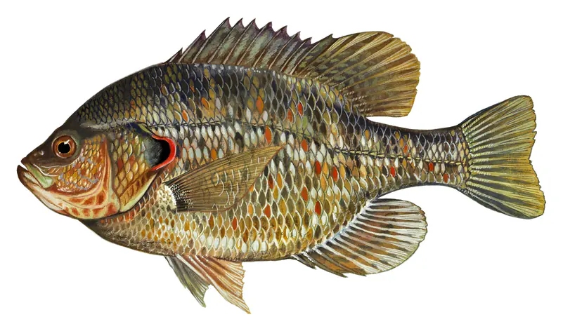
Game fish recorded in Cachuma Lake include largemouth bass, smallmouth bass, bluegill, redear sunfish. In all, 7 fish species have open records inside the lake on GBIF.
The surface of Cachuma Lake was about 67°F on November 8, estimated from a satellite pass on a clear day. It is the top layer of the water, a few degrees either way; coves and shallows run warmer in the sun.
Anglers 16 and older need a California fishing license, sold online by the California Department of Fish and Wildlife. Free fishing days: Two Saturdays a year (2027: July 3 and September 4). Size and bag limits can be set lake by lake: check the current regulations.
Cachuma Lake averages about 56 ft deep. Depth changes with the lake level.
Bureau of Reclamation lists biking, boating, camping, ranger programs, fishing, hiking, horseback riding and picnicking at Cachuma Lake.
EPA's CyAN satellite rated cyanobacteria in Cachuma Lake not detected on November 9. The satellite sees open water only; blooms can be patchy, so avoid water that looks like spilled paint or pea soup and keep dogs out of scum. Swimming advisories come from California health and environment agencies.
Yes. 2 trails run along or near the shore, including Connector Trail (0.4 mi) and Sweetwater Trail (2.4 mi), according to OpenStreetMap.
Cachuma Lake is held back by Bradbury Dam, completed in 1953 and 279 ft high, according to the National Inventory of Dams.
From the California Data Exchange Center (DWR) (CACHUMA LAKE). Lake by Lake checks it every hour; the agency's own figure is always the reference, and provisional readings can be revised.
Lake levels are refreshed every hour. Texas and California reservoirs report once a day; most USGS and NOAA gauges report every 15 to 60 minutes.
Cookies for analytics With your OK we use Google Analytics and Microsoft Clarity to count visits and see how the site is used, so we can make it better. No advertising cookies. Privacy policy