Sun
- Sunrise
- 6:44 AM
- Sunset
- 4:44 PM
- First light
- 6:15 AM
- Last light
- 5:12 PM
Reservoir · Tuolumne County, California
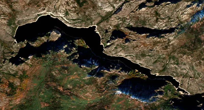
A reservoir on the Tuolumne River in Tuolumne County, California, held back by O`Shaughnessy Dam since 1923.

Hetch Hetchy Reservoir is at 3,748.78 feet above sea level, as of Nov 19, 2026, 12:00 AM PST. It has dropped 1.71 ft in the past 7 days.
A notification from this browser, once, when the level crosses the line (checked every hour). No account and no email. On an iPhone, add Lake by Lake to your home screen first (Share → Add to Home Screen) and open it from there. Or follow the lake in a feed reader: RSS feed.
Hetch Hetchy Reservoir is down 1.71 ft over the last 7 days, at 3,748.78 ft today.
Daily values from the U.S. Geological Survey.
Hetch Hetchy Reservoir is down 9.64 ft over the last 30 days, at 3,748.78 ft today.
Daily values from the U.S. Geological Survey.
Over the past 12 months, Hetch Hetchy Reservoir ranged from 3,748.91 ft (Nov 18, 2026) to 3,807.03 ft (May 25, 2026), a swing of 58.1 ft. Today's level is the lowest of the past 12 months. It is 10.69 ft lower than on this date last year.
Daily values from the U.S. Geological Survey. Why lake levels rise and fall
Solunar periods for Hetch Hetchy Reservoir, local time. How they work
Low · as of Nov 9, 2026
Some cyanobacteria at the surface, under 100,000 cells/mL. About 33,100 cells/mL at the worst spot, covering 11% of the lake.
Week of Aug 16Week of Nov 1
Each bar is one week, colored by the worst reading of that week.
From the U.S. EPA's Cyanobacteria Assessment Network (CyAN), which reads the color of lakes from the Sentinel-3 satellites; it sees open water only, not coves or the shoreline. Blooms can be patchy: what you see on the water matters more. Swimming closures and health advisories come from California health and environment agencies. How to read it
Surface water temperature
57°F on Nov 8, 2026
80°F · Jul 2657°F · Nov 8
23°F cooler than on Jul 26, 2026.
Estimated from Landsat 8/9 (USGS) passes on clear days: the top layer of the water, a few degrees either way. Coves and the shallows can be warmer.
Hetch Hetchy Reservoir water temperature: trend, swimming and the fish →
Tap an icon for details; use two fingers (or Ctrl + scroll) to move the map. Tap a dot for details. Map and lake outline © OpenStreetMap contributors. Places from OpenStreetMap, Overture Maps and Recreation.gov. Not for navigation.
What you’ll find on the shore
← AllParks 1
No aquatic invasive species are on record for Hetch Hetchy Reservoir in the USGS database. Keep it that way: clean, drain and dry your boat between lakes.
California: California-registered motorized boats used in fresh water must display a current Mussel Fee sticker. Many lakes and reservoirs run mandatory inspections or quarantines, moving quagga, zebra or golden mussels is illegal, and boaters are asked to clean, drain and dry. Required: Quagga and Zebra Mussel Fee sticker ($42 every two years ($21 if bought in an even-numbered year)). State rules
Records: USGS Nonindigenous Aquatic Species database. A species not listed may still be present.
Hetch Hetchy Reservoir fills a granite valley on the Tuolumne River inside Yosemite National Park, 17 miles north of Yosemite Valley in a straight line and about 38 miles away by road. It is the largest body of water in the park and the main source of drinking water for about 2.7 million people in the San Francisco Bay Area. The fight over flooding the valley, led by John Muir, is still being argued more than a century later.
People lived in Hetch Hetchy for more than 6,000 years before the dam. They burned the valley floor to keep the grasses short, which made hunting and gathering acorns easier, and the name comes from a Miwok word for edible grasses. Tueeulala Falls, Wapama Falls and Kolana Rock also carry Native names. European Americans arrived in the 1850s. When Muir first came in 1872 and 1873 he compared the valley closely to Yosemite Valley, and its plants were nearly the same.
San Francisco eyed the valley as a reservoir site as early as 1882. Mayor James Phelan filed for the water rights in 1901 and was turned down because the valley lay inside a national park. The 1906 earthquake and fire, which exposed how fragile the city's water supply was, revived the plan. Muir and other preservationists argued that a reservoir could be found outside the park. They lost. In 1913 Congress passed the Raker Act, signed by President Woodrow Wilson, which allowed San Francisco to dam Hetch Hetchy and a second site at Lake Eleanor.
The Hetch Hetchy Railroad was built to haul men and materials from Groveland, 25 miles to the west, and a camp for up to 500 workers grew up at the site. Work on the dam began in 1919 and the first phase was finished in 1923. It is named for its chief engineer, Michael M. O'Shaughnessy, who led the construction. After many delays, the first Hetch Hetchy water reached San Francisco in 1934, and a final phase of construction in 1938 raised the dam to its present height.
The water travels to the Bay Area by gravity alone, passing through hydroelectric powerhouses before it enters the San Joaquin Pipelines and the Coast Range Tunnel. The watershed is protected inside the park, and the system is one of only a few in the country exempt from filtration. Its electricity goes to Muni, San Francisco International Airport and Zuckerberg San Francisco General Hospital, among other city users. Calls to drain the reservoir and restore the valley have never gone away. San Francisco voters rejected a 2012 measure to study the idea, and a lawsuit by Restore Hetch Hetchy was dismissed in 2016, with the appeal turned down in 2018.
Most visits start with a walk across the dam and through a tunnel onto a trail that follows the shoreline. It is 5 miles round trip to Wapama Falls, with Tueeulala Falls in view along the way, and 13 miles round trip to Rancheria Falls. In spring, two of the tallest waterfalls in North America pour over the valley's granite cliffs. Spring and fall are the best seasons, since summer is often hot in this low valley. In years of heavy snowpack, fast melt can send water over the footbridges at Wapama Falls. In June 2011 two men were swept off one of them and drowned in the reservoir.
Swimming and boating are banned to protect the drinking water, and no one may go below the high-water mark. Fishing and hiking are open all year. Pets are not allowed on the dam or the trails, and vehicles longer than 25 feet cannot use the road in. Rattlesnakes and black bears both live along the trails.
Written by Lake by Lake from National Park Service, Yosemite National Park (Hetch Hetchy, Encroaching Civilization - Dams and Trains, Day Hikes in Hetch Hetchy), San Francisco Public Utilities Commission, Water Education Foundation and CBS Sacramento. Checked November 2026.
O`Shaughnessy Dam is a concrete gravity dam 312 feet high and 900 feet long on the Tuolumne River, completed in 1923. It belongs to San Francisco Public Utilities Commission and is run for water supply and hydropower. Water reaches it from 459 square miles of land.
From the National Inventory of Dams (U.S. Army Corps of Engineers), NID ID CA00123. Lake or reservoir: what’s the difference?
Where the level comes from: HETCH HETCHY RES A HETCH HETCHY CA (U.S. Geological Survey).
| Lake | Miles | Level (ft) | vs full | 7 days |
|---|---|---|---|---|
| Lake Eleanor Live reading | 5 | 4645.92 | — | −0.43 |
| Cherry Lake Live reading | 7 | 4686.93 | — | +1.64 |
| Beardsley Lake Live reading | 24 | 3318.49 | — | +1.09 |
| Donnell Lake Live reading | 28 | 4773.91 | — | −3.12 |
| Lake McClure Below full | 36 | 772.37 | −94.63 | +0.16 |
| Don Pedro Reservoir Well below full | 39 | 781.73 | −48.27 | +0.14 |
Compare Hetch Hetchy Reservoir with Lake Eleanor, Cherry Lake, Beardsley Lake or Donnell Lake: size, level, ramps and fish side by side.
Hetch Hetchy Reservoir is at 3,748.78 feet above sea level, as of Nov 19, 2026, 12:00 AM PST. It has dropped 1.71 ft in the past 7 days.
The surface of Hetch Hetchy Reservoir was about 57°F on November 8, estimated from a satellite pass on a clear day. It is the top layer of the water, a few degrees either way; coves and shallows run warmer in the sun.
Anglers 16 and older need a California fishing license, sold online by the California Department of Fish and Wildlife. Free fishing days: Two Saturdays a year (2027: July 3 and September 4). Size and bag limits can be set lake by lake: check the current regulations.
EPA's CyAN satellite rated cyanobacteria in Hetch Hetchy Reservoir low on November 9. The satellite sees open water only; blooms can be patchy, so avoid water that looks like spilled paint or pea soup and keep dogs out of scum. Swimming advisories come from California health and environment agencies.
Hetch Hetchy Reservoir is held back by O`Shaughnessy, completed in 1923 and 312 ft high, according to the National Inventory of Dams.
From the U.S. Geological Survey (HETCH HETCHY RES A HETCH HETCHY CA). Lake by Lake checks it every hour; the agency's own figure is always the reference, and provisional readings can be revised.
Lake levels are refreshed every hour. Texas and California reservoirs report once a day; most USGS and NOAA gauges report every 15 to 60 minutes.
Cookies for analytics With your OK we use Google Analytics and Microsoft Clarity to count visits and see how the site is used, so we can make it better. No advertising cookies. Privacy policy