Sun
- Sunrise
- 6:54 AM
- Sunset
- 4:52 PM
- First light
- 6:26 AM
- Last light
- 5:21 PM
Reservoir · Napa County, California
A reservoir on Putah Creek in Napa County, California, held back by Monticello Dam since 1957.

Lake Berryessa is at 427.25 feet above sea level — 12.75 ft below spillway crest (full pool), 82.0% full, as of Nov 16, 2026. It has dropped 0.05 ft in the past 7 days.
11th fullest of 41 California lakes today by percent full · See the ranking
Record low 361.75 ft (1992), record high 444.75 ft (1998) · Level history since 1985
A notification from this browser, once, when the level crosses the line (checked every hour). No account and no email. On an iPhone, add Lake by Lake to your home screen first (Share → Add to Home Screen) and open it from there. Or follow the lake in a feed reader: RSS feed.
Lake Berryessa is down 0.56 ft over the last 30 days, at 427.25 ft today.
Daily values from the California Data Exchange Center (DWR).
Over the past 12 months, Lake Berryessa ranged from 427.25 ft (Nov 16, 2026) to 439.37 ft (Mar 12, 2026), a swing of 12.1 ft. Today's level is the lowest of the past 12 months. It is 1.68 ft lower than on this date last year.
Daily values from the California Data Exchange Center (DWR). Why lake levels rise and fall
In the California Data Exchange Center (DWR) record, which starts in 1985, the lowest level was 361.75 ft on November 30, 1992 and the highest 444.75 ft on February 7, 1998. Today’s 427.25 ft is 65.5 ft above the record low and 17.5 ft below the record high.
Lake Berryessa level history: every year since 1985, the lowest and highest years →
Solunar periods for Lake Berryessa, local time. How they work
Not detected · as of Nov 9, 2026
The satellite found no cyanobacteria at the surface.
Week of Aug 9Week of Nov 1
Each bar is one week, colored by the worst reading of that week.
From the U.S. EPA's Cyanobacteria Assessment Network (CyAN), which reads the color of lakes from the Sentinel-3 satellites; it sees open water only, not coves or the shoreline. Blooms can be patchy: what you see on the water matters more. Swimming closures and health advisories come from California health and environment agencies. How to read it
Surface water temperature
61°F on Nov 16, 2026
84°F · Jul 2761°F · Nov 16
23°F cooler than on Jul 27, 2026.
Estimated from MODIS Aqua (NASA) passes on clear days: the top layer of the water, a few degrees either way. Coves and the shallows can be warmer.
Lake Berryessa water temperature: trend, swimming and the fish →
On or near the shore of Lake Berryessa: 4 boat ramps, 1 marina, 2 rental outfits, 6 campgrounds, 1 beach and 5 trails. The lake has about 158 miles of shoreline, counting its islands.
Tap an icon for details; use two fingers (or Ctrl + scroll) to move the map. Tap a dot for details. Map and lake outline © OpenStreetMap contributors. Places from OpenStreetMap, Overture Maps and Recreation.gov. Not for navigation.
What you’ll find on the shore
← AllBoating 5
← AllRentals & tours 2
← AllBeaches 1
← AllCamping 6
← AllLodging 7
← AllTrails 5
← AllParks 5
These invasive plants and animals have been recorded in Lake Berryessa: clean, drain and dry everything before you go to another lake.
California: California-registered motorized boats used in fresh water must display a current Mussel Fee sticker. Many lakes and reservoirs run mandatory inspections or quarantines, moving quagga, zebra or golden mussels is illegal, and boaters are asked to clean, drain and dry. Required: Quagga and Zebra Mussel Fee sticker ($42 every two years ($21 if bought in an even-numbered year)). State rules
Records: USGS Nonindigenous Aquatic Species database. A species not listed may still be present.
Species with open-licensed records inside Lake Berryessa's outline, from GBIF.org (surveys, museum collections and angler reports). A record shows a fish was found here, not how many there are now.
Channel edges and river arms; best after dark in summer, and after a rain.
Cool water: near the surface in spring and fall, deep in summer.
Shallow, muddy bays and flooded grass in spring; mud flats and inflows in summer.
Water temperature sets off each spawn; the bars show the usual months at this latitude and elevation, and move with a warm or cold spring. The water is about 61°F now.
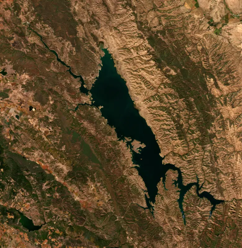
Lake Berryessa is the reservoir behind Monticello Dam on Putah Creek, in the hills of eastern Napa County between Blue Ridge and the Cedar Roughs. It sits about 70 miles northeast of San Francisco and 40 miles west of Sacramento, and it is best known for the Glory Hole, the giant funnel-shaped spillway beside the dam.
Before the dam, this was farm country. The valley was part of Rancho Las Putas, granted in 1843 to the brothers José Jesús and Sisto Berryessa, who owned much of the land in and around what became the town of Monticello. The lake carries their family name. Monticello was a farming town founded by Ezra Peacock in 1867, and about 250 people still lived there when it was evacuated. Residents fought the project and lost. The cemetery was moved, the valley was cleared, and the photographers Dorothea Lange and Pirkle Jones recorded its last days in Death of a Valley, published in 1960.
The Bureau of Reclamation built Monticello Dam between 1953 and 1957 as the centerpiece of the Solano Project. Napa and Yolo counties declined to take part, so the project was sized for Solano County alone, and the first water was delivered in 1959. Below the dam, the Putah Diversion Dam, Lake Solano and the Putah South Canal carry the water to Solano County farms and to cities including Vacaville, Fairfield and Vallejo. A hydroelectric plant added in 1983 generates power from the releases to Putah Creek. Reclamation still owns the lake and runs the recreation area as federal public land.
When the lake is full, the overflow drops into a concrete bellmouth spillway near the dam that locals call the Glory Hole. It is 72 feet across at the rim and falls 200 feet, narrowing to 28 feet at the bottom, before the water rejoins Putah Creek and runs on through Lake Solano to the Yolo Bypass. If the lake ever rose beyond what the spillway can take, Highway 128 would serve as an emergency spillway so that water does not top the dam.
The lake has spilled 26 times since 1957. The spills came in runs of wet years from the 1960s into the mid-2000s, then only in 2017, 2019 and on February 4, 2025, the first time since 2019.
Anglers fish for both cold and warm water species, including rainbow trout, bass, catfish, crappie and bluegill. Largemouth and smallmouth bass were introduced in the late 1950s and spotted bass in the 1980s. The state also stocks landlocked salmon here. In spring 2024 the Department of Fish and Wildlife planted both kokanee and inland Chinook salmon. The Chinook are sterile triploids, and state biologists reported Berryessa fish approaching 10 pounds that year.
Reclamation runs two day-use areas, Oak Shores and Smittle Creek, plus a public launch at Capell Cove and hand launches for canoes and kayaks at Oak Shores and Eticuera. Resorts and campgrounds operate at Markley Cove, Pleasure Cove, Steele Canyon, Spanish Flat and Putah Canyon. The east side holds the Lake Berryessa Wildlife Area, about 2,000 acres co-managed with the Blue Ridge Berryessa Partnership and one of the better local birding spots, at its best during spring nesting and the late-fall migration. In summer the water can warm to about 75 degrees.
The lake is free of zebra, quagga and golden mussels, and the Solano County Water Agency works to keep it that way. Motorized boats must arrive clean, drained and dry and be inspected before launching, and boats coming from elsewhere face a 30-day quarantine unless they pass an approved hot-water decontamination first.
Written by Lake by Lake from U.S. Bureau of Reclamation, Mid-Pacific Region, U.S. Bureau of Reclamation, Solano County Water Agency (Solano Project, Lake Berryessa Mussel Prevention Program), California Department of Fish and Wildlife and Wikipedia. Checked November 2026.
Activities listed by the Bureau of Reclamation: Biking · Boating · Historic sites · Camping · Ranger programs · Fishing · Hiking · Horseback riding · Picnicking · Winter sports · Visitor center · Wildlife viewing
Monticello Dam is a concrete dam 255 feet high and 1,023 feet long on Putah Creek, completed in 1957. It belongs to the Bureau of Reclamation and is run for irrigation and water supply. At its normal level the reservoir holds 1.60 million acre-ft, drained from 567 square miles of land.
From the National Inventory of Dams (U.S. Army Corps of Engineers), NID ID CA10170. Lake or reservoir: what’s the difference?
Where the level comes from: BERRYESSA (California Data Exchange Center (DWR), used on this page) and Lake Berryessa and Monticello Dam (Bureau of Reclamation (RISE)).
| Lake | Miles | Level (ft) | vs full | 7 days |
|---|---|---|---|---|
| Milliken Reservoir Live reading | 12 | 900.71 | — | +0.42 |
| Indian Valley Reservoir Well below full | 46 | 1457.94 | −27.06 | +0.23 |
| Marsh Creek Reservoir Live reading | 48 | 168.42 | — | +0.01 |
| Lake Natoma Slightly below full | 49 | 123.55 | — | −0.05 |
| Lake Sonoma Below full | 51 | 442.37 | −8.73 | −0.43 |
| Folsom Lake Well below full | 51 | 397.40 | −68.60 | −0.25 |
Compare Lake Berryessa with Milliken Reservoir, Indian Valley Reservoir, Marsh Creek Reservoir or Lake Natoma: size, level, ramps and fish side by side.
Lake Berryessa is about 13 mi from Vacaville, CA, 18 mi from Fairfield, CA and 29 mi from Vallejo, CA. See all the lakes near each city.
Lake Berryessa is at 427.25 feet above sea level — 12.75 ft below spillway crest (full pool), 82.0% full, as of Nov 16, 2026. It has dropped 0.05 ft in the past 7 days.
Lake Berryessa's spillway crest (full pool) is 440.00 ft, according to Bureau of Reclamation. Today the lake is 12.75 ft below that mark.
Today's level is 5.64 ft above the median for this date (421.61 ft), from the gauge’s long-term daily record.
361.75 ft, on November 30, 1992, in the California Data Exchange Center (DWR) record, which starts in 1985. Today the lake is 65.5 ft above that.
444.75 ft, on February 7, 1998, in the California Data Exchange Center (DWR) record since 1985. That is 4.8 ft above spillway crest (full pool).
Lake Berryessa has 4 boat ramps on our map, including Boat ramp at Markley Cove Resort, Boat ramp at Putah Canyon Campground, and 1 marina. Low water can close ramps, so check today's level above and the operator before you go.
Yes. There are 6 campgrounds and RV parks within about a mile of the shore, such as Putah Canyon Campground, Spanish Flat Recreation Area Lake Berryessa, Steele Canyon Recreation Area.
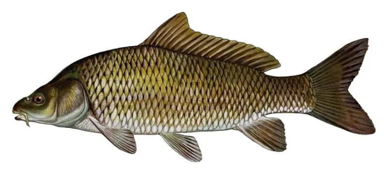
Game fish recorded in Lake Berryessa include white catfish, rainbow trout, common carp. In all, 13 fish species have open records inside the lake on GBIF.
The surface of Lake Berryessa was about 61°F on November 16, estimated from a satellite pass on a clear day. It is the top layer of the water, a few degrees either way; coves and shallows run warmer in the sun.
Anglers 16 and older need a California fishing license, sold online by the California Department of Fish and Wildlife. Free fishing days: Two Saturdays a year (2027: July 3 and September 4). Size and bag limits can be set lake by lake: check the current regulations.
Lake Berryessa is about 200 ft deep at its deepest point, usually near the dam, and about 79 ft deep on average. Depth changes with the lake level.
Bureau of Reclamation lists biking, boating, historic sites, camping, ranger programs, fishing, hiking and horseback riding at Lake Berryessa.
EPA's CyAN satellite rated cyanobacteria in Lake Berryessa not detected on November 9. The satellite sees open water only; blooms can be patchy, so avoid water that looks like spilled paint or pea soup and keep dogs out of scum. Swimming advisories come from California health and environment agencies.
Yes. 5 trails run along or near the shore, including Berryessa North End Trail (5.5 mi), Pope-to-Putah Trail (4.7 mi) and Smittle Creek Trail (2.4 mi), according to OpenStreetMap.
Lake Berryessa is held back by Monticello Dam, completed in 1957 and 255 ft high, according to the National Inventory of Dams.
From the California Data Exchange Center (DWR) (BERRYESSA). Lake by Lake checks it every hour; the agency's own figure is always the reference, and provisional readings can be revised.
Lake levels are refreshed every hour. Texas and California reservoirs report once a day; most USGS and NOAA gauges report every 15 to 60 minutes.
Cookies for analytics With your OK we use Google Analytics and Microsoft Clarity to count visits and see how the site is used, so we can make it better. No advertising cookies. Privacy policy