Sun
- Sunrise
- 6:54 AM
- Sunset
- 4:47 PM
- First light
- 6:25 AM
- Last light
- 5:16 PM
Reservoir · Butte County, California
A reservoir on the Feather River in Butte County, California, held back by Oroville Dam since 1968.
Lake Oroville is at 731.66 feet above sea level — 168.34 ft below full pool, 42.0% full, as of Nov 16, 2026. It has dropped 0.83 ft in the past 7 days.
12th lowest of 41 California lakes today by percent full · See the ranking
Record low 628.63 ft (2021), record high 900.10 ft (2011) · Level history since 1985
Which boat ramps are usable at today’s level →
A notification from this browser, once, when the level crosses the line (checked every hour). No account and no email. On an iPhone, add Lake by Lake to your home screen first (Share → Add to Home Screen) and open it from there. Or follow the lake in a feed reader: RSS feed.
Lake Oroville is down 9.52 ft over the last 30 days, at 731.66 ft today.
Daily values from the California Data Exchange Center (DWR).
Over the past 12 months, Lake Oroville ranged from 731.36 ft (Nov 15, 2026) to 897.43 ft (May 20, 2026), a swing of 166.1 ft. Today's level is near the bottom of that range. It is 37.21 ft lower than on this date last year.
Daily values from the California Data Exchange Center (DWR). Why lake levels rise and fall
In the California Data Exchange Center (DWR) record, which starts in 1985, the lowest level was 628.63 ft on September 30, 2021 and the highest 900.10 ft on June 25, 2011. Today’s 731.66 ft is 103.0 ft above the record low and 168.4 ft below the record high.
Lake Oroville level history: every year since 1985, the lowest and highest years →
Solunar periods for Lake Oroville, local time. How they work
Not detected · as of Nov 9, 2026
The satellite found no cyanobacteria at the surface.
Week of Aug 9Week of Nov 1
Each bar is one week, colored by the worst reading of that week.
From the U.S. EPA's Cyanobacteria Assessment Network (CyAN), which reads the color of lakes from the Sentinel-3 satellites; it sees open water only, not coves or the shoreline. Blooms can be patchy: what you see on the water matters more. Swimming closures and health advisories come from California health and environment agencies. How to read it
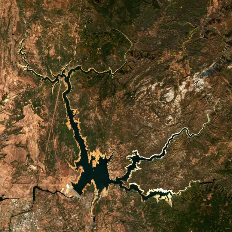
Surface water temperature
54°F on Nov 6, 2026
85°F · Aug 254°F · Nov 6
31°F cooler than on Aug 2, 2026.
Estimated from Landsat 8/9 (USGS) passes on clear days: the top layer of the water, a few degrees either way. Coves and the shallows can be warmer.
Lake Oroville water temperature: trend, swimming and the fish →
On or near the shore of Lake Oroville: 14 boat ramps, 2 marinas and 3 campgrounds. The lake has about 181 miles of shoreline, counting its islands.
Tap an icon for details; use two fingers (or Ctrl + scroll) to move the map. Tap a dot for details. Map and lake outline © OpenStreetMap contributors. Places from OpenStreetMap, Overture Maps and Recreation.gov. Not for navigation.
What you’ll find on the shore
← AllBoating 16
Which boat ramps are usable at today’s level →
← AllCamping 3
← AllParks 2
No aquatic invasive species are on record for Lake Oroville in the USGS database. Keep it that way: clean, drain and dry your boat between lakes.
California: California-registered motorized boats used in fresh water must display a current Mussel Fee sticker. Many lakes and reservoirs run mandatory inspections or quarantines, moving quagga, zebra or golden mussels is illegal, and boaters are asked to clean, drain and dry. Required: Quagga and Zebra Mussel Fee sticker ($42 every two years ($21 if bought in an even-numbered year)). State rules
Records: USGS Nonindigenous Aquatic Species database. A species not listed may still be present.
Species with open-licensed records inside Lake Oroville's outline, from GBIF.org (surveys, museum collections and angler reports). A record shows a fish was found here, not how many there are now.
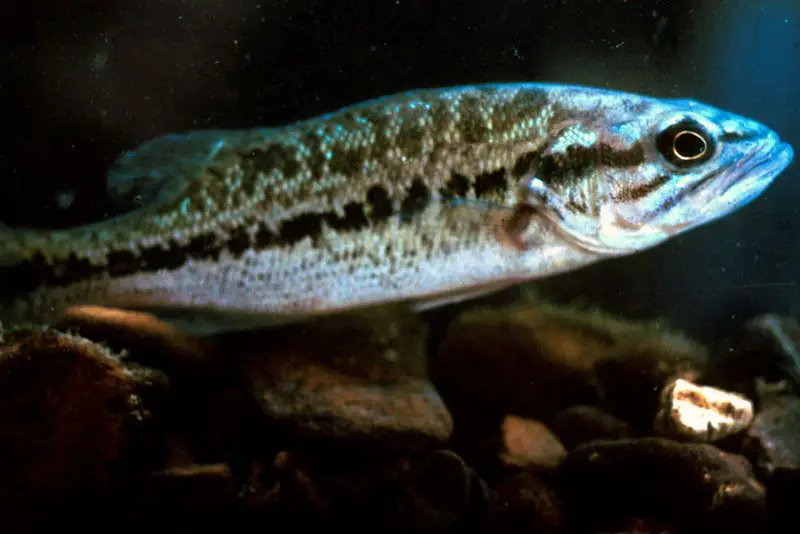
Rocky points, gravel and current breaks; deeper rock piles in summer.
Clear water and steep rock; they often suspend deeper than largemouth.
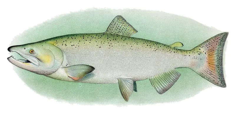
Low light and cold water; the inflows in fall.
Deep, cold water; fall runs toward the tributaries.
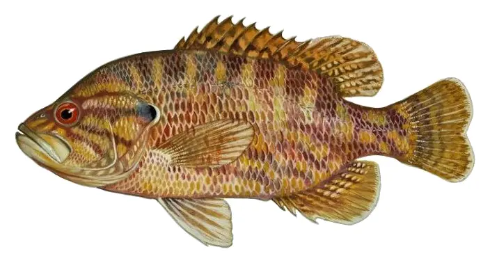
Stumps, brush and weedbeds over soft bottoms; fish tight to cover.
Water temperature sets off each spawn; the bars show the usual months at this latitude and elevation, and move with a warm or cold spring. The water is about 54°F now.
Lake Oroville fills the canyons of the Feather River in the Sierra Nevada foothills of Butte County, California, a few miles northeast of the city of Oroville. It is the largest reservoir of the State Water Project, which sends water to the Bay Area, the San Joaquin Valley and Southern California, and its dam is the tallest in the United States. Many people first heard its name in February 2017, when damage to its spillways forced a mass evacuation downstream.
The Konkow Maidu lived along these rivers long before the Gold Rush. In April 1848, about three months after gold turned up at Sutter's Mill, John Bidwell found gold on the Feather River at a spot that soon carried his name. Bidwell's Bar grew into a mining town, and in the 1850s a suspension bridge shipped from New York around Cape Horn was hung across the Middle Fork there. It was the first suspension bridge in California and carried vehicles until 1954. When the lake filled, the towns of Bidwell and Land, near the old meeting of the North Fork and the main river, went under the water along with the canyon. The old bridge was moved to Bidwell Canyon on the lake's south side, where people can still walk across it. A newer suspension bridge carries State Route 162 over the lake about a mile and a half upstream of the original crossing.
The California Department of Water Resources built Oroville Dam as an earthfill embankment and finished it in 1968. Building it meant moving Highway 70 and the Western Pacific railroad. Even partly built, the dam held back a major Feather River flood in December 1964. The dam's Edward Hyatt Powerplant, built underground, is the largest hydroelectric plant in the State Water Project. In Oroville, the Feather River Fish Hatchery raises Chinook salmon and steelhead, and visitors can watch salmon through underwater windows. Spawning is easiest to see from mid-September to mid-November.
A heavy storm settled over the Feather River basin on February 7, 2017, and the dam's concrete main spillway broke apart. On February 11 the lake spilled over the emergency spillway for the first time in the dam's history, and erosion below it led to an evacuation order covering an estimated 188,000 people. An independent review blamed poor design and construction and weak state oversight. The rebuilt main spillway first carried water on April 2, 2019, and the state put repair and recovery costs at about $1.1 billion. The lake can also fall a long way. In August 2021 the Hyatt plant shut down as the water neared its minimum level for power, and in October 2021 storage dropped to 22 percent of capacity, below the old record low from September 1977.
The lake spreads up the North Fork, Middle Fork, South Fork and West Branch of the Feather, and it holds Bloomer Island and Foreman Island. California State Parks runs it as Lake Oroville State Recreation Area. Marinas sit at Bidwell Canyon and Lime Saddle, Loafer Creek has a campground and launch ramp, and there are boat-in camps and floating campsites whose spots shift with the lake level. The Kelly Ridge Visitor Center, run by the water department, has exhibits on the dam and Native history and a 47-foot tower with telescopes. Below the dam, the North Thermalito Forebay is kept for boats without motors and has a sandy beach. When the lake is full, boaters can get within a quarter mile of Feather Falls on the Fall River. Anglers fish year-round for largemouth, smallmouth and spotted bass, Chinook salmon, brown trout, lake trout, catfish and white crappie, and the state has a safe-eating advisory for mercury and PCBs. Boats are checked for invasive mussels.
Written by Lake by Lake from California State Parks, Water Education Foundation, California Office of Historic Preservation and Wikipedia (Lake Oroville, Bidwell Bar Bridge). Checked November 2026.
Oroville Dam is an earthfill dam 770 feet high and 6,920 feet long on the Feather River, completed in 1968. It belongs to California Department of Water Resources and is run for flood control, irrigation, recreation, hydropower and water supply. At its normal level the reservoir holds 3.54 million acre-ft, drained from 3,611 square miles of land.
From the National Inventory of Dams (U.S. Army Corps of Engineers), NID ID CA00035. Lake or reservoir: what’s the difference?
Where the level comes from: OROVILLE (California Data Exchange Center (DWR)).
| Lake | Miles | Level (ft) | vs full | 7 days |
|---|---|---|---|---|
| New Bullards Bar Reservoir Below full | 21 | 1874.61 | −81.01 | −1.92 |
| Englebright Lake At or near full pool | 24 | 525.26 | −1.74 | −0.30 |
| Miller Lake Live reading | 26 | 181.09 | — | +0.43 |
| Black Butte Lake Well below full | 48 | 436.51 | −36.99 | +0.44 |
| Lake Davis Slightly below full | 59 | 5769.98 | −5.02 | 0.00 |
| Folsom Lake Well below full | 62 | 397.40 | −68.60 | −0.25 |
Compare Lake Oroville with New Bullards Bar Reservoir, Englebright Lake, Miller Lake or Black Butte Lake: size, level, ramps and fish side by side.
Lake Oroville is about 23 mi from Chico, CA and 54 mi from Roseville, CA. See all the lakes near each city.
Lake Oroville is at 731.66 feet above sea level — 168.34 ft below full pool, 42.0% full, as of Nov 16, 2026. It has dropped 0.83 ft in the past 7 days.
Lake Oroville's full pool is 900.00 ft, according to California DWR. Today the lake is 168.34 ft below that mark.
Today's level is 15.56 ft below the median for this date (747.22 ft), from the gauge’s long-term daily record.
628.63 ft, on September 30, 2021, in the California Data Exchange Center (DWR) record, which starts in 1985. Today the lake is 103.0 ft above that.
900.10 ft, on June 25, 2011, in the California Data Exchange Center (DWR) record since 1985. That is 0.1 ft above full pool.
Lake Oroville has 14 boat ramps on our map, including Boat ramp at Bidwell Canyon Marina, Enterprise, Lake Oroville Boat Launch, and 2 marinas. Low water can close ramps, so check today's level above and the operator before you go.
Yes. There are 3 campgrounds and RV parks within about a mile of the shore, such as Lime Saddle Campground, Loafer Creek Campground - California State Parks, Quail Trails Village.
Game fish recorded in Lake Oroville include smallmouth bass, spotted bass, brown trout, Chinook salmon, warmouth. In all, 8 fish species have open records inside the lake on GBIF.
The surface of Lake Oroville was about 54°F on November 6, estimated from a satellite pass on a clear day. It is the top layer of the water, a few degrees either way; coves and shallows run warmer in the sun.
Anglers 16 and older need a California fishing license, sold online by the California Department of Fish and Wildlife. Free fishing days: Two Saturdays a year (2027: July 3 and September 4). Size and bag limits can be set lake by lake: check the current regulations.
Lake Oroville averages about 224 ft deep. Depth changes with the lake level.
boating (14 boat ramps and 2 marinas, with the ramps usable at today’s level), fishing (5 game fish), camping (3 campgrounds) and parks & picnics (2 parks on the shore), according to our map of the shore.
EPA's CyAN satellite rated cyanobacteria in Lake Oroville not detected on November 9. The satellite sees open water only; blooms can be patchy, so avoid water that looks like spilled paint or pea soup and keep dogs out of scum. Swimming advisories come from California health and environment agencies.
Lake Oroville is held back by Oroville Dam, completed in 1968 and 770 ft high, according to the National Inventory of Dams.
From the California Data Exchange Center (DWR) (OROVILLE). Lake by Lake checks it every hour; the agency's own figure is always the reference, and provisional readings can be revised.
Lake levels are refreshed every hour. Texas and California reservoirs report once a day; most USGS and NOAA gauges report every 15 to 60 minutes.
Cookies for analytics With your OK we use Google Analytics and Microsoft Clarity to count visits and see how the site is used, so we can make it better. No advertising cookies. Privacy policy