Sun
- Sunrise
- 6:53 AM
- Sunset
- 4:56 PM
- First light
- 6:25 AM
- Last light
- 5:24 PM
Reservoir · San Mateo County, California
A reservoir on San Andreas Creek in San Mateo County, California, held back by San Andreas Dam since 1870.

San Andreas Lake is at 444.37 feet above sea level, as of Nov 18, 2026, 10:45 PM PST. It has risen 0.18 ft in the past 7 days.
A notification from this browser, once, when the level crosses the line (checked every hour). No account and no email. On an iPhone, add Lake by Lake to your home screen first (Share → Add to Home Screen) and open it from there. Or follow the lake in a feed reader: RSS feed.
San Andreas Lake is up 0.18 ft over the last 7 days, at 444.37 ft today.
Daily values from the U.S. Geological Survey.
San Andreas Lake is up 0.13 ft over the last 30 days, at 444.37 ft today.
Daily values from the U.S. Geological Survey.
Over the past 12 months, San Andreas Lake ranged from 436.05 ft (Feb 8, 2026) to 444.46 ft (Nov 16, 2026), a swing of 8.4 ft. Today's level is near the top of that range. It is 0.63 ft higher than on this date last year.
Daily values from the U.S. Geological Survey. Why lake levels rise and fall
Solunar periods for San Andreas Lake, local time. How they work
Not detected · as of Nov 9, 2026
The satellite found no cyanobacteria at the surface.
Week of Aug 9Week of Nov 1
Each bar is one week, colored by the worst reading of that week.
From the U.S. EPA's Cyanobacteria Assessment Network (CyAN), which reads the color of lakes from the Sentinel-3 satellites; it sees open water only, not coves or the shoreline. Blooms can be patchy: what you see on the water matters more. Swimming closures and health advisories come from California health and environment agencies. How to read it
Surface water temperature
67°F on Oct 13, 2026
76°F · Aug 267°F · Oct 13
8°F cooler than on Aug 2, 2026.
Estimated from Landsat 8/9 (USGS) passes on clear days: the top layer of the water, a few degrees either way. Coves and the shallows can be warmer.
San Andreas Lake water temperature: trend, swimming and the fish →
On or near the shore of San Andreas Lake: 1 campground and 2 trails. The lake has about 8 miles of shoreline, counting its islands.
Tap an icon for details; use two fingers (or Ctrl + scroll) to move the map. Tap a dot for details. Map and lake outline © OpenStreetMap contributors. Places from OpenStreetMap, Overture Maps and Recreation.gov. Not for navigation.
These invasive plants and animals have been recorded in San Andreas Lake: clean, drain and dry everything before you go to another lake.
California: California-registered motorized boats used in fresh water must display a current Mussel Fee sticker. Many lakes and reservoirs run mandatory inspections or quarantines, moving quagga, zebra or golden mussels is illegal, and boaters are asked to clean, drain and dry. Required: Quagga and Zebra Mussel Fee sticker ($42 every two years ($21 if bought in an even-numbered year)). State rules
Records: USGS Nonindigenous Aquatic Species database. A species not listed may still be present.
Species with open-licensed records inside San Andreas Lake's outline, from GBIF.org (surveys, museum collections and angler reports). A record shows a fish was found here, not how many there are now.
Rocky points, gravel and current breaks; deeper rock piles in summer.
Cold, clear water near springs and inlets.
Water temperature sets off each spawn; the bars show the usual months at this latitude and elevation, and move with a warm or cold spring.
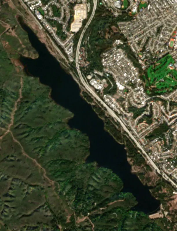
San Andreas Lake is a drinking water reservoir in the hills of San Mateo County, just west of Millbrae and San Bruno, owned by the city of San Francisco. It lies directly on the San Andreas Fault, in the long, straight valley that gave the fault its name. A paved trail runs along its eastern side, but the water itself is closed to the public.
Long before any dam, a small natural pond sat here. Where the fault steps sideways, the ground between the two strands pulls apart and sags, leaving a low spot where water collects. The Portolá expedition, which first saw San Francisco Bay from nearby Sweeney Ridge on November 4, 1769, camped near the site. In 1774 Father Francisco Palóu named the valley the Cañada de San Andrés for the feast of Saint Andrew. When Berkeley geologist Andrew Lawson identified the fault in 1895, he named it after the valley. It is often said the fault was named for the lake, but Lawson's own reports point to the valley.
The Spring Valley Water Company, the private company that supplied San Francisco's water, raised an earth dam across San Andreas Creek in the late 1860s and turned the pond into a reservoir. It became one of three company reservoirs on the Peninsula, along with Pilarcitos and Crystal Springs.
On April 18, 1906, the fault slipped right through the system. The trace crossed the eastern end of the San Andreas Dam. Inspectors afterward found no leaks, though they could not tell whether the upper part of the dam had been hurt without excavating, which the company's chief engineer, Hermann Schussler, planned to do. The San Andreas conduit to the city pulled apart at a slip joint at the head of the Baden marsh and was repaired within 60 hours. Because the Pilarcitos line had been wrecked, Pilarcitos water was rerouted through the San Andreas conduit. A photo taken after the quake shows a fence and a row of trees offset by the fault between San Andreas Lake and Crystal Springs Reservoir, and both can still be picked out today.
The lake sits inside the Peninsula Watershed, about 23,000 acres of protected land owned by the San Francisco Public Utilities Commission and kept largely closed to protect the water supply. The watershed is a state fish and wildlife refuge with old-growth Douglas fir, chaparral and wetlands. It has one of the highest concentrations of rare and endangered species in the Bay Area, including the San Francisco garter snake and the California red-legged frog. Bald eagles nested in the watershed in 2012 for the first time in a century, and more than 180 bird species have been recorded.
There is no boating, fishing or swimming. The way to see the lake is the San Mateo County Crystal Springs Regional Trail. Its San Andreas segment runs on a paved path west of Skyline Boulevard between San Bruno Avenue and Hillcrest Boulevard in Millbrae. From Hillcrest the Sawyer Camp segment continues about 6 miles south, across the San Andreas Dam and down to Lower Crystal Springs Reservoir. Midway along it stands the Jepson Laurel, named in 1923 and more than 600 years old, the oldest and largest California laurel known. Hikers and cyclists share the path.
Written by Lake by Lake from Wikipedia (San Andreas Lake, San Andreas Fault), U.S. Geological Survey, San Francisco Fire Department Museum, San Mateo County Parks and Bay Nature. Checked November 2026.
San Andreas Dam is an earthfill dam 107 feet high and 727 feet long on San Andreas Creek, completed in 1870. It belongs to the City and County of San Francisco and is run for water supply. Water reaches it from 4 square miles of land.
From the National Inventory of Dams (U.S. Army Corps of Engineers), NID ID CA00129. Lake or reservoir: what’s the difference?
Where the level comes from: SAN ANDREAS LAKE A DAM NR MILLBRAE CA (U.S. Geological Survey, used on this page) and San Andreas Lake near Millbrae (NOAA National Water Prediction Service).
| Lake | Miles | Level (ft) | vs full | 7 days |
|---|---|---|---|---|
| Pilarcitos Lake Live reading | 4 | 676.69 | — | +0.57 |
| Crystal Springs Reservoir Live reading | 7 | 273.47 | — | +0.61 |
| Upper San Leandro Reservoir Live reading | 21 | 451.60 | — | +1.00 |
| Stevens Creek Reservoir Live reading | 29 | 527.43 | — | +0.23 |
| San Antonio Reservoir Below full | 32 | 454.86 | −13.34 | +0.30 |
| Calaveras Reservoir Live reading | 34 | 720.12 | — | +0.05 |
Compare San Andreas Lake with Pilarcitos Lake, Crystal Springs Reservoir, Upper San Leandro Reservoir or Stevens Creek Reservoir: size, level, ramps and fish side by side.
San Andreas Lake is about 7 mi from San Mateo, CA, 7 mi from Daly City, CA and 16 mi from Oakland, CA. See all the lakes near each city.
San Andreas Lake is at 444.37 feet above sea level, as of Nov 18, 2026, 10:45 PM PST. It has risen 0.18 ft in the past 7 days.
Yes. There is 1 campground within about a mile of the shore, such as Camp Happy Hall.
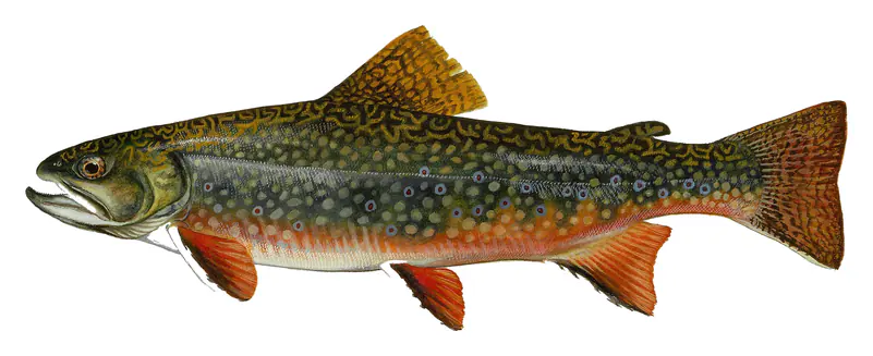
Game fish recorded in San Andreas Lake include smallmouth bass, brook trout. In all, 3 fish species have open records inside the lake on GBIF.
Anglers 16 and older need a California fishing license, sold online by the California Department of Fish and Wildlife. Free fishing days: Two Saturdays a year (2027: July 3 and September 4). Size and bag limits can be set lake by lake: check the current regulations.
fishing (2 game fish), hiking & walking (2 trails along the shore, the longest Sawyer Camp Trail (3.8 mi)) and camping (1 campground), according to our map of the shore.
EPA's CyAN satellite rated cyanobacteria in San Andreas Lake not detected on November 9. The satellite sees open water only; blooms can be patchy, so avoid water that looks like spilled paint or pea soup and keep dogs out of scum. Swimming advisories come from California health and environment agencies.
Yes. 2 trails run along or near the shore, including Sawyer Camp Trail (3.8 mi) and San Andreas Trail (2.7 mi), according to OpenStreetMap.
San Andreas Lake is held back by San Andreas, completed in 1870 and 107 ft high, according to the National Inventory of Dams.
From the U.S. Geological Survey (SAN ANDREAS LAKE A DAM NR MILLBRAE CA). Lake by Lake checks it every hour; the agency's own figure is always the reference, and provisional readings can be revised.
Lake levels are refreshed every hour. Texas and California reservoirs report once a day; most USGS and NOAA gauges report every 15 to 60 minutes.
Cookies for analytics With your OK we use Google Analytics and Microsoft Clarity to count visits and see how the site is used, so we can make it better. No advertising cookies. Privacy policy