Sun
- Sunrise
- 6:59 AM
- Sunset
- 4:49 PM
- First light
- 6:29 AM
- Last light
- 5:19 PM
Reservoir · Shasta County, California
A reservoir on the Sacramento River in Shasta County, California, held back by Shasta Dam since 1945.
Shasta Lake is at 971.25 feet above sea level — 95.75 ft below full pool, 49.0% full, as of Nov 16, 2026. The level has held steady over the past week.
15th lowest of 41 California lakes today by percent full · See the ranking
Record low 882.24 ft (2021), record high 1,066.48 ft (2003) · Level history since 1985
Which boat ramps are usable at today’s level →
A notification from this browser, once, when the level crosses the line (checked every hour). No account and no email. On an iPhone, add Lake by Lake to your home screen first (Share → Add to Home Screen) and open it from there. Or follow the lake in a feed reader: RSS feed.
Shasta Lake is down 5.66 ft over the last 30 days, at 971.25 ft today.
Daily values from the California Data Exchange Center (DWR).
Over the past 12 months, Shasta Lake ranged from 971.09 ft (Nov 11, 2026) to 1,053.50 ft (May 5, 2026), a swing of 82.4 ft. Today's level is near the bottom of that range. It is 18.43 ft lower than on this date last year.
Daily values from the California Data Exchange Center (DWR). Why lake levels rise and fall
In the California Data Exchange Center (DWR) record, which starts in 1985, the lowest level was 882.24 ft on October 21, 2021 and the highest 1,066.48 ft on April 30, 2003. Today’s 971.25 ft is 89.0 ft above the record low and 95.2 ft below the record high.
Shasta Lake level history: every year since 1985, the lowest and highest years →
Solunar periods for Shasta Lake, local time. How they work
Not detected · as of Nov 9, 2026
The satellite found no cyanobacteria at the surface.
Week of Aug 9Week of Nov 1
Each bar is one week, colored by the worst reading of that week.
From the U.S. EPA's Cyanobacteria Assessment Network (CyAN), which reads the color of lakes from the Sentinel-3 satellites; it sees open water only, not coves or the shoreline. Blooms can be patchy: what you see on the water matters more. Swimming closures and health advisories come from California health and environment agencies. How to read it
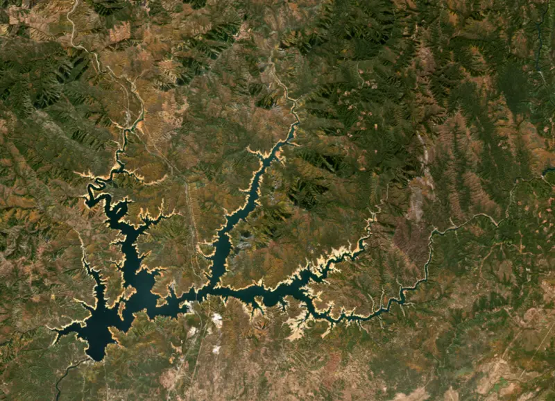
Surface water temperature
65°F on Oct 28, 2026
83°F · Jul 2465°F · Oct 28
18°F cooler than on Jul 24, 2026.
Estimated from Landsat 8/9 (USGS) passes on clear days: the top layer of the water, a few degrees either way. Coves and the shallows can be warmer.
Shasta Lake water temperature: trend, swimming and the fish →
On or near the shore of Shasta Lake: 17 boat ramps, 8 marinas, 3 rental outfits, 37 campgrounds and 8 trails. The lake has about 400 miles of shoreline, counting its islands.
Tap an icon for details; use two fingers (or Ctrl + scroll) to move the map. Tap a dot for details. Map and lake outline © OpenStreetMap contributors. Places from OpenStreetMap, Overture Maps and Recreation.gov. Not for navigation.
What you’ll find on the shore
← AllBoating 25
Which boat ramps are usable at today’s level →
← AllRentals & tours 4
← AllCamping 37
← AllLodging 14
← AllTrails 8
← AllParks 3
← AllDining 3
These invasive plants and animals have been recorded in Shasta Lake: clean, drain and dry everything before you go to another lake.
California: California-registered motorized boats used in fresh water must display a current Mussel Fee sticker. Many lakes and reservoirs run mandatory inspections or quarantines, moving quagga, zebra or golden mussels is illegal, and boaters are asked to clean, drain and dry. Required: Quagga and Zebra Mussel Fee sticker ($42 every two years ($21 if bought in an even-numbered year)). State rules
Records: USGS Nonindigenous Aquatic Species database. A species not listed may still be present.
Species with open-licensed records inside Shasta Lake's outline, from GBIF.org (surveys, museum collections and angler reports). A record shows a fish was found here, not how many there are now.
Cool water: near the surface in spring and fall, deep in summer.
Schools at a set depth in summer: trolling at the right depth is everything.
Deep, cold water; fall runs toward the tributaries.
Water temperature sets off each spawn; the bars show the usual months at this latitude and elevation, and move with a warm or cold spring.
Shasta Lake is the reservoir behind Shasta Dam on the upper Sacramento River, just north of Redding in far northern California. It is the largest reservoir in the state and the keystone of the federal Central Valley Project. Its long arms wind into forested hills, with the snowy cone of Mount Shasta in view to the north.
The Central Valley Project began as a California plan, but the state could not sell its bonds during the Depression and the federal government took it over. The groundbreaking and naming ceremony was held on September 12, 1937, in Kennett, a small town just upstream of the site, and the project was first called Kennett Dam before it took the name of Mount Shasta. Kennett itself went under the new lake within a few years.
Pacific Constructors Inc. won the contract in 1938. Its general superintendent was Frank Crowe, a veteran of Hoover Dam. The crew grew to 4,700 men. Gravel and sand came from a quarry about 9 miles away on a 9.6-mile conveyor belt that ran day and night. The lake began storing water in February 1944, and the last bucket of concrete was poured on January 2, 1945. At 602 feet, Shasta was then the second-highest concrete dam in the world, behind Hoover. The powerplant was finished in 1950, when the project was considered complete.
The reservoir drowned the old route through the canyon. About 30 miles of Southern Pacific track, with its bridges, trestles and tunnels, had to be relocated. The railroad and U.S. 99, the highway that became Interstate 5, were rerouted east over the new Pit River Bridge.
The water also covered much of the homeland of the Winnemem Wintu, whose remaining land lies along the lower McCloud River. Village and burial sites now lie hundreds of feet down, and more than two dozen of the tribe's sacred sites now sit deep under the lake, and the tribe has opposed federal proposals to raise the dam, which would flood more of what remains.
The lake has four main arms, fed by the Sacramento, McCloud and Pit rivers and by Sulanharas Creek. Recreation on the water and the surrounding land is run by the Shasta-Trinity National Forest as part of the Whiskeytown-Shasta-Trinity National Recreation Area, signed into law on November 8, 1965. Houseboats are a large part of lake life, and Bridge Bay, the largest marina, is one of several that rent them.
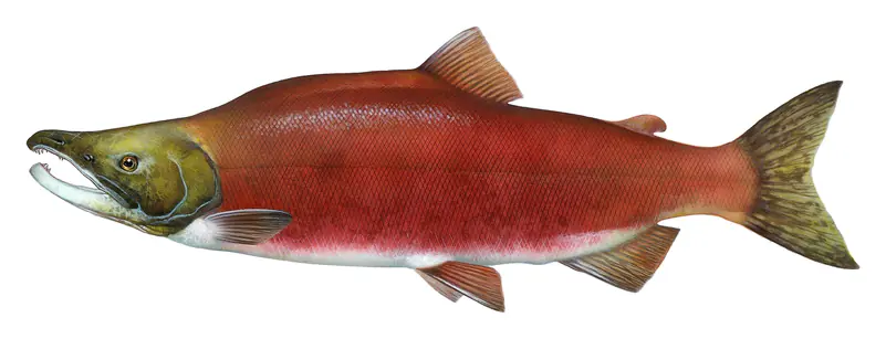
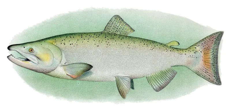
Anglers fish for rainbow trout, Chinook salmon, black bass, catfish and sunfish. The state's 2017 eating advisory, based on mercury and PCBs, suggests fewer meals of black bass, carp and Chinook than of trout or sunfish, and advises women 18 to 45 and children to avoid channel catfish. Eat only skinless fillets. The dam itself cut migrating salmon off from much of their best spawning water upstream. To help endangered winter-run Chinook below the dam, a temperature control device finished in 1997 lets operators release colder water drawn from deeper in the lake.
Because the lake supplies Central Valley farms and the Sacramento River, its level swings widely between wet and dry years. In the 2021 drought the surface fell 106 feet between June 2019 and June 2021, leaving the lake at about 41 percent of capacity by mid-June. A wide band of bare tan lakebed, the familiar bathtub ring, showed around the shoreline, ground that sits underwater when the reservoir is fuller.
Written by Lake by Lake from National Park Service, Wikipedia (Shasta Dam, Shasta Lake), National Park Service, Whiskeytown National Recreation Area, California Office of Environmental Health Hazard Assessment and NASA Earth Observatory. Checked November 2026.
Activities listed by the Bureau of Reclamation: Biking · Boating · Camping · Ranger programs · Fishing · Hiking · Hunting · Picnicking · Water sports · Wildlife viewing
Shasta Dam is a concrete dam 602 feet high and 3,460 feet long on the Sacramento River, completed in 1945. It belongs to the Bureau of Reclamation and is run for hydropower, irrigation, navigation, recreation and water supply. At its normal level the reservoir holds 4.55 million acre-ft, drained from 6,111 square miles of land.
From the National Inventory of Dams (U.S. Army Corps of Engineers), NID ID CA10186. Lake or reservoir: what’s the difference?
Where the level comes from: SHASTA (California Data Exchange Center (DWR), used on this page) and Shasta Lake Dam and Powerplant (Bureau of Reclamation (RISE)).
| Lake | Miles | Level (ft) | vs full | 7 days |
|---|---|---|---|---|
| Keswick Reservoir At or near full pool | 7 | 583.01 | −3.99 | −0.30 |
| Whiskeytown Lake Slightly below full | 10 | 1199.74 | −10.26 | −1.53 |
| Trinity Lake Below full | 19 | 2313.28 | −56.72 | −0.14 |
| Lewiston Lake At or near full pool | 20 | 1900.87 | −1.13 | −0.12 |
| Black Butte Lake Well below full | 63 | 436.51 | −36.99 | +0.44 |
Compare Shasta Lake with Keswick Reservoir, Whiskeytown Lake, Trinity Lake or Lewiston Lake: size, level, ramps and fish side by side.
Shasta Lake is at 971.25 feet above sea level — 95.75 ft below full pool, 49.0% full, as of Nov 16, 2026. The level has held steady over the past week.
Shasta Lake's full pool is 1,067.00 ft, according to Bureau of Reclamation. Today the lake is 95.75 ft below that mark.
Today's level is 11.16 ft below the median for this date (982.41 ft), from the gauge’s long-term daily record.
882.24 ft, on October 21, 2021, in the California Data Exchange Center (DWR) record, which starts in 1985. Today the lake is 89.0 ft above that.
1,066.48 ft, on April 30, 2003, in the California Data Exchange Center (DWR) record since 1985.
Shasta Lake has 17 boat ramps on our map, including Boat ramp at Bridge Bay At Shasta Lake, Boat ramp near Antlers RV Park & Campground, Boat ramp near Bridge Bay At Shasta Lake, and 8 marinas. Low water can close ramps, so check today's level above and the operator before you go.
Yes. There are 37 campgrounds and RV parks within about a mile of the shore, such as Ellery Creek Campground, Lakeshore East Campground, Salt Creek Dispersed Area Campground.
Game fish recorded in Shasta Lake include rainbow trout, Chinook salmon, kokanee salmon, dolly varden. In all, 9 fish species have open records inside the lake on GBIF.
Anglers 16 and older need a California fishing license, sold online by the California Department of Fish and Wildlife. Free fishing days: Two Saturdays a year (2027: July 3 and September 4). Size and bag limits can be set lake by lake: check the current regulations.
Shasta Lake is about 518 ft deep at its deepest point, usually near the dam, and about 151 ft deep on average. Depth changes with the lake level.
Bureau of Reclamation lists biking, boating, camping, ranger programs, fishing, hiking, hunting and picnicking at Shasta National Rec. Area. 21 campgrounds can be booked on Recreation.gov.
EPA's CyAN satellite rated cyanobacteria in Shasta Lake not detected on November 9. The satellite sees open water only; blooms can be patchy, so avoid water that looks like spilled paint or pea soup and keep dogs out of scum. Swimming advisories come from California health and environment agencies.
Yes. 8 trails run along or near the shore, including Bailey Cove Trail (2.7 mi), Clikaputi Loop Trail (7.2 mi) and Clikaputi Trail (1.2 mi), according to OpenStreetMap.
Shasta Lake is held back by Shasta Dam, completed in 1945 and 602 ft high, according to the National Inventory of Dams.
From the California Data Exchange Center (DWR) (SHASTA). Lake by Lake checks it every hour; the agency's own figure is always the reference, and provisional readings can be revised.
Lake levels are refreshed every hour. Texas and California reservoirs report once a day; most USGS and NOAA gauges report every 15 to 60 minutes.