Sun
- Sunrise
- 6:44 AM
- Sunset
- 5:31 PM
- First light
- 6:20 AM
- Last light
- 5:56 PM
Lake · Palm Beach County, Florida
A lake fed by the Kissimmee River in Palm Beach County, Florida, held back by Herbert Hoover Dike - Ciz C since 1965.

Lake Okeechobee is at 14.70 feet above sea level, as of Nov 17, 2026, 9:00 PM EST. It has risen 0.30 ft in the past 7 days.
Record low 10.86 ft (2026), record high 16.51 ft (2022) · Level history since 2022
A notification from this browser, once, when the level crosses the line (checked every hour). No account and no email. On an iPhone, add Lake by Lake to your home screen first (Share → Add to Home Screen) and open it from there. Or follow the lake in a feed reader: RSS feed.
Lake Okeechobee is up 0.30 ft over the last 7 days, at 14.70 ft today.
Daily values from the U.S. Army Corps of Engineers.
Lake Okeechobee is up 2.22 ft over the last 30 days, at 14.70 ft today.
Daily values from the U.S. Army Corps of Engineers.
Over the past 12 months, Lake Okeechobee ranged from 10.86 ft (Jul 24, 2026) to 14.70 ft (Nov 17, 2026), a swing of 3.8 ft. Today's level is the highest of the past 12 months. It is 0.92 ft higher than on this date last year.
Daily values from the U.S. Army Corps of Engineers. Why lake levels rise and fall
In the U.S. Army Corps of Engineers record, which starts in 2022, the lowest level was 10.86 ft on July 24, 2026 and the highest 16.51 ft on December 1, 2022. Today’s 14.70 ft is 3.8 ft above the record low and 1.8 ft below the record high.
Lake Okeechobee level history: every year since 2022, the lowest and highest years →
Solunar periods for Lake Okeechobee, local time. How they work
High · as of Nov 8, 2026
The satellite sees a likely bloom on part of the lake. Avoid discolored water and scum, and keep dogs out of it. About 328,000 cells/mL at the worst spot, covering 17% of the lake.
Week of Aug 16Week of Nov 1
Each bar is one week, colored by the worst reading of that week.
From the U.S. EPA's Cyanobacteria Assessment Network (CyAN), which reads the color of lakes from the Sentinel-3 satellites; it sees open water only, not coves or the shoreline. Blooms can be patchy: what you see on the water matters more. Swimming closures and health advisories come from Florida health and environment agencies. How to read it
Surface water temperature
80°F on Nov 11, 2026
85°F · Jul 2180°F · Nov 11
5°F cooler than on Jul 21, 2026.
Estimated from MODIS Aqua (NASA) passes on clear days: the top layer of the water, a few degrees either way. Coves and the shallows can be warmer.
Lake Okeechobee water temperature: trend, swimming and the fish →
On or near the shore of Lake Okeechobee: 18 boat ramps, 2 marinas, 52 campgrounds and 2 trails. The lake has about 357 miles of shoreline, counting its islands.
Tap an icon for details; use two fingers (or Ctrl + scroll) to move the map. Tap a dot for details. Map and lake outline © OpenStreetMap contributors. Places from OpenStreetMap, Overture Maps and Recreation.gov. Not for navigation.
What you’ll find on the shore
← AllBoating 20
← AllRentals & tours 3
← AllFishing spots 8
← AllCamping 52
← AllLodging 15
← AllTrails 2
← AllParks 6
← AllDining 2
These invasive plants and animals have been recorded in Lake Okeechobee: clean, drain and dry everything before you go to another lake.
Florida: Florida has no clean-drain-dry law, but FWC asks boaters to remove plants from boats, trailers and livewells before entering or leaving any water and to clean, drain and dry. Possessing or moving prohibited aquatic plants such as hydrilla without a permit is illegal. State rules
Records: USGS Nonindigenous Aquatic Species database. A species not listed may still be present.
Species with open-licensed records inside Lake Okeechobee's outline, from GBIF.org (surveys, museum collections and angler reports). A record shows a fish was found here, not how many there are now.
Shallow, protected flats in spring; docks, grass and deep edges in summer heat.
Brush piles, docks and bridge pilings; shallow for a few weeks in spring.
Channel edges and river arms; best after dark in summer, and after a rain.
Beds in shallow, firm bottoms; around docks and weeds all summer.
On the bottom near snail beds; spawns around the full moon.
Water temperature sets off each spawn; the bars show the usual months at this latitude and elevation, and move with a warm or cold spring. The water is about 80°F now.
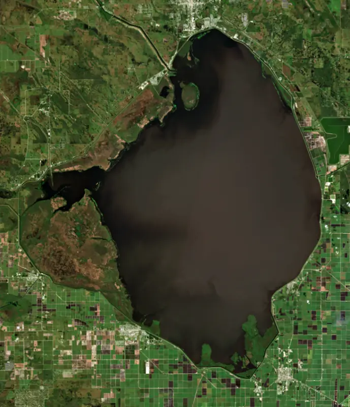
Lake Okeechobee is the broad, shallow lake at the center of South Florida, the largest freshwater lake in the state. It is ringed by the Herbert Hoover Dike and by the farm towns of the Glades, and its water feeds the Everglades to the south and both coasts by canal.
The name joins two Hitchiti words for water and big. The lake sits in a shallow trough that was dry land until about 6,000 years ago. As the sea rose, wetlands spread across it, and their peat built up into a natural dam until the water formed a lake that spilled south into the Everglades. People of the Belle Glade culture lived around it from about 1000 BCE to about 1700 CE, and in the 16th century the Spaniard Hernando de Escalante Fontaneda wrote of a lake called Mayaimi with towns under the Calusa. In 1837, during the Seminole Wars, the Battle of Lake Okeechobee was fought on the north shore. The Kissimmee River brings in more than 60 percent of its water from the north. The Caloosahatchee River to the west and the St. Lucie Canal to the east carry it out, and together with the lake they form the Okeechobee Waterway, a 154-mile boat route from Fort Myers to Stuart that opened in 1937 and passes five Corps locks, including Port Mayaca and Moore Haven.
Early in the 1900s Florida began digging canals to drain the Everglades, and farms spread across the black muck south of the lake behind a low levee of muck. In September 1926 the Great Miami Hurricane drove the lake into Moore Haven and killed more than 100 people. On September 16, 1928, a Category 4 hurricane came ashore in Palm Beach County. Its winds piled the lake against the south shore until water topped the levee and flooded a band of land about 6 miles deep and 75 miles long. Pahokee, Canal Point, Chosen, Belle Glade, South Bay and Bean City went under. The National Hurricane Center counts at least 2,500 dead, most of them non-white migrant farm workers, and a mass grave at Port Mayaca holds about 1,600 victims. Congress then authorized levees. The Corps built them on the south shore and near the city of Okeechobee in the 1930s, extended them to 143 miles after a 1947 hurricane, and named the system for Herbert Hoover in 1960. Seepage, sinkholes and erosion led to a rehabilitation that began in 2005, added more than 56 miles of cutoff wall and replaced 28 culverts. The Corps marked its substantial completion in Clewiston in January 2023, three years ahead of schedule.
The lake is nationally known for largemouth bass and black crappie, and catfish and bream are also fished commercially. On land, the Lake Okeechobee Scenic Trail runs about 109 miles along the top of the dike. The Forest Service dedicated it in 1993 as a segment of the Florida National Scenic Trail. It passes Clewiston, Belle Glade, South Bay, Pahokee, Canal Point, Port Mayaca, Okeechobee and Moore Haven. Kreamer, Ritta and Torry were island settlements with stores, schools and post offices until they emptied out by the 1960s.
Because the dike must be protected, the Corps lets water out when the lake runs high, and those releases to the St. Lucie and Caloosahatchee estuaries have long been a source of conflict on both coasts. The lake has swung the other way too, reaching its all-time low in 2007. Blue-green algae blooms are a regular part of summer here, but in May 2016 a bloom covered 33 square miles, and in early July 2018 blooms were detected across 90 percent of the lake.
Written by Lake by Lake from U.S. Army Corps of Engineers, Jacksonville District, National Weather Service, Miami, NASA Earth Observatory and Wikipedia (Lake Okeechobee, Okeechobee Waterway, Lake Okeechobee Scenic Trail). Checked November 2026.
Activities listed by the U.S. Army Corps of Engineers: Boating · Camping · Fishing · Hiking · Picnicking · Water sports · Wildlife viewing
Herbert Hoover Dike - Ciz C is an earthfill dam 35 feet high and 46,630 feet long, completed in 1965. It belongs to the U.S. Army Corps of Engineers (Jacksonville District) and is run for flood control, irrigation, navigation, fish and wildlife, recreation and water supply. At its normal level the lake holds 4.60 million acre-ft, drained from 5,600 square miles of land.
From the National Inventory of Dams (U.S. Army Corps of Engineers), NID ID FL36001. Lake or reservoir: what’s the difference?
Where the level comes from: Lake Okeechobee (U.S. Army Corps of Engineers).
| Lake | Miles | Level (ft) | vs full | 7 days |
|---|---|---|---|---|
| Lake Istokpoga Live reading | 41 | 39.12 | — | −0.02 |
| Lake Trafford Live reading | 54 | 19.88 | — | 0.00 |
| Lake Kissimmee Live reading | 65 | 52.52 | — | −0.30 |
| Indian Lake Estates Live reading | 69 | 61.20 | — | — |
| Lake Weohyakapka Live reading | 69 | 61.20 | — | −0.26 |
| Lake Rosalie Live reading | 78 | 54.22 | — | −0.26 |
Compare Lake Okeechobee with Lake Istokpoga, Lake Trafford, Lake Kissimmee or Indian Lake Estates: size, level, ramps and fish side by side.
Lake Okeechobee is about 35 mi from Port St. Lucie, FL and 75 mi from Cape Coral, FL. See all the lakes near each city.
Lake Okeechobee is at 14.70 feet above sea level, as of Nov 17, 2026, 9:00 PM EST. It has risen 0.30 ft in the past 7 days.
10.86 ft, on July 24, 2026, in the U.S. Army Corps of Engineers record, which starts in 2022. Today the lake is 3.8 ft above that.
16.51 ft, on December 1, 2022, in the U.S. Army Corps of Engineers record since 2022.
Lake Okeechobee has 18 boat ramps on our map, including Cliff Betts Jr. Lakeside Recreation Area (Culvert 7), Paul Rardin Park Public Boat Ramp, Canal Point Public Boat Ramp, and 2 marinas. Low water can close ramps, so check today's level above and the operator before you go.
Yes. There are 52 campgrounds and RV parks within about a mile of the shore, such as Lake Okeechobee Resort, Pahokee Campground, Torry Island Campground.
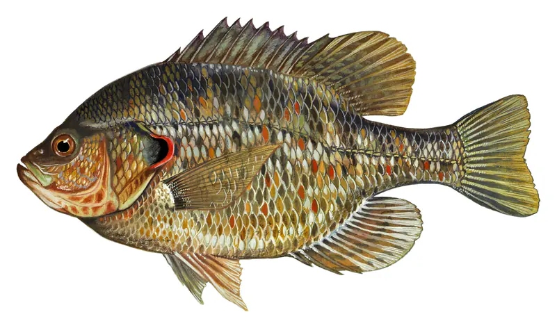
Game fish recorded in Lake Okeechobee include redear sunfish, bluegill, largemouth bass, black crappie, chain pickerel, white catfish. In all, 40 fish species have open records inside the lake on GBIF.
The surface of Lake Okeechobee was about 80°F on November 11, estimated from a satellite pass on a clear day. It is the top layer of the water, a few degrees either way; coves and shallows run warmer in the sun.
Anglers 16 and older need a Florida fishing license, sold online by the Florida Fish and Wildlife Conservation Commission. Free fishing days: First weekend in April and second weekend in June. Size and bag limits can be set lake by lake: check the current regulations.
Lake Okeechobee is about 10 ft deep at its deepest point. Depth changes with the lake level.
In summer a white Secchi disk lowered into Lake Okeechobee stays visible to about 1.3 ft (the median of 1,503 readings, 2016–2026, by South Florida Water Management District and FL Dept. of Environmental Protection, Southeast District): murky water. With the algae measured too (chlorophyll about 23 µg/L), that makes it eutrophic: rich in nutrients, greener water. Clarity drops after storms and during algae blooms.
U.S. Army Corps of Engineers lists boating, camping, fishing, hiking, picnicking, water sports and wildlife viewing at Lake Okeechobee.
EPA's CyAN satellite rated cyanobacteria in Lake Okeechobee high on November 8. The satellite sees open water only; blooms can be patchy, so avoid water that looks like spilled paint or pea soup and keep dogs out of scum. Swimming advisories come from Florida health and environment agencies.
Yes. 2 trails run along or near the shore, including Florida National Scenic Trail - Southern Region and Ocean to Lake Hiking Trail, according to OpenStreetMap.
Lake Okeechobee is held back by Herbert Hoover Dike - Ciz C, completed in 1965 and 35 ft high, according to the National Inventory of Dams.
From the U.S. Army Corps of Engineers (Lake Okeechobee). Lake by Lake checks it every hour; the agency's own figure is always the reference, and provisional readings can be revised.
Lake levels are refreshed every hour. Texas and California reservoirs report once a day; most USGS and NOAA gauges report every 15 to 60 minutes.