Sun
- Sunrise
- 6:50 AM
- Sunset
- 5:31 PM
- First light
- 6:25 AM
- Last light
- 5:56 PM
Lake · Osceola County, Florida
A lake fed by Shingle Creek in Osceola County, Florida.

Lake Tohopekaliga is at 54.79 feet above sea level, as of Nov 19, 2026, 3:00 AM EST. It has dropped 0.12 ft in the past 7 days.
4th lowest of 8 Florida lakes today against normal for the date · See the ranking
Record low 51.82 ft (2024), record high 56.94 ft (2022) · Level history since 2010
A notification from this browser, once, when the level crosses the line (checked every hour). No account and no email. On an iPhone, add Lake by Lake to your home screen first (Share → Add to Home Screen) and open it from there. Or follow the lake in a feed reader: RSS feed.
Lake Tohopekaliga is down 0.12 ft over the last 7 days, at 54.79 ft today.
Daily values from the U.S. Army Corps of Engineers.
Lake Tohopekaliga is up 0.14 ft over the last 30 days, at 54.79 ft today.
Daily values from the U.S. Army Corps of Engineers.
Over the past 12 months, Lake Tohopekaliga ranged from 51.93 ft (Jun 9, 2026) to 55.42 ft (Nov 4, 2026), a swing of 3.5 ft. Today's level is near the top of that range. It is 0.12 ft lower than on this date last year.
Daily values from the U.S. Army Corps of Engineers. Why lake levels rise and fall
In the U.S. Army Corps of Engineers record, which starts in 2010, the lowest level was 51.82 ft on June 18, 2024 and the highest 56.94 ft on October 6, 2022. Today’s 54.79 ft is 3.0 ft above the record low and 2.1 ft below the record high.
Lake Tohopekaliga level history: every year since 2010, the lowest and highest years →
Solunar periods for Lake Tohopekaliga, local time. How they work
Moderate · as of Nov 8, 2026
A bloom may be forming somewhere on the lake. Avoid water that looks like spilled paint or pea soup. About 286,000 cells/mL at the worst spot, covering 21% of the lake.
Week of Aug 16Week of Nov 1
Each bar is one week, colored by the worst reading of that week.
From the U.S. EPA's Cyanobacteria Assessment Network (CyAN), which reads the color of lakes from the Sentinel-3 satellites; it sees open water only, not coves or the shoreline. Blooms can be patchy: what you see on the water matters more. Swimming closures and health advisories come from Florida health and environment agencies. How to read it
Surface water temperature
75°F on Nov 11, 2026
86°F · Jul 2175°F · Nov 11
11°F cooler than on Jul 21, 2026.
Estimated from MODIS Aqua (NASA) passes on clear days: the top layer of the water, a few degrees either way. Coves and the shallows can be warmer.
Lake Tohopekaliga water temperature: trend, swimming and the fish →
On or near the shore of Lake Tohopekaliga: 7 boat ramps, 5 marinas, 2 campgrounds, 2 fishing piers and 3 trails. The lake has about 56 miles of shoreline, counting its islands.
Tap an icon for details; use two fingers (or Ctrl + scroll) to move the map. Tap a dot for details. Map and lake outline © OpenStreetMap contributors. Places from OpenStreetMap, Overture Maps and Recreation.gov. Not for navigation.
What you’ll find on the shore
← AllBoating 12
← AllRentals & tours 2
← AllFishing spots 2
← AllCamping 2
← AllLodging 13
← AllTrails 3
← AllParks 12
← AllDining 4
These invasive plants and animals have been recorded in Lake Tohopekaliga: clean, drain and dry everything before you go to another lake.
Florida: Florida has no clean-drain-dry law, but FWC asks boaters to remove plants from boats, trailers and livewells before entering or leaving any water and to clean, drain and dry. Possessing or moving prohibited aquatic plants such as hydrilla without a permit is illegal. State rules
Records: USGS Nonindigenous Aquatic Species database. A species not listed may still be present.
Species with open-licensed records inside Lake Tohopekaliga's outline, from GBIF.org (surveys, museum collections and angler reports). A record shows a fish was found here, not how many there are now.
Shallow, protected flats in spring; docks, grass and deep edges in summer heat.
Brush piles, docks and bridge pilings; shallow for a few weeks in spring.
Channel edges and river arms; best after dark in summer, and after a rain.
Beds in shallow, firm bottoms; around docks and weeds all summer.
On the bottom near snail beds; spawns around the full moon.
Water temperature sets off each spawn; the bars show the usual months at this latitude and elevation, and move with a warm or cold spring. The water is about 75°F now.
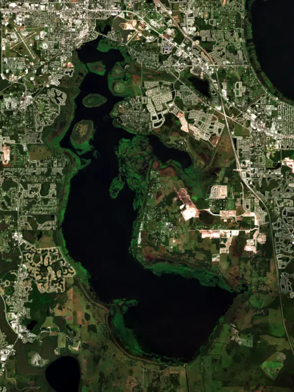
Lake Tohopekaliga, known to most people as Lake Toho or West Lake, is the largest lake in Osceola County, Florida, with the city of Kissimmee on its north shore just south of Orlando. It sits near the head of the Kissimmee Chain of Lakes, whose water eventually reaches Lake Okeechobee. Bass anglers know it from decades of national tournaments and one famous record catch.
The name comes from Creek words meaning a fence or fort and a site, which is why it is often translated as fort site. Kissimmee began as a small trading post called Allendale on the lake's north bank, with a post office opened near Shingle Creek in 1873. After the Civil War, the Philadelphia saw maker Hamilton Disston bought about 4 million acres of Florida marsh and prairie, Allendale included, for 25 cents an acre. In January 1881 he contracted to drain the area and deepen the Kissimmee River so crops and timber could reach the Gulf of Mexico. Steamboat captains then ran the chain of lakes from Kissimmee to the Gulf carrying cypress lumber and sugar cane, and in 1883 voters incorporated the town as Kissimmee City. The freeze of 1895 drove many families farther south, and Disston died in 1896.
Shingle Creek, which rises in Orlando, is the lake's main source. Canal 31, the St. Cloud Canal, ties Toho to East Lake Tohopekaliga, and at the southern tip the Southport canal runs on to Cypress Lake and the rest of the chain. The South Florida Water Management District runs the S-61 navigation lock on the south shore at Southport, and in dry years it can stop locking boats through when the water downstream drops too low. Makinson Island and Paradise Island sit out in the lake. On the north shore, Kissimmee's Lakefront Park has a walking path, a playground and a small lighthouse, with Big Toho Marina next door.
Flood control has its costs here. Years of nutrient runoff from Orlando and Kissimmee, along with a control system that ended the natural cycle of drought and flood, let thick black muck and dense plants build up along almost the whole shoreline and smother the spawning beds of largemouth bass. Wildlife managers answer with drawdowns. In 2004 the Florida Fish and Wildlife Conservation Commission lowered Toho for its fourth habitat drawdown, and bulldozers went onto the exposed bottom to scrape up muck and overgrown plants, hauling it away or piling it into small islands. To drain Toho, officials first had to lower Cypress, Hatchineha and Kissimmee lakes, and that water ran down to Lake Okeechobee when it was already high. Okeechobee guides and environmental groups objected and asked a federal judge to stop the work, but the judge declined.
Toho and the rest of the Kissimmee Chain have long been a regular stop for Bassmaster tournaments, which launch from Kissimmee. In the 1977 Bassmaster Classic, often listed as a Toho event though most of the chain was in play, Rick Clunn became the first angler to win back-to-back Classics. The chain hosted the Classic again in 2006, the first one held in winter, when Preston Clark weighed an 11-pound, 10-ounce bass, the largest in Classic history. The best-known day came on January 17, 2001, when Dean Rojas brought in five bass weighing 45 pounds, 2 ounces, a one-day Bassmaster record, on his way to winning with 108 pounds, 12 ounces over four days. Alligators, bald eagles and sandhill cranes share the lake with the anglers, and boaters crossing toward the lower chain should watch the water level at the Southport lock in dry years.
Written by Lake by Lake from City of Kissimmee, South Florida Water Management District, NBC News, Bassmaster (Southern Open 1 kicks off season, Historical look at Classic waters), Wikipedia and University of Florida LAKEWATCH. Checked November 2026.
Where the level comes from: Lake Tohopekaliga (U.S. Army Corps of Engineers).
| Lake | Miles | Level (ft) | vs full | 7 days |
|---|---|---|---|---|
| East Lake Tohopekaliga Live reading | 9 | 57.85 | — | +0.06 |
| Lake Marion Live reading | 11 | 66.51 | — | −0.12 |
| Bay Lake Live reading | 17 | 94.31 | — | −0.01 |
| Lake Rosalie Live reading | 19 | 54.20 | — | −0.27 |
| Indian Lake Estates Live reading | 27 | 61.20 | — | −0.22 |
| Lake Weohyakapka Live reading | 27 | 61.20 | — | −0.22 |
Compare Lake Tohopekaliga with East Lake Tohopekaliga, Lake Marion, Bay Lake or Lake Rosalie: size, level, ramps and fish side by side.
Lake Tohopekaliga is about 16 mi from Orlando, FL, 36 mi from Lakeland, FL and 48 mi from Palm Bay, FL. See all the lakes near each city.
Lake Tohopekaliga is at 54.79 feet above sea level, as of Nov 19, 2026, 3:00 AM EST. It has dropped 0.12 ft in the past 7 days.
Today's level is 0.09 ft below the median for this date (54.88 ft), from the gauge’s long-term daily record.
51.82 ft, on June 18, 2024, in the U.S. Army Corps of Engineers record, which starts in 2010. Today the lake is 3.0 ft above that.
56.94 ft, on October 6, 2022, in the U.S. Army Corps of Engineers record since 2010.
Lake Tohopekaliga has 7 boat ramps on our map, including Granada Boat Ramp, Kissimmee Lakefront Park - Big Toho Marina Boat Ramp, Scotty's Cove Kayak and Canoe Launch, and 5 marinas. Low water can close ramps, so check today's level above and the operator before you go.
Yes. There are 2 campgrounds and RV parks within about a mile of the shore, such as Richardson's Fish Camp, Lake Toho Fish Camp.
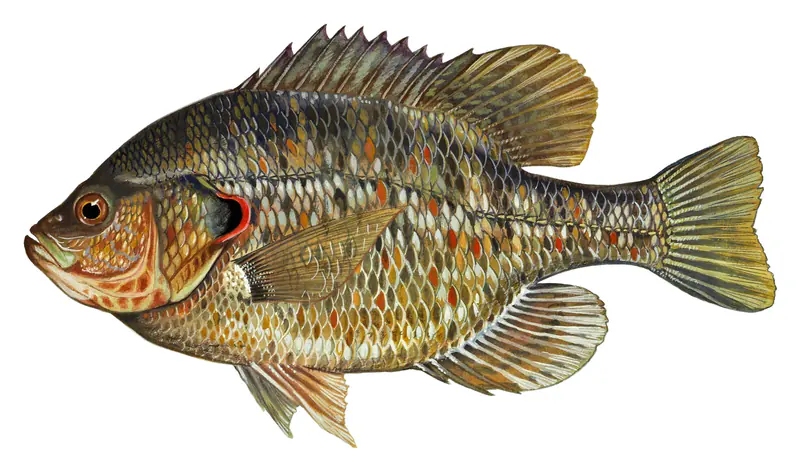
Game fish recorded in Lake Tohopekaliga include largemouth bass, bluegill, redear sunfish, black crappie, chain pickerel, white catfish. In all, 33 fish species have open records inside the lake on GBIF.
The surface of Lake Tohopekaliga was about 75°F on November 11, estimated from a satellite pass on a clear day. It is the top layer of the water, a few degrees either way; coves and shallows run warmer in the sun.
Anglers 16 and older need a Florida fishing license, sold online by the Florida Fish and Wildlife Conservation Commission. Free fishing days: First weekend in April and second weekend in June. Size and bag limits can be set lake by lake: check the current regulations.
In summer a white Secchi disk lowered into Lake Tohopekaliga stays visible to about 3.0 ft (the median of 127 readings, 2016–2025, by FLORIDA LAKEWATCH and South Florida Water Management District): murky water. With the algae measured too (chlorophyll about 16 µg/L), that makes it eutrophic: rich in nutrients, greener water. Clarity drops after storms and during algae blooms.
Yes: hydrology report map with depth contours from the U.S. Geological Survey (1980). It is linked in the lake facts on this page. Depths on a map are measured at a reference level: subtract how far the lake is below it today.
boating (7 boat ramps and 5 marinas), boat tours (2 boat tours and charters), fishing (13 game fish and 2 fishing piers and spots), hiking & walking (3 trails along the shore, the longest Lakeshore Trail (0.7 mi)), camping (2 campgrounds) and cabins & lodging (13 places to stay close to the water), according to our map of the shore.
EPA's CyAN satellite rated cyanobacteria in Lake Tohopekaliga moderate on November 8. The satellite sees open water only; blooms can be patchy, so avoid water that looks like spilled paint or pea soup and keep dogs out of scum. Swimming advisories come from Florida health and environment agencies.
Yes. 3 trails run along or near the shore, including Florida National Scenic Trail - Central Region, Lakeshore Trail (0.7 mi) and Lawrence Silas Trail (0.5 mi), according to OpenStreetMap.
From the U.S. Army Corps of Engineers (Lake Tohopekaliga). Lake by Lake checks it every hour; the agency's own figure is always the reference, and provisional readings can be revised.
Lake levels are refreshed every hour. Texas and California reservoirs report once a day; most USGS and NOAA gauges report every 15 to 60 minutes.
Cookies for analytics With your OK we use Google Analytics and Microsoft Clarity to count visits and see how the site is used, so we can make it better. No advertising cookies. Privacy policy