Sun
- Sunrise
- 6:53 AM
- Sunset
- 4:07 PM
- First light
- 6:19 AM
- Last light
- 4:40 PM
Reservoir · Clearwater County, Idaho
A reservoir on the North Fork Clearwater River in Clearwater County, Idaho, held back by Dworshak Dam since 1973. Also called Dworkshak Reservoir.

Dworshak Reservoir is at 1,512.82 feet above sea level — 87.18 ft below normal pool, as of Nov 18, 2026, 11:59 PM PST. It has dropped 0.69 ft in the past 7 days. That is the lowest level since 2021.
3rd lowest of 16 Idaho lakes today against full pool · See the ranking
Record low 1,445.26 ft (1999), record high 1,600.16 ft (2014) · Level history since 1972
A notification from this browser, once, when the level crosses the line (checked every hour). No account and no email. On an iPhone, add Lake by Lake to your home screen first (Share → Add to Home Screen) and open it from there. Or follow the lake in a feed reader: RSS feed.
Dworshak Reservoir is down 0.69 ft over the last 7 days, at 1,512.82 ft today.
Daily values from the NOAA National Water Prediction Service.
Dworshak Reservoir is down 3.55 ft over the last 30 days, at 1,512.82 ft today.
Daily values from the NOAA National Water Prediction Service.
Over the past 12 months, Dworshak Reservoir ranged from 1,512.88 ft (Nov 16, 2026) to 1,600.10 ft (Jun 9, 2026), a swing of 87.2 ft. Today's level is the lowest of the past 12 months. It is 0.86 ft lower than on this date last year.
Daily values from the NOAA National Water Prediction Service. Why lake levels rise and fall
In the U.S. Army Corps of Engineers record, which starts in 1972, the lowest level was 1,445.26 ft on April 11, 1999 and the highest 1,600.16 ft on June 29, 2014. Today’s 1,512.82 ft is 67.6 ft above the record low and 87.3 ft below the record high. That is the lowest level since 2021.
Dworshak Reservoir level history: every year since 1972, the lowest and highest years →
Solunar periods for Dworshak Reservoir, local time. How they work
Moderate · as of Nov 9, 2026
A bloom may be forming somewhere on the lake. Avoid water that looks like spilled paint or pea soup. About 205,000 cells/mL at the worst spot, covering less than 1% of the lake.
Week of Aug 16Week of Nov 1
Each bar is one week, colored by the worst reading of that week.
From the U.S. EPA's Cyanobacteria Assessment Network (CyAN), which reads the color of lakes from the Sentinel-3 satellites; it sees open water only, not coves or the shoreline. Blooms can be patchy: what you see on the water matters more. Swimming closures and health advisories come from Idaho health and environment agencies. How to read it
Surface water temperature
50°F on Oct 31, 2026
79°F · Jul 2750°F · Oct 31
28°F cooler than on Jul 27, 2026.
Estimated from Landsat 8/9 (USGS) passes on clear days: the top layer of the water, a few degrees either way. Coves and the shallows can be warmer.
Dworshak Reservoir water temperature: trend, swimming and the fish →
On or near the shore of Dworshak Reservoir: 8 boat ramps, 2 marinas, 4 campgrounds and 6 trails. The lake has about 225 miles of shoreline, counting its islands.
Tap an icon for details; use two fingers (or Ctrl + scroll) to move the map. Tap a dot for details. Map and lake outline © OpenStreetMap contributors. Places from OpenStreetMap, Overture Maps and Recreation.gov. Not for navigation.
No aquatic invasive species are on record for Dworshak Reservoir in the USGS database. Keep it that way: clean, drain and dry your boat between lakes.
Idaho: Stop at every open watercraft inspection station, even with a kayak or paddleboard. Remove plants and mud before leaving the water, pull the drain plug and drain all water before transporting, and keep plugs out on the road. Required: Idaho Invasive Species Fund sticker ($10 a year for Idaho motorboats (in registration), $30 for out-of-state motorboats, $7 for nonmotorized boats). State rules
Records: USGS Nonindigenous Aquatic Species database. A species not listed may still be present.
Species with open-licensed records inside Dworshak Reservoir's outline, from GBIF.org (surveys, museum collections and angler reports). A record shows a fish was found here, not how many there are now.
Shallow, protected flats in spring; docks, grass and deep edges in summer heat.
Rocky points, gravel and current breaks; deeper rock piles in summer.
Cool water: near the surface in spring and fall, deep in summer.
Schools at a set depth in summer: trolling at the right depth is everything.
Inlets and shorelines in spring; deeper as the lake warms.
Water temperature sets off each spawn; the bars show the usual months at this latitude and elevation, and move with a warm or cold spring.
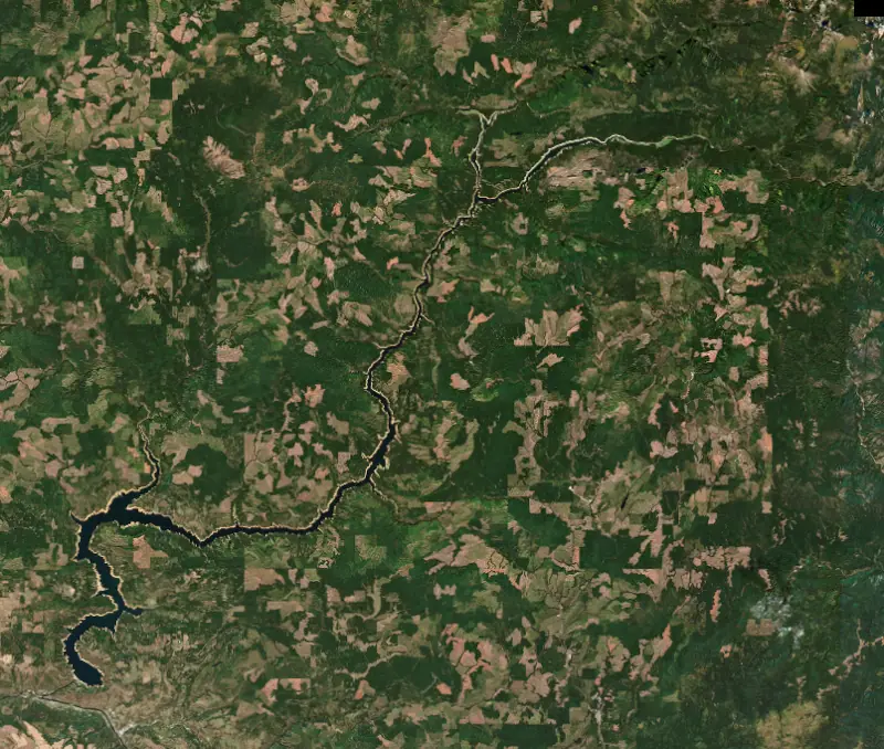
Dworshak Reservoir fills the canyon of the North Fork of the Clearwater River in central Idaho, behind Dworshak Dam just above Ahsahka, a few miles west of Orofino. The lake winds about 54 miles up the canyon through forested mountain country. Its dam is the tallest straight-axis concrete dam in the Western Hemisphere and the third-tallest dam of any kind in the United States.
The project first took the name of its site, Bruces Eddy, a circling current at a sharp bend of the North Fork named for an engineer who died there around 1900. After the great flood of May 1948, report after report in the 1950s pointed to the Clearwater as a good place for a large flood-control dam. The Flood Control Act of 1962 authorized the project and gave it the name of Idaho Senator Henry Dworshak.
An arch dam was ruled out because the rock was not suited to it, so the Army Corps of Engineers chose a concrete gravity dam and made it taller with each round of planning. The first concrete was poured on June 22, 1968, and by the summer of 1973 crews had placed 6.6 million cubic yards. The dam was dedicated on June 15, 1973. Its powerhouse has room for six generators, but only three were installed. The lake drowned elk and white-tailed deer winter range, and the Walla Walla District now manages about 9,000 acres around it for those herds.
The North Fork was the home water of B-run steelhead, large fish that traveled some 500 miles up the Columbia and Snake to spawn there. The dam cut them off from their spawning grounds. To make up for that loss, the Dworshak National Fish Hatchery opened in 1969 just below the dam, where the North Fork meets the main Clearwater at Ahsahka, about 3 miles west of Orofino. The Corps owns it, and the U.S. Fish and Wildlife Service and the Nez Perce Tribe have run it together, raising about 2.1 million B-run steelhead a year along with spring chinook and coho. The site was once the largest inland Native American fishing village in the Pacific Northwest. Visitors can walk through the hatchery, and steelhead are spawned there from January through March.
The lake helps fish far downstream too. In summer the Corps releases its cold water to keep the lower Snake River below 68 degrees for migrating salmon and steelhead.
About 2 million acre-feet of Dworshak's storage is set aside for regional flood control, so the lake must have room to catch the spring runoff and refills in late spring. In a typical year the Corps aims to hold it near full into early July. After that, the cold-water releases for salmon draw it down again through late summer and fall. As the water drops, many shoreline campsites end up a long uphill walk from the waterline. Boat access to the camps up the North Fork is best near full pool, which makes early summer the easiest time to visit by boat.
The visitor center stands by the north end of the dam on Highway 7. Around the lake the Corps runs campgrounds such as Dent Acres and Dam View, and more than 70 small mini-camps along the shore are reached by boat, on foot or by ATV. Mini-camps cannot be reserved. The district's only ATV trail system is here too. People swim, water-ski, hunt and hike, and bald eagles glide over the water all year. Anglers troll the open water for kokanee. Their numbers swing from year to year, and when small kokanee are abundant the smallmouth bass feed well on them.
Written by Lake by Lake from U.S. Army Corps of Engineers, Walla Walla District (Larger than life, a history of Dworshak Dam, 4 million mouths to feed, life at the Dworshak National Fish Hatchery), U.S. Fish and Wildlife Service, Recreation.gov (U.S. Army Corps of Engineers) and The Spokesman-Review. Checked November 2026.
Activities listed by the U.S. Army Corps of Engineers: Boating · Camping · Fishing · Hiking · Off-road vehicles · Picnicking · Visitor center · Water sports · Wildlife viewing
Dworshak Dam is a concrete dam 717 feet high and 3,287 feet long on the North Fork Clearwater River, completed in 1973. It belongs to the U.S. Army Corps of Engineers (Walla Walla District) and is run for flood control, navigation, fish and wildlife, recreation, hydropower and water supply. At its normal level the reservoir holds 3.47 million acre-ft, drained from 2,440 square miles of land.
From the National Inventory of Dams (U.S. Army Corps of Engineers), NID ID ID00287. Lake or reservoir: what’s the difference?
Where the level comes from: Dworshak Reservoir near Ahsahka (NOAA National Water Prediction Service).
| Lake | Miles | Level (ft) | vs full | 7 days |
|---|---|---|---|---|
| Mann Lake Well below full | 29 | 1787.67 | −16.33 | −0.11 |
| Soldiers Meadow Reservoir Well below full | 32 | 4495.37 | −22.53 | +0.14 |
| Lake Waha Live reading | 33 | 3366.80 | — | +0.15 |
| Lake Coeur d'Alene Live reading | 83 | 2124.50 | — | −0.34 |
| Lake Bryan At or near full pool | 83 | 637.08 | −0.92 | +0.20 |
Compare Dworshak Reservoir with Mann Lake, Soldiers Meadow Reservoir, Lake Waha or Lake Coeur d'Alene: size, level, ramps and fish side by side.
Dworshak Reservoir is about 91 mi from Spokane Valley, WA and 96 mi from Spokane, WA. See all the lakes near each city.
Dworshak Reservoir is also known as Dworkshak Reservoir.
Dworshak Reservoir is at 1,512.82 feet above sea level — 87.18 ft below normal pool, as of Nov 18, 2026, 11:59 PM PST. It has dropped 0.69 ft in the past 7 days. That is the lowest level since 2021.
Dworshak Reservoir's normal pool is 1,600.00 ft, according to U.S. Army Corps of Engineers. Today the lake is 87.18 ft below that mark.
Today's level is 6.36 ft below the median for this date (1,519.18 ft), from the gauge’s long-term daily record.
1,445.26 ft, on April 11, 1999, in the U.S. Army Corps of Engineers record, which starts in 1972. Today the lake is 67.6 ft above that.
1,600.16 ft, on June 29, 2014, in the U.S. Army Corps of Engineers record since 1972. That is 0.2 ft above normal pool.
Dworshak Reservoir has 8 boat ramps on our map, including Boat ramp at Big Eddy, Boat ramp at Bruce's Eddy, Boat ramp at Bruce's Eddy (2), and 2 marinas. Low water can close ramps, so check today's level above and the operator before you go.
Yes. There are 4 campgrounds and RV parks within about a mile of the shore, such as Freeman Creek, Dent Acres Campground, Aquarius Campground and Purple Beach Group Site.
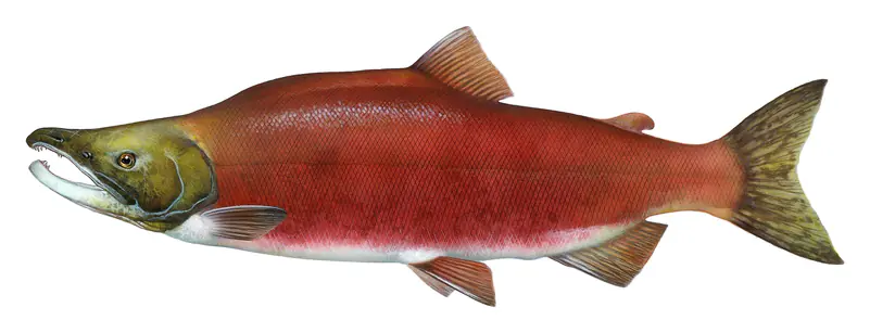
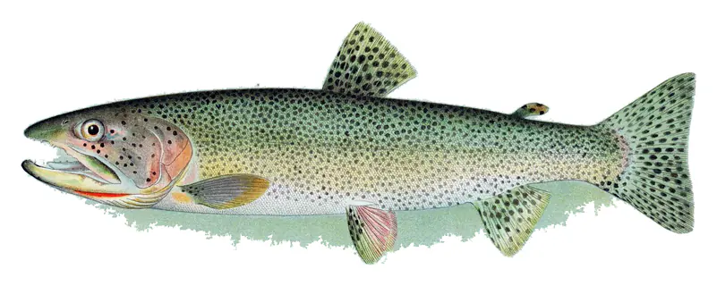
Game fish recorded in Dworshak Reservoir include rainbow trout, kokanee salmon, smallmouth bass, largemouth bass, cutthroat trout, brook trout. In all, 9 fish species have open records inside the lake on GBIF.
Anglers 14 and older need an Idaho fishing license, sold online by the Idaho Department of Fish and Game. Free fishing days: Second Saturday in June. Size and bag limits can be set lake by lake: check the current regulations.
Dworshak Reservoir averages about 203 ft deep. Depth changes with the lake level.
U.S. Army Corps of Engineers lists boating, camping, fishing, hiking, off-road vehicles, picnicking, visitor center and water sports at Dworshak Reservoir. 1 campground can be booked on Recreation.gov.
EPA's CyAN satellite rated cyanobacteria in Dworshak Reservoir moderate on November 9. The satellite sees open water only; blooms can be patchy, so avoid water that looks like spilled paint or pea soup and keep dogs out of scum. Swimming advisories come from Idaho health and environment agencies.
Yes. 6 trails run along or near the shore, including North Fork Downriver Trail (5.4 mi), Big Eddy Trail (9.0 mi) and Dent Trail (1.6 mi), according to OpenStreetMap.
Dworshak Reservoir is held back by Dworshak Dam, completed in 1973 and 717 ft high, according to the National Inventory of Dams.
From the NOAA National Water Prediction Service (Dworshak Reservoir near Ahsahka). Lake by Lake checks it every hour; the agency's own figure is always the reference, and provisional readings can be revised.
Lake levels are refreshed every hour. Texas and California reservoirs report once a day; most USGS and NOAA gauges report every 15 to 60 minutes.
Cookies for analytics With your OK we use Google Analytics and Microsoft Clarity to count visits and see how the site is used, so we can make it better. No advertising cookies. Privacy policy