Sun
- Sunrise
- 7:01 AM
- Sunset
- 4:03 PM
- First light
- 6:27 AM
- Last light
- 4:38 PM
Lake · Bonner County, Idaho
A lake fed by the Priest River in Bonner County, Idaho, held back by Priest Lake Dam since 1979.

Priest Lake is at 2,435.28 feet above sea level, as of Nov 18, 2026, 11:30 PM PST. It has dropped 0.11 ft in the past 7 days.
A notification from this browser, once, when the level crosses the line (checked every hour). No account and no email. On an iPhone, add Lake by Lake to your home screen first (Share → Add to Home Screen) and open it from there. Or follow the lake in a feed reader: RSS feed.
Priest Lake is down 0.11 ft over the last 7 days, at 2,435.28 ft today.
Daily values from the NOAA National Water Prediction Service.
Priest Lake is down 0.94 ft over the last 30 days, at 2,435.28 ft today.
Daily values from the NOAA National Water Prediction Service. Why lake levels rise and fall
Solunar periods for Priest Lake, local time. How they work
Not detected · as of Nov 8, 2026
The satellite found no cyanobacteria at the surface.
Week of Aug 9Week of Nov 1
Each bar is one week, colored by the worst reading of that week.
From the U.S. EPA's Cyanobacteria Assessment Network (CyAN), which reads the color of lakes from the Sentinel-3 satellites; it sees open water only, not coves or the shoreline. Blooms can be patchy: what you see on the water matters more. Swimming closures and health advisories come from Idaho health and environment agencies. How to read it
Surface water temperature
49°F on Nov 4, 2026
76°F · Jul 2149°F · Nov 4
28°F cooler than on Jul 21, 2026.
Estimated from MODIS Aqua (NASA) passes on clear days: the top layer of the water, a few degrees either way. Coves and the shallows can be warmer.
Priest Lake water temperature: trend, swimming and the fish →
On or near the shore of Priest Lake: 7 boat ramps, 4 marinas, 3 rental outfits, 9 campgrounds, 4 beaches and 13 trails. The lake has about 69 miles of shoreline, counting its islands.
Tap an icon for details; use two fingers (or Ctrl + scroll) to move the map. Tap a dot for details. Map and lake outline © OpenStreetMap contributors. Places from OpenStreetMap, Overture Maps and Recreation.gov. Not for navigation.
What you’ll find on the shore
← AllBoating 11
← AllRentals & tours 3
← AllBeaches 4
← AllCamping 9
← AllLodging 11
← AllTrails 13
← AllParks 3
← AllDining 2
These invasive plants and animals have been recorded in Priest Lake: clean, drain and dry everything before you go to another lake.
Idaho: Stop at every open watercraft inspection station, even with a kayak or paddleboard. Remove plants and mud before leaving the water, pull the drain plug and drain all water before transporting, and keep plugs out on the road. Required: Idaho Invasive Species Fund sticker ($10 a year for Idaho motorboats (in registration), $30 for out-of-state motorboats, $7 for nonmotorized boats). State rules
Records: USGS Nonindigenous Aquatic Species database. A species not listed may still be present.
Species with open-licensed records inside Priest Lake's outline, from GBIF.org (surveys, museum collections and angler reports). A record shows a fish was found here, not how many there are now.
Brush piles, docks and bridge pilings; shallow for a few weeks in spring.
Rocky points, gravel and current breaks; deeper rock piles in summer.
Cool water: near the surface in spring and fall, deep in summer.
Deep and cold most of the year; shallow reefs in fall and right after ice-out.
Schools at a set depth in summer: trolling at the right depth is everything.
Water temperature sets off each spawn; the bars show the usual months at this latitude and elevation, and move with a warm or cold spring. The water is about 49°F now.
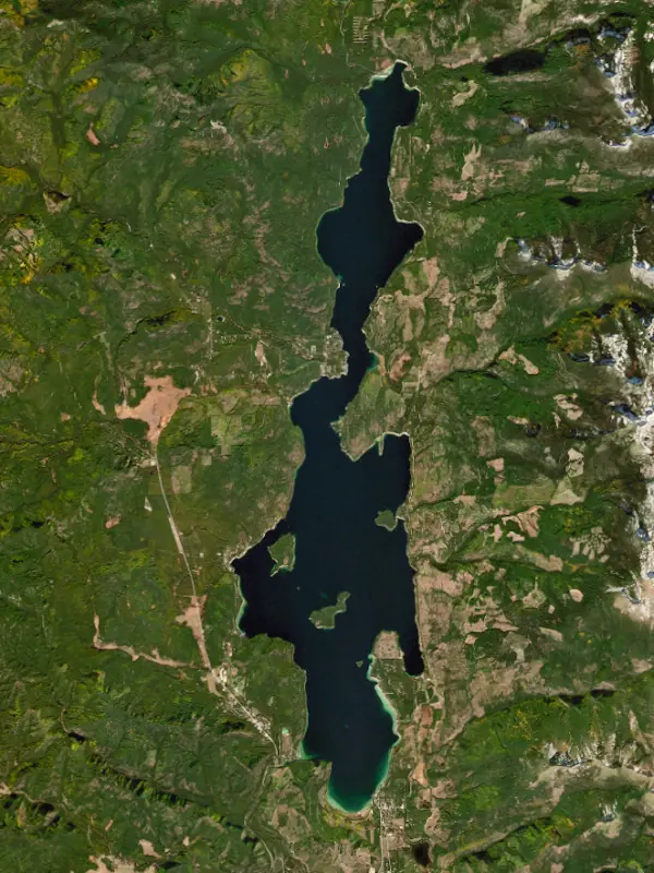
Priest Lake is a long, cold mountain lake in Bonner County at the top of the Idaho Panhandle, about 80 miles northeast of Spokane, with its north end less than 15 miles from Canada. It lies below the crest of the Selkirk Mountains and is one of the three largest lakes in Idaho. It is really two lakes: the main lake, and the smaller, roadless Upper Priest Lake, joined by a narrow channel called the Thorofare.
People have lived around the lake for nearly 10,000 years, and fur traders later did business here with the Kalispel. The Jesuit missionary Pierre-Jean De Smet named it Roothaan Lake, but the name did not stick. In 1865 Captain John Mullan called it Kaniksu, and in time it became Priest Lake. Logging has shaped the country since the 1890s. A federal forest reserve was set aside in 1897, and in 1950 the state's lands on the east side became Priest Lake State Forest. Today tourism carries the local economy, with resorts, campgrounds, hiking trails, huckleberry picking and winter sports. Black bears, deer and moose are common, and a small number of grizzlies live in the surrounding mountains.
Seven islands rise from the main lake. The largest, Kalispell Island, is a tooth-shaped island of about 264 acres with a Forest Service boat-in campground and a 2.5-mile loop trail around its shore.
At the north end, the Thorofare winds a few miles up to Upper Priest Lake, and boats must hold to no-wake speed the whole way. The upper lake has no roads and is managed as a roadless scenic area. Its trails are open only to hikers and bikers, so most visitors paddle up from Beaver Creek or Tule Bay. Its campgrounds are primitive, with fire rings and bear-proof lockers but no drinking water.
The Thorofare has been filling in. Sediment slipping through an old wooden breakwater at its mouth left parts of the channel and the water just outside it as shallow as 2 feet. A 2017 state study called for dredging and a solid breakwater, and in 2018 the Idaho Water Resource Board approved money for the work.
Priest Lake is natural, but its level has been managed since an outlet dam was built in 1951. The dam was rebuilt in 1978. In summer the lake is held at a legally required minimum level for recreation, and in dry years protecting that level has meant cutting the river below the dam to a trickle. The upgrades approved in 2018 were meant to let the lake be held a few inches higher in dry years so more water could go downstream.
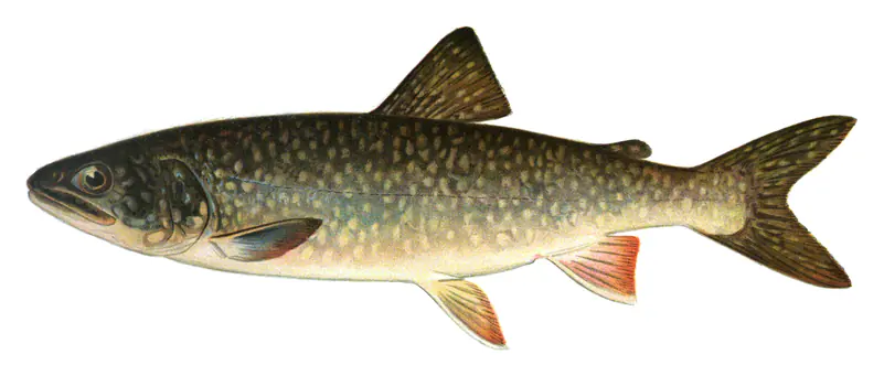
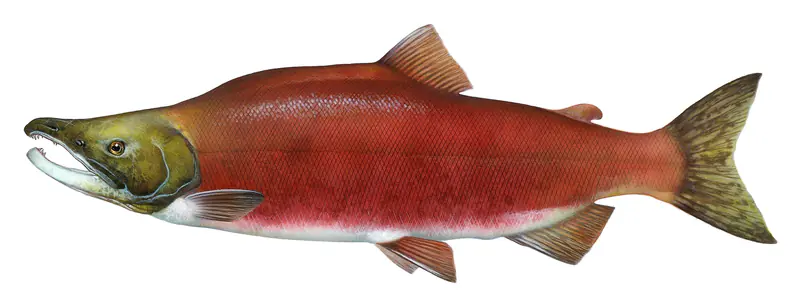
The lake's native sport fish were westslope cutthroat trout, bull trout and mountain whitefish. Lake trout, often called mackinaw, were planted in 1925, and kokanee were stocked with success in the early 1940s. In the late 1960s mysis shrimp were added to build up trophy fishing. The lake trout fed heavily on them and multiplied. In 1971 an angler landed a 57.5-pound lake trout, an Idaho record, but the balance did not last. The growing lake trout population wiped out the kokanee, and the main lake is now dominated by plentiful, mostly smaller lake trout. In 2018, after a public survey split nearly down the middle, Idaho Fish and Game chose not to suppress them.
Upper Priest Lake is managed differently. Since 1997 the department has gillnetted lake trout there each year, which has helped native cutthroat and bull trout hold on.
Written by Lake by Lake from Recreation.gov, Idaho Panhandle National Forests, The Spokesman-Review (Priest Lake's lake trout fishery will not be suppressed, State study says Priest Lake needs $5M worth of work, Idaho set to upgrade Priest Lake outlet dam and keep Thorofare navigable, Ah, solitude) and Wikipedia. Checked November 2026.
Priest Lake Dam is a dam 12 feet high and 194 feet long, completed in 1979. At its normal level the lake holds 76,100 acre-ft, drained from 572 square miles of land.
From the National Inventory of Dams (U.S. Army Corps of Engineers), NID ID ID00318. Lake or reservoir: what’s the difference?
Where the level comes from: Priest Lake at Outlet near Coolin (NOAA National Water Prediction Service).
| Lake | Miles | Level (ft) | vs full | 7 days |
|---|---|---|---|---|
| Lake Pend Oreille Below full | 29 | 2051.25 | −11.25 | −0.22 |
| Cabinet Gorge Reservoir Live reading | 48 | 2174.04 | — | +2.22 |
| Lake Coeur d'Alene Live reading | 58 | 2124.50 | — | −0.34 |
| Lake Koocanusa Well below full | 72 | 2440.21 | −18.79 | −1.73 |
Compare Priest Lake with Lake Pend Oreille, Cabinet Gorge Reservoir, Lake Coeur d'Alene or Lake Koocanusa: size, level, ramps and fish side by side.
Priest Lake is about 61 mi from Spokane Valley, WA and 63 mi from Spokane, WA. See all the lakes near each city.
Priest Lake is at 2,435.28 feet above sea level, as of Nov 18, 2026, 11:30 PM PST. It has dropped 0.11 ft in the past 7 days.
Priest Lake has 7 boat ramps on our map, including Boat ramp near Indian Creek Campground, Priest Lake Idaho, Boat ramp near Indian Creek Campground, Priest Lake Idaho (2), Kalispell Bay Boat Launch, and 4 marinas. Low water can close ramps, so check today's level above and the operator before you go.
Yes. There are 9 campgrounds and RV parks within about a mile of the shore, such as Bartoo Island Boat-in Campground, Kalispell Island Boat-in Campground, Beaver Creek Campground, Priest Lake.
Game fish recorded in Priest Lake include cutthroat trout, rainbow trout, kokanee salmon, lake trout, brook trout, black crappie. In all, 9 fish species have open records inside the lake on GBIF.
The surface of Priest Lake was about 49°F on November 4, estimated from a satellite pass on a clear day. It is the top layer of the water, a few degrees either way; coves and shallows run warmer in the sun.
Anglers 14 and older need an Idaho fishing license, sold online by the Idaho Department of Fish and Game. Free fishing days: Second Saturday in June. Size and bag limits can be set lake by lake: check the current regulations.
Priest Lake is about 39 ft deep at its deepest point. Depth changes with the lake level.
boating (7 boat ramps and 4 marinas), kayaks, boats & jet skis (3 rental outfits on or near the water), fishing (8 game fish), swimming (4 beaches and swimming areas), hiking & walking (13 trails along the shore, the longest Idaho Centennial Trail (9.6 mi)) and camping (9 campgrounds, 6 bookable on Recreation.gov), according to our map of the shore.
EPA's CyAN satellite rated cyanobacteria in Priest Lake not detected on November 8. The satellite sees open water only; blooms can be patchy, so avoid water that looks like spilled paint or pea soup and keep dogs out of scum. Swimming advisories come from Idaho health and environment agencies.
Yes. 13 trails run along or near the shore, including Beach Trail (5.9 mi), Lakeshore Trail (6.8 mi) and Kalispell Island Trail (2.8 mi), according to OpenStreetMap.
Priest Lake is held back by Priest Lake, completed in 1979 and 12 ft high, according to the National Inventory of Dams.
From the NOAA National Water Prediction Service (Priest Lake at Outlet near Coolin). Lake by Lake checks it every hour; the agency's own figure is always the reference, and provisional readings can be revised.
Lake levels are refreshed every hour. Texas and California reservoirs report once a day; most USGS and NOAA gauges report every 15 to 60 minutes.
Cookies for analytics With your OK we use Google Analytics and Microsoft Clarity to count visits and see how the site is used, so we can make it better. No advertising cookies. Privacy policy