Sun
- Sunrise
- 7:21 AM
- Sunset
- 5:17 PM
- First light
- 6:52 AM
- Last light
- 5:45 PM
Reservoir · Russell County, Kansas
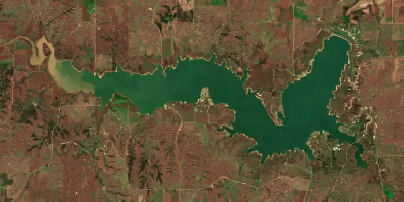
A reservoir on the Saline River in Russell County, Kansas, held back by Wilson Dam since 1964. Also called Wilson Reservoir.

Wilson Lake is at 1,511.26 feet above sea level — 4.74 ft below top of conservation pool, as of Nov 18, 2026, 11:30 PM CST. It has dropped 0.07 ft in the past 7 days.
5th lowest of 24 Kansas lakes today against full pool · See the ranking
Record low 1,505.46 ft (2016), record high 1,527.10 ft (2019) · Level history since 2012
Which boat ramps are usable at today’s level →
A notification from this browser, once, when the level crosses the line (checked every hour). No account and no email. On an iPhone, add Lake by Lake to your home screen first (Share → Add to Home Screen) and open it from there. Or follow the lake in a feed reader: RSS feed.
Wilson Lake is down 0.07 ft over the last 7 days, at 1,511.26 ft today.
Daily values from the U.S. Geological Survey.
Wilson Lake is up 0.09 ft over the last 30 days, at 1,511.26 ft today.
Daily values from the U.S. Geological Survey.
Over the past 12 months, Wilson Lake ranged from 1,510.26 ft (May 16, 2026) to 1,512.11 ft (Jul 10, 2026), a swing of 1.8 ft. Today's level is in the upper half of that range. It is 0.80 ft higher than on this date last year.
Daily values from the U.S. Geological Survey. Why lake levels rise and fall
In the U.S. Geological Survey record, which starts in 2012, the lowest level was 1,505.46 ft on April 16, 2016 and the highest 1,527.10 ft on June 11, 2019. Today’s 1,511.26 ft is 5.8 ft above the record low and 15.8 ft below the record high.
Wilson Lake level history: every year since 2012, the lowest and highest years →
Solunar periods for Wilson Lake, local time. How they work
Moderate · as of Nov 9, 2026
A bloom may be forming somewhere on the lake. Avoid water that looks like spilled paint or pea soup. About 236,000 cells/mL at the worst spot, covering 1% of the lake.
Week of Aug 9Week of Nov 1
Each bar is one week, colored by the worst reading of that week.
From the U.S. EPA's Cyanobacteria Assessment Network (CyAN), which reads the color of lakes from the Sentinel-3 satellites; it sees open water only, not coves or the shoreline. Blooms can be patchy: what you see on the water matters more. Swimming closures and health advisories come from Kansas health and environment agencies. How to read it
Surface water temperature
64°F on Oct 28, 2026
84°F · Aug 164°F · Oct 28
20°F cooler than on Aug 1, 2026.
Estimated from Landsat 8/9 (USGS) passes on clear days: the top layer of the water, a few degrees either way. Coves and the shallows can be warmer.
Wilson Lake water temperature: trend, swimming and the fish →
On or near the shore of Wilson Lake: 10 boat ramps, 1 marina, 4 campgrounds and 11 trails. The lake has about 73 miles of shoreline, counting its islands.
Tap an icon for details; use two fingers (or Ctrl + scroll) to move the map. Tap a dot for details. Map and lake outline © OpenStreetMap contributors. Places from OpenStreetMap, Overture Maps and Recreation.gov. Not for navigation.
Zebra mussels have been found in Wilson Lake. They clog intakes and engines and spread on boats and trailers: clean, drain and dry everything before you go to another lake.
Kansas: Drain livewells and bilges and pull all drain plugs before moving a boat on a public road. Live fish can't leave waters designated for invasive species, wild-caught bait must be used where it was caught, and unused bait goes on dry ground or in a bait bin. State rules
Records: USGS Nonindigenous Aquatic Species database. A species not listed may still be present.
Species with open-licensed records inside Wilson Lake's outline, from GBIF.org (surveys, museum collections and angler reports). A record shows a fish was found here, not how many there are now.
Brush piles, docks and bridge pilings; shallow for a few weeks in spring.
Rocky shorelines at night after ice-out; deep weed edges and humps in summer.
Run up the river arms in spring; follow shad to cool, deep water near the dam in summer.
Shallow, weedy bays right after ice-out; weed edges the rest of the year.
Beds in shallow, firm bottoms; around docks and weeds all summer.
Water temperature sets off each spawn; the bars show the usual months at this latitude and elevation, and move with a warm or cold spring.
Wilson Lake is an Army Corps of Engineers reservoir on the Saline River in the Smoky Hills of north-central Kansas, on the line between Russell and Lincoln counties, with most of it in Russell. The Corps calls it the clearest lake in Kansas. Its red, brown and yellow sandstone bluffs look little like the flat farm country around it, and it has produced state records for striped bass, smallmouth bass and walleye.
Construction of Wilson Dam began in April 1961, and the Corps finished the earthfill embankment in 1964 at a cost of about $20 million. The lake was planned partly for irrigation, but the Saline River carries so much salt that irrigation never proved practical, and the reservoir is run for flood control, recreation, wildlife and downstream water quality. It takes its name from the town of Wilson, about 10 miles to the south. Kansas began stocking fish as soon as water was first held back in 1965. Long before the dam, the spot was a river crossing. An archaeological survey of the lake in 1986 traced the Pawnee Trail, a route from the Platte River in Nebraska to the Great Bend of the Arkansas River, and showed that Zebulon Pike's party crossed the Saline near the site of the dam in 1806.
People have used these hills for a very long time. Rock-filled burial mounds here date from about AD 1 to 900, and the sandstone here holds many petroglyphs. One of them, Circle Rock, is listed on the National Register of Historic Places, though lake water and vandals have damaged it and it now sits partly under the surface. Another carved site, covered with supposed signatures of Buffalo Bill Cody, Wild Bill Hickok and the James brothers that are probably forgeries, lies underwater. Before the lake filled, archaeologists removed some of the best carvings to preserve them. Otoe Park is named for the Otoe people, and Minooka comes from an Otoe word meaning good earth. In the 1870s the railroad brought German and Bohemian settlers, and Wilson came to be known as the Czech capital of Kansas. With few trees on the prairie, they quarried the local limestone for houses and fence posts, and post rock became the symbol of the region.
The bluffs are Dakota Sandstone, laid down along a shallow sea about 80 million years ago, and fossils from that time turn up along Southshore Drive and near the spillway. At the west edge of Lucas Park on the north shore, the 305-acre Rocktown Natural Area holds sandstone pillars 15 to 30 feet tall, and the Rocktown Trail runs through it. The Corps runs Lucas, Minooka and Sylvan parks, the last one below the dam. Wilson State Park covers the Hell Creek and Otoe areas at the eastern end of the south shore, with a marina in the Hell Creek area. K-232 runs over the dam, and the shallow upper end to the west is the Wilson Wildlife Area, where the state protects native mixed-grass prairie and hunters come for pheasant, quail, deer and waterfowl.
The same salt that ruled out irrigation made Wilson the lake Kansas chose for an experiment with striped bass in the 1960s, using fry brought from South Carolina. The experiment worked. The Corps reports stripers of more than 40 pounds from the lake. Walleye gather off the face of the dam in early April and move to the mudflats in May and June. Smallmouth bass hold on rocky points, largemouth and crappie on standing timber and brush piles in the coves, and channel and flathead catfish are common. Invasive white perch and zebra mussels have also reached the lake.
Written by Lake by Lake from U.S. Army Corps of Engineers, Kansas City District (Wilson Lake History (archived), Wilson Lake Fishing (archived)), Kansas Forestry, Fish and Game Commission and Wikipedia. Checked November 2026.
Activities listed by the U.S. Army Corps of Engineers: Biking · Boating · Camping · Fishing · Hiking · Picnicking · Water sports · Wildlife viewing
Wilson Dam is an earthfill dam 152 feet high and 5,600 feet long on the Saline River, completed in 1964. It belongs to the U.S. Army Corps of Engineers (Kansas City District) and is run for flood control, irrigation, fish and wildlife and recreation. At its normal level the reservoir holds 245,000 acre-ft, drained from 1,917 square miles of land.
From the National Inventory of Dams (U.S. Army Corps of Engineers), NID ID KS00013. Lake or reservoir: what’s the difference?
Where the level comes from: WILSON LK NR WILSON, KS (U.S. Geological Survey, used on this page) and Saline River (KS) at Wilson Lake (NOAA National Water Prediction Service).
| Lake | Miles | Level (ft) | vs full | 7 days |
|---|---|---|---|---|
| Kanopolis Lake Above full pool | 38 | 1465.81 | +2.81 | −0.22 |
| Glen Elder Reservoir Above full pool | 38 | 1457.23 | +1.63 | −0.42 |
| Webster Reservoir Well below full | 59 | 1865.20 | −27.25 | −0.05 |
| Kirwin Reservoir Well below full | 59 | 1704.78 | −24.47 | +0.02 |
| Cedar Bluff Reservoir Well below full | 67 | 2118.52 | −25.48 | −0.08 |
| Lovewell Reservoir At or near full pool | 69 | 1581.45 | −1.15 | −0.02 |
Compare Wilson Lake with Kanopolis Lake, Glen Elder Reservoir, Webster Reservoir or Kirwin Reservoir: size, level, ramps and fish side by side.
Wilson Lake is also known as Wilson Reservoir.
Wilson Lake is at 1,511.26 feet above sea level — 4.74 ft below top of conservation pool, as of Nov 18, 2026, 11:30 PM CST. It has dropped 0.07 ft in the past 7 days.
Wilson Lake's top of conservation pool is 1,516.00 ft, according to U.S. Army Corps of Engineers. Today the lake is 4.74 ft below that mark.
Today's level is 2.46 ft below the median for this date (1,513.72 ft), from the gauge’s long-term daily record.
1,505.46 ft, on April 16, 2016, in the U.S. Geological Survey record, which starts in 2012. Today the lake is 5.8 ft above that.
1,527.10 ft, on June 11, 2019, in the U.S. Geological Survey record since 2012. That is 11.1 ft above top of conservation pool.
Wilson Lake has 10 boat ramps on our map, including Elm Creek (State Boat Ramp), Lucas Park (Corps Boat Ramp), Minooka Park (Corps Boat Ramp), and 1 marina. Low water can close ramps, so check today's level above and the operator before you go.
Yes. There are 4 campgrounds and RV parks within about a mile of the shore, such as Otoe Public Use Area, Sylvan Park Campground, Minooka Park Campground.
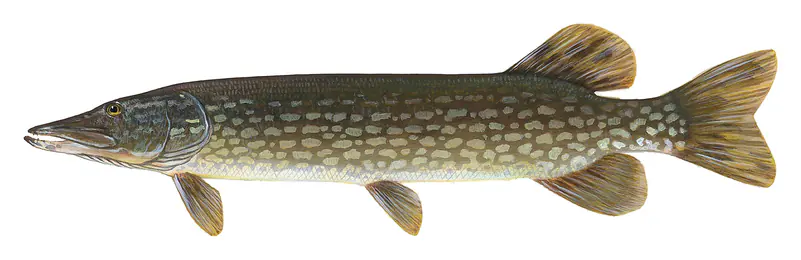
Game fish recorded in Wilson Lake include black crappie, walleye, striped bass, northern pike, bluegill, white perch. In all, 7 fish species have open records inside the lake on GBIF.
Anglers 16 and older need a Kansas fishing license, sold online by the Kansas Department of Wildlife and Parks. Free fishing days: Traditionally the first full weekend in June. Size and bag limits can be set lake by lake: check the current regulations.
Wilson Lake averages about 27 ft deep. Depth changes with the lake level.
U.S. Army Corps of Engineers lists biking, boating, camping, fishing, hiking, picnicking, water sports and wildlife viewing at Wilson Lake. 3 campgrounds can be booked on Recreation.gov.
EPA's CyAN satellite rated cyanobacteria in Wilson Lake moderate on November 9. The satellite sees open water only; blooms can be patchy, so avoid water that looks like spilled paint or pea soup and keep dogs out of scum. Swimming advisories come from Kansas health and environment agencies.
Yes. 11 trails run along or near the shore, including Brokebike Mountian (Marina Loop) (2.7 mi), Hell Creek Loop (6.0 mi) and Marina Loop (3.9 mi), according to OpenStreetMap.
Wilson Lake is held back by Wilson Dam, completed in 1964 and 152 ft high, according to the National Inventory of Dams.
From the U.S. Geological Survey (WILSON LK NR WILSON, KS). Lake by Lake checks it every hour; the agency's own figure is always the reference, and provisional readings can be revised.
Lake levels are refreshed every hour. Texas and California reservoirs report once a day; most USGS and NOAA gauges report every 15 to 60 minutes.
Cookies for analytics With your OK we use Google Analytics and Microsoft Clarity to count visits and see how the site is used, so we can make it better. No advertising cookies. Privacy policy