Sun
- Sunrise
- 6:33 AM
- Sunset
- 4:41 PM
- First light
- 6:06 AM
- Last light
- 5:09 PM
Reservoir · Livingston County, Kentucky
A reservoir on the Tennessee River in Kentucky and Tennessee, held back by Kentucky Dam since 1944.

Kentucky Lake is at 354.69 feet above sea level — 4.31 ft below summer pool, as of Nov 17, 2026, 8:00 PM CST. It has risen 0.23 ft in the past 7 days.
8th fullest of 18 Kentucky lakes today against full pool · See the ranking
Record low 353.65 ft (2022), record high 366.91 ft (2016) · Level history since 2014
A notification from this browser, once, when the level crosses the line (checked every hour). No account and no email. On an iPhone, add Lake by Lake to your home screen first (Share → Add to Home Screen) and open it from there. Or follow the lake in a feed reader: RSS feed.
Kentucky Lake is up 0.23 ft over the last 7 days, at 354.69 ft today.
Daily values from the NOAA National Water Prediction Service.
Kentucky Lake is up 0.19 ft over the last 30 days, at 354.69 ft today.
Daily values from the NOAA National Water Prediction Service.
Over the past 12 months, Kentucky Lake ranged from 354.24 ft (Nov 8, 2026) to 360.46 ft (May 27, 2026), a swing of 6.2 ft. Today's level is near the bottom of that range. It is about where it was a year ago.
Daily values from the NOAA National Water Prediction Service. Why lake levels rise and fall
In the U.S. Army Corps of Engineers record, which starts in 2014, the lowest level was 353.65 ft on January 31, 2022 and the highest 366.91 ft on January 6, 2016. Today’s 354.69 ft is 1.0 ft above the record low and 12.2 ft below the record high.
Kentucky Lake level history: every year since 2014, the lowest and highest years →
Solunar periods for Kentucky Lake, local time. How they work
High · as of Nov 9, 2026
The satellite sees a likely bloom on part of the lake. Avoid discolored water and scum, and keep dogs out of it. About 366,000 cells/mL at the worst spot, covering 2% of the lake.
Week of Aug 16Week of Nov 1
Each bar is one week, colored by the worst reading of that week.
From the U.S. EPA's Cyanobacteria Assessment Network (CyAN), which reads the color of lakes from the Sentinel-3 satellites; it sees open water only, not coves or the shoreline. Blooms can be patchy: what you see on the water matters more. Swimming closures and health advisories come from Kentucky health and environment agencies. How to read it
Surface water temperature
64°F on Nov 10, 2026
83°F · Jul 2964°F · Nov 10
19°F cooler than on Jul 29, 2026.
Estimated from MODIS Aqua (NASA) passes on clear days: the top layer of the water, a few degrees either way. Coves and the shallows can be warmer.
Kentucky Lake water temperature: trend, swimming and the fish →
On or near the shore of Kentucky Lake: 100 boat ramps, 48 marinas, 2 rental outfits, 80 campgrounds, 4 beaches, 1 fishing pier and 20 trails. The lake has about 834 miles of shoreline, counting its islands.
Tap an icon for details; use two fingers (or Ctrl + scroll) to move the map. Tap a dot for details. Map and lake outline © OpenStreetMap contributors. Places from OpenStreetMap, Overture Maps and Recreation.gov. Not for navigation.
What you’ll find on the shore
← AllBoating 148
← AllRentals & tours 2
← AllFishing spots 6
← AllBeaches 4
← AllCamping 80+
← AllLodging 24+
← AllTrails 20+
← AllParks 20+
← AllDining 16
Zebra mussels have been found in Kentucky Lake. They clog intakes and engines and spread on boats and trailers: clean, drain and dry everything before you go to another lake.
Kentucky: Kentucky has no clean-drain-dry law; KDFWR asks boaters to remove plants, mud and mussels, drain motors, bilges and livewells before leaving the access, trash unused bait, and dry gear for five days. Possessing, importing or releasing prohibited non-native aquatic species such as zebra mussels is illegal. State rules
Tennessee: Tennessee has no statewide clean-drain-dry law; TWRA urges you to remove plants, animals and mud, drain all water, and dry the boat for five days (or hot-wash it) before moving to another lake. Moving live invasive carp is illegal. State rules
Records: USGS Nonindigenous Aquatic Species database. A species not listed may still be present.
Species with open-licensed records inside Kentucky Lake's outline, from GBIF.org (surveys, museum collections and angler reports). A record shows a fish was found here, not how many there are now.
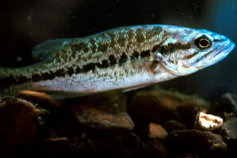
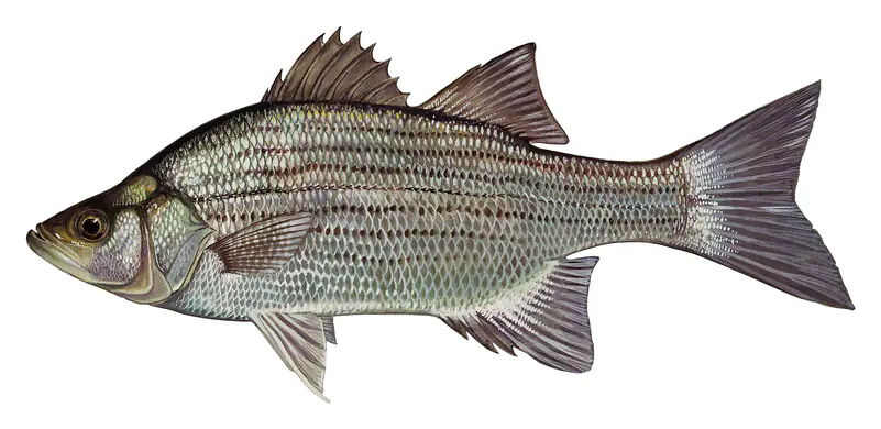
Channel edges and river arms; best after dark in summer, and after a rain.
Rocky points, gravel and current breaks; deeper rock piles in summer.
Run up the river arms in spring; follow shad to cool, deep water near the dam in summer.
Clear water and steep rock; they often suspend deeper than largemouth.
Spring runs up the tributaries; schools busting shad in late summer.
Water temperature sets off each spawn; the bars show the usual months at this latitude and elevation, and move with a warm or cold spring. The water is about 64°F now.
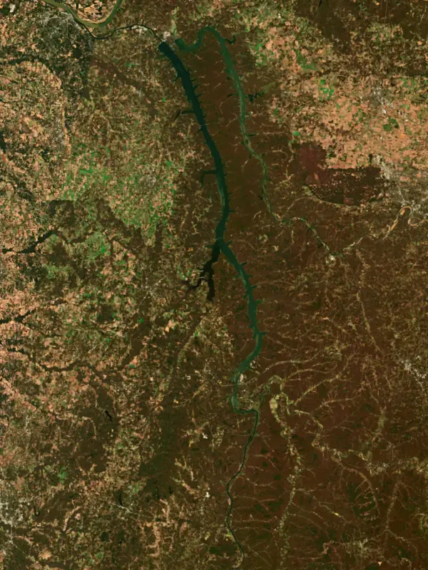
Kentucky Lake is the reservoir behind the Tennessee Valley Authority's Kentucky Dam, near the mouth of the Tennessee River in western Kentucky, and it reaches south deep into Tennessee. By surface area it is the largest artificial lake east of the Mississippi, and together with Lake Barkley it frames the wooded peninsula of Land Between the Lakes. Anglers know it for crappie, bass and catfish.
An Army Corps of Engineers survey ordered in 1930 called for a channel deep enough for barges from Knoxville all the way to Paducah, and the TVA, created in 1933, took up the job. The great flood of 1937, which devastated the Tennessee and Ohio valleys, added urgency. Congress authorized Kentucky Dam in May 1938, at mile 22.4 of the Tennessee, to carry river traffic and to shave flood crests on the lower Ohio and Mississippi. The gates closed on August 30, 1944, and the first generator came on two weeks later. Its lock was the largest single-lift lock on any American inland river when it opened, raising boats up to 75 feet. For decades U.S. 62 and 641 crossed the river on top of the dam, until two new bridges just downstream opened in 2009. Cheap TVA power and barge access drew a cluster of chemical plants to Calvert City, just below the dam.
Making the lake meant moving 2,609 families, 3,390 graves and 365 miles of road. Three towns went completely under: Johnsonville and Springville in Tennessee, and Birmingham in Kentucky. Birmingham, settled in 1849 and named for the English city, was one of the oldest places in Marshall County and an important early boat landing. Its cemetery was moved to Briensburg, and in Marshall County alone the TVA acquired more than 35,000 acres.
A second round of removals followed in the 1960s. The Army Corps built Lake Barkley on the Cumberland River, finished in 1965, and the peninsula between the two lakes became the Land Between the Lakes National Recreation Area. About 2,700 people from some 900 families were relocated to create it. The communities of Fenton, Golden Pond, Hematite and Energy in Kentucky and Model, Blue Spring, Hays and Mint Spring in Tennessee were emptied, and most residents opposed the move. The TVA ran the area until a 1998 act of Congress handed it to the U.S. Forest Service. A navigation canal a few miles above Kentucky Dam links the two lakes.
In Tennessee the lake touches nine counties and takes in more than 100 tributary creeks. The Duck, Beech and Big Sandy rivers form its biggest embayments. Largemouth dominate the bass fishing, both black and white crappie are plentiful, and blue catfish are the most harvested catfish. Sauger, which outnumber walleye here, are a cold-weather fishery, at their best from December through March. Anglers have long sunk Christmas trees, stake beds and treetops as fish cover, and the Tennessee Wildlife Resources Agency adds marked fish attractors and has planted cypress trees in some areas during low water. Bighead carp, first reported in the lake in 2002, have spread quickly and compete with native fish.
The lake has the largest flood storage in the TVA system, and it sits about 5 feet lower at winter pool than at full pool. Kentucky Dam Village State Resort Park lies at the north end near the dam and Kenlake State Resort Park on the western shore, and the lake hosts professional fishing tournaments.
Written by Lake by Lake from Wikipedia (Kentucky Dam, Kentucky Lake), American Society of Civil Engineers, Kentucky Historical Society, Tennessee Encyclopedia and Tennessee Wildlife Resources Agency. Checked November 2026.
Kentucky Dam is a concrete dam 206 feet high and 8,422 feet long on the Tennessee River, completed in 1944. It belongs to the Tennessee Valley Authority and is run for flood control, navigation, recreation and hydropower. At its normal level the reservoir holds 6.13 million acre-ft, drained from 40,200 square miles of land.
From the National Inventory of Dams (U.S. Army Corps of Engineers), NID ID KY05017. Lake or reservoir: what’s the difference?
Where the level comes from: Tennessee River at Kentucky Lake Pool (NOAA National Water Prediction Service).
| Lake | Miles | Level (ft) | vs full | 7 days |
|---|---|---|---|---|
| Lake Barkley Slightly below full | 2 | 354.88 | −4.12 | +0.04 |
| Devils Kitchen Lake Live reading | 63 | 507.95 | — | — |
| Little Grassy Lake Live reading | 65 | 447.31 | — | — |
| Crab Orchard Lake Live reading | 68 | 404.79 | — | — |
| Rend Lake At or near full pool | 80 | 403.31 | −1.69 | — |
Compare Kentucky Lake with Lake Barkley, Devils Kitchen Lake, Little Grassy Lake or Crab Orchard Lake: size, level, ramps and fish side by side.
Kentucky Lake is about 60 mi from Clarksville, TN and 78 mi from Evansville, IN. See all the lakes near each city.
Kentucky Lake is at 354.69 feet above sea level — 4.31 ft below summer pool, as of Nov 17, 2026, 8:00 PM CST. It has risen 0.23 ft in the past 7 days.
Kentucky Lake's summer pool is 359.00 ft, according to Tennessee Valley Authority. Today the lake is 4.31 ft below that mark.
Today's level is 0.01 ft above the median for this date (354.68 ft), from the gauge’s long-term daily record.
353.65 ft, on January 31, 2022, in the U.S. Army Corps of Engineers record, which starts in 2014. Today the lake is 1.0 ft above that.
366.91 ft, on January 6, 2016, in the U.S. Army Corps of Engineers record since 2014. That is 7.9 ft above summer pool.
Kentucky Lake has 100 boat ramps on our map, including Antioch, Barge Island Public Use Area at Birmingham Point, Big Bear Public Use Area, and 48 marinas. Low water can close ramps, so check today's level above and the operator before you go.
Yes. There are 80 campgrounds and RV parks within about a mile of the shore, such as Wildcat Creek, Pisgah Point Camping Area and Boat Ramp, Brownfield Riverside Resort and Miss Kay's Country Store.
Game fish recorded in Kentucky Lake include striped bass, channel catfish, smallmouth bass, bluegill, chain pickerel, flathead catfish. In all, 40 fish species have open records inside the lake on GBIF.
The surface of Kentucky Lake was about 64°F on November 10, estimated from a satellite pass on a clear day. It is the top layer of the water, a few degrees either way; coves and shallows run warmer in the sun.
Kentucky Lake lies in Kentucky and Tennessee: the license of the state where you fish applies. Anglers 16 and older need a Kentucky fishing license, sold online by the Kentucky Department of Fish and Wildlife Resources. Free fishing days: First full weekend in June. Anglers 13 and older need a Tennessee fishing license, sold online by the Tennessee Wildlife Resources Agency. Free fishing days: Free Fishing Day, one Saturday in June; children 15 and under fish free that whole week. Size and bag limits can be set lake by lake: check the current regulations.
Kentucky Lake averages about 38 ft deep. Depth changes with the lake level.
boating (100 boat ramps and 48 marinas), kayaks, boats & jet skis (2 rental outfits on or near the water), fishing (16 game fish and 1 fishing pier or spot), swimming (4 beaches and swimming areas), hiking & walking (20+ trails along the shore, the longest Canal Loop Trail (11 mi)) and camping (80+ campgrounds), according to our map of the shore.
EPA's CyAN satellite rated cyanobacteria in Kentucky Lake high on November 9. The satellite sees open water only; blooms can be patchy, so avoid water that looks like spilled paint or pea soup and keep dogs out of scum. Swimming advisories come from Kentucky health and environment agencies.
Yes. 20 trails run along or near the shore, including Bo Beckett Memorial Trail (9.5 mi), Canal Loop Trail (11 mi) and North/South Trail, according to OpenStreetMap.
Kentucky Lake is held back by Kentucky Dam, completed in 1944 and 206 ft high, according to the National Inventory of Dams.
From the NOAA National Water Prediction Service (Tennessee River at Kentucky Lake Pool). Lake by Lake checks it every hour; the agency's own figure is always the reference, and provisional readings can be revised.
Lake levels are refreshed every hour. Texas and California reservoirs report once a day; most USGS and NOAA gauges report every 15 to 60 minutes.