Sun
- Sunrise
- 8:06 AM
- Sunset
- 5:20 PM
- First light
- 7:32 AM
- Last light
- 5:53 PM
Lake · Ontonagon County, Michigan
A lake in Ontonagon County, Michigan, held back by Bergland Dam since 1906.

Lake Gogebic is at 1,294.16 feet above sea level, as of Nov 19, 2026, 3:15 AM EST. The level has held steady over the past week.
A notification from this browser, once, when the level crosses the line (checked every hour). No account and no email. On an iPhone, add Lake by Lake to your home screen first (Share → Add to Home Screen) and open it from there. Or follow the lake in a feed reader: RSS feed.
Lake Gogebic has held steady over the last 7 days (within 0.05 ft).
Daily values from the U.S. Geological Survey.
Lake Gogebic has held steady over the last 30 days (within 0.05 ft).
Daily values from the U.S. Geological Survey.
Over the past 12 months, Lake Gogebic ranged from 1,293.91 ft (Mar 5, 2026) to 1,296.68 ft (Apr 19, 2026), a swing of 2.8 ft. Today's level is near the bottom of that range. It is 0.39 ft lower than on this date last year.
Daily values from the U.S. Geological Survey. Why lake levels rise and fall
Solunar periods for Lake Gogebic, local time. How they work
Not detected · as of Nov 9, 2026
The satellite found no cyanobacteria at the surface.
Week of Aug 16Week of Nov 1
Each bar is one week, colored by the worst reading of that week.
From the U.S. EPA's Cyanobacteria Assessment Network (CyAN), which reads the color of lakes from the Sentinel-3 satellites; it sees open water only, not coves or the shoreline. Blooms can be patchy: what you see on the water matters more. Swimming closures and health advisories come from Michigan health and environment agencies. How to read it
Surface water temperature
44°F on Nov 16, 2026
76°F · Jul 2844°F · Nov 16
32°F cooler than on Jul 28, 2026.
Estimated from MODIS Aqua (NASA) passes on clear days: the top layer of the water, a few degrees either way. Coves and the shallows can be warmer.
Lake Gogebic water temperature: trend, swimming and the fish →
On or near the shore of Lake Gogebic: 5 boat ramps, 3 campgrounds, 1 beach and 2 trails. The lake has about 38 miles of shoreline, counting its islands.
Tap an icon for details; use two fingers (or Ctrl + scroll) to move the map. Tap a dot for details. Map and lake outline © OpenStreetMap contributors. Places from OpenStreetMap, Overture Maps and Recreation.gov. Not for navigation.
What you’ll find on the shore
← AllBoating 5
← AllBeaches 1
← AllCamping 3
← AllLodging 16
← AllTrails 2
← AllParks 6
← AllDining 3
These invasive plants and animals have been recorded in Lake Gogebic: clean, drain and dry everything before you go to another lake.
Michigan: Remove all aquatic plants from the boat, gear and trailer before launching. Before driving away, pull all drain plugs (bilge, ballast, livewell), drain all water and make sure boat and trailer are free of plants and animals; dispose of unused bait on land or in the trash. State rules
Records: USGS Nonindigenous Aquatic Species database. A species not listed may still be present.
Species with open-licensed records inside Lake Gogebic's outline, from GBIF.org (surveys, museum collections and angler reports). A record shows a fish was found here, not how many there are now.
Brush piles, docks and bridge pilings; shallow for a few weeks in spring.
Rocky points, gravel and current breaks; deeper rock piles in summer.
Rocky shorelines at night after ice-out; deep weed edges and humps in summer.
Shallow, weedy bays right after ice-out; weed edges the rest of the year.
Schools near the bottom; a favorite through the ice.
Water temperature sets off each spawn; the bars show the usual months at this latitude and elevation, and move with a warm or cold spring. The water is about 44°F now.
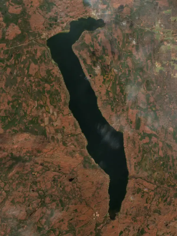
Lake Gogebic is the largest natural lake in Michigan's Upper Peninsula, a long, narrow lake in the far western end of the peninsula near the Wisconsin line. It straddles Gogebic and Ontonagon counties and even the line between the Central and Eastern time zones, and it sits inside the Ottawa National Forest. People know it for walleye and jumbo perch, and in winter for ice fishing and snowmobile trails.
This is the old country of the Lake Superior Chippewa, and the lake's name in Ojibwe is Ataagibiigamaa-zaaga'igan. The English name grew out of an earlier spelling, Agogebic, and nobody agrees on what it meant. Gogebic County's own history has suggested a body of water hanging on high, while an 1884 history of Fort Mackinac rendered it as water-mold lake. The county, carved out of Ontonagon County in 1887, took its name from the lake. Local folklore says that before the forests grew in, the shoreline looked like an alligator, and the high ground near the southwest corner is still called the eye. In the summer of 1962, two old gravestones turned up about 100 feet from the water on what is now state park land, one carved 1822 JOHN KEY and the other 1824 WHITH. Searches of the records found neither name, and the state's conservation department marked the spot.
The lake runs north and south. M-28 follows the north shore, M-64 runs down the west side to connect with U.S. 2 near the south end, and the village of Marenisco lies a short drive south on M-64. Bergland, on the north shore, grew up in the logging era and is named for its founder, Gunlik Bergland; its historical museum now fills the old Bergland ranger station house of the Ottawa National Forest. Water comes in mainly from the Merriwether and Slate rivers and Trout Brook and leaves at the north end through the West Branch of the Ontonagon River. The lake is natural, but the Upper Peninsula Power Company regulates its level with the Bergland Dam a little way down the West Branch.
In 1926 the county park trustees acquired land on the west shore and deeded it to the state, and E.J. Stickley and W. Bonafas gave more. The park opened in 1930. It sits on M-64, about 9 miles north of U.S. 2 and 8 miles south of M-28, with almost a mile of lake frontage, a campground, a paved boat launch, a sandy swimming beach without lifeguards and a short interpretive trail into the national forest.
Lake Gogebic is shallow for its size. The north and south ends are weedy, the shores range from sand beaches to rock, clay and cobble, and the middle of the lake is soft mud and clay. A state survey in 2005 found walleye, northern pike, smallmouth bass, yellow perch, cisco and burbot among the fish. Walleye fishing starts with jigs in mid-May, and once the water warms in June the walleye tend to suspend under schools of young cisco, where anglers troll crankbaits for them. Smallmouth spawn in early to mid June, and local fishing advice is to release them then. The big perch hold on the mud flats in the middle of the lake for much of the year, feeding in winter on mayfly larvae that hatch out of the muck, and lodges around the lake hold ice-fishing derbies that draw anglers from across the U.P. and northern Wisconsin. In winter the frozen lake is open to snowmobiles, and seven trails lead in and out of the area.
Written by Lake by Lake from Lake Gogebic Area Chamber of Commerce (Lake Gogebic State Park, Lake Gogebic fishing, Lake Gogebic area information, Museums and historical sites) and Wikipedia (Lake Gogebic, Gogebic County, Michigan). Checked November 2026.
Bergland Dam is a dam 8 feet high and 179 feet long, completed in 1906. It belongs to Upper Peninsula Power Company. At its normal level the lake holds 35,200 acre-ft, drained from 17 square miles of land.
From the National Inventory of Dams (U.S. Army Corps of Engineers), NID ID MI00028. Lake or reservoir: what’s the difference?
Where the level comes from: LAKE GOGEBIC NEAR BERGLAND, MI (U.S. Geological Survey).
| Lake | Miles | Level (ft) | vs full | 7 days |
|---|---|---|---|---|
| Cisco Lake Live reading | 24 | 1683.54 | — | −0.01 |
| Anvil Lake Live reading | 50 | 1691.72 | — | −0.04 |
| Willow Reservoir Below full | 62 | 1521.73 | −7.62 | +0.41 |
| Rice Reservoir Live reading | 73 | 1457.61 | — | −0.06 |
| Alice Lake Reservoir Live reading | 77 | 1458.60 | — | +0.07 |
| Spirit Reservoir Live reading | 80 | 1433.79 | — | +0.17 |
Compare Lake Gogebic with Cisco Lake, Anvil Lake, Willow Reservoir or Rice Reservoir: size, level, ramps and fish side by side.
Lake Gogebic is at 1,294.16 feet above sea level, as of Nov 19, 2026, 3:15 AM EST. The level has held steady over the past week.
Lake Gogebic has 5 boat ramps on our map, including Lake Gogebic State Park Boat Launch, Boat ramp at Ontonagon County Park, Boat ramp near Gogebic County Park. Low water can close ramps, so check today's level above and the operator before you go.
Yes. There are 3 campgrounds and RV parks within about a mile of the shore, such as Ontonagon County Park, Gogebic County Park, Lake Gogebic State Park.
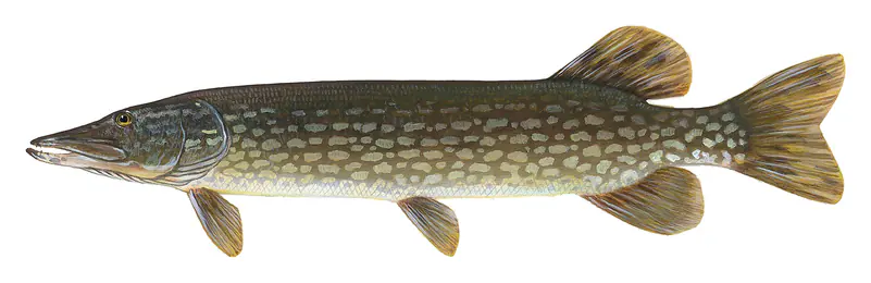
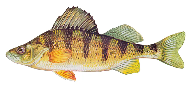
Game fish recorded in Lake Gogebic include walleye, yellow perch, northern pike, black crappie, smallmouth bass, bluegill. In all, 12 fish species have open records inside the lake on GBIF.
The surface of Lake Gogebic was about 44°F on November 16, estimated from a satellite pass on a clear day. It is the top layer of the water, a few degrees either way; coves and shallows run warmer in the sun.
Anglers 17 and older need a Michigan fishing license, sold online by the Michigan Department of Natural Resources. Free fishing days: Presidents' Day weekend (Sat-Sun) and the Saturday and Sunday after the first full week of June. Size and bag limits can be set lake by lake: check the current regulations.
In summer a white Secchi disk lowered into Lake Gogebic stays visible to about 7.0 ft (the median of 194 readings, 2016–2023, by Michigan EGLE - MiCorps and North American Lake Management Society): clear water. With the algae measured too (chlorophyll about 9 µg/L), that makes it eutrophic: rich in nutrients, greener water. Clarity drops after storms and during algae blooms.
boating (5 boat ramps), fishing (8 game fish), swimming (1 beach or swimming area), hiking & walking (2 trails along the shore, the longest Forest Trail (2.5 mi)), camping (3 campgrounds) and cabins & lodging (16 places to stay close to the water), according to our map of the shore.
EPA's CyAN satellite rated cyanobacteria in Lake Gogebic not detected on November 9. The satellite sees open water only; blooms can be patchy, so avoid water that looks like spilled paint or pea soup and keep dogs out of scum. Swimming advisories come from Michigan health and environment agencies.
Yes. 2 trails run along or near the shore, including Bergland to Sidnaw Rail-Trail and Forest Trail (2.5 mi), according to OpenStreetMap.
Lake Gogebic is held back by Bergland Dam, completed in 1906 and 8 ft high, according to the National Inventory of Dams.
From the U.S. Geological Survey (LAKE GOGEBIC NEAR BERGLAND, MI). Lake by Lake checks it every hour; the agency's own figure is always the reference, and provisional readings can be revised.
Lake levels are refreshed every hour. Texas and California reservoirs report once a day; most USGS and NOAA gauges report every 15 to 60 minutes.
Cookies for analytics With your OK we use Google Analytics and Microsoft Clarity to count visits and see how the site is used, so we can make it better. No advertising cookies. Privacy policy