Sun
- Sunrise
- 7:24 AM
- Sunset
- 5:04 PM
- First light
- 6:54 AM
- Last light
- 5:34 PM
Lake · St. Clair County, Michigan
A lake in St. Clair County, Michigan.
Lake Huron is at 578.36 feet above sea level, as of Nov 17, 2026, 9:24 PM EST. It has dropped 0.18 ft in the past 7 days.
A notification from this browser, once, when the level crosses the line (checked every hour). No account and no email. On an iPhone, add Lake by Lake to your home screen first (Share → Add to Home Screen) and open it from there. Or follow the lake in a feed reader: RSS feed.
Lake Huron is up 3.75 ft over the last 30 days, at 578.36 ft today.
Daily values from the NOAA National Water Prediction Service. Why lake levels rise and fall
Solunar periods for Lake Huron, local time. How they work
High · as of Oct 31, 2026
The satellite sees a likely bloom on part of the lake. Avoid discolored water and scum, and keep dogs out of it. About 752,000 cells/mL at the worst spot, covering less than 1% of the lake.
Week of Aug 16Week of Nov 1
Each bar is one week, colored by the worst reading of that week.
From the U.S. EPA's Cyanobacteria Assessment Network (CyAN), which reads the color of lakes from the Sentinel-3 satellites; it sees open water only, not coves or the shoreline. Blooms can be patchy: what you see on the water matters more. Swimming closures and health advisories come from Michigan health and environment agencies. How to read it
Surface water temperature
52°F on Nov 14, 2026
65°F · Jul 2152°F · Nov 14
13°F cooler than on Jul 21, 2026.
Estimated from NOAA’s Great Lakes analysis passes on clear days: the top layer of the water, a few degrees either way. Coves and the shallows can be warmer.
Lake Huron water temperature: trend, swimming and the fish →
The map loads when you scroll to it.
Zebra mussels and Quagga mussels have been found in Lake Huron. They clog intakes and engines and spread on boats and trailers: clean, drain and dry everything before you go to another lake.
Michigan: Remove all aquatic plants from the boat, gear and trailer before launching. Before driving away, pull all drain plugs (bilge, ballast, livewell), drain all water and make sure boat and trailer are free of plants and animals; dispose of unused bait on land or in the trash. State rules
Records: USGS Nonindigenous Aquatic Species database. A species not listed may still be present.
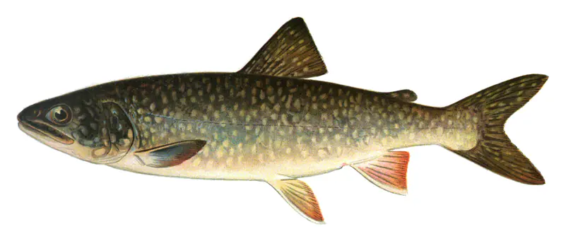
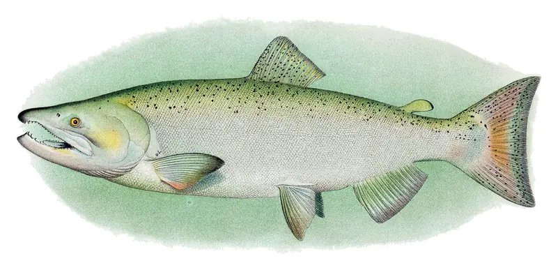
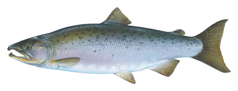
In the last 12 months, Michigan Department of Natural Resources stocked 726,549 fish in Lake Huron: lake trout (405,238), rainbow trout (160,472), Coho salmon (85,370) and Atlantic salmon (44,974).
Source: Michigan Department of Natural Resources stocking records.
Species with open-licensed records inside Lake Huron's outline, from GBIF.org (surveys, museum collections and angler reports). A record shows a fish was found here, not how many there are now. marks fish the state stocks here.
Rocky shorelines at night after ice-out; deep weed edges and humps in summer.
Cool water: near the surface in spring and fall, deep in summer.
Deep and cold most of the year; shallow reefs in fall and right after ice-out.
Deep, cold water; fall runs toward the tributaries.
Near the surface in cool months; fall runs to the inlets.
Water temperature sets off each spawn; the bars show the usual months at this latitude and elevation, and move with a warm or cold spring. The water is about 52°F now.
Lake Huron is the second largest of the Great Lakes by surface area, shared by Michigan and the Canadian province of Ontario. On the Michigan side it runs down the east coast of the Lower Peninsula, from the Straits of Mackinac past Saginaw Bay and the Thumb to Port Huron, where it drains into the St. Clair River. Counting its roughly 30,000 islands, it has the longest shoreline of any Great Lake.
The lake basin was left by melting glacial ice at the end of the last ice age, and geologists named a far older glaciation, the Huronian, for evidence found in the region. The French, the first Europeans in the region, called it La Mer Douce, the freshwater sea, and named it for the people they called the Huron, the Wyandot. A French map of 1656 used a Wyandot name, Karegnondi. La Salle later sailed onto it aboard Le Griffon, the ship he had built in 1679.
Huron and Michigan are, in the water's terms, a single lake. The two meet through the Straits of Mackinac, about 5 miles wide, and share one surface level, so hydrologists treat them together as Lake Michigan-Huron. That shared level swings widely over the years. The lake set its all-time high in the summer of 1986, broke its all-time low in January 2013, and then broke high-water records again for several months in a row in 2020.
The lake has distinct regions. Georgian Bay, in Ontario, has rocky shores lined with vacation homes, and Manitoulin Island is the largest freshwater island on Earth. On the Michigan side, Mackinac Island, in the Straits, is a popular tourist destination, while Saginaw Bay, fed by an intensively farmed river basin that includes Flint and Saginaw-Bay City, holds one of the lake's most productive fisheries. Port towns such as Cheboygan, Alpena, Harrisville and Bay City line the shore, with long stretches of shallow, sandy beach in between. At the south end, Fort Gratiot Light in Port Huron marks the entrance to the St. Clair River. First built in 1825 and rebuilt in 1829, it is the oldest surviving lighthouse in Michigan, and St. Clair County has owned it since 2010.
Lake Huron has a long record of lost ships. In the Great Storm of November 1913, which raged for 16 hours, ten ships sank on Lake Huron and more than 20 were driven ashore. Off the Michigan coast, the Thunder Bay National Marine Sanctuary, designated on October 7, 2000, as the first national marine sanctuary in the Great Lakes and enlarged in 2014, protects nearly 100 historic shipwrecks. The lake's cold fresh water keeps many of them in remarkable condition.
The lake's fish community has been reshaped more than once. Sea lamprey, alewife and rainbow smelt invaded and multiplied by the 1930s, and native lake trout were nearly wiped out by 1950. Around 2003 the food web shifted again when alewife nearly disappeared, Pacific salmon numbers dropped, and Chinook catches declined. Native fish gained. Lake trout and walleye benefited, and Saginaw Bay's walleye population met its recovery targets in 2009. Zebra and quagga mussels, round gobies and the spiny water flea now live in the lake too, so it pays to clean boats and gear between waters.
Written by Lake by Lake from U.S. Environmental Protection Agency, NOAA Office of National Marine Sanctuaries (Thunder Bay National Marine Sanctuary, About Thunder Bay National Marine Sanctuary) and Wikipedia (Lake Huron, Fort Gratiot Light). Checked November 2026.
Where the level comes from: Lake Huron at Fort Gratiot Tidal Gauge (NOAA National Water Prediction Service, used on this page), Lake Huron at Lake Port (NOAA National Water Prediction Service) and Lake Huron at Harbor Beach Tidal Gauge (NOAA National Water Prediction Service).
| Lake | Miles | Level (ft) | vs full | 7 days |
|---|---|---|---|---|
| Lake St. Clair Live reading | 44 | 574.37 | — | — |
| Lake Erie Live reading | 84 | 571.06 | — | — |
Compare Lake Huron with Lake St. Clair or Lake Erie: size, level, ramps and fish side by side.
Lake Huron is about 84 mi from Ann Arbor, MI. See all the lakes near each city.
Lake Huron is at 578.36 feet above sea level, as of Nov 17, 2026, 9:24 PM EST. It has dropped 0.18 ft in the past 7 days.
The surface of Lake Huron was about 52°F on November 14, estimated from a satellite pass on a clear day. It is the top layer of the water, a few degrees either way; coves and shallows run warmer in the sun.
Anglers 17 and older need a Michigan fishing license, sold online by the Michigan Department of Natural Resources. Free fishing days: Presidents' Day weekend (Sat-Sun) and the Saturday and Sunday after the first full week of June. Size and bag limits can be set lake by lake: check the current regulations.
NOAA's flood categories for the Lake Huron gauge: action stage at 581.8 ft.
Yes: bathymetry poster with depth contours from the NOAA National Centers for Environmental Information. It is linked in the lake facts on this page. Depths on a map are measured at a reference level: subtract how far the lake is below it today.
EPA's CyAN satellite rated cyanobacteria in Lake Huron high on October 31. The satellite sees open water only; blooms can be patchy, so avoid water that looks like spilled paint or pea soup and keep dogs out of scum. Swimming advisories come from Michigan health and environment agencies.
Yes. Michigan Department of Natural Resources stocked lake trout, rainbow trout, splake and Coho salmon in Lake Huron; the latest stocking on record was on June 17, 2026.
From the NOAA National Water Prediction Service (Lake Huron at Fort Gratiot Tidal Gauge). Lake by Lake checks it every hour; the agency's own figure is always the reference, and provisional readings can be revised.
Lake levels are refreshed every hour. Texas and California reservoirs report once a day; most USGS and NOAA gauges report every 15 to 60 minutes.