Sun
- Sunrise
- 7:47 AM
- Sunset
- 5:19 PM
- First light
- 7:16 AM
- Last light
- 5:50 PM
Lake · Oceana County, Michigan
A lake fed by Pere Marquette Lake in Illinois, Indiana, Michigan and Wisconsin.

Lake Michigan is at 578.45 feet above sea level, as of Nov 19, 2026, 3:18 AM EST. It has dropped 0.47 ft in the past 7 days.
A notification from this browser, once, when the level crosses the line (checked every hour). No account and no email. On an iPhone, add Lake by Lake to your home screen first (Share → Add to Home Screen) and open it from there. Or follow the lake in a feed reader: RSS feed.
Lake Michigan is down 0.47 ft over the last 7 days, at 578.45 ft today.
Daily values from the NOAA Tides & Currents.
Lake Michigan is down 0.59 ft over the last 30 days, at 578.45 ft today.
Daily values from the NOAA Tides & Currents.
Over the past 12 months, Lake Michigan ranged from 577.20 ft (Dec 21, 2025) to 579.87 ft (Jul 5, 2026), a swing of 2.7 ft. Today's level is in the upper half of that range. It is 0.45 ft higher than on this date last year.
Daily values from the NOAA Tides & Currents. Why lake levels rise and fall
Solunar periods for Lake Michigan, local time. How they work
High · as of Nov 9, 2026
The satellite sees a likely bloom on part of the lake. Avoid discolored water and scum, and keep dogs out of it. About 711,000 cells/mL at the worst spot, covering less than 1% of the lake.
Week of Aug 16Week of Nov 1
Each bar is one week, colored by the worst reading of that week.
From the U.S. EPA's Cyanobacteria Assessment Network (CyAN), which reads the color of lakes from the Sentinel-3 satellites; it sees open water only, not coves or the shoreline. Blooms can be patchy: what you see on the water matters more. Swimming closures and health advisories come from Michigan health and environment agencies. How to read it
Surface water temperature
52°F on Nov 17, 2026
68°F · Jul 2452°F · Nov 17
16°F cooler than on Jul 24, 2026.
Estimated from NOAA’s Great Lakes analysis passes on clear days: the top layer of the water, a few degrees either way. Coves and the shallows can be warmer.
Lake Michigan water temperature: trend, swimming and the fish →
The map loads when you scroll to it.
Zebra mussels and Quagga mussels have been found in Lake Michigan. They clog intakes and engines and spread on boats and trailers: clean, drain and dry everything before you go to another lake.
Illinois: Before leaving the water you must drain bait buckets, livewells, bilges and any other compartment holding lake water. It's illegal to launch a boat, or drive it on a public road, with aquatic plants or animals attached to the boat or trailer. State rules
Indiana: Indiana has no clean-drain-dry law, but the DNR asks boaters to remove plants and mud, drain the motor, livewell and bilge on land, and dry gear for five days. It's illegal to transport any of 30 listed invasive aquatic plants, such as Eurasian watermilfoil, including on a boat or trailer. State rules
Michigan: Remove all aquatic plants from the boat, gear and trailer before launching. Before driving away, pull all drain plugs (bilge, ballast, livewell), drain all water and make sure boat and trailer are free of plants and animals; dispose of unused bait on land or in the trash. State rules
Wisconsin: Before leaving, remove all plants and animals from the boat, trailer and gear and drain all water, including livewells and buckets; launching, or driving on a highway, with plants or animals attached is illegal. Never move live fish away from the water; leftover minnows can go to another lake only if no lake water or fish were added. State rules
Records: USGS Nonindigenous Aquatic Species database. A species not listed may still be present.
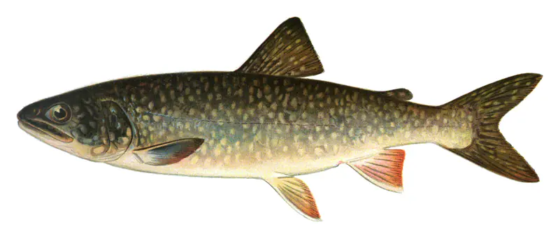
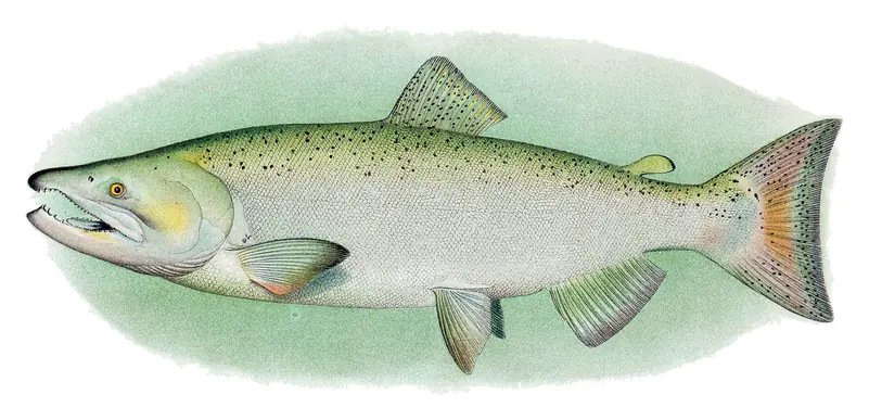
In the last 12 months, Michigan Department of Natural Resources stocked 2,469,118 fish in Lake Michigan: lake trout (2,089,490), walleye (221,332) and brown trout (158,296).
Source: Michigan Department of Natural Resources stocking records.
Species with open-licensed records inside Lake Michigan's outline, from GBIF.org (surveys, museum collections and angler reports). A record shows a fish was found here, not how many there are now. marks fish the state stocks here.
Rocky shorelines at night after ice-out; deep weed edges and humps in summer.
Cool water: near the surface in spring and fall, deep in summer.
Low light and cold water; the inflows in fall.
Deep and cold most of the year; shallow reefs in fall and right after ice-out.
Deep, cold water; fall runs toward the tributaries.
Water temperature sets off each spawn; the bars show the usual months at this latitude and elevation, and move with a warm or cold spring. The water is about 52°F now.
Lake Michigan is the only one of the five Great Lakes that lies entirely inside the United States, shared by Michigan, Wisconsin, Illinois and Indiana. Chicago and Milwaukee sit on its shores, it supplies drinking water to the cities around it, and its east coast holds the largest collection of freshwater sand dunes in the world.
The name is believed to come from an Ojibwe word usually rendered as mishigami, meaning great water. The French explorer Jean Nicolet is thought to have been the first European to reach the lake, around 1634 or 1638.
The basin is the work of glaciers. Over the last two million years, continental ice sheets advanced and retreated again and again, widening and deepening old river valleys into the Great Lakes basins and leaving ridges of debris called moraines. The last glacier left the Sleeping Bear country about 11,800 years ago. Several earlier lakes filled the basin as the ice melted, among them glacial Lake Chicago and Lake Algonquin, before the water settled near its present shape.
In the north, the lake opens into Lake Huron through the Straits of Mackinac, and the connection keeps the two at the same level. Hydrologically they are one body of water. Some water also leaves the other way, through the Chicago River and the Illinois Waterway toward the Mississippi. Water entering the lake takes about 62 years to flush through it.
Green Bay, in the northwest, is the largest bay, and Grand Traverse and Little Traverse bays cut into the Michigan shore in the north. Beaver Island is the largest island, and North and South Manitou lie off Leelanau County. Chicago, Milwaukee, Gary, Kenosha, Racine and Sheboygan line the southern and western shores, while Muskegon and Traverse City are on the Michigan side.
The dunes formed where wind and waves worked against glacial moraines along the eastern shore. At Sleeping Bear Dunes National Lakeshore, perched dunes sit on top of bluffs several hundred feet above the water, on the Sleeping Bear Plateau, Empire Bluffs, Pyramid Point and the west side of South Manitou Island. At the Dune Climb, sand has been creeping forward at an average of about 4 feet a year. At the south end, Indiana Dunes National Park protects another large dune system.
Lake trout were once the top predator here. Sea lampreys, overfishing and the effects of an improved Welland Canal cut them down, and the alewife, a small invasive herring, multiplied. Michigan's answer came on April 2, 1966, when the Department of Natural Resources began stocking coho salmon, a plan led by fisheries chief Howard Tanner and launched at the Platte River hatchery. Pacific salmon then became the base of a large sport fishery. Steelhead, yellow perch and bass are also fished, and lake whitefish is the main commercial catch. Zebra and quagga mussels have since changed the lake's clarity and fertility.
Over a century of records, the level has moved within a range of a little more than 6 feet, usually peaking in late summer and bottoming out in winter. Lake Michigan-Huron set its lowest monthly level on record in January 2013, then climbed for seven years and set new monthly highs from January through August 2020.
Most Great Lakes beaches have no lifeguard. The National Weather Service says the drowning risk climbs sharply once waves reach about 3 feet, and that most drownings and rescues happen in waves of 3 to 6 feet. Piers and breakwalls focus strong currents that are often too fast to swim against. The agency advises checking the beach forecast first, staying at least 100 yards from piers, never jumping off them, and, if caught in a current, flipping onto your back, floating and following it until you can swim free.
Written by Lake by Lake from Indiana Department of Environmental Management, Wikipedia, National Park Service, Sleeping Bear Dunes National Lakeshore, Michigan Department of Natural Resources, Indiana Department of Natural Resources and National Weather Service. Checked November 2026.
Where the level comes from: Lake Michigan (NOAA Tides & Currents).
| Lake | Miles | Level (ft) | vs full | 7 days |
|---|---|---|---|---|
| Lake Winnebago Live reading | 69 | 746.80 | — | +0.01 |
| Wind Lake Live reading | 76 | 767.79 | — | +1.33 |
| Hustisford-Sinissippi Lake Live reading | 77 | 855.51 | — | — |
Compare Lake Michigan with Lake Winnebago, Wind Lake or Hustisford-Sinissippi Lake: size, level, ramps and fish side by side.
Lake Michigan is about 57 mi from Milwaukee, WI and 77 mi from Green Bay, WI. See all the lakes near each city.
Lake Michigan is at 578.45 feet above sea level, as of Nov 19, 2026, 3:18 AM EST. It has dropped 0.47 ft in the past 7 days.
The surface of Lake Michigan was about 52°F on November 17, estimated from a satellite pass on a clear day. It is the top layer of the water, a few degrees either way; coves and shallows run warmer in the sun.
Lake Michigan lies in Illinois and Indiana and Michigan and Wisconsin: the license of the state where you fish applies. Anglers 16 and older need an Illinois fishing license, sold online by the Illinois Department of Natural Resources. Free fishing days: Third weekend in June (Friday through Monday). Anglers 18 and older need an Indiana fishing license, sold online by the Indiana Department of Natural Resources. Free fishing days: Four days a year for Indiana residents (2026: May 10, June 6-7 and September 26). Anglers 17 and older need a Michigan fishing license, sold online by the Michigan Department of Natural Resources. Free fishing days: Presidents' Day weekend (Sat-Sun) and the Saturday and Sunday after the first full week of June. Anglers 16 and older need a Wisconsin fishing license, sold online by the Wisconsin Department of Natural Resources. Free fishing days: Third full weekend in January and first full weekend in June. Size and bag limits can be set lake by lake: check the current regulations.
Lake Michigan is about 922 ft deep at its deepest point. Depth changes with the lake level.
Yes: great Lakes bathymetry page (Lake Michigan posters) from the NOAA National Centers for Environmental Information. It is linked in the lake facts on this page. Depths on a map are measured at a reference level: subtract how far the lake is below it today.
EPA's CyAN satellite rated cyanobacteria in Lake Michigan high on November 9. The satellite sees open water only; blooms can be patchy, so avoid water that looks like spilled paint or pea soup and keep dogs out of scum. Swimming advisories come from Michigan health and environment agencies.
Yes. Michigan Department of Natural Resources stocked walleye, lake trout and brown trout in Lake Michigan; the latest stocking on record was on October 30, 2026.
From the NOAA Tides & Currents (Lake Michigan). Lake by Lake checks it every hour; the agency's own figure is always the reference, and provisional readings can be revised.
Lake levels are refreshed every hour. Texas and California reservoirs report once a day; most USGS and NOAA gauges report every 15 to 60 minutes.
Cookies for analytics With your OK we use Google Analytics and Microsoft Clarity to count visits and see how the site is used, so we can make it better. No advertising cookies. Privacy policy