Sun
- Sunrise
- 8:00 AM
- Sunset
- 5:09 PM
- First light
- 7:26 AM
- Last light
- 5:43 PM
Lake · Keweenaw County, Michigan
A lake fed by the Saint Louis River in Michigan, Minnesota and Wisconsin.

Lake Superior is at 601.86 feet above sea level, as of Nov 19, 2026, 1:24 AM EST. It has dropped 0.15 ft in the past 7 days.
A notification from this browser, once, when the level crosses the line (checked every hour). No account and no email. On an iPhone, add Lake by Lake to your home screen first (Share → Add to Home Screen) and open it from there. Or follow the lake in a feed reader: RSS feed.
Lake Superior is down 0.15 ft over the last 7 days, at 601.86 ft today.
Daily values from the NOAA Tides & Currents.
Lake Superior has held steady over the last 30 days (within 0.05 ft).
Daily values from the NOAA Tides & Currents.
Over the past 12 months, Lake Superior ranged from 600.98 ft (Mar 2, 2026) to 602.23 ft (Aug 27, 2026), a swing of 1.3 ft. Today's level is in the upper half of that range. It is 0.28 ft higher than on this date last year.
Daily values from the NOAA Tides & Currents. Why lake levels rise and fall
Solunar periods for Lake Superior, local time. How they work
High · as of Nov 7, 2026
The satellite sees a likely bloom on part of the lake. Avoid discolored water and scum, and keep dogs out of it. About 511,000 cells/mL at the worst spot, covering less than 1% of the lake.
Week of Aug 16Week of Nov 1
Each bar is one week, colored by the worst reading of that week.
From the U.S. EPA's Cyanobacteria Assessment Network (CyAN), which reads the color of lakes from the Sentinel-3 satellites; it sees open water only, not coves or the shoreline. Blooms can be patchy: what you see on the water matters more. Swimming closures and health advisories come from Michigan health and environment agencies. How to read it
Surface water temperature
46°F on Nov 17, 2026
48°F · Jul 2446°F · Nov 17
2°F cooler than on Jul 24, 2026.
Estimated from NOAA’s Great Lakes analysis passes on clear days: the top layer of the water, a few degrees either way. Coves and the shallows can be warmer.
Lake Superior water temperature: trend, swimming and the fish →
The map loads when you scroll to it.
Zebra mussels and Quagga mussels have been found in Lake Superior. They clog intakes and engines and spread on boats and trailers: clean, drain and dry everything before you go to another lake.
Michigan: Remove all aquatic plants from the boat, gear and trailer before launching. Before driving away, pull all drain plugs (bilge, ballast, livewell), drain all water and make sure boat and trailer are free of plants and animals; dispose of unused bait on land or in the trash. State rules
Minnesota: Clean all plants, mud and invasive animals off your boat and trailer, drain all water and pull drain plugs before leaving the access, keep plugs out while transporting, and put unwanted bait in the trash. Inspectors at accesses can require inspection or decontamination and deny launch if plants or invasives are found. State rules
Wisconsin: Before leaving, remove all plants and animals from the boat, trailer and gear and drain all water, including livewells and buckets; launching, or driving on a highway, with plants or animals attached is illegal. Never move live fish away from the water; leftover minnows can go to another lake only if no lake water or fish were added. State rules
Records: USGS Nonindigenous Aquatic Species database. A species not listed may still be present.
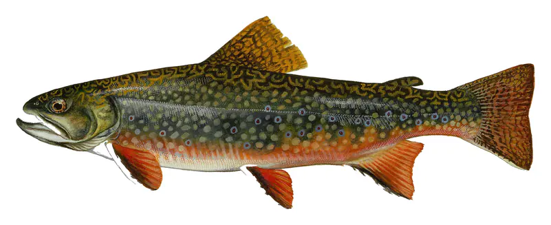
In the last 12 months, Michigan Department of Natural Resources stocked 66,346 fish in Lake Superior: splake (66,346).
Source: Michigan Department of Natural Resources stocking records.
Species with open-licensed records inside Lake Superior's outline, from GBIF.org (surveys, museum collections and angler reports). A record shows a fish was found here, not how many there are now. marks fish the state stocks here.
Rocky shorelines at night after ice-out; deep weed edges and humps in summer.
Cool water: near the surface in spring and fall, deep in summer.
Deep and cold most of the year; shallow reefs in fall and right after ice-out.
Cold, clear water near springs and inlets.
Water temperature sets off each spawn; the bars show the usual months at this latitude and elevation, and move with a warm or cold spring. The water is about 46°F now.
Lake Superior is the northernmost and largest of the Great Lakes, shared by Michigan, Wisconsin, Minnesota and the Canadian province of Ontario. By surface area it is the biggest body of fresh water on Earth. The Ojibwe call it Gichigami, big water, and the English name simply marks its place above the other lakes on the map.
The basin began to take shape about 1.1 billion years ago, when the middle of the continent started to split apart along what geologists call the Midcontinent Rift. Lava poured out in floods and hardened into basalt thousands of feet thick. Hot water moving through those volcanic layers later left behind the largest deposit of native copper ever found. The rock sags into a bowl under the lake, with Michigan's Keweenaw Peninsula on one rim and Isle Royale on the other.
In the last ice age a glacier about 2 miles thick covered the region. It scoured the basin and dragged loose chunks of copper, known as float copper, for hundreds of miles. When the ice melted, water filled the bowl. The lake took its present form between roughly 10,000 and 7,500 years ago, which makes it the youngest of the Great Lakes.
Superior is the coldest of the Great Lakes, and ice can linger along its shores until late May or early June. The water is so poor in nutrients that it stays unusually clear, and zebra and quagga mussels have done little harm here. On average, water stays in the lake about 191 years before it leaves through the St. Marys River at Sault Ste. Marie, bound for Lake Huron.
The outflow there runs through hydropower plants and a row of gates called the Compensating Works. The commander of the Army Corps of Engineers' Detroit District and a Canadian engineer set the monthly release for a binational board of the International Joint Commission, following a plan in use since January 2015. Even so, rain, snowmelt, evaporation and wind move the lake far more than the gates do. Seiches, standing waves that slosh from shore to shore, can raise or lower the water near shore by 3 feet or more.
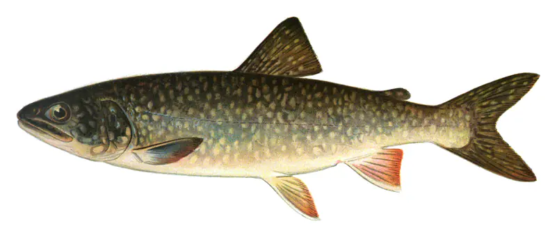
From 1920 to 1950 commercial crews took about 4 million pounds of lake trout a year. Overfishing and the sea lamprey, an invasive parasite that had reached Superior by 1938, broke that fishery, and by 1964 the catch had fallen 95 percent. Lampricide, barriers and traps, tight harvest rules and stocking brought the trout back. Natural reproduction picked up enough in the mid-1990s that stocking could be cut, and refuges around Gull Island and Devils Island let the Apostle Islands stop stocking altogether. In November 2024 the Lake Superior Committee, a group of state, tribal and Canadian fishery managers, declared the trout restored across most of the lake. Western waters from Cornucopia, Wisconsin, to Minnesota still lag, and on the Keweenaw, stamp sands left by copper mining are eroding onto a major spawning area.
Off the tip of Wisconsin's Bayfield Peninsula, Apostle Islands National Lakeshore takes in 21 islands, sea caves and the largest collection of lighthouses in the national park system. Along Pictured Rocks National Lakeshore in Michigan, three old wrecks show near the beach when the water is low.
About 350 ships have gone down in Superior, and roughly half have been found. The best known is the Edmund Fitzgerald, which left Superior, Wisconsin, on the afternoon of November 9, 1975, loaded with taconite pellets. A November storm with gusts near 70 knots and seas of 18 to 25 feet caught her on the run toward the shelter of Whitefish Point, and she sank on November 10 with all 29 men aboard. A Navy aircraft located the wreck 17 miles north-northwest of the point four days later. Her bell is now displayed at the Great Lakes Shipwreck Museum at Whitefish Point.
Written by Lake by Lake from National Park Service, Pictured Rocks National Lakeshore, National Park Service (Lake Superior Geology, Apostle Islands National Lakeshore), International Joint Commission, International Lake Superior Board of Control, Great Lakes Now (Wisconsin Public Radio) and Great Lakes Shipwreck Historical Society. Checked November 2026.
Where the level comes from: Lake Superior (NOAA Tides & Currents).
| Lake | Miles | Level (ft) | vs full | 7 days |
|---|---|---|---|---|
| Greenwood Reservoir Live reading | 69 | 1507.83 | — | −0.25 |
| Schweitzer Reservoir Live reading | 69 | 1334.46 | — | +0.29 |
Compare Lake Superior with Greenwood Reservoir or Schweitzer Reservoir: size, level, ramps and fish side by side.
Lake Superior is at 601.86 feet above sea level, as of Nov 19, 2026, 1:24 AM EST. It has dropped 0.15 ft in the past 7 days.
The surface of Lake Superior was about 46°F on November 17, estimated from a satellite pass on a clear day. It is the top layer of the water, a few degrees either way; coves and shallows run warmer in the sun.
Lake Superior lies in Michigan and Minnesota and Wisconsin: the license of the state where you fish applies. Anglers 17 and older need a Michigan fishing license, sold online by the Michigan Department of Natural Resources. Free fishing days: Presidents' Day weekend (Sat-Sun) and the Saturday and Sunday after the first full week of June. Anglers 16 and older need a Minnesota fishing license, sold online by the Minnesota Department of Natural Resources. Free fishing days: Take a Mom Fishing Weekend (Mother’s Day weekend) and Take a Kid Fishing Weekend (early June), for residents. Anglers 16 and older need a Wisconsin fishing license, sold online by the Wisconsin Department of Natural Resources. Free fishing days: Third full weekend in January and first full weekend in June. Size and bag limits can be set lake by lake: check the current regulations.
Lake Superior is about 1,332 ft deep at its deepest point. Depth changes with the lake level.
EPA's CyAN satellite rated cyanobacteria in Lake Superior high on November 7. The satellite sees open water only; blooms can be patchy, so avoid water that looks like spilled paint or pea soup and keep dogs out of scum. Swimming advisories come from Michigan health and environment agencies.
Yes. Michigan Department of Natural Resources stocked splake, lake trout, brook trout and walleye in Lake Superior; the latest stocking on record was on May 8, 2026.
From the NOAA Tides & Currents (Lake Superior). Lake by Lake checks it every hour; the agency's own figure is always the reference, and provisional readings can be revised.
Lake levels are refreshed every hour. Texas and California reservoirs report once a day; most USGS and NOAA gauges report every 15 to 60 minutes.
Cookies for analytics With your OK we use Google Analytics and Microsoft Clarity to count visits and see how the site is used, so we can make it better. No advertising cookies. Privacy policy