Sun
- Sunrise
- 6:53 AM
- Sunset
- 4:56 PM
- First light
- 6:25 AM
- Last light
- 5:25 PM
Reservoir · Miller County, Missouri
A reservoir on the Osage River in Miller County, Missouri, held back by Bagnell Dam since 1931.

Lake of the Ozarks is at 657.40 feet above sea level — 2.60 ft below full reservoir level, as of Nov 17, 2026, 8:00 PM CST. It has dropped 0.05 ft in the past 7 days.
4th lowest of 12 Missouri lakes today against full pool · See the ranking
A notification from this browser, once, when the level crosses the line (checked every hour). No account and no email. On an iPhone, add Lake by Lake to your home screen first (Share → Add to Home Screen) and open it from there. Or follow the lake in a feed reader: RSS feed.
Lake of the Ozarks is down 0.26 ft over the last 30 days, at 657.40 ft today.
Daily values from the NOAA National Water Prediction Service. Why lake levels rise and fall
Solunar periods for Lake of the Ozarks, local time. How they work
High · as of Nov 9, 2026
The satellite sees a likely bloom on part of the lake. Avoid discolored water and scum, and keep dogs out of it. About 337,000 cells/mL at the worst spot, covering less than 1% of the lake.
Week of Aug 9Week of Nov 1
Each bar is one week, colored by the worst reading of that week.
From the U.S. EPA's Cyanobacteria Assessment Network (CyAN), which reads the color of lakes from the Sentinel-3 satellites; it sees open water only, not coves or the shoreline. Blooms can be patchy: what you see on the water matters more. Swimming closures and health advisories come from Missouri health and environment agencies. How to read it
Surface water temperature
61°F on Nov 8, 2026
92°F · Jul 1961°F · Nov 8
31°F cooler than on Jul 19, 2026.
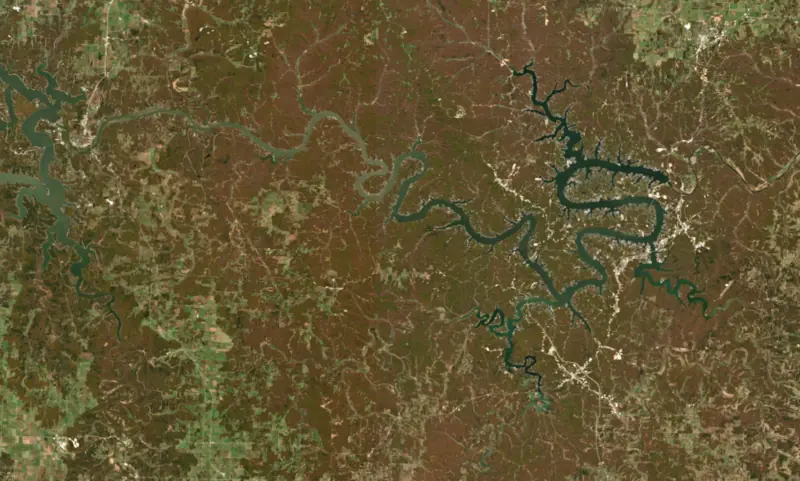
Estimated from Landsat 8/9 (USGS) passes on clear days: the top layer of the water, a few degrees either way. Coves and the shallows can be warmer.
Lake of the Ozarks water temperature: trend, swimming and the fish →
On or near the shore of Lake of the Ozarks: 150 boat ramps, 68 marinas, 24 rental outfits, 65 campgrounds, 14 beaches, 1 fishing pier, 17 trails and 1 fishing guide. The lake has about 938 miles of shoreline, counting its islands.
Tap an icon for details; use two fingers (or Ctrl + scroll) to move the map. Tap a dot for details. Map and lake outline © OpenStreetMap contributors. Places from OpenStreetMap, Overture Maps and Recreation.gov. Not for navigation.
What you’ll find on the shore
← AllBoating 218+
← AllRentals & tours 35
← AllFishing spots 10
← AllBeaches 14
← AllCamping 65
← AllLodging 24+
← AllTrails 17
← AllParks 14
← AllDining 24+
Zebra mussels have been found in Lake of the Ozarks. They clog intakes and engines and spread on boats and trailers: clean, drain and dry everything before you go to another lake.
Missouri: Missouri has no clean-drain-dry law; MDC asks boaters to remove plants, animals and mud, drain all water including livewells and transom wells before leaving, let the boat dry completely, and trash unused bait. Prohibited species such as zebra mussels may not be transported alive. State rules
Records: USGS Nonindigenous Aquatic Species database. A species not listed may still be present.
Species with open-licensed records inside Lake of the Ozarks's outline, from GBIF.org (surveys, museum collections and angler reports). A record shows a fish was found here, not how many there are now.
Shallow, protected flats in spring; docks, grass and deep edges in summer heat.
Channel edges and river arms; best after dark in summer, and after a rain.
Run up the river arms in spring; follow shad to cool, deep water near the dam in summer.
Cool water: near the surface in spring and fall, deep in summer.
Clear water and steep rock; they often suspend deeper than largemouth.
Water temperature sets off each spawn; the bars show the usual months at this latitude and elevation, and move with a warm or cold spring. The water is about 61°F now.
Lake of the Ozarks is the reservoir behind Bagnell Dam on the Osage River in central Missouri, spread across Benton, Camden, Miller and Morgan counties. Its long, twisting outline earned it the nickname the Missouri Dragon. Since the 1930s it has drawn vacationers to its private docks, resorts and busy main channel.
The plan goes back to 1912, when Kansas City developer Ralph Street began surveying the Osage valley for a hydroelectric dam that would send power to St. Louis. His own financing ran out in the mid-1920s, and Union Electric Company of St. Louis, now Ameren Missouri, carried the project through. Work on Bagnell Dam began in August 1929 and was finished in April 1931. The lake started filling in February 1931 and opened to boats on May 30 of that year. Ameren still runs the powerhouse at the foot of the dam under a federal license.
Before the water came, crews burned houses, cut the timber and moved cemeteries. Some graves were never found and are still under the lake. Old Linn Creek, settled in 1841 where the Niangua met the Osage and the Camden County seat since 1855, was torn down, and the county seat went to the new town of Camdenton, begun in 1931. Irontown and Gladstone were also cleared and flooded. During construction the water was called the Osage Reservoir, and the legislature named it Lake Benton after Senator Thomas Hart Benton, but neither name lasted. Because the lake was built for power rather than flood storage, it has little room to hold floodwater, and the dam's floodgates were opened during the 2019 floods. Unlike many Corps of Engineers flood-control lakes, most of the shoreline here is private, and Ameren still decides who may build docks and seawalls along it.
The main channel follows the Osage River down from the tailwater of Truman Dam to Bagnell Dam, with major arms reaching up the Gravois, the Niangua and the Grand Glaize. Osage Beach, the largest town, sits where US 54 crosses the Grand Glaize Arm, and Route 5 crosses the main channel on the Hurricane Deck Bridge between Laurie and Camdenton. Lake of the Ozarks State Park, the largest park in the Missouri system, lies along the Grand Glaize Arm. The National Park Service set it up in the mid-1930s and handed it to the state in 1946. The Civilian Conservation Corps built its log buildings, rustic bridges and stone work, and the park and its main road, Highway 134, are on the National Register of Historic Places. On the Niangua Arm, Ha Ha Tonka State Park guards the sandstone shell of a castle that Kansas City businessman Robert Snyder began in 1905. His family fought the dam in the 1920s and lost, the rising water split the estate, and the castle burned in 1942.
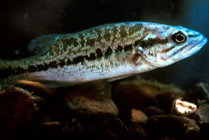
The lake is known for crappie, and the Missouri Department of Conservation sinks brush piles for them, including a large batch in the Gravois Arm, and publishes their locations, since finding cover is most of the game. Largemouth bass are abundant, and the Niangua and Grand Glaize arms are the usual recommendation, fished around points, brush and docks in spring and fall. The lake yields a large share of Missouri's paddlefish harvest, and the Osage Arm is the place to snag them during the season. Walleye have been stocked since the mid-1990s. The Truman Dam tailwater is the early-spring walleye spot and is also good for hybrid striped bass. Striped bass are stocked in small numbers as a trophy fishery, and blue catfish in a middle length range have had to be released since 2014.
Written by Lake by Lake from Missouri Department of Conservation, Missouri State Parks (Cultural History - Lake of the Ozarks State Park, Park History - Ha Ha Tonka), KCUR Kansas City Public Radio and Wikipedia (Lake of the Ozarks, Linn Creek, Missouri). Checked November 2026.
Bagnell Dam is a concrete gravity dam 148 feet high and 2,543 feet long on the Osage River, completed in 1931. It belongs to Union Electric Company and is run for hydropower, recreation and flood control. At its normal level the reservoir holds 1.93 million acre-ft, drained from 14,000 square miles of land.
From the National Inventory of Dams (U.S. Army Corps of Engineers), NID ID MO30014. Lake or reservoir: what’s the difference?
Where the level comes from: Osage River at Bagnell Dam (NOAA National Water Prediction Service).
| Lake | Miles | Level (ft) | vs full | 7 days |
|---|---|---|---|---|
| Truman Reservoir Live reading | 42 | 703.40 | — | −1.74 |
| Pomme de Terre Lake At or near full pool | 43 | 837.68 | −1.32 | −0.14 |
| Stockton Lake Slightly below full | 72 | 861.97 | −5.03 | −0.10 |
| Concordia Lake Live reading | 72 | 707.51 | — | −0.14 |
Compare Lake of the Ozarks with Truman Reservoir, Pomme de Terre Lake, Stockton Lake or Concordia Lake: size, level, ramps and fish side by side.
Lake of the Ozarks is about 54 mi from Columbia, MO. See all the lakes near each city.
Lake of the Ozarks is at 657.40 feet above sea level — 2.60 ft below full reservoir level, as of Nov 17, 2026, 8:00 PM CST. It has dropped 0.05 ft in the past 7 days.
Lake of the Ozarks's full reservoir level is 660.00 ft, according to Ameren Missouri. Today the lake is 2.60 ft below that mark.
Lake of the Ozarks has 150 boat ramps on our map, including Boat ramp at Encounter Cove, Boat ramp at G and G Marina, Boat ramp at LakeTime RV Ozarks, and 68 marinas. Low water can close ramps, so check today's level above and the operator before you go.
Yes. There are 65 campgrounds and RV parks within about a mile of the shore, such as Lands' End Condo Rental-Lake of the Ozarks, Truman Dam - Warsaw, Mo, 2Beaches RV Park.
Game fish recorded in Lake of the Ozarks include largemouth bass, blue catfish, flathead catfish, channel catfish, blue catfish, striped bass. In all, 30 fish species have open records inside the lake on GBIF.
The surface of Lake of the Ozarks was about 61°F on November 8, estimated from a satellite pass on a clear day. It is the top layer of the water, a few degrees either way; coves and shallows run warmer in the sun.
Anglers 16 and older need a Missouri fishing license, sold online by the Missouri Department of Conservation. Free fishing days: Saturday and Sunday following the first Monday in June. Size and bag limits can be set lake by lake: check the current regulations.
NOAA's flood categories for the Lake of the Ozarks gauge: minor flooding at 660.0 ft. Today the lake is 2.60 ft below the first flooding level.
Lake of the Ozarks averages about 35 ft deep. Depth changes with the lake level.
In summer a white Secchi disk lowered into Lake of the Ozarks stays visible to about 4.1 ft (the median of 605 readings, 2016–2025, by Univ. of Missouri, Columbia and Missouri Dept. of Natural Resources): somewhat murky water. With the algae measured too (chlorophyll about 15 µg/L), that makes it eutrophic: rich in nutrients, greener water. Clarity drops after storms and during algae blooms.
boating (150+ boat ramps and 68 marinas), kayaks, boats & jet skis (24 rental outfits on or near the water), boat tours (11 boat tours and charters), fishing (17 game fish, 1 fishing pier or spot and 1 fishing guide), swimming (14 beaches and swimming areas) and hiking & walking (17 trails along the shore, the longest Trail of Four Winds - South Loop (9.6 mi)), according to our map of the shore.
EPA's CyAN satellite rated cyanobacteria in Lake of the Ozarks high on November 9. The satellite sees open water only; blooms can be patchy, so avoid water that looks like spilled paint or pea soup and keep dogs out of scum. Swimming advisories come from Missouri health and environment agencies.
Yes. 17 trails run along or near the shore, including Lake Trail (1.6 mi), Lake View Bend Trail (1.3 mi) and Rocky Top Trail (2.0 mi), according to OpenStreetMap.
Lake of the Ozarks is held back by Bagnell Dam, completed in 1931 and 148 ft high, according to the National Inventory of Dams.
From the NOAA National Water Prediction Service (Osage River at Bagnell Dam). Lake by Lake checks it every hour; the agency's own figure is always the reference, and provisional readings can be revised.
Lake levels are refreshed every hour. Texas and California reservoirs report once a day; most USGS and NOAA gauges report every 15 to 60 minutes.