Sun
- Sunrise
- 6:55 AM
- Sunset
- 4:48 PM
- First light
- 6:26 AM
- Last light
- 5:17 PM
Reservoir · Ralls County, Missouri
A reservoir on the Salt River in Ralls County, Missouri, held back by Clarence Cannon Dam since 1983.

Mark Twain Lake is at 602.22 feet above sea level — 3.78 ft below top of conservation pool, as of Nov 18, 2026, 11:30 PM CST. It has dropped 0.54 ft in the past 7 days.
3rd lowest of 12 Missouri lakes today against full pool · See the ranking
Record low 595.80 ft (1997), record high 640.21 ft (2008) · Level history since 1984
A notification from this browser, once, when the level crosses the line (checked every hour). No account and no email. On an iPhone, add Lake by Lake to your home screen first (Share → Add to Home Screen) and open it from there. Or follow the lake in a feed reader: RSS feed.
Mark Twain Lake is down 0.54 ft over the last 7 days, at 602.22 ft today.
Daily values from the NOAA National Water Prediction Service.
Mark Twain Lake is down 0.60 ft over the last 30 days, at 602.22 ft today.
Daily values from the NOAA National Water Prediction Service.
Over the past 12 months, Mark Twain Lake ranged from 599.99 ft (Mar 6, 2026) to 616.78 ft (Jun 15, 2026), a swing of 16.8 ft. Today's level is near the bottom of that range. It is 1.39 ft higher than on this date last year.
Daily values from the NOAA National Water Prediction Service. Why lake levels rise and fall
In the U.S. Army Corps of Engineers record, which starts in 1984, the lowest level was 595.80 ft on November 27, 1997 and the highest 640.21 ft on July 30, 2008. Today’s 602.22 ft is 6.4 ft above the record low and 38.0 ft below the record high.
Mark Twain Lake level history: every year since 1984, the lowest and highest years →
Solunar periods for Mark Twain Lake, local time. How they work
Not detected · as of Nov 9, 2026
The satellite found no cyanobacteria at the surface.
Week of Aug 9Week of Nov 1
Each bar is one week, colored by the worst reading of that week.
From the U.S. EPA's Cyanobacteria Assessment Network (CyAN), which reads the color of lakes from the Sentinel-3 satellites; it sees open water only, not coves or the shoreline. Blooms can be patchy: what you see on the water matters more. Swimming closures and health advisories come from Missouri health and environment agencies. How to read it
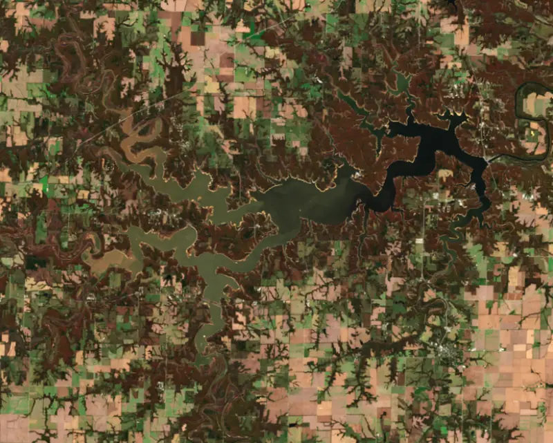
Surface water temperature
62°F on Nov 10, 2026
84°F · Aug 2162°F · Nov 10
22°F cooler than on Aug 21, 2026.
Estimated from Landsat 8/9 (USGS) passes on clear days: the top layer of the water, a few degrees either way. Coves and the shallows can be warmer.
Mark Twain Lake water temperature: trend, swimming and the fish →
On or near the shore of Mark Twain Lake: 17 boat ramps, 3 marinas, 20 campgrounds, 3 beaches, 40 fishing piers and 9 trails. The lake has about 368 miles of shoreline, counting its islands.
Tap an icon for details; use two fingers (or Ctrl + scroll) to move the map. Tap a dot for details. Map and lake outline © OpenStreetMap contributors. Places from OpenStreetMap, Overture Maps and Recreation.gov. Not for navigation.
What you’ll find on the shore
← AllBoating 20
← AllFishing spots 42+
← AllBeaches 3
← AllCamping 20
← AllLodging 5
← AllTrails 9
← AllParks 5
These invasive plants and animals have been recorded in Mark Twain Lake: clean, drain and dry everything before you go to another lake.
Missouri: Missouri has no clean-drain-dry law; MDC asks boaters to remove plants, animals and mud, drain all water including livewells and transom wells before leaving, let the boat dry completely, and trash unused bait. Prohibited species such as zebra mussels may not be transported alive. State rules
Records: USGS Nonindigenous Aquatic Species database. A species not listed may still be present.
Species with open-licensed records inside Mark Twain Lake's outline, from GBIF.org (surveys, museum collections and angler reports). A record shows a fish was found here, not how many there are now.
Channel edges and river arms; best after dark in summer, and after a rain.
Beds in shallow, firm bottoms; around docks and weeds all summer.
Tight to rocks, stumps and weed edges in warm shallows; common in small ponds.
Water temperature sets off each spawn; the bars show the usual months at this latitude and elevation, and move with a warm or cold spring. The water is about 62°F now.
Mark Twain Lake is the Army Corps of Engineers reservoir on the Salt River in northeast Missouri, in Ralls and Monroe counties southwest of Hannibal. It is the largest reservoir in north Missouri, and it wraps around the village of Florida, where Samuel Clemens was born. Crappie, bass and catfish draw anglers from St. Louis, Iowa and Illinois.
The Salt River, named for the salt springs and licks along its course, carved limestone bluffs into the farm country here and flooded its valley often. A dam to tame it, called Joanna Dam, was first proposed in 1937. Its great champion was Clarence Cannon, who served 42 years in the U.S. House and farmed in Lincoln County. Congress authorized the project in the Flood Control Act of 1962, and after Cannon died in 1964 the dam was renamed for him. Construction began in 1966 and was finished in 1983, and the lake filled in 1984. Johnny Cash played at the dedication in 1984.
The project was not smooth. In 1981, while the dam was still unfinished, flood control operations flooded leased farmland above and below the site and seriously damaged the main dam, and federal auditors reported in 1983 that costs had climbed well above earlier estimates and completion had slipped by four years. The finished dam combines a concrete section with an earth embankment and holds a powerhouse with two generators. A smaller re-regulation dam 9.5 miles downstream creates a pool that was meant to let water be pumped back into the lake and run through the turbines again at times of peak demand. The project serves flood control for the Salt River valley, hydropower, water supply, fish and wildlife and recreation.
The lake fills the valleys of the Salt River and its forks. Its main arms follow the North Fork, Middle Fork and South Fork, and Indian Creek and Lick Creek form others. The village of Florida is now almost surrounded by water. Mark Twain State Park, created in 1924, grew from 100 acres bought by the Mark Twain Memorial Park Association, helped by concerts from Twain's daughter Clara. It was Missouri's third state park and the first north of the Missouri River. Its land once looked out over the Salt River and now looks out over the lake, best seen from the bluff at Buzzard's Roost. Next door, the Mark Twain Birthplace State Historic Site keeps the house where Clemens was born under the roof of a museum. The Crigler Mound Group, a set of prehistoric burial mounds near Florida, is on the National Register of Historic Places.
The Missouri Department of Conservation calls crappie the lake's main fish. Coves were left full of standing timber when the lake filled, and anglers work the banks and that flooded timber in spring, drop-offs, roadbeds and old fencerows in summer, and deeper water in fall, when the crappie tend to run larger. Largemouth bass hold from the shallows to about 12 feet, and the lake hosts a heavy schedule of catch-and-release tournaments. White bass chase shad to the surface in summer. Channel catfish are abundant, blue and flathead catfish over 25 pounds are caught on trotlines and jugs every year, and catfishing is best in the upper North, Middle and South forks and Indian Creek. The Corps and the department have sunk fish attractors in both deep and shallow water.
The water is usually muddy through spring and early summer and clears in midsummer and fall. Rain raises the lake quickly, and the standing timber in the coves is a real hazard to boats. There are no private docks on the shore and just two marinas, which gives the lake a remote feel.
Written by Lake by Lake from Missouri State Parks, Missouri Department of Conservation (An Angler's Guide to Mark Twain Lake (Missouri Conservationist, June 2004), Mark Twain Lake fishing prospects), U.S. General Accounting Office, U.S. Army Corps of Engineers and Wikipedia. Checked November 2026.
Activities listed by the U.S. Army Corps of Engineers: Boating · Climbing · Historic sites · Camping · Fishing · Hiking · Horseback riding · Picnicking · Visitor center · Water sports
Clarence Cannon Dam is a concrete dam 138 feet high and 1,940 feet long on the Salt River, completed in 1983. It belongs to the U.S. Army Corps of Engineers (St. Louis District) and is run for flood control, navigation, fish and wildlife, recreation, hydropower and water supply. At its normal level the reservoir holds 520,661 acre-ft, drained from 2,318 square miles of land.
From the National Inventory of Dams (U.S. Army Corps of Engineers), NID ID MO82201. Lake or reservoir: what’s the difference?
Where the level comes from: Salt River above Clarence Cannon Dam (pool) (NOAA National Water Prediction Service).
| Lake | Miles | Level (ft) | vs full | 7 days |
|---|---|---|---|---|
| Monroe City Lake Live reading | 6 | 666.82 | — | −0.11 |
| Long Branch Reservoir At or near full pool | 48 | 791.21 | +0.21 | −0.19 |
| Marceline Lake Live reading | 73 | 755.79 | — | −0.13 |
Compare Mark Twain Lake with Monroe City Lake, Long Branch Reservoir or Marceline Lake: size, level, ramps and fish side by side.
Mark Twain Lake is about 54 mi from Columbia, MO and 97 mi from St. Louis, MO. See all the lakes near each city.
Mark Twain Lake is at 602.22 feet above sea level — 3.78 ft below top of conservation pool, as of Nov 18, 2026, 11:30 PM CST. It has dropped 0.54 ft in the past 7 days.
Mark Twain Lake's top of conservation pool is 606.00 ft, according to U.S. Army Corps of Engineers. Today the lake is 3.78 ft below that mark.
Today's level is 0.50 ft above the median for this date (601.72 ft), from the gauge’s long-term daily record.
595.80 ft, on November 27, 1997, in the U.S. Army Corps of Engineers record, which starts in 1984. Today the lake is 6.4 ft above that.
640.21 ft, on July 30, 2008, in the U.S. Army Corps of Engineers record since 1984. That is 34.2 ft above top of conservation pool.
Mark Twain Lake has 17 boat ramps on our map, including 107 Boat Ramp, CR 447, Elk Fork Salt River, and 3 marinas. Low water can close ramps, so check today's level above and the operator before you go.
Yes. There are 20 campgrounds and RV parks within about a mile of the shore, such as Elk Fork Campground, John Spalding Rec Ar Campground, John C. Briscoe Group Use Campground.
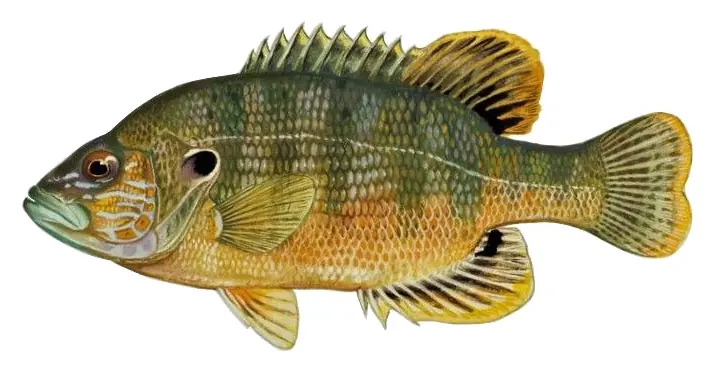
Game fish recorded in Mark Twain Lake include channel catfish, flathead catfish, bluegill, green sunfish, orangespotted sunfish. In all, 23 fish species have open records inside the lake on GBIF.
The surface of Mark Twain Lake was about 62°F on November 10, estimated from a satellite pass on a clear day. It is the top layer of the water, a few degrees either way; coves and shallows run warmer in the sun.
Anglers 16 and older need a Missouri fishing license, sold online by the Missouri Department of Conservation. Free fishing days: Saturday and Sunday following the first Monday in June. Size and bag limits can be set lake by lake: check the current regulations.
In summer a white Secchi disk lowered into Mark Twain Lake stays visible to about 3.5 ft (the median of 202 readings, 2016–2025, by Univ. of Missouri, Columbia and Missouri Dept. of Natural Resources): somewhat murky water. With the algae measured too (chlorophyll about 15 µg/L), that makes it eutrophic: rich in nutrients, greener water. Clarity drops after storms and during algae blooms.
U.S. Army Corps of Engineers lists boating, climbing, historic sites, camping, fishing, hiking, horseback riding and picnicking at Mark Twain Lake. 5 campgrounds can be booked on Recreation.gov.
EPA's CyAN satellite rated cyanobacteria in Mark Twain Lake not detected on November 9. The satellite sees open water only; blooms can be patchy, so avoid water that looks like spilled paint or pea soup and keep dogs out of scum. Swimming advisories come from Missouri health and environment agencies.
Yes. 9 trails run along or near the shore, including Cabin Loop (4.4 mi), Dogwood Trail (1.9 mi) and Joanna Trail (19 mi), according to OpenStreetMap.
Mark Twain Lake is held back by Clarence Cannon Dam, completed in 1983 and 138 ft high, according to the National Inventory of Dams.
From the NOAA National Water Prediction Service (Salt River above Clarence Cannon Dam (pool)). Lake by Lake checks it every hour; the agency's own figure is always the reference, and provisional readings can be revised.
Lake levels are refreshed every hour. Texas and California reservoirs report once a day; most USGS and NOAA gauges report every 15 to 60 minutes.
Cookies for analytics With your OK we use Google Analytics and Microsoft Clarity to count visits and see how the site is used, so we can make it better. No advertising cookies. Privacy policy