Sun
- Sunrise
- 7:46 AM
- Sunset
- 4:56 PM
- First light
- 7:12 AM
- Last light
- 5:30 PM
Lake · Lake County, Montana
A lake fed by the Flathead River in Lake County, Montana, held back by Selis Ksanka Qlispe Dam since 1938.

Flathead Lake is at 2,890.67 feet above sea level — 2.33 ft below full pool, as of Nov 18, 2026, 10:30 PM MST. It has dropped 0.18 ft in the past 7 days.
Fullest of 13 Montana lakes today against full pool · See the ranking
Record low 2,883.13 ft (2008), record high 2,893.57 ft (2022) · Level history since 1999
A notification from this browser, once, when the level crosses the line (checked every hour). No account and no email. On an iPhone, add Lake by Lake to your home screen first (Share → Add to Home Screen) and open it from there. Or follow the lake in a feed reader: RSS feed.
Flathead Lake is down 0.18 ft over the last 7 days, at 2,890.67 ft today.
Daily values from the U.S. Geological Survey.
Flathead Lake is down 1.23 ft over the last 30 days, at 2,890.67 ft today.
Daily values from the U.S. Geological Survey.
Over the past 12 months, Flathead Lake ranged from 2,886.35 ft (Mar 20, 2026) to 2,893.15 ft (Jul 2, 2026), a swing of 6.8 ft. Today's level is in the upper half of that range. It is 0.51 ft lower than on this date last year.
Daily values from the U.S. Geological Survey. Why lake levels rise and fall
In the U.S. Geological Survey record, which starts in 1999, the lowest level was 2,883.13 ft on April 10, 2008 and the highest 2,893.57 ft on June 24, 2022. Today’s 2,890.67 ft is 7.5 ft above the record low and 2.9 ft below the record high.
Flathead Lake level history: every year since 1999, the lowest and highest years →
Solunar periods for Flathead Lake, local time. How they work
Low · as of Nov 7, 2026
Some cyanobacteria at the surface, under 100,000 cells/mL. About 69,800 cells/mL at the worst spot, covering less than 1% of the lake.
Week of Aug 16Week of Nov 1
Each bar is one week, colored by the worst reading of that week.
From the U.S. EPA's Cyanobacteria Assessment Network (CyAN), which reads the color of lakes from the Sentinel-3 satellites; it sees open water only, not coves or the shoreline. Blooms can be patchy: what you see on the water matters more. Swimming closures and health advisories come from Montana health and environment agencies. How to read it
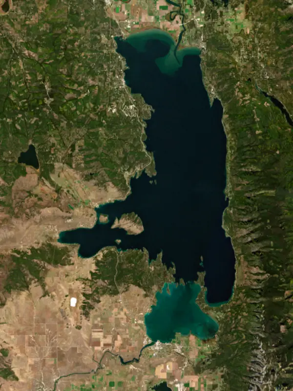
Surface water temperature
54°F on Oct 25, 2026
72°F · Jul 2154°F · Oct 25
19°F cooler than on Jul 21, 2026.
Estimated from MODIS Aqua (NASA) passes on clear days: the top layer of the water, a few degrees either way. Coves and the shallows can be warmer.
Flathead Lake water temperature: trend, swimming and the fish →
On or near the shore of Flathead Lake: 13 boat ramps, 8 marinas, 13 rental outfits, 22 campgrounds, 10 beaches, 11 trails and 2 fishing guides. The lake has about 184 miles of shoreline, counting its islands.
Tap an icon for details; use two fingers (or Ctrl + scroll) to move the map. Tap a dot for details. Map and lake outline © OpenStreetMap contributors. Places from OpenStreetMap, Overture Maps and Recreation.gov. Not for navigation.
What you’ll find on the shore
← AllBoating 21
← AllRentals & tours 17
← AllFishing spots 4
← AllBeaches 10
← AllCamping 22
← AllLodging 24+
← AllTrails 11
← AllParks 20+
← AllDining 24+
These invasive plants and animals have been recorded in Flathead Lake: clean, drain and dry everything before you go to another lake.
Montana: Stop at every open watercraft inspection station, and have any boat coming from out of state inspected before it touches Montana water (out-of-state wake and ballast boats must also be decontaminated). When you pull out, remove all plants and drain bilges, livewells, ballast tanks, motors and bait buckets before leaving the ramp area. Required: Vessel AIS Prevention Pass (out-of-state boats) ($30 a year for out-of-state motorboats, $10 for nonmotorized). State rules
Records: USGS Nonindigenous Aquatic Species database. A species not listed may still be present.
Species with open-licensed records inside Flathead Lake's outline, from GBIF.org (surveys, museum collections and angler reports). A record shows a fish was found here, not how many there are now.
Shallow, protected flats in spring; docks, grass and deep edges in summer heat.
Cool water: near the surface in spring and fall, deep in summer.
Shallow, weedy bays right after ice-out; weed edges the rest of the year.
Deep and cold most of the year; shallow reefs in fall and right after ice-out.
Schools at a set depth in summer: trolling at the right depth is everything.
Water temperature sets off each spawn; the bars show the usual months at this latitude and elevation, and move with a warm or cold spring.
Flathead Lake fills the floor of a glacier-scoured valley in northwest Montana, between the Mission Mountains on the east and the Salish Mountains on the west, about 7 miles south of Kalispell. Montana Fish, Wildlife and Parks calls it the largest natural freshwater lake by surface area in the western United States. Its southern half lies within the Flathead Indian Reservation, home of the Confederated Salish and Kootenai Tribes.
Glaciers ground through this valley during the last ice age, which ended about 12,000 years ago. As the ice melted back, it left the Polson terminal moraine, the high ground that rises south of the lake, and a bedrock hill buried beneath it kept the lake from draining away after the moraine was partly cut through. The Salish, Kootenai and Pend d'Oreille have their own names for the water, and it was once known as Salish Lake. The English name comes from Flathead, a label others mistakenly gave the Salish people. The Treaty of Hellgate in 1855 set aside the Flathead Reservation, which takes in much of the lake. From 1885 to 1910, steamboats carried passengers and freight the length of the lake, from Demersville in the north to Polson in the south.
Flathead is a natural lake, but a dam on the outlet near Polson now controls its top 10 feet. A subsidiary of the Montana Power Company began building it in 1930, and it went into operation in 1938 as Kerr Dam, generating power and supplying irrigation water. When the license came up for renewal, the Confederated Salish and Kootenai Tribes filed a competing application, and a 1985 settlement gave them a path to take over the project. On September 5, 2015, they became the first tribes in the nation to own a major hydroelectric dam. Federal regulators approved the new name, Seli'š Ksanka Qlispe', that November, and the tribal company Energy Keepers runs it. Hungry Horse Dam stands upstream on the South Fork of the Flathead. In the drought of 2023 the lake sat abnormally low.
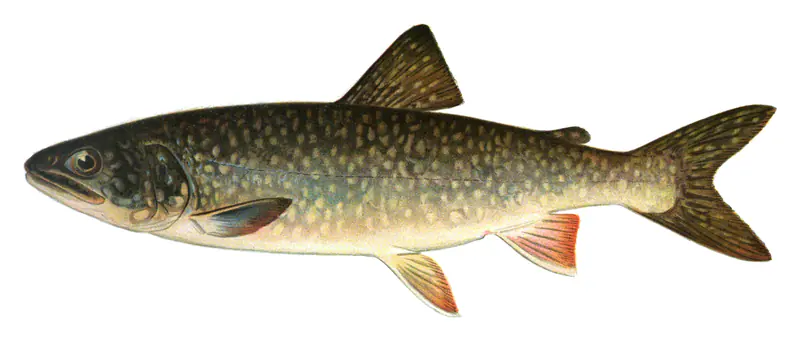
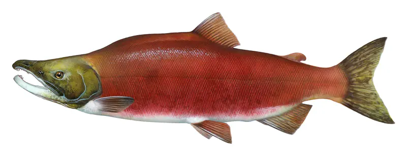
Bull trout and westslope cutthroat trout are the lake's native trout. Mysis shrimp, brought in to feed kokanee salmon and first noted in the lake in 1981, upended the food web instead, and the kokanee disappeared. Lake trout multiplied and now make up most of the catch, lake whitefish are plentiful, and the native trout have declined. The tribes and the state adopted a joint plan in 2000 to protect native trout, and their later plans call for reducing lake trout through fishing and netting. The tribes' Mack Days contest, first held in the fall of 2002, encourages anglers to catch and keep lake trout, also called mackinaw. Anyone fishing the southern half of the lake needs a tribal fishing license.
Wild Horse Island, the largest island on the lake at about 2,160 acres, is a day-use state park reached only by boat. Kootenai people reportedly kept horses there to protect them from raids, and today it holds bighorn sheep, mule deer, bald eagles, falcons and a handful of wild horses. Pets are not allowed, and bears visit the island too. Flathead Lake State Park has five mainland units as well. Big Arm and West Shore sit on the west side along U.S. 93, Finley Point and Yellow Bay on the east shore, and Wayfarers near Bigfork, where the Swan River enters the lake. Cherry orchards line the east shore, where the climate is mild for so far north, and Glacier National Park lies about 30 miles to the northeast.
Written by Lake by Lake from Wikipedia, University of Montana, U.S. Department of Energy, Montana Fish, Wildlife and Parks (Flathead Lake State Park, Wild Horse Island) and Confederated Salish and Kootenai Tribes, Mack Days. Checked November 2026.
Selis Ksanka Qlispe Dam is a concrete arch dam 200 feet high and 675 feet long, completed in 1938. It belongs to Energy Keepers, Inc. and is run for hydropower and recreation. At its normal level the lake holds 1.79 million acre-ft, drained from 7,096 square miles of land.
From the National Inventory of Dams (U.S. Army Corps of Engineers), NID ID MT00226. Lake or reservoir: what’s the difference?
Where the level comes from: Flathead Lake at Polson MT (U.S. Geological Survey, used on this page) and Flathead Lake at Polson (NOAA National Water Prediction Service).
| Lake | Miles | Level (ft) | vs full | 7 days |
|---|---|---|---|---|
| Hungry Horse Reservoir Live reading | 45 | 3536.90 | — | −0.80 |
| Gibson Reservoir Well below full | 65 | 4609.84 | −114.16 | +0.45 |
| Lake Koocanusa Well below full | 76 | 2440.26 | −18.74 | −1.68 |
| Pishkun Reservoir Well below full | 77 | 4349.24 | −20.76 | 0.00 |
| Willow Creek Reservoir Live reading | 81 | 4133.62 | — | +0.94 |
| Lake Sherburne Well below full | 84 | 4748.54 | −39.46 | +1.14 |
Compare Flathead Lake with Hungry Horse Reservoir, Gibson Reservoir, Lake Koocanusa or Pishkun Reservoir: size, level, ramps and fish side by side.
Flathead Lake is at 2,890.67 feet above sea level — 2.33 ft below full pool, as of Nov 18, 2026, 10:30 PM MST. It has dropped 0.18 ft in the past 7 days.
Flathead Lake's full pool is 2,893.00 ft, according to Energy Keepers (Seli'š Ksanka Qlispe' Dam). Today the lake is 2.33 ft below that mark.
Today's level is 1.28 ft above the median for this date (2,889.39 ft), from the gauge’s long-term daily record.
2,883.13 ft, on April 10, 2008, in the U.S. Geological Survey record, which starts in 1999. Today the lake is 7.5 ft above that.
2,893.57 ft, on June 24, 2022, in the U.S. Geological Survey record since 1999. That is 0.6 ft above full pool.
Flathead Lake has 13 boat ramps on our map, including Boat ramp at Glacier National Park Montana, Boat ramp at Salish Point Swimming Access, Boat ramp at Walstead Park, and 8 marinas. Low water can close ramps, so check today's level above and the operator before you go.
Yes. There are 22 campgrounds and RV parks within about a mile of the shore, such as Woods Bay Marina & RV Park, Trinity Lutheran Camp, Flathead Lutheran Bible Camp.
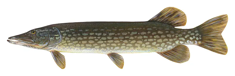
Game fish recorded in Flathead Lake include rainbow trout, largemouth bass, lake trout, yellow perch, kokanee salmon, northern pike. In all, 16 fish species have open records inside the lake on GBIF.
Anglers 12 and older need a Montana fishing license, sold online by the Montana Fish, Wildlife & Parks. Free fishing days: Mother's Day weekend and Father's Day weekend. Size and bag limits can be set lake by lake: check the current regulations.
Flathead Lake is about 371 ft deep at its deepest point. Depth changes with the lake level.
Yes: bathymetric map from the Montana Fish, Wildlife & Parks. It is linked in the lake facts on this page. Depths on a map are measured at a reference level: subtract how far the lake is below it today.
boating (13 boat ramps and 8 marinas), kayaks, boats & jet skis (13 rental outfits on or near the water), boat tours (4 boat tours and charters), fishing (11 game fish and 2 fishing guides), swimming (10 beaches and swimming areas) and hiking & walking (11 trails along the shore, the longest Beardance Trail (6.4 mi)), according to our map of the shore.
EPA's CyAN satellite rated cyanobacteria in Flathead Lake low on November 7. The satellite sees open water only; blooms can be patchy, so avoid water that looks like spilled paint or pea soup and keep dogs out of scum. Swimming advisories come from Montana health and environment agencies.
Yes. 11 trails run along or near the shore, including Trail #2 (2.2 mi), Pileated Path (0.5 mi) and Bluebird Boulevard Trail (1.1 mi), according to OpenStreetMap.
Flathead Lake is held back by Selis Ksanka Qlispe (Skq), completed in 1938 and 200 ft high, according to the National Inventory of Dams.
From the U.S. Geological Survey (Flathead Lake at Polson MT). Lake by Lake checks it every hour; the agency's own figure is always the reference, and provisional readings can be revised.
Lake levels are refreshed every hour. Texas and California reservoirs report once a day; most USGS and NOAA gauges report every 15 to 60 minutes.
Cookies for analytics With your OK we use Google Analytics and Microsoft Clarity to count visits and see how the site is used, so we can make it better. No advertising cookies. Privacy policy