Sun
- Sunrise
- 6:45 AM
- Sunset
- 4:40 PM
- First light
- 6:16 AM
- Last light
- 5:09 PM
Lake · Washoe County, Nevada
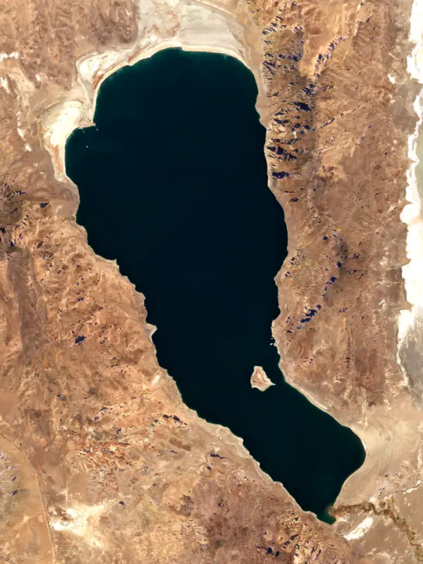
A lake fed by the Truckee River in Washoe County, Nevada.

Pyramid Lake is at 3,801.30 feet above sea level, as of Nov 2, 2026, 11:30 AM PST.
A notification from this browser, once, when the level crosses the line (checked every hour). No account and no email. On an iPhone, add Lake by Lake to your home screen first (Share → Add to Home Screen) and open it from there. Or follow the lake in a feed reader: RSS feed.
Daily values from the U.S. Geological Survey. Why lake levels rise and fall
Solunar periods for Pyramid Lake, local time. How they work
Moderate · as of Nov 7, 2026
A bloom may be forming somewhere on the lake. Avoid water that looks like spilled paint or pea soup. About 217,000 cells/mL at the worst spot, covering less than 1% of the lake.
Week of Aug 16Week of Nov 1
Each bar is one week, colored by the worst reading of that week.
From the U.S. EPA's Cyanobacteria Assessment Network (CyAN), which reads the color of lakes from the Sentinel-3 satellites; it sees open water only, not coves or the shoreline. Blooms can be patchy: what you see on the water matters more. Swimming closures and health advisories come from Nevada health and environment agencies. How to read it
Surface water temperature
58°F on Nov 12, 2026
83°F · Jul 1958°F · Nov 12
24°F cooler than on Jul 19, 2026.
Estimated from MODIS Aqua (NASA) passes on clear days: the top layer of the water, a few degrees either way. Coves and the shallows can be warmer.
Pyramid Lake water temperature: trend, swimming and the fish →
On or near the shore of Pyramid Lake: 1 campground, 8 beaches and 1 fishing guide. The lake has about 78 miles of shoreline, counting its islands.
Tap an icon for details; use two fingers (or Ctrl + scroll) to move the map. Tap a dot for details. Map and lake outline © OpenStreetMap contributors. Places from OpenStreetMap, Overture Maps and Recreation.gov. Not for navigation.
No aquatic invasive species are on record for Pyramid Lake in the USGS database. Keep it that way: clean, drain and dry your boat between lakes.
Nevada: Every boat that can hold water, canoes and kayaks included, must display a Nevada AIS decal, and moving quagga mussels or other invasive species is illegal (wardens can hold the boat). Clean, drain (pull the plug) and dry before going to another lake; Lake Tahoe runs its own separate boat inspections. Required: Nevada AIS decal. State rules
Records: USGS Nonindigenous Aquatic Species database. A species not listed may still be present.
Species with open-licensed records inside Pyramid Lake's outline, from GBIF.org (surveys, museum collections and angler reports). A record shows a fish was found here, not how many there are now.
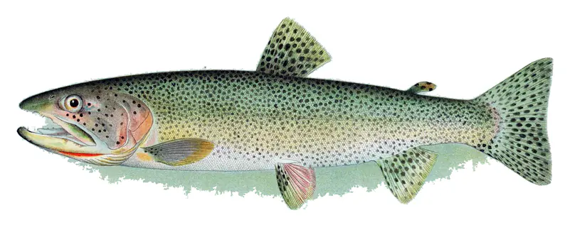
Cool water: near the surface in spring and fall, deep in summer.
Inlets and shorelines in spring; deeper as the lake warms.
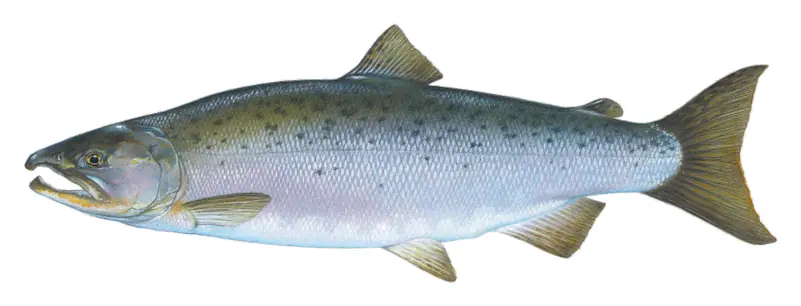
Near the surface in cool months; fall runs to the inlets.
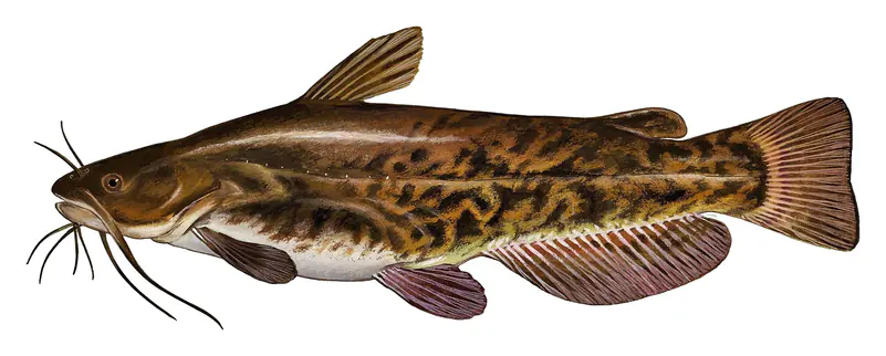
Soft, weedy bottoms in shallow bays; bites best after dark in late spring and summer.
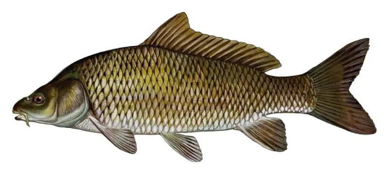
Shallow, muddy bays and flooded grass in spring; mud flats and inflows in summer.
Water temperature sets off each spawn; the bars show the usual months at this latitude and elevation, and move with a warm or cold spring. The water is about 58°F now.
Pyramid Lake is a large desert lake in Washoe County, Nevada, about 40 miles northeast of Reno, and it lies entirely within the reservation of the Pyramid Lake Paiute Tribe. It is the biggest piece left of Lake Lahontan, the Ice Age lake that once spread across much of northwestern Nevada. People know it for its tufa rocks, its white pelicans and its trophy Lahontan cutthroat trout.
The Truckee River, which carries the outflow of Lake Tahoe, is the lake's main source. It enters at the south end near the town of Nixon. Nothing flows out. Water leaves only through evaporation and seepage, so the lake is mildly salty, at about one-sixth the salinity of the ocean.
John C. Frémont reached the shore on January 10, 1844, and named the lake for the pyramid-shaped rock island off its east shore. The Paiute, who call themselves Numu, name that rock Wono. Their own name for the lake comes from the cui-ui, a large sucker found nowhere else, and the people here have long been known as the cui-ui eaters. Caves and rock shelters along the shore show they have lived at the lake for thousands of years. The reservation was set aside in 1859, and on May 12, 1860, Paiute fighters won the first Battle of Pyramid Lake against European American settlers.
Derby Dam was completed on the Truckee in 1905, about 10 miles above the reservation line. It turned 48 percent of the river into the 32-mile Truckee Canal to irrigate farms in the Carson River basin. The lake began to drop that year and kept dropping until 1967, by which time it had fallen 87 feet. Winnemucca Lake, a sister lake in the next basin to the east, dried up. Cut off from much of the river, the lake's native cutthroat had died out by the 1940s.
The cui-ui was on the first federal list of endangered species in 1967. The tribe used that protection to fight for water, taking its case as far as the Supreme Court, and a settlement followed in 1990. The Truckee River Operating Agreement, which put that settlement into practice, took effect in 2015.
The lake's trout were the largest inland cutthroat anywhere. The world record, 41 pounds, was caught by Johnny Skimmerhorn in 1925. In 1977 biologists came upon a single small population in a remote stream in the Pilot Mountains on the Nevada-Utah border that looked like the original lake fish, and genetic work published decades later matched them to museum specimens from Pyramid Lake. The U.S. Fish and Wildlife Service's Lahontan National Fish Hatchery Complex began raising them in 1995 and, working with the tribe, stocked them into the lake in 2006. By 2014 the first of them were running up the lower Truckee to spawn.
Fishing is run by the tribe, not the state. Anglers need a tribal permit instead of a Nevada license. The trout season runs from October 1 through June 30, and the rules call for barbless hooks and no bait of any kind. Sacramento perch, brought to the lake in 1877, may be fished all year.
Anaho Island, just south of the pyramid, became a national wildlife refuge in 1913 by order of President Woodrow Wilson. It holds one of the largest colonies of American white pelicans in the West. The island is closed to the public, and boats must stay 1,000 feet away. The tribe also keeps visitors away from the Needles at the north end, from the pyramid and the Stone Mother formation, and since 2011 from the north and east shores, to protect sacred sites. Camping and swimming also need a tribal permit, sold online or at the ranger station in Sutcliffe on the west shore. The tribe's museum and visitor center is in Nixon.
Written by Lake by Lake from Pyramid Lake Paiute Tribe, National Park Service, Nevada State Historic Preservation Office, U.S. Fish and Wildlife Service (From Peak to Pyramid, Anaho Island National Wildlife Refuge) and Wikipedia. Checked November 2026.
Where the level comes from: PYRAMID LAKE NR NIXON, NV (U.S. Geological Survey).
| Lake | Miles | Level (ft) | vs full | 7 days |
|---|---|---|---|---|
| Frenchman Lake Slightly below full | 37 | 5577.83 | −10.17 | +0.02 |
| Lake Lahontan Live reading | 43 | 4125.04 | — | +1.22 |
| Stampede Reservoir Well below full | 48 | 5919.31 | −29.39 | −0.26 |
| Lake Davis Slightly below full | 52 | 5769.98 | −5.02 | 0.00 |
| Boca Reservoir Well below full | 52 | 5558.71 | −46.29 | −2.13 |
| Prosser Creek Reservoir Well below full | 54 | 5700.71 | −40.49 | −2.53 |
Compare Pyramid Lake with Frenchman Lake, Lake Lahontan, Stampede Reservoir or Lake Davis: size, level, ramps and fish side by side.
Pyramid Lake is about 31 mi from Sparks, NV and 35 mi from Reno, NV. See all the lakes near each city.
Pyramid Lake is at 3,801.30 feet above sea level, as of Nov 2, 2026, 11:30 AM PST.
Yes. There is 1 campground within about a mile of the shore, such as Pyramid Lake Paiute Tribe.
Game fish recorded in Pyramid Lake include great basin cutthroat trout, rainbow trout, Coho salmon, brown bullhead, common carp. In all, 11 fish species have open records inside the lake on GBIF.
The surface of Pyramid Lake was about 58°F on November 12, estimated from a satellite pass on a clear day. It is the top layer of the water, a few degrees either way; coves and shallows run warmer in the sun.
Anglers 12 and older need a Nevada fishing license, sold online by the Nevada Department of Wildlife. Free fishing days: Second Saturday in June. Size and bag limits can be set lake by lake: check the current regulations.
Pyramid Lake is about 356 ft deep at its deepest point, and about 88 ft deep on average. Depth changes with the lake level.
Yes: reconnaissance bathymetric map from the U.S. Geological Survey (1970). It is linked in the lake facts on this page. Depths on a map are measured at a reference level: subtract how far the lake is below it today.
fishing (5 game fish and 1 fishing guide), swimming (8 beaches and swimming areas), camping (1 campground), cabins & lodging (2 places to stay close to the water) and parks & picnics (1 park on the shore), according to our map of the shore.
EPA's CyAN satellite rated cyanobacteria in Pyramid Lake moderate on November 7. The satellite sees open water only; blooms can be patchy, so avoid water that looks like spilled paint or pea soup and keep dogs out of scum. Swimming advisories come from Nevada health and environment agencies.
From the U.S. Geological Survey (PYRAMID LAKE NR NIXON, NV). Lake by Lake checks it every hour; the agency's own figure is always the reference, and provisional readings can be revised.
Lake levels are refreshed every hour. Texas and California reservoirs report once a day; most USGS and NOAA gauges report every 15 to 60 minutes.