Sun
- Sunrise
- 6:48 AM
- Sunset
- 4:43 PM
- First light
- 6:19 AM
- Last light
- 5:11 PM
Lake · Placer County, California
A lake fed by Griff Creek in California and Nevada, held back by Lake Tahoe Dam since 1913.

Lake Tahoe is at 6,226.54 feet above sea level — 2.56 ft below legal maximum, as of Nov 19, 2026, 1:00 AM PST. It has risen 0.09 ft in the past 7 days.
Fullest of 10 California lakes today against full pool · See the ranking
Record low 6,221.37 ft (2015), record high 6,229.16 ft (2024) · Level history since 2013
A notification from this browser, once, when the level crosses the line (checked every hour). No account and no email. On an iPhone, add Lake by Lake to your home screen first (Share → Add to Home Screen) and open it from there. Or follow the lake in a feed reader: RSS feed.
Lake Tahoe is up 0.09 ft over the last 7 days, at 6,226.54 ft today.
Daily values from the NOAA National Water Prediction Service.
Lake Tahoe is down 0.08 ft over the last 30 days, at 6,226.54 ft today.
Daily values from the NOAA National Water Prediction Service.
Over the past 12 months, Lake Tahoe ranged from 6,226.43 ft (Nov 13, 2026) to 6,228.72 ft (May 12, 2026), a swing of 2.3 ft. Today's level is near the bottom of that range. It is 0.23 ft lower than on this date last year.
Daily values from the NOAA National Water Prediction Service. Why lake levels rise and fall
In the U.S. Army Corps of Engineers record, which starts in 2013, the lowest level was 6,221.37 ft on December 9, 2015 and the highest 6,229.16 ft on April 7, 2024. Today’s 6,226.54 ft is 5.2 ft above the record low and 2.6 ft below the record high.
Lake Tahoe level history: every year since 2013, the lowest and highest years →
Solunar periods for Lake Tahoe, local time. How they work
Low · as of Nov 7, 2026
Some cyanobacteria at the surface, under 100,000 cells/mL. About 12,600 cells/mL at the worst spot, covering less than 1% of the lake.
Week of Aug 16Week of Nov 1
Each bar is one week, colored by the worst reading of that week.
From the U.S. EPA's Cyanobacteria Assessment Network (CyAN), which reads the color of lakes from the Sentinel-3 satellites; it sees open water only, not coves or the shoreline. Blooms can be patchy: what you see on the water matters more. Swimming closures and health advisories come from California health and environment agencies. How to read it
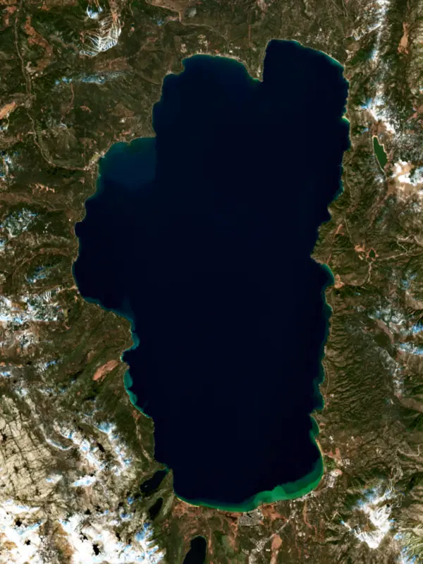
Surface water temperature
49°F on Nov 15, 2026
71°F · Jul 2449°F · Nov 15
22°F cooler than on Jul 24, 2026.
Estimated from Landsat 8/9 (USGS) passes on clear days: the top layer of the water, a few degrees either way. Coves and the shallows can be warmer.
Lake Tahoe water temperature: trend, swimming and the fish →
On or near the shore of Lake Tahoe: 13 boat ramps, 15 marinas, 32 rental outfits, 24 campgrounds, 60 beaches, 18 trails and 2 fishing guides. The lake has about 92 miles of shoreline, counting its islands.
Tap an icon for details; use two fingers (or Ctrl + scroll) to move the map. Tap a dot for details. Map and lake outline © OpenStreetMap contributors. Places from OpenStreetMap, Overture Maps and Recreation.gov. Not for navigation.
What you’ll find on the shore
← AllBoating 28
← AllRentals & tours 49
← AllFishing spots 3
← AllBeaches 60
← AllCamping 24
← AllLodging 24+
← AllTrails 18
← AllParks 20+
← AllDining 24+
These invasive plants and animals have been recorded in Lake Tahoe: clean, drain and dry everything before you go to another lake.
California: California-registered motorized boats used in fresh water must display a current Mussel Fee sticker. Many lakes and reservoirs run mandatory inspections or quarantines, moving quagga, zebra or golden mussels is illegal, and boaters are asked to clean, drain and dry. Required: Quagga and Zebra Mussel Fee sticker ($42 every two years ($21 if bought in an even-numbered year)). State rules
Nevada: Every boat that can hold water, canoes and kayaks included, must display a Nevada AIS decal, and moving quagga mussels or other invasive species is illegal (wardens can hold the boat). Clean, drain (pull the plug) and dry before going to another lake; Lake Tahoe runs its own separate boat inspections. Required: Nevada AIS decal. State rules
Records: USGS Nonindigenous Aquatic Species database. A species not listed may still be present.
Species with open-licensed records inside Lake Tahoe's outline, from GBIF.org (surveys, museum collections and angler reports). A record shows a fish was found here, not how many there are now.
Cool water: near the surface in spring and fall, deep in summer.
Low light and cold water; the inflows in fall.
Deep and cold most of the year; shallow reefs in fall and right after ice-out.
Schools at a set depth in summer: trolling at the right depth is everything.
Inlets and shorelines in spring; deeper as the lake warms.
Water temperature sets off each spawn; the bars show the usual months at this latitude and elevation, and move with a warm or cold spring. The water is about 49°F now.
Lake Tahoe lies high in the Sierra Nevada on the line between California and Nevada, east of the main Sierra crest. It is the second deepest lake in the United States and is famous for its clear blue water, which scientists have measured regularly since 1968.
The Washoe were the first people of the Tahoe basin. They spent the warm months around the lake hunting, fishing and gathering, then moved down to the valleys of Nevada and California for the winter. They called the lake da-ow-aga and revere it as the center of the Washoe world, and the name Tahoe comes from a Washoe word interpreted as edge of the lake. Between 1848 and 1862, during the gold and silver rushes, the Washoe lost an estimated 10,000 square miles of land, and newcomers logged off the surrounding forests to build mines and towns. Logging and overfishing also helped wipe out the lake's only native trout, the Lahontan cutthroat, which was gone by the 1930s. The Washoe Tribe of Nevada and California continues to work to reclaim parts of its homeland.
The basin formed as mountains rose to its east and west, and glaciers, landslides and lava from volcanic vents, mostly to the north, finished the job. Glaciers gouged out Emerald Bay on the west shore, and the two points at its mouth are their end moraines. Fannette Island, a granite knob in the bay, is the only island in the lake. In 1929 Lora Knight finished Vikingsholm, a summer house at the head of the bay modeled on old Norwegian farmsteads and stave churches. Vikingsholm is a mile down a steep trail from the Highway 89 overlook. The waters at the mouth of the bay became California's first underwater shipwreck preserve in 1994, with sunken barges and small boats for divers to find.
Sixty-three streams feed the lake, the largest being the Upper Truckee River. Only one leaves it: the Truckee River, which flows out at Tahoe City, through Truckee and Reno, and ends in Pyramid Lake in Nevada. A dam first went up at the outlet in 1870 and was rebuilt in concrete in 1913. It belongs to the Newlands Project, one of the Bureau of Reclamation's first water projects. Its 17 gates control only the top 6.1 feet of the lake, and a federal water master appointed by the U.S. District Court runs it day to day. When dry years drop the lake below its natural rim, the Truckee stops flowing out entirely, as it did from October to December 2022. The lowest level on record came on Nov. 30, 1992, nearly 3 feet below the rim.
Clarity is measured by lowering a white disk until it disappears. Summer readings have worsened steadily over the long record while winter readings have improved. Mysis shrimp, put in the lake on purpose in the 1960s, are linked to lost clarity, and Asian clams, first recorded in 2002, have spread from the southeast shore toward the north end. After quagga mussels turned up in Lake Mead in 2007, Tahoe began inspecting boats, and launch ramps are now gated so no uninspected boat can get on the water.
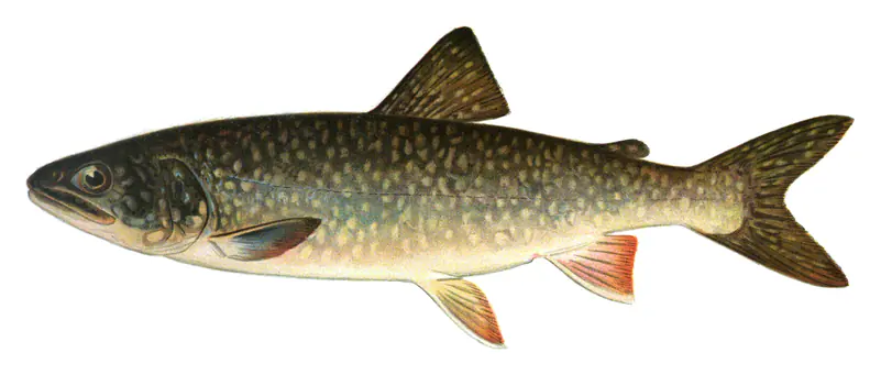
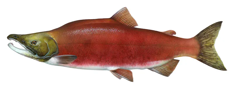
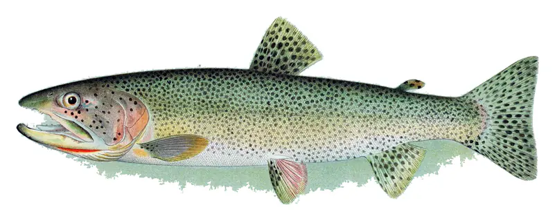
The fishing is built mostly on introduced fish. Lake trout, called mackinaw here, make up most of the catch and are taken by deep trolling and jigging from boats. Kokanee, also caught by trolling, make up about a quarter of the catch, and stocked rainbow trout are the best bet from shore at Sand Harbor and Cave Rock on the Nevada side. In 2019 a federal hatchery released the first Lahontan cutthroat from a line descended from the original Tahoe fish, and the native trout has been stocked since.
Written by Lake by Lake from California State Parks, U.S. Bureau of Reclamation, UC Davis Tahoe Environmental Research Center, Nevada Department of Wildlife, U.S. Fish and Wildlife Service and Tahoe Resource Conservation District. Checked November 2026.
Activities listed by the USDA Forest Service: Biking · Boating · Camping · Ranger programs · Fishing · Hiking · Horseback riding · Off-road vehicles · Visitor center · Swimming
Lake Tahoe Dam is a buttress dam 18 feet high and 109 feet long, completed in 1913. It belongs to the Bureau of Reclamation and is run for irrigation. At its normal level the lake holds 732,000 acre-ft, drained from 507 square miles of land.
From the National Inventory of Dams (U.S. Army Corps of Engineers), NID ID CA10162. Lake or reservoir: what’s the difference?
Where the level comes from: Lake Tahoe at Tahoe City (NOAA National Water Prediction Service).
| Lake | Miles | Level (ft) | vs full | 7 days |
|---|---|---|---|---|
| Marlette Lake Live reading | 11 | 18.82 | — | +0.28 |
| Donner Lake Below full | 13 | 5929.12 | −6.68 | −0.63 |
| Prosser Creek Reservoir Well below full | 14 | 5700.26 | −40.94 | −2.53 |
| Boca Reservoir Well below full | 14 | 5558.92 | −46.08 | −1.41 |
| Loon Lake Below full | 17 | 6389.31 | −20.69 | +0.05 |
| Stampede Reservoir Well below full | 20 | 5919.31 | −29.39 | −0.26 |
Compare Lake Tahoe with Marlette Lake, Donner Lake, Prosser Creek Reservoir or Boca Reservoir: size, level, ramps and fish side by side.
Lake Tahoe is about 29 mi from Reno, NV and 35 mi from Sparks, NV. See all the lakes near each city.
Lake Tahoe is at 6,226.54 feet above sea level — 2.56 ft below legal maximum, as of Nov 19, 2026, 1:00 AM PST. It has risen 0.09 ft in the past 7 days.
Lake Tahoe's legal maximum is 6,229.10 ft, according to Truckee River Operating Agreement. Today the lake is 2.56 ft below that mark.
Today's level is 0.27 ft above the median for this date (6,226.27 ft), from the gauge’s long-term daily record.
6,221.37 ft, on December 9, 2015, in the U.S. Army Corps of Engineers record, which starts in 2013. Today the lake is 5.2 ft above that.
6,229.16 ft, on April 7, 2024, in the U.S. Army Corps of Engineers record since 2013. That is 0.1 ft above legal maximum.
Lake Tahoe has 13 boat ramps on our map, including Boat ramp at Kings Beach Boat Dock, Boat ramp at Lakeside Marina, Boat ramp at South Lake Tahoe Recreation Area, and 15 marinas. Low water can close ramps, so check today's level above and the operator before you go.
Yes. There are 24 campgrounds and RV parks within about a mile of the shore, such as Wright's Lake Campground, Camp Galilee, Emerald Bay Boat Camp.
Game fish recorded in Lake Tahoe include great basin cutthroat trout, lake trout, kokanee salmon, rainbow trout, brown trout, brook trout. In all, 16 fish species have open records inside the lake on GBIF.
The surface of Lake Tahoe was about 49°F on November 15, estimated from a satellite pass on a clear day. It is the top layer of the water, a few degrees either way; coves and shallows run warmer in the sun.
Lake Tahoe lies in California and Nevada: the license of the state where you fish applies. Anglers 16 and older need a California fishing license, sold online by the California Department of Fish and Wildlife. Free fishing days: Two Saturdays a year (2027: July 3 and September 4). Anglers 12 and older need a Nevada fishing license, sold online by the Nevada Department of Wildlife. Free fishing days: Second Saturday in June. Size and bag limits can be set lake by lake: check the current regulations.
NOAA's flood categories for the Lake Tahoe gauge: action stage at 6228.7 ft and minor flooding at 6229.1 ft. Today the lake is 2.56 ft below the first flooding level.
Lake Tahoe is about 1,644 ft deep at its deepest point, and about 927 ft deep on average. Depth changes with the lake level.
Yes: bathymetric map from the U.S. Geological Survey (1999). It is linked in the lake facts on this page. Depths on a map are measured at a reference level: subtract how far the lake is below it today.
USDA Forest Service lists biking, boating, camping, ranger programs, fishing, hiking, horseback riding and off-road vehicles at Lake Tahoe Basin Management Unit. 8 campgrounds can be booked on Recreation.gov.
EPA's CyAN satellite rated cyanobacteria in Lake Tahoe low on November 7. The satellite sees open water only; blooms can be patchy, so avoid water that looks like spilled paint or pea soup and keep dogs out of scum. Swimming advisories come from California health and environment agencies.
Yes. 18 trails run along or near the shore, including Lakefront Interpretive Trail (0.4 mi), Rubicon Trail (5.8 mi) and Edward F. Dolder Nature Trail (1.3 mi), according to OpenStreetMap.
Lake Tahoe is held back by Lake Tahoe Dam, completed in 1913 and 18 ft high, according to the National Inventory of Dams.
From the NOAA National Water Prediction Service (Lake Tahoe at Tahoe City). Lake by Lake checks it every hour; the agency's own figure is always the reference, and provisional readings can be revised.
Lake levels are refreshed every hour. Texas and California reservoirs report once a day; most USGS and NOAA gauges report every 15 to 60 minutes.
Cookies for analytics With your OK we use Google Analytics and Microsoft Clarity to count visits and see how the site is used, so we can make it better. No advertising cookies. Privacy policy