Sun
- Sunrise
- 7:06 AM
- Sunset
- 4:42 PM
- First light
- 6:35 AM
- Last light
- 5:13 PM
Lake · Ontario County, New York
A lake fed by Sucker Brook in Ontario County, New York.

Canandaigua Lake is at 687.11 feet above sea level, as of Nov 19, 2026, 3:15 AM EST. The level has held steady over the past week.
A notification from this browser, once, when the level crosses the line (checked every hour). No account and no email. On an iPhone, add Lake by Lake to your home screen first (Share → Add to Home Screen) and open it from there. Or follow the lake in a feed reader: RSS feed.
Canandaigua Lake has held steady over the last 7 days (within 0.05 ft).
Daily values from the NOAA National Water Prediction Service.
Canandaigua Lake is down 0.34 ft over the last 30 days, at 687.11 ft today.
Daily values from the NOAA National Water Prediction Service. Why lake levels rise and fall
Solunar periods for Canandaigua Lake, local time. How they work
Not detected · as of Nov 9, 2026
The satellite found no cyanobacteria at the surface.
Week of Aug 9Week of Nov 1
Each bar is one week, colored by the worst reading of that week.
From the U.S. EPA's Cyanobacteria Assessment Network (CyAN), which reads the color of lakes from the Sentinel-3 satellites; it sees open water only, not coves or the shoreline. Blooms can be patchy: what you see on the water matters more. Swimming closures and health advisories come from New York health and environment agencies. How to read it
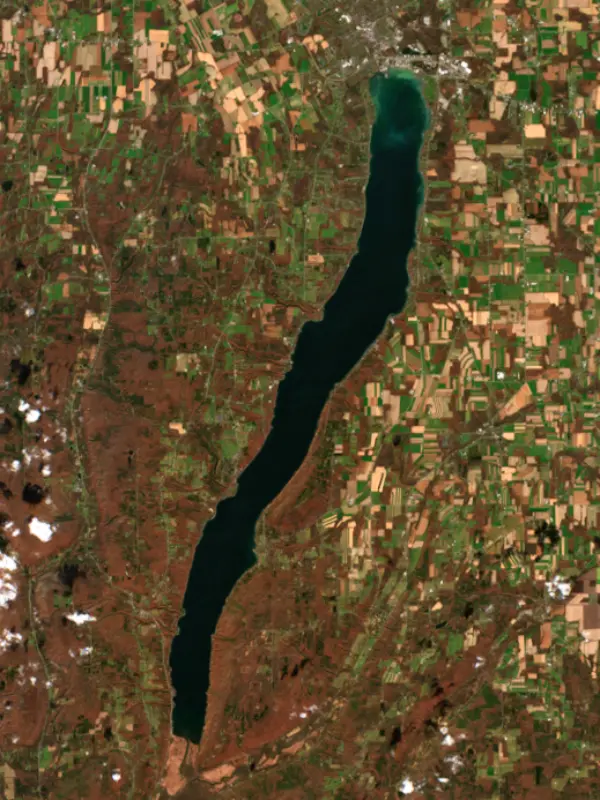
Surface water temperature
58°F on Nov 2, 2026
74°F · Aug 2258°F · Nov 2
16°F cooler than on Aug 22, 2026.
Estimated from Landsat 8/9 (USGS) passes on clear days: the top layer of the water, a few degrees either way. Coves and the shallows can be warmer.
Canandaigua Lake water temperature: trend, swimming and the fish →
On or near the shore of Canandaigua Lake: 4 boat ramps, 9 marinas, 2 rental outfits, 1 campground, 6 beaches, 1 fishing pier and 3 trails. The lake has about 38 miles of shoreline, counting its islands.
Tap an icon for details; use two fingers (or Ctrl + scroll) to move the map. Tap a dot for details. Map and lake outline © OpenStreetMap contributors. Places from OpenStreetMap, Overture Maps and Recreation.gov. Not for navigation.
What you’ll find on the shore
← AllBoating 13
← AllRentals & tours 2
← AllFishing spots 1
← AllBeaches 6
← AllCamping 1
← AllLodging 20
← AllTrails 3
← AllParks 5
← AllDining 16
Zebra mussels and Quagga mussels have been found in Canandaigua Lake. They clog intakes and engines and spread on boats and trailers: clean, drain and dry everything before you go to another lake.
New York: Before launching into public water, drain all water and remove any plants or animals from the boat, trailer and gear. In and within 10 miles of the Adirondack Park, motorboats must carry a clean-drain-dry certificate (free from a launch steward or self-issued), and trailered boats must pass an inspection before launching on Lake George. State rules
Records: USGS Nonindigenous Aquatic Species database. A species not listed may still be present.
The last stocking on record was in October 2025 (lake trout).
All 6 stockings · Source: New York State Department of Environmental Conservation stocking records.
Species with open-licensed records inside Canandaigua Lake's outline, from GBIF.org (surveys, museum collections and angler reports). A record shows a fish was found here, not how many there are now. marks fish the state stocks here.
Shallow, protected flats in spring; docks, grass and deep edges in summer heat.
Low light and cold water; the inflows in fall.
Deep and cold most of the year; shallow reefs in fall and right after ice-out.
Weedy shallows and lily pads all year.
Shallow, muddy bays and flooded grass in spring; mud flats and inflows in summer.
Water temperature sets off each spawn; the bars show the usual months at this latitude and elevation, and move with a warm or cold spring.
Canandaigua Lake is the westernmost of the major Finger Lakes, a long, deep lake that runs about 15.5 miles south from the city of Canandaigua toward the village of Naples. It lies in Ontario and Yates counties. The name comes from a Seneca word usually given as the chosen spot. Today the lake is the city's drinking water and a summer home for many Rochester families.
This is the heart of Seneca country. The Seneca call themselves the people of the great hill, and the archaeologist Arthur C. Parker, himself part Seneca, concluded that the hill was South Hill, known as Nundawao, at the head of the lake. He placed the earliest Seneca town in a bowl of land near Naples. Bare Hill, on the east shore, became tied to a story about a great serpent, but the Seneca historian G. Peter Jemison wrote that the elders he brought there did not know that legend. During the Revolutionary War the Seneca sided with the British, and in 1779 the Sullivan campaign burned their villages and crops. The Seneca recall hiding women and children that year on the lake's only island, a tiny patch of rock near the north end. Once called Squaw Island, it was renamed Skenoh Island in 2021, from a Seneca word for health or peace. The Treaty of Canandaigua was signed just north of the lake.
Bare Hill sits on the northern edge of the Allegheny Plateau and rises about 850 feet above the water. Early settlers grew wheat on it, then grazed sheep, and when the flocks disappeared the slopes grew back to brush and trees. In 1986 a landowner announced plans for a 33-home subdivision there. Local residents and Seneca people objected, the Trust for Public Land bought the ground, and in 1989 it went to the state as the Bare Hill Unique Area, open for hiking, hunting and cross-country skiing. Parker began lighting a bonfire on the summit to mark the end of summer, and the tradition continues. On the Saturday evening before Labor Day, the Bare Hill fire starts the Ring of Fire, when people around the shore light their own fires for peace and the harvest.
The watershed is more than 10 times the size of the lake. The West River and Naples Creek bring in water at the south end, and more than a hundred small streams and gullies run straight into the lake. Two gated channels drain the north end, both run by the City of Canandaigua. The Canandaigua Outlet is the main flood-control channel, and the Feeder Canal was dug in the early 1900s to carry the city's treated wastewater downstream. The lake is the only drinking-water source for the city and town of Canandaigua, and its water won statewide taste contests in 2013 and 2017. About 97 percent of the shoreline is private. Steamboats worked the lake from 1827 to 1935, and a replica paddleboat still runs cruises.
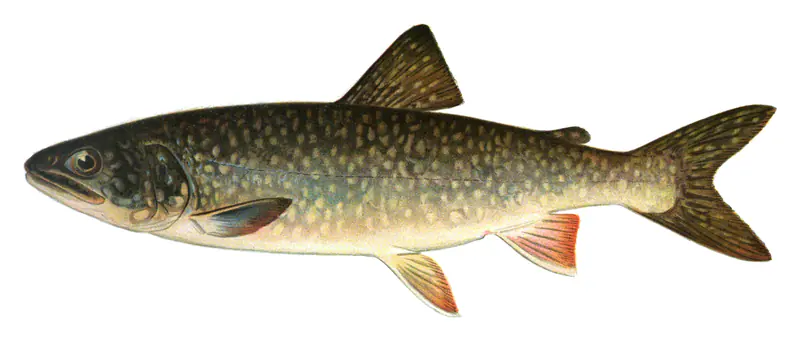
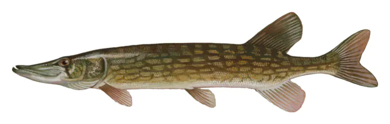
Lake trout are the main cold-water fish, kept going almost entirely by stocking, and stocked brown trout add to the mix. Rainbow trout reproduce on their own, and Naples Creek, their only significant spawning stream, is known for its rainbow fishing. Smallmouth bass do well over the rocky, gravelly bottom. Largemouth bass and chain pickerel hold in the weed beds at the north and south ends, yellow perch are caught all year, and the West River holds largemouth, crappie and bullhead. Alewife and rainbow smelt, the forage for the trout, have declined, and zebra and quagga mussels are one of the reasons. Bowfishing and spearfishing are not allowed.
Written by Lake by Lake from Canandaigua Lake Watershed Council (Setting, Fish and Wildlife), New York State Department of Environmental Conservation and Wikipedia. Checked November 2026.
Where the level comes from: Canandaigua Lake at Canandaigua (NOAA National Water Prediction Service).
| Lake | Miles | Level (ft) | vs full | 7 days |
|---|---|---|---|---|
| Seneca Lake Live reading | 17 | 443.85 | — | +0.26 |
| Keuka Lake Live reading | 18 | 713.09 | — | −0.10 |
| Conesus Lake Live reading | 23 | 816.76 | — | −0.21 |
| Cayuga Lake Live reading | 28 | 382.40 | — | — |
| Mount Morris Lake Live reading | 34 | 586.82 | — | +0.28 |
| Owasco Lake Live reading | 37 | 711.59 | — | −0.06 |
Compare Canandaigua Lake with Seneca Lake, Keuka Lake, Conesus Lake or Cayuga Lake: size, level, ramps and fish side by side.
Canandaigua Lake is about 27 mi from Rochester, NY, 58 mi from Syracuse, NY and 80 mi from Buffalo, NY. See all the lakes near each city.
Canandaigua Lake is at 687.11 feet above sea level, as of Nov 19, 2026, 3:15 AM EST. The level has held steady over the past week.
Canandaigua Lake has 4 boat ramps on our map, including Boat ramp at Canandaigua Lake State Marine Park, Onanda Park Boat Launch, Woodville Boat Launch, and 9 marinas. Low water can close ramps, so check today's level above and the operator before you go.
Yes. There is 1 campground within about a mile of the shore, such as Indian Village Campground.
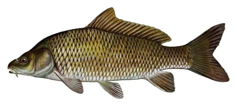
Game fish recorded in Canandaigua Lake include largemouth bass, lake trout, chain pickerel, common carp, cisco, rock bass. In all, 15 fish species have open records inside the lake on GBIF.
Anglers 16 and older need a New York fishing license, sold online by the New York State Department of Environmental Conservation. Free fishing days: Presidents’ Day weekend, a weekend in late June, National Hunting and Fishing Day (September) and Veterans Day. Size and bag limits can be set lake by lake: check the current regulations.
NOAA's flood categories for the Canandaigua Lake gauge: action stage at 689.0 ft, minor flooding at 690.0 ft, moderate flooding at 691.0 ft and major flooding at 692.0 ft. Today the lake is 2.89 ft below the first flooding level.
Canandaigua Lake is about 276 ft deep at its deepest point, and about 144 ft deep on average. Depth changes with the lake level.
In summer a white Secchi disk lowered into Canandaigua Lake stays visible to about 16.8 ft (the median of 62 readings, 2017–2020, by North American Lake Management Society): very clear water. Silt after rain lowers the reading as much as algae do. Clarity drops after storms and during algae blooms.
Yes: fishing map with depth contours from the New York State Department of Environmental Conservation. It is linked in the lake facts on this page. Depths on a map are measured at a reference level: subtract how far the lake is below it today.
boating (4 boat ramps and 9 marinas), kayaks, boats & jet skis (2 rental outfits on or near the water), fishing (7 game fish and 1 fishing pier or spot; stocked by the state), swimming (6 beaches and swimming areas), hiking & walking (3 trails along the shore, the longest Onanda Park Uplands Trail (1.3 mi)) and camping (1 campground), according to our map of the shore.
EPA's CyAN satellite rated cyanobacteria in Canandaigua Lake not detected on November 9. The satellite sees open water only; blooms can be patchy, so avoid water that looks like spilled paint or pea soup and keep dogs out of scum. Swimming advisories come from New York health and environment agencies.
Yes. New York State Department of Environmental Conservation stocked lake trout and brown trout in Canandaigua Lake; the latest stocking on record was in October 2025.
Yes. 3 trails run along or near the shore, including Onanda Park Uplands Trail (1.3 mi), Barnes Road Trail (0.8 mi) and Onanda Park Ridge Trail (0.5 mi), according to OpenStreetMap.
From the NOAA National Water Prediction Service (Canandaigua Lake at Canandaigua). Lake by Lake checks it every hour; the agency's own figure is always the reference, and provisional readings can be revised.
Lake levels are refreshed every hour. Texas and California reservoirs report once a day; most USGS and NOAA gauges report every 15 to 60 minutes.
Cookies for analytics With your OK we use Google Analytics and Microsoft Clarity to count visits and see how the site is used, so we can make it better. No advertising cookies. Privacy policy