Sun
- Sunrise
- 7:02 AM
- Sunset
- 4:37 PM
- First light
- 6:31 AM
- Last light
- 5:08 PM
Lake · Onondaga County, New York
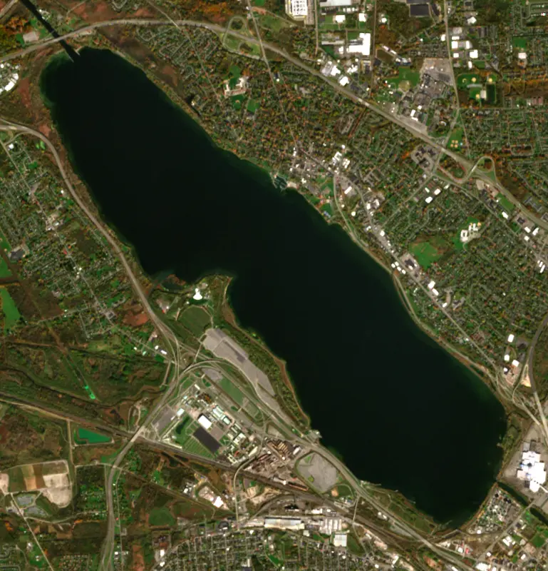
A lake fed by Ninemile Creek in Onondaga County, New York.

Onondaga Lake is at 363.33 feet above sea level, as of Nov 19, 2026, 3:30 AM EST. It has risen 0.11 ft in the past 7 days.
2nd highest of 8 New York lakes today against normal for the date · See the ranking
Record low 361.59 ft (1978), record high 369.77 ft (1993) · Level history since 1970
A notification from this browser, once, when the level crosses the line (checked every hour). No account and no email. On an iPhone, add Lake by Lake to your home screen first (Share → Add to Home Screen) and open it from there. Or follow the lake in a feed reader: RSS feed.
Onondaga Lake is up 0.11 ft over the last 7 days, at 363.33 ft today.
Daily values from the U.S. Geological Survey.
Onondaga Lake is up 0.29 ft over the last 30 days, at 363.33 ft today.
Daily values from the U.S. Geological Survey.
Over the past 12 months, Onondaga Lake ranged from 362.27 ft (Feb 17, 2026) to 366.22 ft (Apr 6, 2026), a swing of 4.0 ft. Today's level is in the lower half of that range. It is 0.51 ft lower than on this date last year.
Daily values from the U.S. Geological Survey. Why lake levels rise and fall
In the U.S. Geological Survey record, which starts in 1970, the lowest level was 361.59 ft on March 12, 1978 and the highest 369.77 ft on April 27, 1993. Today’s 363.33 ft is 1.7 ft above the record low and 6.4 ft below the record high.
Onondaga Lake level history: every year since 1970, the lowest and highest years →
Solunar periods for Onondaga Lake, local time. How they work
Not detected · as of Nov 9, 2026
The satellite found no cyanobacteria at the surface.
Week of Aug 16Week of Nov 1
Each bar is one week, colored by the worst reading of that week.
From the U.S. EPA's Cyanobacteria Assessment Network (CyAN), which reads the color of lakes from the Sentinel-3 satellites; it sees open water only, not coves or the shoreline. Blooms can be patchy: what you see on the water matters more. Swimming closures and health advisories come from New York health and environment agencies. How to read it
Surface water temperature
58°F on Nov 2, 2026
77°F · Aug 2258°F · Nov 2
19°F cooler than on Aug 22, 2026.
Estimated from Landsat 8/9 (USGS) passes on clear days: the top layer of the water, a few degrees either way. Coves and the shallows can be warmer.
Onondaga Lake water temperature: trend, swimming and the fish →
On or near the shore of Onondaga Lake: 2 boat ramps, 2 marinas, 1 fishing pier and 6 trails. The lake has about 13 miles of shoreline, counting its islands.
Tap an icon for details; use two fingers (or Ctrl + scroll) to move the map. Tap a dot for details. Map and lake outline © OpenStreetMap contributors. Places from OpenStreetMap, Overture Maps and Recreation.gov. Not for navigation.
What you’ll find on the shore
← AllBoating 4
← AllFishing spots 2
← AllLodging 9
← AllTrails 6
← AllParks 14
Zebra mussels and Quagga mussels have been found in Onondaga Lake. They clog intakes and engines and spread on boats and trailers: clean, drain and dry everything before you go to another lake.
New York: Before launching into public water, drain all water and remove any plants or animals from the boat, trailer and gear. In and within 10 miles of the Adirondack Park, motorboats must carry a clean-drain-dry certificate (free from a launch steward or self-issued), and trailered boats must pass an inspection before launching on Lake George. State rules
Records: USGS Nonindigenous Aquatic Species database. A species not listed may still be present.
Species with open-licensed records inside Onondaga Lake's outline, from GBIF.org (surveys, museum collections and angler reports). A record shows a fish was found here, not how many there are now.
Shallow, protected flats in spring; docks, grass and deep edges in summer heat.
Rocky points, gravel and current breaks; deeper rock piles in summer.
Rocky shorelines at night after ice-out; deep weed edges and humps in summer.
Beds in shallow, firm bottoms; around docks and weeds all summer.
Shallow, muddy bays and flooded grass in spring; mud flats and inflows in summer.
Water temperature sets off each spawn; the bars show the usual months at this latitude and elevation, and move with a warm or cold spring.
Onondaga Lake lies on the northwest edge of Syracuse in Central New York, with Liverpool, Geddes, Solvay and the State Fairgrounds around its shores. To the Onondaga Nation it is sacred water, the place where the Haudenosaunee Confederacy was founded. For most of the 20th century it was better known as one of the most polluted lakes in the country, and a long cleanup has changed it again.
In Haudenosaunee tradition the Peacemaker brought the warring nations together on the shores of this lake and united them under the Great Law of Peace. The founding was recorded on the Hiawatha Belt, whose design later became the flag of the Haudenosaunee Confederacy. In 1654 the Onondaga showed French visitors the salt springs at the south end of the lake, and they invited Jesuits to build a mission on the eastern shore, Sainte Marie de Gannentaha, which lasted only from 1656 to 1658. The site now holds the Skä•noñh Great Law of Peace Center, which opened in November 2015 as a Haudenosaunee heritage site. The Onondaga Nation still disputes the 1788 Treaty of Fort Stanwix, which handed the lands around the lake to salt makers.
Salt making from those springs, and then the Erie Canal in the 1820s, drew settlers to Syracuse. By 1822 the outlet to the Seneca River had been dredged and the lake lowered, partly to drain the marshes blamed for malaria. In the late 1800s hotels, resorts and amusement parks lined the shore. The Solvay Process Company was founded in 1881 and began making soda ash from brine and limestone in 1884, dumping much of its waste into the lake and onto wastebeds built over wetlands on the southwest shore. Solvay became part of Allied Chemical in 1920, and from 1950 a chlorine plant using mercury cells discharged mercury straight into the water. Ice harvesting on the lake was banned in 1901, swimming in 1940 and fishing in 1970, the year the federal government sued to stop the mercury. Sewage from Syracuse added to the damage. In 1994 the lake bottom and its wastebeds were added to the federal Superfund list.
Under a 2006 consent decree, Honeywell, Allied's successor, dredged about 2.2 million cubic yards of contaminated sediment between 2012 and 2014 and then capped the lake bottom. By 2017, 89 acres of wetlands along the shore and tributaries such as Ninemile Creek had been created or improved with nearly 780,000 native plants. Upgrades at the Syracuse Metropolitan Wastewater Treatment Plant cut ammonia and phosphorus, which cleared the water and brought oxygen back to the depths. The Onondaga Nation considers the cleanup inadequate and has pressed for more dredging.
In the 1980s the lake's fish were almost all pollution-tolerant species. Since then scientists have recorded 66 kinds, and anglers now come for largemouth and smallmouth bass, walleye and yellow perch. Brown trout stocked in Ninemile Creek now live in the lake most of the year, and the state-threatened lake sturgeon turns up as well. Bald eagles spend the winter here. A state health advisory still limits eating fish from the lake, and for some species the advice is to eat none at all.
Much of the shoreline is now public. Onondaga Lake Park, run by the county, follows about seven miles of the eastern shore in Liverpool. The Salt Museum, which opened in 1933, is built around a surviving chimney from one of the old salt boiling blocks. On the west shore, the park's West Shore Trail runs through the Lakeview Amphitheater, and boaters can tie up at Lakeview Point Landing. The county has also put new docks on the outlet along the Seneca River, and paddlers can reach the lake from the restored Ninemile Creek.
Written by Lake by Lake from New York State Department of Environmental Conservation, Onondaga County Department of Water Environment Protection, Onondaga Nation (Honeywell and Onondaga Lake, a Timeline, The Cleanup Plan) and Wikipedia (Onondaga Lake, Sainte Marie among the Iroquois). Checked November 2026.
Where the level comes from: ONONDAGA LAKE AT LIVERPOOL NY (U.S. Geological Survey, used on this page) and Onondaga Lake at Liverpool (NOAA National Water Prediction Service).
| Lake | Miles | Level (ft) | vs full | 7 days |
|---|---|---|---|---|
| Oneida Lake Live reading | 10 | 369.20 | — | +0.24 |
| Owasco Lake Live reading | 21 | 711.59 | — | −0.06 |
| Cayuga Lake Live reading | 28 | 382.40 | — | — |
| Seneca Lake Live reading | 40 | 443.85 | — | +0.26 |
| Delta Reservoir Live reading | 41 | 526.88 | — | +0.66 |
| Keuka Lake Live reading | 54 | 713.09 | — | −0.10 |
Compare Onondaga Lake with Oneida Lake, Owasco Lake, Cayuga Lake or Seneca Lake: size, level, ramps and fish side by side.
Onondaga Lake is about 5 mi from Syracuse, NY. See all the lakes near each city.
Onondaga Lake is at 363.33 feet above sea level, as of Nov 19, 2026, 3:30 AM EST. It has risen 0.11 ft in the past 7 days.
Today's level is 0.01 ft below the median for this date (363.34 ft), from the gauge’s long-term daily record.
361.59 ft, on March 12, 1978, in the U.S. Geological Survey record, which starts in 1970. Today the lake is 1.7 ft above that.
369.77 ft, on April 27, 1993, in the U.S. Geological Survey record since 1970.
Onondaga Lake has 2 boat ramps on our map, including Boat ramp near Onondaga Lake West Shore Trail Extension, Onondaga Lake Park Boat Launch, and 2 marinas. Low water can close ramps, so check today's level above and the operator before you go.
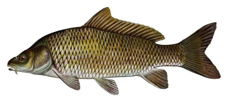
Game fish recorded in Onondaga Lake include smallmouth bass, largemouth bass, walleye, bluegill, common carp, white perch. In all, 10 fish species have open records inside the lake on GBIF.
Anglers 16 and older need a New York fishing license, sold online by the New York State Department of Environmental Conservation. Free fishing days: Presidents’ Day weekend, a weekend in late June, National Hunting and Fishing Day (September) and Veterans Day. Size and bag limits can be set lake by lake: check the current regulations.
Onondaga Lake is about 62 ft deep at its deepest point, and about 19 ft deep on average. Depth changes with the lake level.
Yes: fishing map with depth contours from the New York State Department of Environmental Conservation. It is linked in the lake facts on this page. Depths on a map are measured at a reference level: subtract how far the lake is below it today.
boating (2 boat ramps and 2 marinas), fishing (8 game fish and 1 fishing pier or spot), hiking & walking (6 trails along the shore, the longest Erie Canalway Trail (Camillus to Syracuse) (9.0 mi)), cabins & lodging (9 places to stay close to the water) and parks & picnics (14 parks on the shore), according to our map of the shore.
EPA's CyAN satellite rated cyanobacteria in Onondaga Lake not detected on November 9. The satellite sees open water only; blooms can be patchy, so avoid water that looks like spilled paint or pea soup and keep dogs out of scum. Swimming advisories come from New York health and environment agencies.
Yes. 6 trails run along or near the shore, including Erie Canalway Trail (Camillus to Syracuse) (9.0 mi), Loop the Lake Trail (1.9 mi) and Shoreline Walking Trail (2.2 mi), according to OpenStreetMap.
From the U.S. Geological Survey (ONONDAGA LAKE AT LIVERPOOL NY). Lake by Lake checks it every hour; the agency's own figure is always the reference, and provisional readings can be revised.
Lake levels are refreshed every hour. Texas and California reservoirs report once a day; most USGS and NOAA gauges report every 15 to 60 minutes.
Cookies for analytics With your OK we use Google Analytics and Microsoft Clarity to count visits and see how the site is used, so we can make it better. No advertising cookies. Privacy policy