Sun
- Sunrise
- 6:56 AM
- Sunset
- 5:06 PM
- First light
- 6:28 AM
- Last light
- 5:34 PM
Reservoir · Chatham County, North Carolina
A reservoir on the Haw River in Chatham County, North Carolina, held back by B. Everett Jordan Dam since 1974.

Jordan Lake is at 211.94 feet above sea level, as of Nov 19, 2026, 5:00 AM EST. It has dropped 0.35 ft in the past 7 days. That is the lowest level since 2023.
Lowest of 9 North Carolina lakes today against normal for the date · See the ranking
Record low 211.60 ft (2023), record high 233.06 ft (2016) · Level history since 2011
Which boat ramps are usable at today’s level →
A notification from this browser, once, when the level crosses the line (checked every hour). No account and no email. On an iPhone, add Lake by Lake to your home screen first (Share → Add to Home Screen) and open it from there. Or follow the lake in a feed reader: RSS feed.
Jordan Lake is down 0.35 ft over the last 7 days, at 211.94 ft today.
Daily values from the U.S. Geological Survey.
Over the past 324 days, Jordan Lake ranged from 211.94 ft (Nov 19, 2026) to 217.00 ft (Mar 17, 2026), a swing of 5.1 ft. Today's level is the lowest of the past 324 days. It is 2.04 ft lower than on this date last year.
Daily values from the U.S. Geological Survey. Why lake levels rise and fall
In the U.S. Geological Survey record, which starts in 2011, the lowest level was 211.60 ft on November 21, 2023 and the highest 233.06 ft on January 2, 2016. Today’s 211.94 ft is 0.3 ft above the record low and 21.1 ft below the record high. That is the lowest level since 2023.
Jordan Lake level history: every year since 2011, the lowest and highest years →
Solunar periods for Jordan Lake, local time. How they work
Not detected · as of Nov 9, 2026
The satellite found no cyanobacteria at the surface.
Week of Aug 9Week of Nov 1
Each bar is one week, colored by the worst reading of that week.
From the U.S. EPA's Cyanobacteria Assessment Network (CyAN), which reads the color of lakes from the Sentinel-3 satellites; it sees open water only, not coves or the shoreline. Blooms can be patchy: what you see on the water matters more. Swimming closures and health advisories come from North Carolina health and environment agencies. How to read it
Surface water temperature
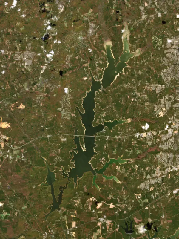
64°F on Oct 25, 2026
86°F · Jul 2964°F · Oct 25
22°F cooler than on Jul 29, 2026.
Estimated from Landsat 8/9 (USGS) passes on clear days: the top layer of the water, a few degrees either way. Coves and the shallows can be warmer.
Jordan Lake water temperature: trend, swimming and the fish →
On or near the shore of Jordan Lake: 15 boat ramps, 2 marinas, 8 campgrounds, 7 beaches and 9 trails. The lake has about 172 miles of shoreline, counting its islands.
Tap an icon for details; use two fingers (or Ctrl + scroll) to move the map. Tap a dot for details. Map and lake outline © OpenStreetMap contributors. Places from OpenStreetMap, Overture Maps and Recreation.gov. Not for navigation.
What you’ll find on the shore
← AllBoating 17
Which boat ramps are usable at today’s level →
← AllBeaches 7
← AllCamping 8
← AllLodging 2
← AllTrails 9
← AllParks 5
These invasive plants and animals have been recorded in Jordan Lake: clean, drain and dry everything before you go to another lake.
North Carolina: North Carolina has no clean-drain-dry law for boaters. The Wildlife Resources Commission urges you to clean off plants, animals and mud, drain all water, dry your gear, and never move fish or plants from one water to another. State rules
Records: USGS Nonindigenous Aquatic Species database. A species not listed may still be present.
Species with open-licensed records inside Jordan Lake's outline, from GBIF.org (surveys, museum collections and angler reports). A record shows a fish was found here, not how many there are now.
Shallow, protected flats in spring; docks, grass and deep edges in summer heat.
Channel edges and river arms; best after dark in summer, and after a rain.
Schools near the bottom; best in the cool months.
Beds in shallow, firm bottoms; around docks and weeds all summer.
Sandy, shallow banks and wood cover in creek arms and the upper end of reservoirs.
Water temperature sets off each spawn; the bars show the usual months at this latitude and elevation, and move with a warm or cold spring.
Jordan Lake is an Army Corps of Engineers reservoir in Chatham County, North Carolina, filling the old New Hope Valley south of Durham and west of Cary, about 30 miles west of downtown Raleigh. It was built for flood control on the Cape Fear basin and now supplies drinking water to much of the western Triangle. People know it for its campgrounds and beaches, its bass and crappie, and the bald eagles that spend the summer there.
The New Hope Valley was hard country to cross and to farm, with creeks that flooded often. The Corps surveyed New Hope Creek in 1933, and a hurricane in 1945 that stalled over the state for three days caused more than $2 million in damage downstream. Congress authorized the project in 1963 as New Hope Lake, and dam construction began in 1967. The project was renamed in 1973 for B. Everett Jordan, a textile executive who lived near Saxapahaw and served in the U.S. Senate from 1958 to 1973 and helped bring federal money to the state for water projects. Jordan died in 1974, before the lake was finished. It completed filling in 1982.
Before the water rose, archaeologists dug at sites in the valley, recovering Native American artifacts from a human presence that reached back thousands of years. The government had begun buying family homesteads in the 1950s. Farm communities such as Seaforth and Pea Ridge disappeared under the lake, along with roads, barns, foundations and some graves that were never moved. Friendship, another valley settlement, was remembered as one of the first places in the South where Black and white families lived side by side after the Civil War. The Durham and South Carolina Railroad through the valley was relocated, and roads were rerouted. In dry years, old roadbeds reappear along the shore.
The dam stands on the Haw River near Moncure, just below the point where the New Hope River joins it. Most of the lake lies in the long New Hope arm, which reaches north into Durham County. U.S. 64 crosses the lake along the line of an 18th-century road whose toll bridge spanned New Hope Creek. Besides flood control, the lake holds a water supply pool, and the state allocates its water among nearby towns and counties, with Cary and Apex holding the largest share and Durham, Chatham County, Pittsboro and the Orange Water and Sewer Authority also drawing from it. Releases from the dam keep a minimum flow in the Cape Fear River downstream at Lillington. Heavy nutrient loads have made the lake prone to algae, and the state's Jordan Lake Rules set limits on runoff and wastewater in its watershed.
The state runs Jordan Lake State Recreation Area, with access areas around the shore that include Crosswinds, Ebenezer Church, New Hope Overlook, Parkers Creek, Poplar Point, Seaforth, Vista Point and White Oak. Five of them have campgrounds, with more than 1,000 sites between them, and several have swim beaches and boat ramps. About 15 miles of trails wind through the woods. The lake is one of the largest summer homes for bald eagles, and a viewing platform helps visitors find them.
State biologists describe the lake's largemouth bass and black crappie populations as exceptional. It also holds a healthy population of native white catfish, a species that has declined in coastal rivers where invasive flathead and blue catfish eat them. Flatheads are established in Jordan Lake too, and biologists keep watching how the white catfish hold up.
Written by Lake by Lake from North Carolina Department of Environmental Quality, North Carolina Department of Natural and Cultural Resources, North Carolina State Parks, North Carolina Wildlife Resources Commission, ABC11 WTVD and Wikipedia. Checked November 2026.
Activities listed by the U.S. Army Corps of Engineers: Boating · Camping · Fishing · Hiking · Picnicking · Water sports · Wildlife viewing
B. Everett Jordan Dam is an earthfill dam 114 feet high and 1,330 feet long on the Haw River, completed in 1974. It belongs to the U.S. Army Corps of Engineers (Wilmington District) and is run for flood control, fish and wildlife, recreation, hydropower and water supply. At its normal level the reservoir holds 215,130 acre-ft, drained from 1,690 square miles of land.
From the National Inventory of Dams (U.S. Army Corps of Engineers), NID ID NC00173. Lake or reservoir: what’s the difference?
Where the level comes from: B. EVERETT JORDAN LAKE AT DAM NR MONCURE, NC (U.S. Geological Survey, used on this page) and Haw River at Jordan Lake (NOAA National Water Prediction Service).
| Lake | Miles | Level (ft) | vs full | 7 days |
|---|---|---|---|---|
| Bond Lake Live reading | 16 | 341.45 | — | −0.18 |
| Hatchers Grove Reservoir Live reading | 16 | 325.32 | — | −0.11 |
| Coles Branch Reservoir Live reading | 17 | 312.07 | — | −0.08 |
| Sorrells Grove Reservoir Live reading | 20 | 303.45 | — | −0.09 |
| Page Lake Live reading | 20 | 305.39 | — | −0.16 |
| Lake Crabtree Live reading | 20 | 275.24 | — | −0.22 |
Compare Jordan Lake with Bond Lake, Hatchers Grove Reservoir, Coles Branch Reservoir or Sorrells Grove Reservoir: size, level, ramps and fish side by side.
Jordan Lake is about 16 mi from Cary, NC, 24 mi from Durham, NC and 27 mi from Raleigh, NC. See all the lakes near each city.
Jordan Lake is at 211.94 feet above sea level, as of Nov 19, 2026, 5:00 AM EST. It has dropped 0.35 ft in the past 7 days. That is the lowest level since 2023.
Today's level is 3.27 ft below the median for this date (215.21 ft), from the gauge’s long-term daily record.
211.60 ft, on November 21, 2023, in the U.S. Geological Survey record, which starts in 2011. Today the lake is 0.3 ft above that.
233.06 ft, on January 2, 2016, in the U.S. Geological Survey record since 2011.
Jordan Lake has 15 boat ramps on our map, including Vista Point Boat Ramp, White Oak Boat Ramp, New Hope Overlook Boat Ramp, and 2 marinas. Low water can close ramps, so check today's level above and the operator before you go.
Yes. There are 8 campgrounds and RV parks within about a mile of the shore, such as Parkers Creek Campground, Crosswinds Campgrounds, Popular Point Campground.
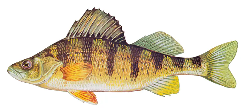
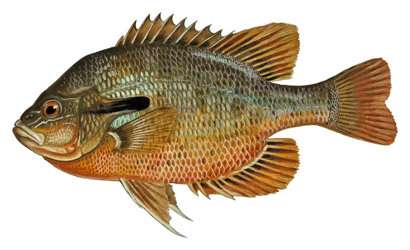
Game fish recorded in Jordan Lake include bluegill, yellow perch, channel catfish, largemouth bass, white catfish, redbreast sunfish. In all, 30 fish species have open records inside the lake on GBIF.
Anglers 16 and older need a North Carolina fishing license, sold online by the North Carolina Wildlife Resources Commission. Free fishing days: July 4. Size and bag limits can be set lake by lake: check the current regulations.
Jordan Lake is about 39 ft deep at its deepest point, usually near the dam, and about 15 ft deep on average. Depth changes with the lake level.
In summer a white Secchi disk lowered into Jordan Lake stays visible to about 2.3 ft (the median of 99 readings, 2023–2025, by North Carolina Dept of Environmental Quality NCDEQ-DWR WQX): murky water. With the algae measured too (chlorophyll about 44 µg/L), that makes it eutrophic: rich in nutrients, greener water. Clarity drops after storms and during algae blooms.
U.S. Army Corps of Engineers lists boating, camping, fishing, hiking, picnicking, water sports and wildlife viewing at B. Everett Jordan Lake.
EPA's CyAN satellite rated cyanobacteria in Jordan Lake not detected on November 9. The satellite sees open water only; blooms can be patchy, so avoid water that looks like spilled paint or pea soup and keep dogs out of scum. Swimming advisories come from North Carolina health and environment agencies.
Yes. 9 trails run along or near the shore, including Eagle Spur Trail (2.3 mi), Lake Path (0.5 mi) and Old Seaforth Rd trail (0.4 mi), according to OpenStreetMap.
Jordan Lake is held back by B. Everett Jordan Dam, completed in 1974 and 114 ft high, according to the National Inventory of Dams.
From the U.S. Geological Survey (B. EVERETT JORDAN LAKE AT DAM NR MONCURE, NC). Lake by Lake checks it every hour; the agency's own figure is always the reference, and provisional readings can be revised.
Lake levels are refreshed every hour. Texas and California reservoirs report once a day; most USGS and NOAA gauges report every 15 to 60 minutes.
Cookies for analytics With your OK we use Google Analytics and Microsoft Clarity to count visits and see how the site is used, so we can make it better. No advertising cookies. Privacy policy