Sun
- Sunrise
- 7:21 AM
- Sunset
- 5:11 PM
- First light
- 6:52 AM
- Last light
- 5:41 PM
Reservoir · Franklin County, Ohio
A reservoir on Big Walnut Creek in Franklin County, Ohio, held back by Hoover Dam since 1956.

Hoover Reservoir is at 889.64 feet above sea level — 4.36 ft below spillway crest (full pool), as of Nov 19, 2026, 1:00 AM EST. It has dropped 0.27 ft in the past 7 days.
6th lowest of 27 Ohio lakes today against full pool · See the ranking
Record low 879.55 ft (2019), record high 897.40 ft (2020) · Level history since 2017
A notification from this browser, once, when the level crosses the line (checked every hour). No account and no email. On an iPhone, add Lake by Lake to your home screen first (Share → Add to Home Screen) and open it from there. Or follow the lake in a feed reader: RSS feed.
Hoover Reservoir is down 0.27 ft over the last 7 days, at 889.64 ft today.
Daily values from the U.S. Geological Survey.
Hoover Reservoir is down 1.68 ft over the last 30 days, at 889.64 ft today.
Daily values from the U.S. Geological Survey.
Over the past 12 months, Hoover Reservoir ranged from 880.05 ft (Dec 9, 2025) to 895.62 ft (May 23, 2026), a swing of 15.6 ft. Today's level is in the upper half of that range. It is 8.93 ft higher than on this date last year.
Daily values from the U.S. Geological Survey. Why lake levels rise and fall
In the U.S. Geological Survey record, which starts in 2017, the lowest level was 879.55 ft on December 9, 2019 and the highest 897.40 ft on May 20, 2020. Today’s 889.64 ft is 10.1 ft above the record low and 7.8 ft below the record high.
Hoover Reservoir level history: every year since 2017, the lowest and highest years →
Solunar periods for Hoover Reservoir, local time. How they work
Not detected · as of Nov 9, 2026
The satellite found no cyanobacteria at the surface.
Week of Aug 16Week of Nov 1
Each bar is one week, colored by the worst reading of that week.
From the U.S. EPA's Cyanobacteria Assessment Network (CyAN), which reads the color of lakes from the Sentinel-3 satellites; it sees open water only, not coves or the shoreline. Blooms can be patchy: what you see on the water matters more. Swimming closures and health advisories come from Ohio health and environment agencies. How to read it
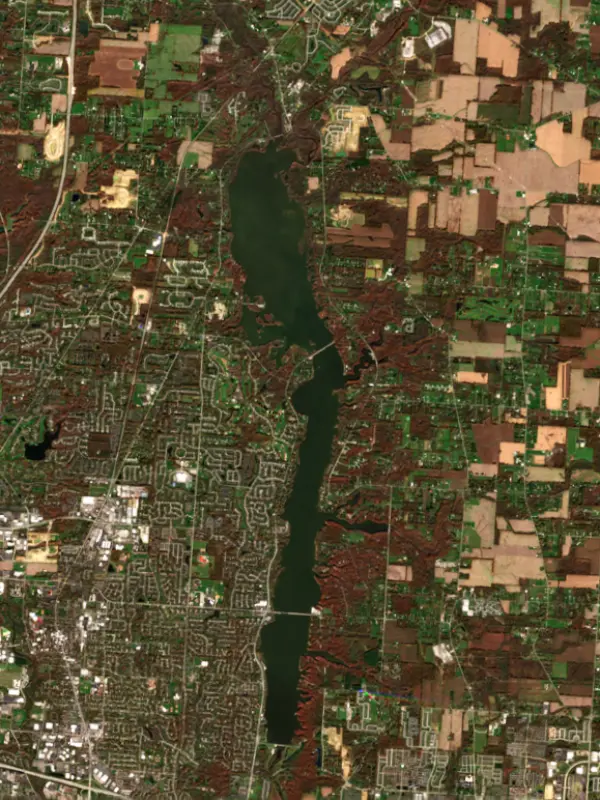
The last 6 satellite passes
78°F · Aug 362°F · Oct 30
15°F cooler than on Aug 3, 2026.
Estimated from Landsat 8/9 (USGS) passes on clear days: the top layer of the water, a few degrees either way. Coves and the shallows can be warmer.
Hoover Reservoir water temperature: trend, swimming and the fish →
On or near the shore of Hoover Reservoir: 5 boat ramps, 2 marinas, 2 rental outfits, 1 campground and 8 trails. The lake has about 48 miles of shoreline, counting its islands.
Tap an icon for details; use two fingers (or Ctrl + scroll) to move the map. Tap a dot for details. Map and lake outline © OpenStreetMap contributors. Places from OpenStreetMap, Overture Maps and Recreation.gov. Not for navigation.
What you’ll find on the shore
← AllBoating 7
← AllRentals & tours 2
← AllFishing spots 3
← AllCamping 1
← AllTrails 8
← AllParks 6
← AllDining 6
Zebra mussels have been found in Hoover Reservoir. They clog intakes and engines and spread on boats and trailers: clean, drain and dry everything before you go to another lake.
Ohio: Ohio has no clean-drain-dry law for boaters; ODNR asks you to clean, drain and dry your boat before leaving every lake and to put unused bait in the trash. Possessing, selling or releasing listed injurious invasive species such as round goby is illegal. State rules
Records: USGS Nonindigenous Aquatic Species database. A species not listed may still be present.
Species with open-licensed records inside Hoover Reservoir's outline, from GBIF.org (surveys, museum collections and angler reports). A record shows a fish was found here, not how many there are now.
Shallow, protected flats in spring; docks, grass and deep edges in summer heat.
Brush piles, docks and bridge pilings; shallow for a few weeks in spring.
Channel edges and river arms; best after dark in summer, and after a rain.
Rocky shorelines at night after ice-out; deep weed edges and humps in summer.
Spring runs up the tributaries; schools busting shad in late summer.
Water temperature sets off each spawn; the bars show the usual months at this latitude and elevation, and move with a warm or cold spring. The water is about 55°F now.
Hoover Reservoir is a long, narrow drinking water lake on Big Walnut Creek, stretching from the dam near Westerville north to the village of Galena in Delaware County. The City of Columbus built it in the 1950s, and it holds more water than the city's two Scioto River reservoirs combined. People know it for quiet, slow boating, bald eagles, birding on its mudflats and some of the biggest catfish in Ohio.
In January 1945 the watershed that fed Columbus froze for about three and a half months, the worst drought the city had known. The postwar boom was pushing demand up at the same time, and the city's existing supply was close to its limit. The answer was a dam on Big Walnut Creek, which rises about 20 miles northeast of the city. The reservoir was built between 1952 and 1955, and the dam was dedicated in September 1955. It honors two brothers, Charles and Clarence Hoover, who both served the city waterworks; Charles was one of the first superintendents of the water division. Today the reservoir supplies the whole northeast part of Franklin County.
The lake's upper reach climbs into Delaware County, where Big Walnut and Little Walnut creeks come in near Galena. As the water spread up Little Walnut Creek in the 1950s, about 300 graves in the Galena Cemetery were moved up the hill toward Walnut Street. Much of the land around the north end is now the Hoover Nature Preserve, set aside in 1988 to protect the drinking water. At about 2,200 acres it is by far the largest of the city's nature preserves, with steep wooded hillsides, wetlands, floodplain and part of the lake itself. Hoover Prairie and Mud Hen Marsh lie next to it. When the water is low, wide mudflats open up, and the Hoover Mudflats Boardwalk is the place birders go to watch them. Several bald eagle nests sit in or beside the preserve, and eagles are seen around the lake all year. The upland woods also hold prothonotary and cerulean warblers, both species of concern in Ohio.
Because Hoover is a water supply, the city keeps boating gentle. Motors are limited to small outboards, larger engines must stay tilted up, and speeds are low. Water skiing, wakeboarding, jet skis, tubing and swimming are not allowed. The city's Hoover Reservoir park on Sunbury Road in Westerville has a launch ramp, public docks, picnic shelters, a disc golf course and access to the greenway trail.
The Ohio Division of Wildlife manages the fishery under an agreement with the city. In fall 2011 it stocked blue catfish here as a pilot project, testing whether a reservoir could grow a trophy fishery for a fish that in Ohio now survives only in the Ohio River and its tributaries. It worked. In 2019 anglers reported 41 blue catfish of 35 inches or more from Hoover, more than any other water in the state, the Ohio River included. State biologists consider escapes downstream unlikely here, and they plan to keep stocking. The blue catfish is a state species of concern, and the shoreline along the Hoover Oxbow may give it places to spawn.
Written by Lake by Lake from City of Columbus, Department of Public Utilities, Columbus Recreation and Parks Department (Hoover Reservoir Parkland, Hoover Nature Preserve Management Plan 2023), Village of Galena and Farm and Dairy (Blue catfish project moves to Hoover Reservoir, Ohio boasts healthy catfish populations for anglers). Checked November 2026.
Hoover Dam is an earthfill dam 86 feet high and 2,583 feet long on Big Walnut Creek, completed in 1956. It belongs to the City of Columbus and is run for water supply and recreation. At its normal level the reservoir holds 72,510 acre-ft, drained from 190 square miles of land.
From the National Inventory of Dams (U.S. Army Corps of Engineers), NID ID OH00737. Lake or reservoir: what’s the difference?
Where the level comes from: Hoover Reservoir at Central College OH (U.S. Geological Survey).
| Lake | Miles | Level (ft) | vs full | 7 days |
|---|---|---|---|---|
| Alum Creek Lake Slightly below full | 7 | 885.64 | −2.36 | −0.55 |
| Griggs Reservoir At or near full pool | 13 | 755.90 | +0.30 | +0.13 |
| O'Shaughnessy Reservoir At or near full pool | 13 | 848.51 | +0.01 | +0.05 |
| Delaware Lake Slightly below full | 20 | 912.24 | −2.76 | −0.47 |
| Buckeye Lake Live reading | 24 | 891.51 | — | 0.00 |
| Deer Creek Lake Below full | 38 | 800.01 | −9.99 | −1.51 |
Compare Hoover Reservoir with Alum Creek Lake, Griggs Reservoir, O'Shaughnessy Reservoir or Delaware Lake: size, level, ramps and fish side by side.
Hoover Reservoir is about 10 mi from Columbus, OH. See all the lakes near each city.
Hoover Reservoir is at 889.64 feet above sea level — 4.36 ft below spillway crest (full pool), as of Nov 19, 2026, 1:00 AM EST. It has dropped 0.27 ft in the past 7 days.
Hoover Reservoir's spillway crest (full pool) is 894.00 ft, according to City of Columbus, Division of Water. Today the lake is 4.36 ft below that mark.
Today's level is 3.21 ft above the median for this date (886.43 ft), from the gauge’s long-term daily record.
879.55 ft, on December 9, 2019, in the U.S. Geological Survey record, which starts in 2017. Today the lake is 10.1 ft above that.
897.40 ft, on May 20, 2020, in the U.S. Geological Survey record since 2017. That is 3.4 ft above spillway crest (full pool).
Hoover Reservoir has 5 boat ramps on our map, including Boat ramp at Red Bank Marina - Hoover Dam, Twin Bridge Boat Ramp, Boat ramp at Oxbow Road Park, and 2 marinas. Low water can close ramps, so check today's level above and the operator before you go.
Yes. There is 1 campground within about a mile of the shore, such as Berkshire Campground.
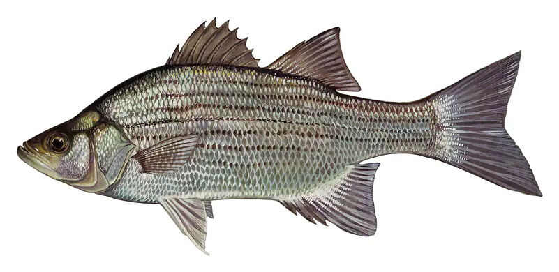
Game fish recorded in Hoover Reservoir include white crappie, walleye, black crappie, white bass, bluegill, blue catfish. In all, 40 fish species have open records inside the lake on GBIF.
The water at Hoover Reservoir is 55°F, measured 1 hr ago by the USGS sensor in the lake. Surface temperature changes through the day and with depth.
Anglers 16 and older need an Ohio fishing license, sold online by the Ohio Department of Natural Resources Division of Wildlife. Free fishing days: Father's Day weekend. Size and bag limits can be set lake by lake: check the current regulations.
Hoover Reservoir averages about 24 ft deep. Depth changes with the lake level.
Yes: fishing map with depth contours from the Ohio Department of Natural Resources, Division of Wildlife. It is linked in the lake facts on this page. Depths on a map are measured at a reference level: subtract how far the lake is below it today.
boating (5 boat ramps and 2 marinas), kayaks, boats & jet skis (2 rental outfits on or near the water), fishing (17 game fish), hiking & walking (8 trails along the shore, the longest Hoover Meadows Trail (1.2 mi)), camping (1 campground) and parks & picnics (6 parks on the shore), according to our map of the shore.
EPA's CyAN satellite rated cyanobacteria in Hoover Reservoir not detected on November 9. The satellite sees open water only; blooms can be patchy, so avoid water that looks like spilled paint or pea soup and keep dogs out of scum. Swimming advisories come from Ohio health and environment agencies.
Yes. 8 trails run along or near the shore, including Galena Brick Trail (0.4 mi), Hoover Dam Park Loop (0.7 mi) and Lawrence Woods Loop (0.4 mi), according to OpenStreetMap.
Hoover Reservoir is held back by Hoover Dam, completed in 1956 and 86 ft high, according to the National Inventory of Dams.
From the U.S. Geological Survey (Hoover Reservoir at Central College OH). Lake by Lake checks it every hour; the agency's own figure is always the reference, and provisional readings can be revised.
Lake levels are refreshed every hour. Texas and California reservoirs report once a day; most USGS and NOAA gauges report every 15 to 60 minutes.
Cookies for analytics With your OK we use Google Analytics and Microsoft Clarity to count visits and see how the site is used, so we can make it better. No advertising cookies. Privacy policy