Sun
- Sunrise
- 7:12 AM
- Sunset
- 5:25 PM
- First light
- 6:45 AM
- Last light
- 5:52 PM
Reservoir · Caddo County, Oklahoma
A reservoir on the Cobb Cr in Caddo County, Oklahoma, held back by Fort Cobb Dam since 1959.

Fort Cobb Reservoir is at 1,342.93 feet above sea level — 0.93 ft above top of conservation pool, as of Nov 19, 2026, 2:00 AM CST. It has risen 0.10 ft in the past 7 days.
4th fullest of 37 Oklahoma lakes today against full pool · See the ranking
Record low 1,334.76 ft (2015), record high 1,349.26 ft (2019) · Level history since 2014
A notification from this browser, once, when the level crosses the line (checked every hour). No account and no email. On an iPhone, add Lake by Lake to your home screen first (Share → Add to Home Screen) and open it from there. Or follow the lake in a feed reader: RSS feed.
Fort Cobb Reservoir is up 0.10 ft over the last 7 days, at 1,342.93 ft today.
Daily values from the NOAA National Water Prediction Service.
Fort Cobb Reservoir is up 0.69 ft over the last 30 days, at 1,342.93 ft today.
Daily values from the NOAA National Water Prediction Service.
Over the past 12 months, Fort Cobb Reservoir ranged from 1,338.39 ft (Oct 13, 2026) to 1,342.94 ft (Nov 17, 2026), a swing of 4.5 ft. Today's level is near the top of that range. It is 0.98 ft higher than on this date last year.
Daily values from the NOAA National Water Prediction Service. Why lake levels rise and fall
In the U.S. Army Corps of Engineers record, which starts in 2014, the lowest level was 1,334.76 ft on January 1, 2015 and the highest 1,349.26 ft on June 2, 2019. Today’s 1,342.93 ft is 8.2 ft above the record low and 6.3 ft below the record high.
Fort Cobb Reservoir level history: every year since 2014, the lowest and highest years →
Solunar periods for Fort Cobb Reservoir, local time. How they work
Very high · as of Nov 9, 2026
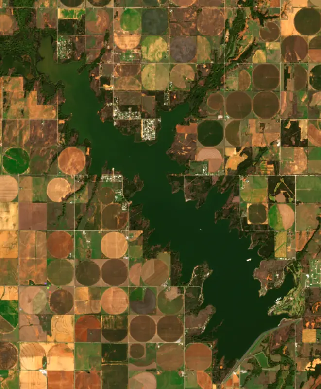
The satellite sees a strong bloom on part of the lake. Stay out of discolored water, keep pets away and check for state advisories. About 1,170,000 cells/mL at the worst spot, covering 41% of the lake.
Week of Aug 9Week of Nov 1
Each bar is one week, colored by the worst reading of that week.
From the U.S. EPA's Cyanobacteria Assessment Network (CyAN), which reads the color of lakes from the Sentinel-3 satellites; it sees open water only, not coves or the shoreline. Blooms can be patchy: what you see on the water matters more. Swimming closures and health advisories come from Oklahoma health and environment agencies. How to read it
Surface water temperature
69°F on Oct 21, 2026
86°F · Jul 2569°F · Oct 21
17°F cooler than on Jul 25, 2026.
Estimated from Landsat 8/9 (USGS) passes on clear days: the top layer of the water, a few degrees either way. Coves and the shallows can be warmer.
Fort Cobb Reservoir water temperature: trend, swimming and the fish →
On or near the shore of Fort Cobb Reservoir: 8 boat ramps, 1 marina, 1 campground and 1 trail. The lake has about 35 miles of shoreline, counting its islands.
Tap an icon for details; use two fingers (or Ctrl + scroll) to move the map. Tap a dot for details. Map and lake outline © OpenStreetMap contributors. Places from OpenStreetMap, Overture Maps and Recreation.gov. Not for navigation.
These invasive plants and animals have been recorded in Fort Cobb Reservoir: clean, drain and dry everything before you go to another lake.
Oklahoma: Before launching, remove all aquatic plants and zebra or quagga mussels from your boat, trailer and gear (state law); moving aquatic plants between waters is also illegal. Draining, and drying for five days if you can't hot-wash, are recommended but not required. State rules
Records: USGS Nonindigenous Aquatic Species database. A species not listed may still be present.
Species with open-licensed records inside Fort Cobb Reservoir's outline, from GBIF.org (surveys, museum collections and angler reports). A record shows a fish was found here, not how many there are now.
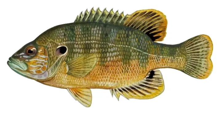
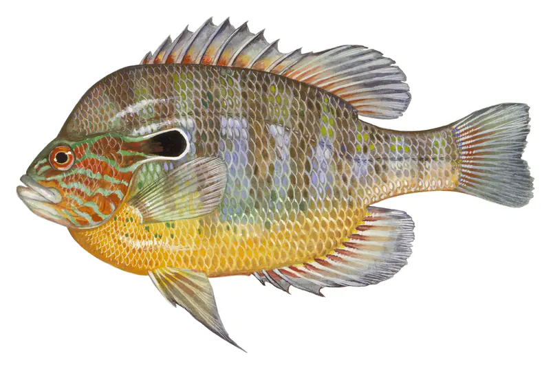
Shallow, protected flats in spring; docks, grass and deep edges in summer heat.
Beds in shallow, firm bottoms; around docks and weeds all summer.
Tight to rocks, stumps and weed edges in warm shallows; common in small ponds.
Clear water over gravel near weeds; creek arms and coves, nests in colonies in summer.
Water temperature sets off each spawn; the bars show the usual months at this latitude and elevation, and move with a warm or cold spring.
Fort Cobb Reservoir (also called Fort Cobb Lake) is a reservoir located in Caddo County in the U.S. state of Oklahoma. It impounds the waters of Cobb Creek (joining from the west), Lake Creek (joining from the north), and Willow Creek (joining from the northeast). The lake covers approximately 4,000 acres (16 km²) of water and 45 mi (72 km) of shoreline.
From Wikipedia, under CC BY-SA 4.0. Its figures may differ from the agency numbers on this page, which are the ones we use.
Fort Cobb Dam and Reservoir, Washita Basin Project , are on Pond (Cobb) Creek, a tributary of the Washita River in Caddo County, Oklahoma. The lake has approximately 4,000 water surface acres, 4,5550 land acres and 45 miles of shoreline. Accessible from numerous roads. Several boat ramps and camping facilities. Predominate species include largemouth bass, crappie, catfish, hybrid striped bass, and white bass. Fishing year-round. Current Reservoir Levels
Activities listed by the Bureau of Reclamation: Boating · Camping · Fishing · Hiking · Hunting · Picnicking · Water sports
Fort Cobb Dam is an earthfill dam 101 feet high and 9,900 feet long on the Cobb Cr, completed in 1959. It belongs to the Bureau of Reclamation and is run for flood control. At its normal level the reservoir holds 80,010 acre-ft, drained from 308 square miles of land.
From the National Inventory of Dams (U.S. Army Corps of Engineers), NID ID OK02502. Lake or reservoir: what’s the difference?
Where the level comes from: Cobb Creek at Fort Cobb Lake (NOAA National Water Prediction Service, used on this page) and Fort Cobb Reservoir and Dam (Bureau of Reclamation (RISE)).
| Lake | Miles | Level (ft) | vs full | 7 days |
|---|---|---|---|---|
| Lake Ellsworth Below full | 26 | 1220.98 | −11.02 | +0.05 |
| Lake Lawtonka Slightly below full | 29 | 1337.61 | −5.74 | +0.04 |
| Grama Lake Live reading | 31 | 1858.30 | — | +0.05 |
| Comanche Lake Live reading | 31 | 1809.90 | — | +0.13 |
| Quanah Parker Lake Live reading | 33 | 1481.96 | — | 0.00 |
| Tom Steed Reservoir Slightly below full | 42 | 1406.41 | −4.59 | −0.01 |
Compare Fort Cobb Reservoir with Lake Ellsworth, Lake Lawtonka, Grama Lake or Comanche Lake: size, level, ramps and fish side by side.
Fort Cobb Reservoir is about 57 mi from Oklahoma City, OK. See all the lakes near each city.
Fort Cobb Reservoir is at 1,342.93 feet above sea level — 0.93 ft above top of conservation pool, as of Nov 19, 2026, 2:00 AM CST. It has risen 0.10 ft in the past 7 days.
Fort Cobb Reservoir's top of conservation pool is 1,342.00 ft, according to U.S. Army Corps of Engineers. Today the lake is 0.93 ft above that mark.
Today's level is 0.97 ft above the median for this date (1,341.96 ft), from the gauge’s long-term daily record.
1,334.76 ft, on January 1, 2015, in the U.S. Army Corps of Engineers record, which starts in 2014. Today the lake is 8.2 ft above that.
1,349.26 ft, on June 2, 2019, in the U.S. Army Corps of Engineers record since 2014. That is 7.3 ft above top of conservation pool.
Fort Cobb Reservoir has 8 boat ramps on our map, including Crows Roost West, Lemmon Landing Road, Primitive (3), and 1 marina. Low water can close ramps, so check today's level above and the operator before you go.
Yes. There is 1 campground within about a mile of the shore, such as Caddo Hill Campground.
Game fish recorded in Fort Cobb Reservoir include bluegill, largemouth bass, orangespotted sunfish, green sunfish, Rio Grande longear sunfish. In all, 10 fish species have open records inside the lake on GBIF.
Anglers 18 and older need an Oklahoma fishing license, sold online by the Oklahoma Department of Wildlife Conservation. Free fishing days: First weekend in June. Size and bag limits can be set lake by lake: check the current regulations.
Fort Cobb Reservoir averages about 20 ft deep. Depth changes with the lake level.
In summer a white Secchi disk lowered into Fort Cobb Reservoir stays visible to about 1.8 ft (the median of 19 readings, 2017–2024, by OWRB Lakes Monitoring): murky water. With the algae measured too (chlorophyll about 84 µg/L), that makes it hypereutrophic: very rich in nutrients, prone to algae. Clarity drops after storms and during algae blooms.
Bureau of Reclamation lists boating, camping, fishing, hiking, hunting, picnicking and water sports at Fort Cobb Reservoir.
EPA's CyAN satellite rated cyanobacteria in Fort Cobb Reservoir very high on November 9. The satellite sees open water only; blooms can be patchy, so avoid water that looks like spilled paint or pea soup and keep dogs out of scum. Swimming advisories come from Oklahoma health and environment agencies.
Yes. A trail runs along or near the shore, including Western Oaks Trail (2.7 mi), according to OpenStreetMap.
Fort Cobb Reservoir is held back by Fort Cobb Dam, completed in 1959 and 101 ft high, according to the National Inventory of Dams.
From the NOAA National Water Prediction Service (Cobb Creek at Fort Cobb Lake). Lake by Lake checks it every hour; the agency's own figure is always the reference, and provisional readings can be revised.
Lake levels are refreshed every hour. Texas and California reservoirs report once a day; most USGS and NOAA gauges report every 15 to 60 minutes.
Cookies for analytics With your OK we use Google Analytics and Microsoft Clarity to count visits and see how the site is used, so we can make it better. No advertising cookies. Privacy policy