Sun
- Sunrise
- 7:03 AM
- Sunset
- 5:15 PM
- First light
- 6:36 AM
- Last light
- 5:43 PM
Reservoir · Tulsa County, Oklahoma
A reservoir on the Arkansas River in Tulsa County, Oklahoma, held back by Keystone Dam since 1964.

Keystone Lake is at 722.55 feet above sea level — 0.45 ft below normal pool, as of Nov 17, 2026, 8:00 PM CST. It has dropped 1.02 ft in the past 7 days.
10th fullest of 37 Oklahoma lakes today against full pool · See the ranking
A notification from this browser, once, when the level crosses the line (checked every hour). No account and no email. On an iPhone, add Lake by Lake to your home screen first (Share → Add to Home Screen) and open it from there. Or follow the lake in a feed reader: RSS feed.
Keystone Lake is down 0.38 ft over the last 30 days, at 722.55 ft today.
Daily values from the NOAA National Water Prediction Service. Why lake levels rise and fall
Solunar periods for Keystone Lake, local time. How they work
Not detected · as of Nov 9, 2026
The satellite found no cyanobacteria at the surface.
Week of Aug 16Week of Nov 1
Each bar is one week, colored by the worst reading of that week.
From the U.S. EPA's Cyanobacteria Assessment Network (CyAN), which reads the color of lakes from the Sentinel-3 satellites; it sees open water only, not coves or the shoreline. Blooms can be patchy: what you see on the water matters more. Swimming closures and health advisories come from Oklahoma health and environment agencies. How to read it
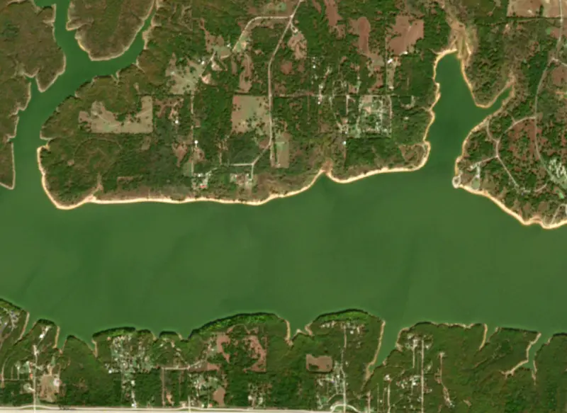
Surface water temperature
72°F on Oct 22, 2026
90°F · Jul 2672°F · Oct 22
18°F cooler than on Jul 26, 2026.
Estimated from Landsat 8/9 (USGS) passes on clear days: the top layer of the water, a few degrees either way. Coves and the shallows can be warmer.
Keystone Lake water temperature: trend, swimming and the fish →
On or near the shore of Keystone Lake: 19 boat ramps, 5 marinas, 18 campgrounds, 1 beach and 1 trail. The lake has about 292 miles of shoreline, counting its islands.
Tap an icon for details; use two fingers (or Ctrl + scroll) to move the map. Tap a dot for details. Map and lake outline © OpenStreetMap contributors. Places from OpenStreetMap, Overture Maps and Recreation.gov. Not for navigation.
What you’ll find on the shore
← AllBoating 24
← AllRentals & tours 1
← AllFishing spots 2
← AllBeaches 1
← AllCamping 18
← AllLodging 3
← AllTrails 1
← AllParks 5
← AllDining 5
No aquatic invasive species are on record for Keystone Lake in the USGS database. Keep it that way: clean, drain and dry your boat between lakes.
Oklahoma: Before launching, remove all aquatic plants and zebra or quagga mussels from your boat, trailer and gear (state law); moving aquatic plants between waters is also illegal. Draining, and drying for five days if you can't hot-wash, are recommended but not required. State rules
Records: USGS Nonindigenous Aquatic Species database. A species not listed may still be present.
Species with open-licensed records inside Keystone Lake's outline, from GBIF.org (surveys, museum collections and angler reports). A record shows a fish was found here, not how many there are now.
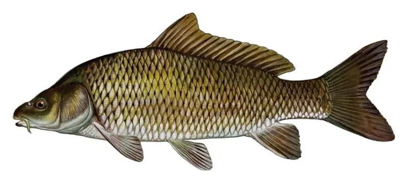
Shallow, protected flats in spring; docks, grass and deep edges in summer heat.
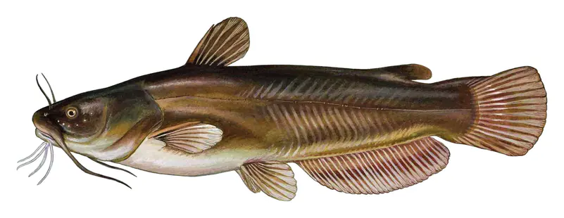
Shallow, muddy bays and flooded grass in spring; mud flats and inflows in summer.
Clear, weedy shallows and quiet creek arms; worms or cut bait on the bottom at dusk.
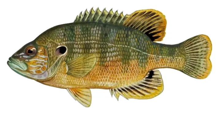
Tight to rocks, stumps and weed edges in warm shallows; common in small ponds.
Water temperature sets off each spawn; the bars show the usual months at this latitude and elevation, and move with a warm or cold spring.
Keystone Lake is the Corps of Engineers reservoir on the Arkansas and Cimarron rivers about 15 miles west of Tulsa, reaching into Osage, Pawnee, Creek and Tulsa counties. Being so close to the city, it gets heavy fishing pressure, mostly for striped bass, white bass, crappie and catfish.
The lake takes its name from Keystone, a small town that stood from 1900 until 1962 at the point where the Cimarron flows into the Arkansas. Congress authorized the dam in the Flood Control Act of 1950, and the Tulsa District of the Army Corps of Engineers began building it in January 1957, just below that confluence. Rising water covered Keystone in 1962. The dam was in service for flood control by September 1964, and its two generators began producing power in 1968. State Highway 151 crosses the top of the dam.
Other communities had to move. Mannford, named for Mann's Ford, a Cimarron River crossing on land allotted to Creek citizens Tom and Hazel Mann, learned in 1958 that the reservoir would flood it. In June 1959, 83 of its 93 registered voters chose to rebuild the town to the southeast, on a site now bordered by water on three sides. The new Mannford got a new school, town buildings and paved streets, and the state's historical society describes it as the first fully planned relocated town in Oklahoma. Prue and Appalachia Bay were also moved, part of Osage was abandoned, and engineers built a levee around low-lying parts of Cleveland.
Tulsa lies downstream, and two storms put the dam to the test. In the fall of 1986 the remnants of Hurricane Paine dropped nearly 22 inches of rain northwest of the lake. The reservoir filled, the Corps opened the gates to roughly 305,000 cubic feet per second, and a private levee in west Tulsa failed. In May 2019 releases reached about 275,000 cubic feet per second, the most since 1986, and Corps engineers and the National Guard watched over the 20-mile Tulsa and West Tulsa levee system between Sand Springs and Tulsa.
The river below the dam has its own history. A small reregulating dam built 7.8 miles downstream in 1968 was removed in 1986 after 16 people drowned there.
The state's fisheries biologists list channel and blue catfish, white bass, striped bass, crappie and largemouth bass as the lake's main fisheries. Water moves through Keystone fast and the level can swing widely, with muddy water in some seasons, so largemouth and stripers struggle to reproduce, while crappie, white bass, catfish and gizzard shad tend to be plentiful. Hot summers are the stripers' weak point. Late-summer die-offs of adult fish led the Corps to change how it released floodwater starting in 1989, but it later dropped the practice because it damaged equipment below the dam. Biologists now watch water quality through every summer, and the last documented die-off was in August 2021.
Much of the shoreline is sand or rock. Since 2014 the Wildlife Department has sunk more than 80 brush piles, mostly cedar trees, and posts their locations on its online fish attractor map. They are not marked with buoys because the water level changes so much. Mannford, just south of the lake, is known as the striped bass capital.
Keystone State Park sits on the lake near Sand Springs along Highway 151, close to the dam. It has furnished cabins open all year, three campgrounds, a swim beach, a children's fishing pond, boat ramps and a marina, with off-road vehicle areas below the dam. Walnut Creek State Park lies on another part of the shore.
Written by Lake by Lake from Oklahoma Department of Wildlife Conservation, Oklahoma Historical Society, Encyclopedia of Oklahoma History and Culture, U.S. Army, Oklahoma Tourism and Recreation Department and Wikipedia. Checked November 2026.
Keystone Dam is a concrete gravity dam 121 feet high and 4,600 feet long on the Arkansas River, completed in 1964. It belongs to the U.S. Army Corps of Engineers (Tulsa District) and is run for flood control, recreation, hydropower and water supply. At its normal level the reservoir holds 505,381 acre-ft, drained from 74,506 square miles of land.
From the National Inventory of Dams (U.S. Army Corps of Engineers), NID ID OK10309. Lake or reservoir: what’s the difference?
Where the level comes from: Eastern Oklahoma Lakes at Keystone Lake (NOAA National Water Prediction Service).
| Lake | Miles | Level (ft) | vs full | 7 days |
|---|---|---|---|---|
| Heyburn Lake At or near full pool | 14 | 760.53 | −0.97 | −0.04 |
| Skiatook Lake Slightly below full | 17 | 710.43 | −3.57 | −0.17 |
| Birch Lake Slightly below full | 27 | 747.52 | −2.98 | −0.09 |
| Oologah Lake Above full pool | 37 | 640.37 | +2.37 | −0.17 |
| Copan Lake At or near full pool | 53 | 709.09 | −0.91 | −0.11 |
| Kaw Lake At or near full pool | 53 | 1010.73 | +0.73 | −0.29 |
Compare Keystone Lake with Heyburn Lake, Skiatook Lake, Birch Lake or Oologah Lake: size, level, ramps and fish side by side.
Keystone Lake is about 20 mi from Tulsa, OK and 28 mi from Broken Arrow, OK. See all the lakes near each city.
Keystone Lake is at 722.55 feet above sea level — 0.45 ft below normal pool, as of Nov 17, 2026, 8:00 PM CST. It has dropped 1.02 ft in the past 7 days.
Keystone Lake's normal pool is 723.00 ft, according to U.S. Army Corps of Engineers. Today the lake is 0.45 ft below that mark.
Keystone Lake has 19 boat ramps on our map, including Boat ramp near Appalachia Bay Recreation Area Campground, Boat ramp near Pier 51 Marina, Boat ramp near Yogi Bear's Jellystone Park Camp-Resort at Keystone Lake, and 5 marinas. Low water can close ramps, so check today's level above and the operator before you go.
Yes. There are 18 campgrounds and RV parks within about a mile of the shore, such as Yogi Bear's Jellystone Park Camp-Resort at Keystone Lake, The RV Park at Keystone Lake, LLC, Washington Irving South Campground.
Game fish recorded in Keystone Lake include largemouth bass, common carp, yellow bullhead, green sunfish. In all, 12 fish species have open records inside the lake on GBIF.
Anglers 18 and older need an Oklahoma fishing license, sold online by the Oklahoma Department of Wildlife Conservation. Free fishing days: First weekend in June. Size and bag limits can be set lake by lake: check the current regulations.
NOAA's flood categories for the Keystone Lake gauge: major flooding at 754.0 ft. Today the lake is 31.45 ft below the first flooding level.
Keystone Lake averages about 23 ft deep. Depth changes with the lake level.
boating (19 boat ramps and 5 marinas), boat tours (1 boat tour or charter), fishing (4 game fish), swimming (1 beach or swimming area), hiking & walking (1 trail along the shore, the longest MKT Trail (2.2 mi)) and camping (18 campgrounds, 4 bookable on Recreation.gov), according to our map of the shore.
EPA's CyAN satellite rated cyanobacteria in Keystone Lake not detected on November 9. The satellite sees open water only; blooms can be patchy, so avoid water that looks like spilled paint or pea soup and keep dogs out of scum. Swimming advisories come from Oklahoma health and environment agencies.
Yes. A trail runs along or near the shore, including MKT Trail (2.2 mi), according to OpenStreetMap.
Keystone Lake is held back by Keystone Dam, completed in 1964 and 121 ft high, according to the National Inventory of Dams.
From the NOAA National Water Prediction Service (Eastern Oklahoma Lakes at Keystone Lake). Lake by Lake checks it every hour; the agency's own figure is always the reference, and provisional readings can be revised.
Lake levels are refreshed every hour. Texas and California reservoirs report once a day; most USGS and NOAA gauges report every 15 to 60 minutes.