Sun
- Sunrise
- 6:58 AM
- Sunset
- 5:13 PM
- First light
- 6:31 AM
- Last light
- 5:41 PM
Reservoir · McIntosh County, Oklahoma
A reservoir on the Canadian River in McIntosh County, Oklahoma, held back by Eufaula Dam since 1964. Also called Eufaula Reservoir and Eufaula Lake.

Lake Eufaula is at 581.23 feet above sea level — 3.77 ft below normal pool, as of Nov 17, 2026, 8:00 PM CST. It has dropped 0.24 ft in the past 7 days.
14th lowest of 37 Oklahoma lakes today against full pool · See the ranking
Record low 579.26 ft (2022), record high 599.64 ft (2015) · Level history since 2014
A notification from this browser, once, when the level crosses the line (checked every hour). No account and no email. On an iPhone, add Lake by Lake to your home screen first (Share → Add to Home Screen) and open it from there. Or follow the lake in a feed reader: RSS feed.
Lake Eufaula is down 0.24 ft over the last 7 days, at 581.23 ft today.
Daily values from the U.S. Army Corps of Engineers.
Lake Eufaula is up 0.14 ft over the last 30 days, at 581.23 ft today.
Daily values from the U.S. Army Corps of Engineers.
Over the past 12 months, Lake Eufaula ranged from 580.50 ft (Feb 2, 2026) to 587.70 ft (Jun 27, 2026), a swing of 7.2 ft. Today's level is near the bottom of that range. It is 1.11 ft lower than on this date last year.
Daily values from the U.S. Army Corps of Engineers. Why lake levels rise and fall
In the U.S. Army Corps of Engineers record, which starts in 2014, the lowest level was 579.26 ft on November 23, 2022 and the highest 599.64 ft on May 26, 2015. Today’s 581.23 ft is 2.0 ft above the record low and 18.4 ft below the record high.
Lake Eufaula level history: every year since 2014, the lowest and highest years →
Solunar periods for Lake Eufaula, local time. How they work
High · as of Nov 9, 2026
The satellite sees a likely bloom on part of the lake. Avoid discolored water and scum, and keep dogs out of it. About 445,000 cells/mL at the worst spot, covering less than 1% of the lake.
Week of Aug 16Week of Nov 1
Each bar is one week, colored by the worst reading of that week.
From the U.S. EPA's Cyanobacteria Assessment Network (CyAN), which reads the color of lakes from the Sentinel-3 satellites; it sees open water only, not coves or the shoreline. Blooms can be patchy: what you see on the water matters more. Swimming closures and health advisories come from Oklahoma health and environment agencies. How to read it
Surface water temperature
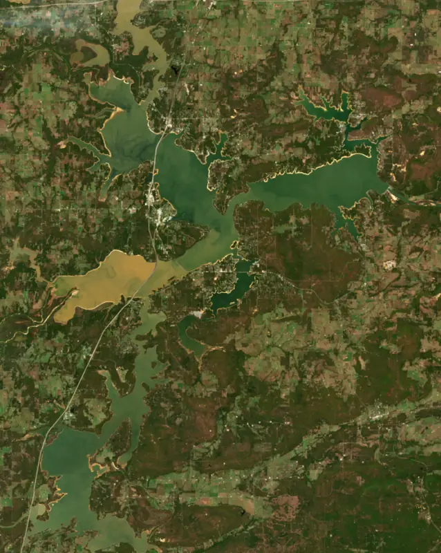
63°F on Nov 13, 2026
88°F · Jul 1963°F · Nov 13
25°F cooler than on Jul 19, 2026.
Estimated from MODIS Aqua (NASA) passes on clear days: the top layer of the water, a few degrees either way. Coves and the shallows can be warmer.
Lake Eufaula water temperature: trend, swimming and the fish →
On or near the shore of Lake Eufaula: 13 boat ramps, 10 marinas, 1 rental outfit, 30 campgrounds and 5 beaches. The lake has about 891 miles of shoreline, counting its islands.
Tap an icon for details; use two fingers (or Ctrl + scroll) to move the map. Tap a dot for details. Map and lake outline © OpenStreetMap contributors. Places from OpenStreetMap, Overture Maps and Recreation.gov. Not for navigation.
What you’ll find on the shore
← AllBoating 23
← AllRentals & tours 1
← AllFishing spots 2
← AllBeaches 5
← AllCamping 30
← AllLodging 24+
← AllParks 12
← AllDining 18
Zebra mussels have been found in Lake Eufaula. They clog intakes and engines and spread on boats and trailers: clean, drain and dry everything before you go to another lake.
Oklahoma: Before launching, remove all aquatic plants and zebra or quagga mussels from your boat, trailer and gear (state law); moving aquatic plants between waters is also illegal. Draining, and drying for five days if you can't hot-wash, are recommended but not required. State rules
Records: USGS Nonindigenous Aquatic Species database. A species not listed may still be present.
Species with open-licensed records inside Lake Eufaula's outline, from GBIF.org (surveys, museum collections and angler reports). A record shows a fish was found here, not how many there are now.
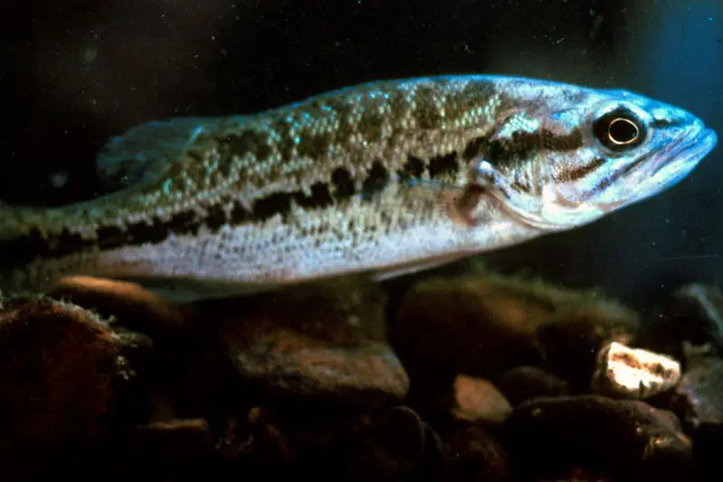
Shallow, protected flats in spring; docks, grass and deep edges in summer heat.
Brush piles, docks and bridge pilings; shallow for a few weeks in spring.
Channel edges and river arms; best after dark in summer, and after a rain.
Run up the river arms in spring; follow shad to cool, deep water near the dam in summer.
Clear water and steep rock; they often suspend deeper than largemouth.
Water temperature sets off each spawn; the bars show the usual months at this latitude and elevation, and move with a warm or cold spring. The water is about 63°F now.
Lake Eufaula is the U.S. Army Corps of Engineers reservoir on the Canadian River in eastern Oklahoma, lying mostly in McIntosh and Pittsburg counties with smaller reaches in Haskell and Okmulgee counties. It holds more water than any other lake in Oklahoma, which earned it the nickname the gentle giant. Crappie, white bass and catfish, two large state park areas and some 20 Corps recreation areas draw an estimated two million visitors a year.
Congress approved the project in 1946. The country along the river was poor, and floods could leave it underwater and cut off. Local backers organized the Eufaula Lake Development Association, led for a time by a Checotah theater owner, and kept up a correspondence with Oklahoma congressmen Carl Albert and Ed Edmondson. The Corps built it between 1956 and 1964 for flood control, water supply, hydroelectric power, navigation and recreation, and President Lyndon B. Johnson came to dedicate it on September 25, 1964.
The water covered river-bottom farmland, the kind of ground where Muscogee (Creek) farmers had long raised cotton and corn. Tourism has since become the main economic base around the town of Eufaula.
The Canadian, North Canadian and Deep Fork rivers are its main sources of water. The lake sits about 10 miles south of Interstate 40 on U.S. 69, and Eufaula, Checotah, Canadian, Krebs and McAlester are the nearby towns.
The town of Eufaula, the McIntosh County seat, began in 1872 as a railhead of the Missouri, Kansas and Texas Railway near North Fork Town. An Indian agent for the Five Tribes suggested the name, after a Muscogee tribal town in Alabama, the homeland the Creeks left for Indian Territory under the 1832 Treaty of Cusseta.
The state opened two parks on the lake in 1965, Fountainhead and Arrowhead, and borrowed $8 million from the federal government to build a resort lodge at each. Neither lodge made money, and the state never repaid the loans. The federal government sold Arrowhead Lodge to the Choctaw Nation and Fountainhead Lodge to private investors, and Fountainhead later went to the Muscogee (Creek) Nation at a sheriff's auction in 2005 and was torn down in 2008. The state kept the parks.
Fountainhead became Lake Eufaula State Park in 2002. It lies about 14 miles southwest of Checotah and has a swimming beach, a marina, the Deep Fork Nature Center, yurts, and trails for hikers, mountain bikers and riders. Arrowhead, now run as an area of the same park, covers 2,200 acres near the town of Canadian, with an 18-hole golf course, a marina, an equestrian camp, the Outlaw Nature Trail and its own airstrip for visitors who fly in.
The state wildlife department rates Eufaula an excellent fishery for crappie, white bass and catfish, with blue, channel and flathead catfish all present. Biologists maintain fish attractors around the lake and publish a map of them. Florida-strain largemouth bass have been stocked since the 1980s, smallmouth bass were stocked from 1992 to 1998, and a 14-inch minimum length on black bass has been in place since 1987 to put more spawning-size fish in the lake. Big swings in water level, muddy water and silt have long made the lake hard to manage.
Written by Lake by Lake from Oklahoma Historical Society (Lake Eufaula (Encyclopedia of Oklahoma History and Culture), Eufaula (Encyclopedia of Oklahoma History and Culture)), Oklahoma Department of Wildlife Conservation, U.S. Army, Oklahoma Tourism and Recreation Department (TravelOK) and Wikipedia. Checked November 2026.
Activities listed by the U.S. Army Corps of Engineers: Boating · Camping · Fishing · Hiking · Horseback riding · Off-road vehicles · Picnicking · Water sports · Wildlife viewing
Eufaula Dam is a concrete gravity dam 114 feet high and 3,200 feet long on the Canadian River, completed in 1964. It belongs to the U.S. Army Corps of Engineers (Tulsa District) and is run for flood control, recreation, hydropower and water supply. At its normal level the reservoir holds 2.31 million acre-ft, drained from 8,405 square miles of land.
From the National Inventory of Dams (U.S. Army Corps of Engineers), NID ID OK10308. Lake or reservoir: what’s the difference?
Where the level comes from: Lake Eufaula (U.S. Army Corps of Engineers, used on this page) and Eastern Oklahoma Lakes at Eufala Lake (NOAA National Water Prediction Service).
| Lake | Miles | Level (ft) | vs full | 7 days |
|---|---|---|---|---|
| Tenkiller Lake Below full | 26 | 624.95 | −7.05 | −0.18 |
| Fort Gibson Lake At or near full pool | 40 | 553.05 | −0.95 | −0.90 |
| Wister Lake Slightly below full | 44 | 473.48 | −4.52 | −0.28 |
| Sardis Lake At or near full pool | 47 | 597.10 | −1.90 | −0.09 |
| Lake Hudson At or near full pool | 65 | 619.80 | +0.80 | +0.02 |
| Heyburn Lake At or near full pool | 69 | 760.53 | −0.97 | −0.04 |
Compare Lake Eufaula with Tenkiller Lake, Fort Gibson Lake, Wister Lake or Sardis Lake: size, level, ramps and fish side by side.
Lake Eufaula is about 56 mi from Broken Arrow, OK. See all the lakes near each city.
Lake Eufaula is also known as Eufaula Reservoir and Eufaula Lake.
Lake Eufaula is at 581.23 feet above sea level — 3.77 ft below normal pool, as of Nov 17, 2026, 8:00 PM CST. It has dropped 0.24 ft in the past 7 days.
Lake Eufaula's normal pool is 585.00 ft, according to U.S. Army Corps of Engineers. Today the lake is 3.77 ft below that mark.
Today's level is 3.24 ft below the median for this date (584.47 ft), from the gauge’s long-term daily record.
579.26 ft, on November 23, 2022, in the U.S. Army Corps of Engineers record, which starts in 2014. Today the lake is 2.0 ft above that.
599.64 ft, on May 26, 2015, in the U.S. Army Corps of Engineers record since 2014. That is 14.6 ft above normal pool.
Lake Eufaula has 13 boat ramps on our map, including Boat ramp near Juniper Point Recreation Area, Boat ramp at Crowder Point East Recreation Area, Boat ramp at Highway 31 Landing Recreation Area, and 10 marinas. Low water can close ramps, so check today's level above and the operator before you go.
Yes. There are 30 campgrounds and RV parks within about a mile of the shore, such as Bugtussel, Oak Ridge Recreation Area, Gentry Creek Campground.
Game fish recorded in Lake Eufaula include largemouth bass, blue catfish, flathead catfish, channel catfish, white crappie, bluegill. In all, 40 fish species have open records inside the lake on GBIF.
The surface of Lake Eufaula was about 63°F on November 13, estimated from a satellite pass on a clear day. It is the top layer of the water, a few degrees either way; coves and shallows run warmer in the sun.
Anglers 18 and older need an Oklahoma fishing license, sold online by the Oklahoma Department of Wildlife Conservation. Free fishing days: First weekend in June. Size and bag limits can be set lake by lake: check the current regulations.
Lake Eufaula is about 89 ft deep at its deepest point, usually near the dam, and about 16 ft deep on average. Depth changes with the lake level.
Yes: volumetric survey report with contour map from the Texas Water Development Board (2004). It is linked in the lake facts on this page. Depths on a map are measured at a reference level: subtract how far the lake is below it today.
U.S. Army Corps of Engineers lists boating, camping, fishing, hiking, horseback riding, off-road vehicles, picnicking and water sports at Eufaula Lake. 7 campgrounds can be booked on Recreation.gov.
EPA's CyAN satellite rated cyanobacteria in Lake Eufaula high on November 9. The satellite sees open water only; blooms can be patchy, so avoid water that looks like spilled paint or pea soup and keep dogs out of scum. Swimming advisories come from Oklahoma health and environment agencies.
Lake Eufaula is held back by Eufaula Dam, completed in 1964 and 114 ft high, according to the National Inventory of Dams.
From the U.S. Army Corps of Engineers (Lake Eufaula). Lake by Lake checks it every hour; the agency's own figure is always the reference, and provisional readings can be revised.
Lake levels are refreshed every hour. Texas and California reservoirs report once a day; most USGS and NOAA gauges report every 15 to 60 minutes.