Sun
- Sunrise
- 7:08 AM
- Sunset
- 4:43 PM
- First light
- 6:37 AM
- Last light
- 5:14 PM
Reservoir · Lane County, Oregon
A reservoir on the Middle Fork Willamette River in Lane County, Oregon, held back by Dexter Dam since 1955. Also called Dexter Reservoir.

Dexter Lake is at 692.62 feet above sea level — 2.38 ft below top of power pool, as of Nov 17, 2026, 6:45 PM PST. It has risen 0.31 ft in the past 7 days.
Fullest of 38 Oregon lakes today against full pool · See the ranking
Record low 688.34 ft (1969), record high 695.10 ft (1969) · Level history since 1960
A notification from this browser, once, when the level crosses the line (checked every hour). No account and no email. On an iPhone, add Lake by Lake to your home screen first (Share → Add to Home Screen) and open it from there. Or follow the lake in a feed reader: RSS feed.
Dexter Lake is up 0.31 ft over the last 7 days, at 692.62 ft today.
Daily values from the U.S. Geological Survey.
Dexter Lake has held steady over the last 30 days (within 0.05 ft).
Daily values from the U.S. Geological Survey.
Over the past 12 months, Dexter Lake ranged from 690.85 ft (Dec 16, 2025) to 694.21 ft (May 5, 2026), a swing of 3.4 ft. Today's level is in the upper half of that range. It is 0.27 ft lower than on this date last year.
Daily values from the U.S. Geological Survey. Why lake levels rise and fall
In the U.S. Army Corps of Engineers record, which starts in 1960, the lowest level was 688.34 ft on May 28, 1969 and the highest 695.10 ft on May 11, 1969. Today’s 692.62 ft is 4.3 ft above the record low and 2.5 ft below the record high.
Dexter Lake level history: every year since 1960, the lowest and highest years →
Solunar periods for Dexter Lake, local time. How they work
Stay away from algae and scum, and keep dogs out of the water near them.
From the Oregon Health Authority, checked Nov 16. Advisories change with the weather: check the agency's page and the signs at the water before you go.
Not detected · as of Nov 9, 2026
The satellite found no cyanobacteria at the surface.
Week of Aug 16Week of Nov 1
Each bar is one week, colored by the worst reading of that week.
From the U.S. EPA's Cyanobacteria Assessment Network (CyAN), which reads the color of lakes from the Sentinel-3 satellites; it sees open water only, not coves or the shoreline. Blooms can be patchy: what you see on the water matters more. Swimming closures and health advisories come from Oregon health and environment agencies. How to read it
Surface water temperature
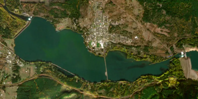
63°F on Oct 11, 2026
74°F · Jul 3163°F · Oct 11
11°F cooler than on Jul 31, 2026.
Estimated from Landsat 8/9 (USGS) passes on clear days: the top layer of the water, a few degrees either way. Coves and the shallows can be warmer.
Dexter Lake water temperature: trend, swimming and the fish →
On or near the shore of Dexter Lake: 3 boat ramps, 1 marina, 1 rental outfit, 1 campground and 1 trail. The lake has about 10 miles of shoreline, counting its islands.
Tap an icon for details; use two fingers (or Ctrl + scroll) to move the map. Tap a dot for details. Map and lake outline © OpenStreetMap contributors. Places from OpenStreetMap, Overture Maps and Recreation.gov. Not for navigation.
What you’ll find on the shore
← AllBoating 4
← AllRentals & tours 1
← AllFishing spots 1
← AllCamping 1
← AllTrails 1
← AllParks 2
← AllDining 2
No aquatic invasive species are on record for Dexter Lake in the USGS database. Keep it that way: clean, drain and dry your boat between lakes.
Oregon: All boaters, paddlers included, must stop at open boat inspection stations. After leaving the water, pull the drain plug and drain all water-holding areas before trailering; releasing live bait, fish or plants into a waterbody is illegal. Required: Waterway Access Permit (paddlecraft); Out-of-State AIS Permit (motorboats) (Paddlecraft $6 for 7 days, $20 a year or $35 for 2 years; out-of-state motorboats $30 a year). State rules
Records: USGS Nonindigenous Aquatic Species database. A species not listed may still be present.
Species with open-licensed records inside Dexter Lake's outline, from GBIF.org (surveys, museum collections and angler reports). A record shows a fish was found here, not how many there are now.
Shallow, protected flats in spring; docks, grass and deep edges in summer heat.
Brush piles, docks and bridge pilings; shallow for a few weeks in spring.
Rocky points, gravel and current breaks; deeper rock piles in summer.
Cool water: near the surface in spring and fall, deep in summer.
Soft, weedy bottoms in shallow bays; bites best after dark in late spring and summer.
Water temperature sets off each spawn; the bars show the usual months at this latitude and elevation, and move with a warm or cold spring.
Dexter Reservoir (also known as Dexter Lake) is a reservoir in Lane County, in the U.S. state of Oregon. It is about 16 miles (26 km) southeast of Eugene on the Middle Fork Willamette River, immediately downriver from Lookout Point Lake, another reservoir. The communities of Dexter and Lowell are near the lake.
From Wikipedia, under CC BY-SA 4.0.
22 miles southeast of Eugene, Dexter Lake is a popular recreation area offering year-round fishing, seasonal water skiing, sailing, swimming, picnicking and hunting. The area is also managed for wildlife habitat such as waterfowl, blacktail deer, upland game birds, wintering elk, bald eagles, osprey and many other species. Dexter Dam was completed in 1954 and provides flood control and has one generator, which produces 15,000 kilowatts
Activities listed by the U.S. Army Corps of Engineers: Boating · Hiking · Picnicking · Water sports · Wildlife viewing
Dexter Dam is an earthfill dam 65 feet high and 2,765 feet long on the Middle Fork Willamette River, completed in 1955. It belongs to the U.S. Army Corps of Engineers (Portland District) and is run for flood control, irrigation, navigation, recreation and hydropower. At its normal level the reservoir holds 22,200 acre-ft, drained from 996 square miles of land.
From the National Inventory of Dams (U.S. Army Corps of Engineers), NID ID OR00006. Lake or reservoir: what’s the difference?
Where the level comes from: DEXTER LAKE AT DEXTER, OR (U.S. Geological Survey).
| Lake | Miles | Level (ft) | vs full | 7 days |
|---|---|---|---|---|
| Lookout Point Lake Well below full | 3 | 779.15 | −146.85 | −10.95 |
| Fall Creek Lake Well below full | 3 | 696.02 | −133.98 | — |
| Dorena Reservoir Well below full | 12 | 770.97 | −61.03 | +1.76 |
| Cottage Grove Lake Well below full | 19 | 750.15 | −39.85 | +0.67 |
| Hills Creek Lake Well below full | 24 | 1444.13 | −96.87 | −0.88 |
| Fern Ridge Reservoir Well below full | 28 | 353.30 | −20.20 | −5.38 |
Compare Dexter Lake with Lookout Point Lake, Fall Creek Lake, Dorena Reservoir or Cottage Grove Lake: size, level, ramps and fish side by side.
Dexter Lake is about 18 mi from Eugene, OR. See all the lakes near each city.
Dexter Lake is also known as Dexter Reservoir.
Dexter Lake is at 692.62 feet above sea level — 2.38 ft below top of power pool, as of Nov 17, 2026, 6:45 PM PST. It has risen 0.31 ft in the past 7 days.
Dexter Lake's top of power pool is 695.00 ft, according to U.S. Army Corps of Engineers. Today the lake is 2.38 ft below that mark.
Today's level is 0.75 ft below the median for this date (693.37 ft), from the gauge’s long-term daily record.
688.34 ft, on May 28, 1969, in the U.S. Army Corps of Engineers record, which starts in 1960. Today the lake is 4.3 ft above that.
695.10 ft, on May 11, 1969, in the U.S. Army Corps of Engineers record since 1960. That is 0.1 ft above top of power pool.
Dexter Lake has 3 boat ramps on our map, including Dexter State Park, Lowell Boat Ramp, Meridian Park, and 1 marina. Low water can close ramps, so check today's level above and the operator before you go.
Yes. There is 1 campground within about a mile of the shore, such as Dexter Shores RV Park.
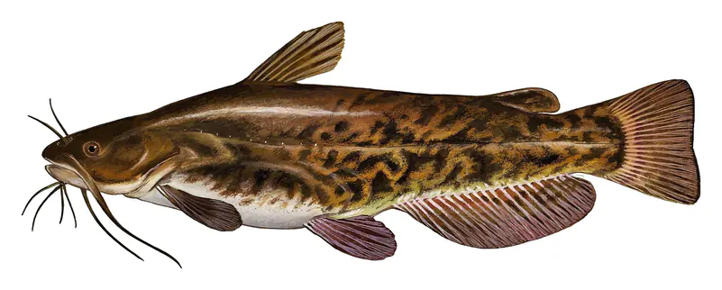
Game fish recorded in Dexter Lake include largemouth bass, white crappie, smallmouth bass, rainbow trout, brown bullhead. In all, 9 fish species have open records inside the lake on GBIF.
Anglers 12 and older need an Oregon fishing license, sold online by the Oregon Department of Fish and Wildlife. Free fishing days: Presidents' Day weekend, one weekend in June, and Thanksgiving weekend. Size and bag limits can be set lake by lake: check the current regulations.
Dexter Lake averages about 22 ft deep. Depth changes with the lake level.
Yes: atlas lake page with bathymetric map from the Portland State University, Atlas of Oregon Lakes (1951). It is linked in the lake facts on this page. Depths on a map are measured at a reference level: subtract how far the lake is below it today.
U.S. Army Corps of Engineers lists boating, hiking, picnicking, water sports and wildlife viewing at Dexter Lake.
EPA's CyAN satellite rated cyanobacteria in Dexter Lake not detected on November 9. The satellite sees open water only; blooms can be patchy, so avoid water that looks like spilled paint or pea soup and keep dogs out of scum. Swimming advisories come from Oregon health and environment agencies.
Yes. A trail runs along or near the shore, including Middle Fork Willamette Trail (2.6 mi), according to OpenStreetMap.
Dexter Lake is held back by Dexter Dam, completed in 1955 and 65 ft high, according to the National Inventory of Dams.
From the U.S. Geological Survey (DEXTER LAKE AT DEXTER, OR). Lake by Lake checks it every hour; the agency's own figure is always the reference, and provisional readings can be revised.
Lake levels are refreshed every hour. Texas and California reservoirs report once a day; most USGS and NOAA gauges report every 15 to 60 minutes.