Sun
- Sunrise
- 7:04 AM
- Sunset
- 4:42 PM
- First light
- 6:33 AM
- Last light
- 5:13 PM
Lake · Douglas County, Oregon
A lake in Douglas County, Oregon.

Diamond Lake is at 5,183.57 feet above sea level, as of Nov 17, 2026, 6:30 PM PST. The level has held steady over the past week.
2nd highest of 9 Oregon lakes today against normal for the date · See the ranking
A notification from this browser, once, when the level crosses the line (checked every hour). No account and no email. On an iPhone, add Lake by Lake to your home screen first (Share → Add to Home Screen) and open it from there. Or follow the lake in a feed reader: RSS feed.
Diamond Lake is down 0.48 ft over the last 30 days, at 5,183.57 ft today.
Daily values from the U.S. Geological Survey.
Over the past 12 months, Diamond Lake ranged from 5,183.21 ft (Dec 4, 2025) to 5,184.20 ft (Oct 4, 2026), a swing of 1.0 ft. Today's level is in the lower half of that range. It is 0.15 ft higher than on this date last year.
Daily values from the U.S. Geological Survey. Why lake levels rise and fall
Solunar periods for Diamond Lake, local time. How they work
Stay away from algae and scum, and keep dogs out of the water near them.
From the Oregon Health Authority, checked Nov 16. Advisories change with the weather: check the agency's page and the signs at the water before you go.
Moderate · as of Nov 6, 2026
A bloom may be forming somewhere on the lake. Avoid water that looks like spilled paint or pea soup. About 270,000 cells/mL at the worst spot, covering 47% of the lake.
Week of Aug 9Week of Nov 1
Each bar is one week, colored by the worst reading of that week.
From the U.S. EPA's Cyanobacteria Assessment Network (CyAN), which reads the color of lakes from the Sentinel-3 satellites; it sees open water only, not coves or the shoreline. Blooms can be patchy: what you see on the water matters more. Swimming closures and health advisories come from Oregon health and environment agencies. How to read it
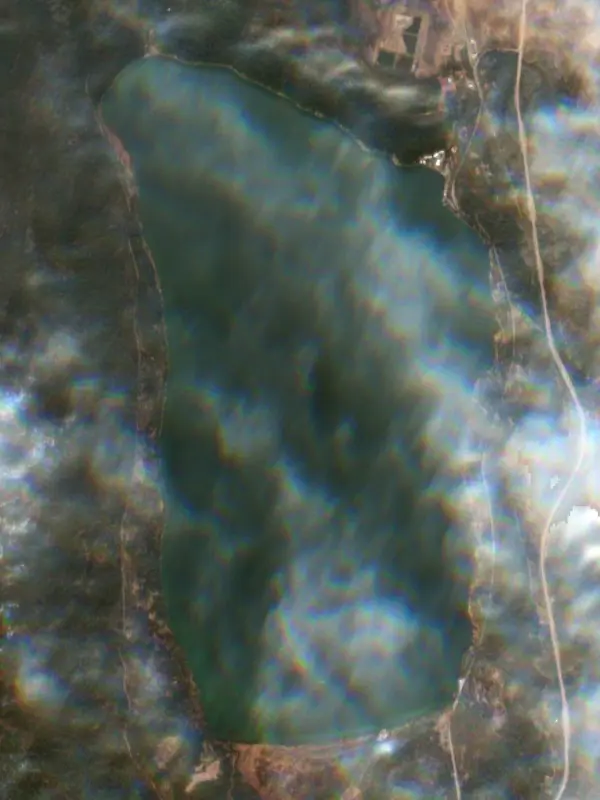
Surface water temperature
49°F on Oct 20, 2026
72°F · Jul 2449°F · Oct 20
23°F cooler than on Jul 24, 2026.
Estimated from Landsat 8/9 (USGS) passes on clear days: the top layer of the water, a few degrees either way. Coves and the shallows can be warmer.
Diamond Lake water temperature: trend, swimming and the fish →
On or near the shore of Diamond Lake: 5 boat ramps, 5 campgrounds and 3 trails. The lake has about 9 miles of shoreline, counting its islands.
Tap an icon for details; use two fingers (or Ctrl + scroll) to move the map. Tap a dot for details. Map and lake outline © OpenStreetMap contributors. Places from OpenStreetMap, Overture Maps and Recreation.gov. Not for navigation.
What you’ll find on the shore
← AllBoating 5
← AllCamping 5
← AllLodging 1
← AllTrails 3
← AllParks 2
← AllDining 2
No aquatic invasive species are on record for Diamond Lake in the USGS database. Keep it that way: clean, drain and dry your boat between lakes.
Oregon: All boaters, paddlers included, must stop at open boat inspection stations. After leaving the water, pull the drain plug and drain all water-holding areas before trailering; releasing live bait, fish or plants into a waterbody is illegal. Required: Waterway Access Permit (paddlecraft); Out-of-State AIS Permit (motorboats) (Paddlecraft $6 for 7 days, $20 a year or $35 for 2 years; out-of-state motorboats $30 a year). State rules
Records: USGS Nonindigenous Aquatic Species database. A species not listed may still be present.
Species with open-licensed records inside Diamond Lake's outline, from GBIF.org (surveys, museum collections and angler reports). A record shows a fish was found here, not how many there are now.
Cool water: near the surface in spring and fall, deep in summer.
Water temperature sets off each spawn; the bars show the usual months at this latitude and elevation, and move with a warm or cold spring.
Diamond Lake is a high, shallow natural lake in the Umpqua National Forest of southern Oregon, just north of Crater Lake National Park, with Mount Bailey rising on its west side and the spire of Mount Thielsen on its east. It lies off Oregon Route 138, about 80 miles east of Roseburg. For generations it has been one of the state's favorite rainbow trout lakes, and it is also known for a long fight against an invasive minnow.
During the Ice Age, glaciers filled the valley between Mount Bailey and Mount Thielsen. When the last and largest advance melted, it left a shallow basin and the water to fill it. The toe of a lava flow from Thielsen forms a low dam across the north end, and the lake drains at its northwest corner into Lake Creek, which runs to the North Umpqua River. The height of that outlet is the reason the lake stays so shallow. Meltwater also laid down beds of fine glacial clay that water cannot pass through. About 6,600 years ago, the eruption of Mount Mazama that created Crater Lake sent glowing avalanches of pumice north through the area. Their deposits lie beneath the lake, and it is still not clear how the avalanche crossed the water, perhaps on a raft of floating pumice or over winter ice. Silent Creek is the main inflow. The lake is named for John Diamond, a settler from Coburg who saw it in 1852 from the summit of Diamond Peak while helping open an emigrant road.
Rainbow trout are not native here. The lake lacks spawning habitat but grows trout quickly on its insects, so the fishery depends on stocking. The trouble has been the tui chub, a minnow from the Klamath Basin. Chub wrecked the trout fishery once before, and the state poisoned the lake with rotenone in 1954, which brought decades of excellent fishing. Chub turned up again in 1992, most likely from anglers using them as live bait, and grew to an estimated 8 million adults and 90 million young. Trout catches collapsed. The large zooplankton vanished, the mass of chub loaded the water with nutrients, and blooms of a toxic cyanobacterium closed the lake to water contact for parts of the summers of 2001, 2002 and 2003. State Representative Susan Morgan started the push for a cleanup in 2002, and in September 2006 the Oregon Department of Fish and Wildlife treated the lake again at a cost of nearly $6 million. The recovery was fast. Water clarity, about 7.5 feet in July 2006, reached 37.5 feet the next summer, and the trout came back. Golden shiners, another bait minnow, appeared in 2008, and a single chub was caught in a trap net in 2015. The state answered with predatory trout, planning tiger trout releases in 2016 and stocking brown trout from 2018 to eat any minnows that slip in. Anglers are asked never to move live fish or use them as bait, and boaters to empty bilge water and check for invasive species.
The Forest Service runs the campgrounds. Diamond Lake Campground stretches along much of the east shore, Broken Arrow sits at the south end and Thielsen View on the west shore. An 11-mile paved path circles the lake, and trails climb to the summits of Mount Bailey and Mount Thielsen, with the Pacific Crest Trail close by. Boats are held to 10 mph, and many anglers fish near Silent Creek or in the deeper water to the north. The state stocks hundreds of thousands of rainbow fingerlings a year. At this elevation the water stays cold even in summer, and in winter the area turns to snowmobiling, cross-country skiing and sled dog racing.
Written by Lake by Lake from USDA Forest Service, Umpqua National Forest (via NPS History), Oregon Department of Fish and Wildlife (Diamond Lake Restoration Update, Diamond Lake water quality monitoring, Tui chub found in Diamond Lake (news release, November 2015)), USDA Forest Service (Recreation.gov) and Wikipedia. Checked November 2026.
Where the level comes from: DIAMOND LAKE NEAR DIAMOND LAKE, OR (U.S. Geological Survey).
| Lake | Miles | Level (ft) | vs full | 7 days |
|---|---|---|---|---|
| Lemolo Lake Live reading | 10 | 4123.79 | — | −0.15 |
| Crater Lake Live reading | 15 | 6165.09 | — | −0.09 |
| Crescent Lake Well below full | 24 | 4825.53 | −21.47 | +0.03 |
| Hills Creek Lake Well below full | 38 | 1444.13 | −96.87 | −0.88 |
| Wickiup Reservoir Well below full | 42 | 4310.76 | −26.90 | +2.33 |
| Crane Prairie Reservoir Slightly below full | 44 | 4440.61 | −4.39 | +0.13 |
Compare Diamond Lake with Lemolo Lake, Crater Lake, Crescent Lake or Hills Creek Lake: size, level, ramps and fish side by side.
Diamond Lake is at 5,183.57 feet above sea level, as of Nov 17, 2026, 6:30 PM PST. The level has held steady over the past week.
Today's level is 0.26 ft above the median for this date (5,183.31 ft), from the gauge’s long-term daily record.
Diamond Lake has 5 boat ramps on our map, including Diamond Lake Campground - C Loop, North Boat Ramp, South Shore Boating Site. Low water can close ramps, so check today's level above and the operator before you go.
Yes. There are 5 campgrounds and RV parks within about a mile of the shore, such as Thielsen View Campground, Diamond Lake Campground, Diamond Lake RV Park.
Game fish recorded in Diamond Lake include rainbow trout. In all, 4 fish species have open records inside the lake on GBIF.
Anglers 12 and older need an Oregon fishing license, sold online by the Oregon Department of Fish and Wildlife. Free fishing days: Presidents' Day weekend, one weekend in June, and Thanksgiving weekend. Size and bag limits can be set lake by lake: check the current regulations.
Diamond Lake is about 53 ft deep at its deepest point. Depth changes with the lake level.
Yes: atlas lake page with bathymetric map from the Portland State University, Atlas of Oregon Lakes (2003). It is linked in the lake facts on this page. Depths on a map are measured at a reference level: subtract how far the lake is below it today.
boating (5 boat ramps), fishing (1 game fish), hiking & walking (3 trails along the shore, the longest North Crater Trail (8.5 mi)), camping (5 campgrounds, 3 bookable on Recreation.gov), cabins & lodging (1 place to stay close to the water) and parks & picnics (2 parks on the shore), according to our map of the shore.
EPA's CyAN satellite rated cyanobacteria in Diamond Lake moderate on November 6. The satellite sees open water only; blooms can be patchy, so avoid water that looks like spilled paint or pea soup and keep dogs out of scum. Swimming advisories come from Oregon health and environment agencies.
Yes. 3 trails run along or near the shore, including Dellenback Bike Path (6.9 mi), Diamond Lake Loop (1.7 mi) and North Crater Trail (8.5 mi), according to OpenStreetMap.
From the U.S. Geological Survey (DIAMOND LAKE NEAR DIAMOND LAKE, OR). Lake by Lake checks it every hour; the agency's own figure is always the reference, and provisional readings can be revised.
Lake levels are refreshed every hour. Texas and California reservoirs report once a day; most USGS and NOAA gauges report every 15 to 60 minutes.
