Sun
- Sunrise
- 7:02 AM
- Sunset
- 4:51 PM
- First light
- 6:33 AM
- Last light
- 5:21 PM
Reservoir · Huntingdon County, Pennsylvania
A reservoir on the Raystown Branch Juniata River in Huntingdon County, Pennsylvania, held back by Raystown Dam since 1973.

Raystown Lake is at 778.99 feet above sea level — 7.01 ft below top of conservation pool, as of Nov 19, 2026, 3:00 AM EST. It has dropped 0.38 ft in the past 7 days.
7th lowest of 21 Pennsylvania lakes today against full pool · See the ranking
Record low 776.41 ft (2021), record high 793.06 ft (2011) · Level history since 2003
A notification from this browser, once, when the level crosses the line (checked every hour). No account and no email. On an iPhone, add Lake by Lake to your home screen first (Share → Add to Home Screen) and open it from there. Or follow the lake in a feed reader: RSS feed.
Raystown Lake is down 0.38 ft over the last 7 days, at 778.99 ft today.
Daily values from the U.S. Geological Survey.
Raystown Lake is down 7.09 ft over the last 30 days, at 778.99 ft today.
Daily values from the U.S. Geological Survey.
Over the past 12 months, Raystown Lake ranged from 776.54 ft (Feb 18, 2026) to 786.78 ft (Aug 3, 2026), a swing of 10.2 ft. Today's level is in the lower half of that range. It is 4.64 ft lower than on this date last year.
Daily values from the U.S. Geological Survey. Why lake levels rise and fall
In the U.S. Geological Survey record, which starts in 2003, the lowest level was 776.41 ft on December 27, 2021 and the highest 793.06 ft on September 11, 2011. Today’s 778.99 ft is 2.6 ft above the record low and 14.1 ft below the record high.
Raystown Lake level history: every year since 2003, the lowest and highest years →
Solunar periods for Raystown Lake, local time. How they work
Not detected · as of Nov 9, 2026
The satellite found no cyanobacteria at the surface.
Week of Aug 9Week of Nov 1
Each bar is one week, colored by the worst reading of that week.
From the U.S. EPA's Cyanobacteria Assessment Network (CyAN), which reads the color of lakes from the Sentinel-3 satellites; it sees open water only, not coves or the shoreline. Blooms can be patchy: what you see on the water matters more. Swimming closures and health advisories come from Pennsylvania health and environment agencies. How to read it
Surface water temperature
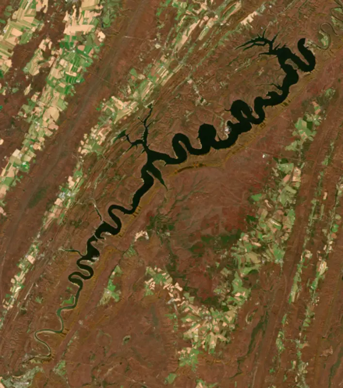
54°F on Nov 2, 2026
83°F · Aug 654°F · Nov 2
28°F cooler than on Aug 6, 2026.
Estimated from Landsat 8/9 (USGS) passes on clear days: the top layer of the water, a few degrees either way. Coves and the shallows can be warmer.
Raystown Lake water temperature: trend, swimming and the fish →
On or near the shore of Raystown Lake: 8 boat ramps, 3 marinas, 1 rental outfit, 17 campgrounds, 1 beach and 15 trails. The lake has about 122 miles of shoreline, counting its islands.
Tap an icon for details; use two fingers (or Ctrl + scroll) to move the map. Tap a dot for details. Map and lake outline © OpenStreetMap contributors. Places from OpenStreetMap, Overture Maps and Recreation.gov. Not for navigation.
What you’ll find on the shore
← AllBoating 11
← AllRentals & tours 1
← AllFishing spots 3
← AllBeaches 1
← AllCamping 17
← AllLodging 5
← AllTrails 15
← AllParks 6
Zebra mussels have been found in Raystown Lake. They clog intakes and engines and spread on boats and trailers: clean, drain and dry everything before you go to another lake.
Pennsylvania: Your boat, trailer, motor and gear must be free of plants and other aquatic organisms; when leaving any water, drain the boat, livewells and bilges by pulling the drain plug and keep plugs out or open while trailering. Officers can keep a boat off the water or order it decontaminated. State rules
Records: USGS Nonindigenous Aquatic Species database. A species not listed may still be present.
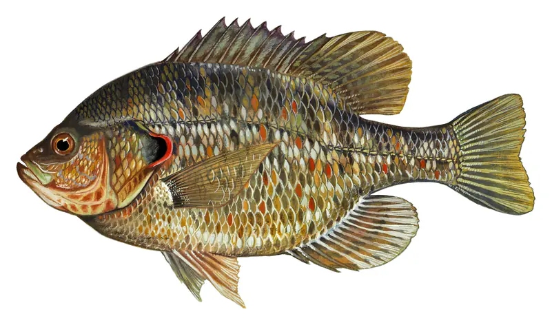
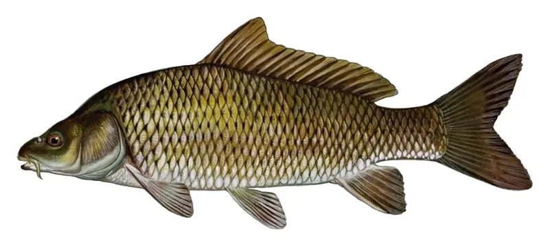
Species with open-licensed records inside Raystown Lake's outline, from GBIF.org (surveys, museum collections and angler reports). A record shows a fish was found here, not how many there are now.
Channel edges and river arms; best after dark in summer, and after a rain.
Run up the river arms in spring; follow shad to cool, deep water near the dam in summer.
Beds in shallow, firm bottoms; around docks and weeds all summer.
On the bottom near snail beds; spawns around the full moon.
Shallow, muddy bays and flooded grass in spring; mud flats and inflows in summer.
Water temperature sets off each spawn; the bars show the usual months at this latitude and elevation, and move with a warm or cold spring.
Raystown Lake is an Army Corps of Engineers reservoir on the Raystown Branch of the Juniata River, in southern Huntingdon and northern Bedford counties in south central Pennsylvania. It is the largest lake that lies entirely inside the state, and it is known for big striped bass, wooded shores with little private building, and a mountain bike trail system ranked among the best in the country.
The first dam was a private hydroelectric project, finished in 1911, and it held back a shallow lake about a quarter the size of the one there now. The flood of 1936, which wrecked much of the Juniata valley, built the case for something far bigger. Congress authorized the Corps project in the Flood Control Act of 1962, and work started in the fall of 1968. The dam was still unfinished when Tropical Storm Agnes hit in June 1972, and it still held back floodwater from the storm. It was completed in the fall of 1973, Vice President Gerald Ford dedicated it in 1974, and the lake first reached full pool in 1975. The Corps credits it with preventing hundreds of millions of dollars in flood damage since then in Huntingdon, Lewistown, Mapleton and other towns downstream.
The new lake drowned the old dam, which local scuba divers now explore, along with the villages of Brumbaugh's Crossing, Hawn's Bridge, Sarah and Snydertown. About 407 graves were moved. Before the water rose, Juniata College and Penn State excavated Sheep Rock Shelter, an archaeological site that now lies under the lake. Since 1988 a hydroelectric plant run by Allegheny Electric Cooperative has generated power at the dam.
The dam stands about 6 river miles above the point where the Raystown Branch joins the Juniata near Huntingdon. The Corps owns the land around the lake, including about 21,000 acres of forested mountain slopes, so cottages and homes sit back from the water rather than along it. The project has five campgrounds, 10 boat launches, two full-service marinas and nearly 70 miles of trails. The Seven Points area has a marina, a swimming beach and a disc golf course.
The Allegrippis Trails opened in May 2009 as a 30-mile network of stacked loops through about 4,000 acres of forest and meadow along the lake, laid out by mountain bikers for mountain bikers. The International Mountain Bicycling Association named it a flagship riding area. In 2016 a skills park opened across from the visitor center on Seven Points Road so riders can practice before heading out.
State biologists call Raystown a two-story reservoir. It is deep enough to keep cold and cool water through the summer, so cold-water fish such as lake trout share the lake with warm-water bass and catfish. The Fish and Boat Commission stocks young lake trout, striped bass, walleye, muskellunge and tiger muskellunge, and two anglers' clubs, the Pennsylvania Striped Bass Association and the Keystone Striper Club, add stripers of their own. Largemouth and smallmouth bass, crappie, bluegill, yellow perch and channel catfish sustain themselves.
The lake holds two state records: an inland striped bass of 53 pounds 12 ounces caught in 1994, and a landlocked Atlantic salmon of 17 pounds 2 ounces caught in 2001. In a 2016 spring survey, biologists netted legal-size stripers at the highest rate since their records began in 1983, and the fish were in good condition. Trout and rainbow smelt fall under special regulations here, so check the current rules before keeping either.
Written by Lake by Lake from U.S. Army Corps of Engineers, Baltimore District, U.S. Army (Raystown Dam flood gate systems enter latest phase of comprehensive rehabilitation, Raystown debuts mountain bike skills park), Pennsylvania Fish and Boat Commission (Biologist Report, Raystown Lake Striped Bass Evaluation, State Record Fish) and Wikipedia. Checked November 2026.
Activities listed by the U.S. Army Corps of Engineers: Biking · Boating · Camping · Fishing · Hiking · Picnicking · Visitor center · Water sports · Wildlife viewing · Swimming
Raystown Dam is a rockfill dam 225 feet high and 1,700 feet long on the Raystown Branch Juniata River, completed in 1973. It belongs to the U.S. Army Corps of Engineers (Baltimore District) and is run for flood control and recreation. At its normal level the reservoir holds 514,000 acre-ft, drained from 960 square miles of land.
From the National Inventory of Dams (U.S. Army Corps of Engineers), NID ID PA00004. Lake or reservoir: what’s the difference?
Where the level comes from: Raystown Lake near Huntingdon, PA (U.S. Geological Survey, used on this page) and Central PA Dams Raystown Dam on Raystown Branch of Juniata River (NOAA National Water Prediction Service).
| Lake | Miles | Level (ft) | vs full | 7 days |
|---|---|---|---|---|
| Glendale Lake Live reading | 33 | 1427.30 | — | +0.01 |
| Curwensville Lake At or near full pool | 45 | 1162.32 | +0.32 | +0.01 |
| Foster Joseph Sayers Reservoir At or near full pool | 47 | 629.52 | −0.48 | −0.55 |
| Kettle Creek Lake Above full pool | 64 | 842.07 | +1.07 | −0.14 |
| George B. Stevenson Reservoir At or near full pool | 67 | 922.00 | +1.00 | −0.42 |
| Conemaugh Lake Live reading | 72 | 904.89 | — | −1.74 |
Compare Raystown Lake with Glendale Lake, Curwensville Lake, Foster Joseph Sayers Reservoir or Kettle Creek Lake: size, level, ramps and fish side by side.
Raystown Lake is at 778.99 feet above sea level — 7.01 ft below top of conservation pool, as of Nov 19, 2026, 3:00 AM EST. It has dropped 0.38 ft in the past 7 days.
Raystown Lake's top of conservation pool is 786.00 ft, according to U.S. Army Corps of Engineers. Today the lake is 7.01 ft below that mark.
Today's level is 6.73 ft below the median for this date (785.72 ft), from the gauge’s long-term daily record.
776.41 ft, on December 27, 2021, in the U.S. Geological Survey record, which starts in 2003. Today the lake is 2.6 ft above that.
793.06 ft, on September 11, 2011, in the U.S. Geological Survey record since 2003. That is 7.1 ft above top of conservation pool.
Raystown Lake has 8 boat ramps on our map, including Boat ramp at Lake Raystown Resort, Boat ramp at Snyders Run Boat Launch, Boat ramp near Lake Raystown Resort and Campground, and 3 marinas. Low water can close ramps, so check today's level above and the operator before you go.
Yes. There are 17 campgrounds and RV parks within about a mile of the shore, such as Nancy's Boat To Shore Campground, Senoia Campground, Lake Raystown Resort Lakeside Villas.
Game fish recorded in Raystown Lake include flathead catfish, striped bass, bluegill, redear sunfish, common carp, green sunfish. In all, 6 fish species have open records inside the lake on GBIF.
Anglers 16 and older need a Pennsylvania fishing license, sold online by the Pennsylvania Fish and Boat Commission. Free fishing days: Two Fish-for-Free Days (2026: May 24 and July 4). Size and bag limits can be set lake by lake: check the current regulations.
Raystown Lake averages about 62 ft deep. Depth changes with the lake level.
In summer a white Secchi disk lowered into Raystown Lake stays visible to about 10.2 ft (the median of 9 readings, 2017–2018, by North American Lake Management Society and EPA National Aquatic Resources Survey (NARS)): clear water. Silt after rain lowers the reading as much as algae do. Clarity drops after storms and during algae blooms.
U.S. Army Corps of Engineers lists biking, boating, camping, fishing, hiking, picnicking, visitor center and water sports at Raystown Lake. 3 campgrounds can be booked on Recreation.gov.
EPA's CyAN satellite rated cyanobacteria in Raystown Lake not detected on November 9. The satellite sees open water only; blooms can be patchy, so avoid water that looks like spilled paint or pea soup and keep dogs out of scum. Swimming advisories come from Pennsylvania health and environment agencies.
Yes. 15 trails run along or near the shore, including Terrace Mountain Trail (11 mi), Old Logger's Trail (5.5 mi) and Hydro Loop (1.9 mi), according to OpenStreetMap.
Raystown Lake is held back by Raystown Dam, completed in 1973 and 225 ft high, according to the National Inventory of Dams.
From the U.S. Geological Survey (Raystown Lake near Huntingdon, PA). Lake by Lake checks it every hour; the agency's own figure is always the reference, and provisional readings can be revised.
Lake levels are refreshed every hour. Texas and California reservoirs report once a day; most USGS and NOAA gauges report every 15 to 60 minutes.
Cookies for analytics With your OK we use Google Analytics and Microsoft Clarity to count visits and see how the site is used, so we can make it better. No advertising cookies. Privacy policy