Sun
- Sunrise
- 7:10 AM
- Sunset
- 5:23 PM
- First light
- 6:42 AM
- Last light
- 5:50 PM
Reservoir · Pickens County, South Carolina
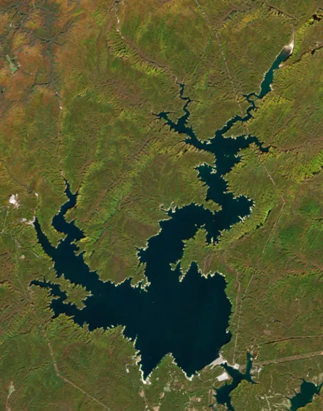
A reservoir on the Keowee in Pickens County, South Carolina, held back by Jocassee Main Dam since 1973.

Lake Jocassee is at 83.52 ft on its local gauge — 16.48 ft below full pond (local datum), as of Nov 19, 2026, 5:00 AM EST. It has risen 0.40 ft in the past 7 days.
Lake Jocassee is up 0.40 ft over the last 7 days, at 83.52 ft today.
Daily values from the NOAA National Water Prediction Service.
Lake Jocassee is down 0.68 ft over the last 30 days, at 83.52 ft today.
Daily values from the NOAA National Water Prediction Service. Why lake levels rise and fall
Solunar periods for Lake Jocassee, local time. How they work
Not detected · as of Nov 9, 2026
The satellite found no cyanobacteria at the surface.
Week of Aug 16Week of Nov 1
Each bar is one week, colored by the worst reading of that week.
From the U.S. EPA's Cyanobacteria Assessment Network (CyAN), which reads the color of lakes from the Sentinel-3 satellites; it sees open water only, not coves or the shoreline. Blooms can be patchy: what you see on the water matters more. Swimming closures and health advisories come from South Carolina health and environment agencies. How to read it
Surface water temperature
65°F on Nov 16, 2026
80°F · Aug 1265°F · Nov 16
15°F cooler than on Aug 12, 2026.
Estimated from Landsat 8/9 (USGS) passes on clear days: the top layer of the water, a few degrees either way. Coves and the shallows can be warmer.
Lake Jocassee water temperature: trend, swimming and the fish →
On or near the shore of Lake Jocassee: 4 boat ramps, 1 rental outfit, 2 campgrounds, 1 beach and 3 trails. The lake has about 89 miles of shoreline, counting its islands.
Tap an icon for details; use two fingers (or Ctrl + scroll) to move the map. Tap a dot for details. Map and lake outline © OpenStreetMap contributors. Places from OpenStreetMap, Overture Maps and Recreation.gov. Not for navigation.
What you’ll find on the shore
← AllBoating 4
← AllRentals & tours 3
← AllBeaches 1
← AllCamping 2
← AllLodging 4
← AllTrails 3
← AllParks 2
No aquatic invasive species are on record for Lake Jocassee in the USGS database. Keep it that way: clean, drain and dry your boat between lakes.
South Carolina: South Carolina has no clean-drain-dry law for boats, but it is illegal to possess hydrilla, water hyacinth and other listed aquatic plants or put them in state waters, so strip off all plant fragments. Officials urge boaters to clean, drain and dry before moving to another lake. State rules
Records: USGS Nonindigenous Aquatic Species database. A species not listed may still be present.
Species with open-licensed records inside Lake Jocassee's outline, from GBIF.org (surveys, museum collections and angler reports). A record shows a fish was found here, not how many there are now.
Channel edges and river arms; best after dark in summer, and after a rain.
Rocky points, gravel and current breaks; deeper rock piles in summer.
Rocky shorelines and riprap at night in late winter; deep weed edges and humps in summer.
Cool water: near the surface in spring and fall, deep in summer.
Clear water and steep rock; they often suspend deeper than largemouth.
Water temperature sets off each spawn; the bars show the usual months at this latitude and elevation, and move with a warm or cold spring. The water is about 65°F now.
Lake Jocassee is a deep, cold reservoir in the Blue Ridge Mountains of upstate South Carolina, shared by Oconee and Pickens counties. Duke Energy filled it in 1973 as part of a pumped-storage power project. It is known for clear water, waterfalls that drop straight into the lake, and trout and bass that hold several state records.
Before the dam this was the Jocassee Valley, part of the Cherokee homeland. Keowee Town, the capital of the Lower Cherokee, stood just south of where the dam is now. Most of the gorges were ceded in a 1785 treaty, and settlers began receiving land grants in 1791. The name comes from a Cherokee legend about a young woman named Jocassee whose lover, from the rival Green Bird people, was killed. She is said to have walked out over the water to meet his ghost, and the name is usually translated as Place of the Lost One. Through much of the 1900s timber companies owned and logged the land. In 1963 Duke Power began buying the land through a subsidiary, and on January 2, 1965, it announced the Keowee-Toxaway Project, which created both Lake Keowee and Lake Jocassee. Work started in 1967. The rising water covered homes, camps and the old Attakulla Lodge, which now sits about 300 feet down, along with the Mount Carmel Baptist Church cemetery, where a scene from the 1972 film Deliverance was shot before the valley flooded.
Four rivers feed the lake: the Whitewater, Thompson, Horsepasture and Toxaway. All of them fall off the Blue Ridge Escarpment through steep gorges, which is why the water stays cool and clear all year. At the southeast corner, the Jocassee Hydro Station separates Jocassee from Lake Keowee below it. As a pumped-storage plant, it can send water down to Keowee to make power when demand is high and pump it back up when demand is low. A second pumped-storage station, Bad Creek, sits on the lake near the Whitewater River and began generating in 1991. Duke Energy and the state own nearly all the land around the shore and have kept it undeveloped. In 1998 and 1999 South Carolina and The Conservation Fund bought about 32,000 acres of the surrounding Jocassee Gorges, which the state now manages as public land for hunting and wildlife. The gorges are the home ground of the Oconee bell, a rare wildflower that the French botanist Andre Michaux recorded in 1788 where the Toxaway and Whitewater rivers met, a spot now under the lake.
Devils Fork State Park holds the only public access to the lake, with four boat ramps. Boaters pay the park's daily admission to launch, and boats may not be left at the docks for more than an hour. Several waterfalls on the lake, including Laurel Fork Falls, Mill Creek Falls, Wright Fork Falls and Moondance Falls, can be reached only by water. The park also has boat-in campsites, villas and the 1-mile Oconee Bell Nature Trail, where the flowers bloom from mid-March to early April. Swimming is allowed but there are no lifeguards or roped areas, and the clear water draws scuba divers. Any boat with a motor must be registered with the South Carolina Department of Natural Resources.
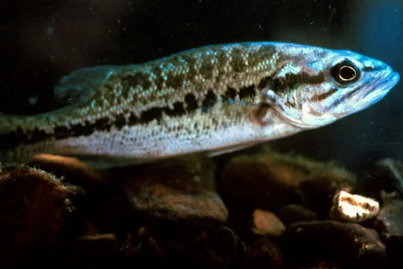
The fishing is unusual for the state. The park calls Jocassee the only South Carolina lake with both trophy trout and smallmouth bass. The state records for brown trout, at 17 pounds 9.5 ounces in 1987, and rainbow trout, at 11 pounds 5 ounces in 1993, both came from here, as did the records for smallmouth, spotted and redeye bass, all caught in 2001. White bass, largemouth, bluegill and black crappie round out the catch.
Written by Lake by Lake from South Carolina Department of Natural Resources (Lake Jocassee, Jocassee Gorges Management Plan: Introduction, Freshwater Game Fish Records for South Carolina), South Carolina State Parks, Discover South Carolina and Wikipedia. Checked November 2026.
Jocassee Main Dam is a rockfill dam 385 feet high and 1,800 feet long on the Keowee, completed in 1973. It belongs to Duke Energy and is run for hydropower. At its normal level the reservoir holds 1.16 million acre-ft, drained from 147 square miles of land.
From the National Inventory of Dams (U.S. Army Corps of Engineers), NID ID SC00529. Lake or reservoir: what’s the difference?
Where the level comes from: Seneca River at Jocassee Dam (NOAA National Water Prediction Service).
| Lake | Miles | Level (ft) | vs full | 7 days |
|---|---|---|---|---|
| Lake Keowee Slightly below full | 11 | 95.64* | −4.36 | −1.03 |
| Table Rock Reservoir Live reading | 16 | 1241.51 | — | −0.29 |
| Wolf Creek Lake Below full | 19 | 91.09* | −8.91 | −0.78 |
| Lake Glenville Below full | 21 | 91.10* | −8.90 | −0.45 |
| Bear Creek Lake Slightly below full | 21 | 95.64* | −4.36 | −1.08 |
| Tuckasegee Lake At or near full pool | 23 | 100.24* | +0.24 | +0.69 |
* Local gauge datum: 100 ft = full pond (Duke Energy lakes).
Compare Lake Jocassee with Lake Keowee, Table Rock Reservoir, Wolf Creek Lake or Lake Glenville: size, level, ramps and fish side by side.
Lake Jocassee is at 83.52 ft on its local gauge — 16.48 ft below full pond (local datum), as of Nov 19, 2026, 5:00 AM EST. It has risen 0.40 ft in the past 7 days.
Lake Jocassee's full pond (local datum) is 100 ft (local datum), according to Duke Energy local datum: 100 ft = full pond. Today the lake is 16.48 ft below that mark.
Lake Jocassee has 4 boat ramps on our map, including Double Springs (Devils Fork 1), Main Boat Ramp (Jocassee 1), Roundhouse Point (Devils Fork 2). Low water can close ramps, so check today's level above and the operator before you go.
Yes. There are 2 campgrounds and RV parks within about a mile of the shore, such as Double Springs Campground, Lake Jocassee SC, Devils Fork State Park Campground.
Game fish recorded in Lake Jocassee include channel catfish, smallmouth bass, walleye, rainbow trout, spotted bass, brown trout. In all, 19 fish species have open records inside the lake on GBIF.
The surface of Lake Jocassee was about 65°F on November 16, estimated from a satellite pass on a clear day. It is the top layer of the water, a few degrees either way; coves and shallows run warmer in the sun.
Anglers 16 and older need a South Carolina fishing license, sold online by the South Carolina Department of Natural Resources. Free fishing days: Memorial Day and July 4 (residents, freshwater only). Size and bag limits can be set lake by lake: check the current regulations.
NOAA's flood categories for the Lake Jocassee gauge: action stage at 100.0 ft, minor flooding at 102.0 ft, moderate flooding at 105.0 ft and major flooding at 110.0 ft. Today the lake is 18.48 ft below the first flooding level.
Lake Jocassee averages about 153 ft deep. Depth changes with the lake level.
In summer a white Secchi disk lowered into Lake Jocassee stays visible to about 17.6 ft (the median of 86 readings, 2017–2026, by South Carolina Department of Environmental Services and EPA National Aquatic Resources Survey (NARS)): very clear water. With the algae measured too (chlorophyll about 2 µg/L), that makes it oligotrophic: clear, low in nutrients. Clarity drops after storms and during algae blooms.
boating (4 boat ramps), kayaks, boats & jet skis (1 rental outfit on or near the water), boat tours (2 boat tours and charters), fishing (11 game fish), swimming (1 beach or swimming area) and hiking & walking (3 trails along the shore, the longest Canebrake Trail (5.2 mi)), according to our map of the shore.
EPA's CyAN satellite rated cyanobacteria in Lake Jocassee not detected on November 9. The satellite sees open water only; blooms can be patchy, so avoid water that looks like spilled paint or pea soup and keep dogs out of scum. Swimming advisories come from South Carolina health and environment agencies.
Yes. 3 trails run along or near the shore, including Foothills Trail, Canebrake Trail (5.2 mi) and Oconee Bell Trail Loop (1.1 mi), according to OpenStreetMap.
Lake Jocassee is held back by Jocassee Main Dam, completed in 1973 and 385 ft high, according to the National Inventory of Dams.
From the NOAA National Water Prediction Service (Seneca River at Jocassee Dam). Lake by Lake checks it every hour; the agency's own figure is always the reference, and provisional readings can be revised.
Lake levels are refreshed every hour. Texas and California reservoirs report once a day; most USGS and NOAA gauges report every 15 to 60 minutes.
Cookies for analytics With your OK we use Google Analytics and Microsoft Clarity to count visits and see how the site is used, so we can make it better. No advertising cookies. Privacy policy