Sun
- Sunrise
- 7:14 AM
- Sunset
- 5:23 PM
- First light
- 6:47 AM
- Last light
- 5:51 PM
Reservoir · Jefferson County, Tennessee
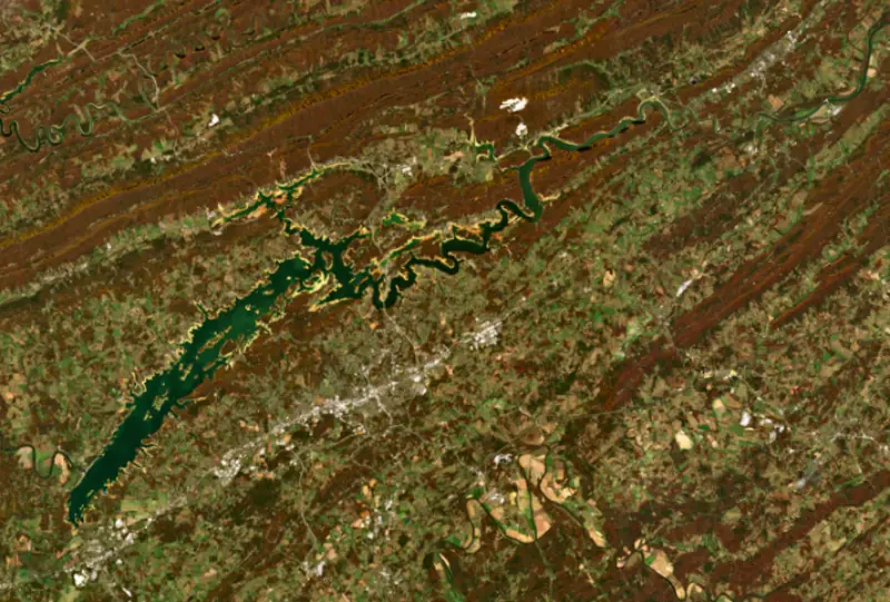
A reservoir on the Holston River in Jefferson County, Tennessee, held back by Cherokee Dam since 1941.

Cherokee Lake is at 1,046.94 feet above sea level — 24.06 ft below summer pool, as of Nov 19, 2026, 1:00 AM EST. It has dropped 1.34 ft in the past 7 days.
2nd lowest of 23 Tennessee lakes today against full pool · See the ranking
A notification from this browser, once, when the level crosses the line (checked every hour). No account and no email. On an iPhone, add Lake by Lake to your home screen first (Share → Add to Home Screen) and open it from there. Or follow the lake in a feed reader: RSS feed.
Cherokee Lake is down 1.34 ft over the last 7 days, at 1,046.94 ft today.
Daily values from the NOAA National Water Prediction Service.
Cherokee Lake is down 6.32 ft over the last 30 days, at 1,046.94 ft today.
Daily values from the NOAA National Water Prediction Service. Why lake levels rise and fall
Solunar periods for Cherokee Lake, local time. How they work
High · as of Nov 9, 2026
The satellite sees a likely bloom on part of the lake. Avoid discolored water and scum, and keep dogs out of it. About 398,000 cells/mL at the worst spot, covering 7% of the lake.
Week of Aug 16Week of Nov 1
Each bar is one week, colored by the worst reading of that week.
From the U.S. EPA's Cyanobacteria Assessment Network (CyAN), which reads the color of lakes from the Sentinel-3 satellites; it sees open water only, not coves or the shoreline. Blooms can be patchy: what you see on the water matters more. Swimming closures and health advisories come from Tennessee health and environment agencies. How to read it
Surface water temperature
59°F on Nov 16, 2026
82°F · Jul 2759°F · Nov 16
22°F cooler than on Jul 27, 2026.
Estimated from Landsat 8/9 (USGS) passes on clear days: the top layer of the water, a few degrees either way. Coves and the shallows can be warmer.
Cherokee Lake water temperature: trend, swimming and the fish →
On or near the shore of Cherokee Lake: 39 boat ramps, 9 marinas, 2 rental outfits, 29 campgrounds, 1 fishing pier, 1 trail and 1 fishing guide. The lake has about 373 miles of shoreline, counting its islands.
Tap an icon for details; use two fingers (or Ctrl + scroll) to move the map. Tap a dot for details. Map and lake outline © OpenStreetMap contributors. Places from OpenStreetMap, Overture Maps and Recreation.gov. Not for navigation.
What you’ll find on the shore
← AllBoating 48
← AllRentals & tours 2
← AllFishing spots 6
← AllCamping 29
← AllLodging 16
← AllTrails 1
← AllParks 8
← AllDining 13
Zebra mussels have been found in Cherokee Lake. They clog intakes and engines and spread on boats and trailers: clean, drain and dry everything before you go to another lake.
Tennessee: Tennessee has no statewide clean-drain-dry law; TWRA urges you to remove plants, animals and mud, drain all water, and dry the boat for five days (or hot-wash it) before moving to another lake. Moving live invasive carp is illegal. State rules
Records: USGS Nonindigenous Aquatic Species database. A species not listed may still be present.
Species with open-licensed records inside Cherokee Lake's outline, from GBIF.org (surveys, museum collections and angler reports). A record shows a fish was found here, not how many there are now.
Shallow, protected flats in spring; docks, grass and deep edges in summer heat.
Channel edges and river arms; best after dark in summer, and after a rain.
Rocky points, gravel and current breaks; deeper rock piles in summer.
Run up the river arms in spring; follow shad to cool, deep water near the dam in summer.
Clear water and steep rock; they often suspend deeper than largemouth.
Water temperature sets off each spawn; the bars show the usual months at this latitude and elevation, and move with a warm or cold spring. The water is about 59°F now.
Cherokee Lake is a Tennessee Valley Authority reservoir on the Holston River in East Tennessee, northeast of Knoxville, reaching up the valley through Jefferson, Grainger, Hamblen and Hawkins counties. TVA built it in a hurry on the eve of World War II to make power for the war effort, and today it is one of the most popular fishing lakes in the region.
The dam site, a shale ridge across the Holston Valley known then as Mossy Creek, was not part of TVA's original plan for the Tennessee River system. It had been surveyed only as a backup. When war broke out in Europe, Congress began looking for new sources of power for defense plants, and in June 1940 TVA proposed a hydroelectric dam at Mossy Creek. Congress authorized it on July 31, 1940, and work started the next day. The dam was closed and the reservoir began filling on December 5, 1941, two days before Pearl Harbor. The first generator went into service on April 16, 1942. During the war Cherokee supplied power to the Alcoa aluminum plant and the Manhattan Project plants at Oak Ridge. The dam has no navigation lock, though it was designed so one could be added, and the project, with its streamlined Moderne powerhouse, is listed on the National Register of Historic Places. The dam and lake take their name from the Cherokee people, who once lived in this country.
The reservoir took 45,158 acres of land and displaced 875 families, 550 of them farm families, some on land held for generations. The village of Bean Station, at the crossing of U.S. 11W and 25E, had 195 families, and many of them moved their roadside businesses out to the new highway routes. TVA and the state rebuilt about 100 miles of highway and 14 bridges, and 1,827 graves were moved from 51 cemeteries. The towns around the lake today include Jefferson City, about 3 miles south of the dam, along with Morristown, Bean Station and Rogersville. Panther Creek State Park sits on the shore, and TVA's own campground, picnic area and boat ramp near the dam were finished after the war.
Like TVA's other tributary reservoirs, Cherokee is lowered in fall and winter to make room for floodwater during the December-to-April flood season, then held back in spring so it can refill for summer. The swing is large, and in winter wide bands of bare red clay show along the shore.
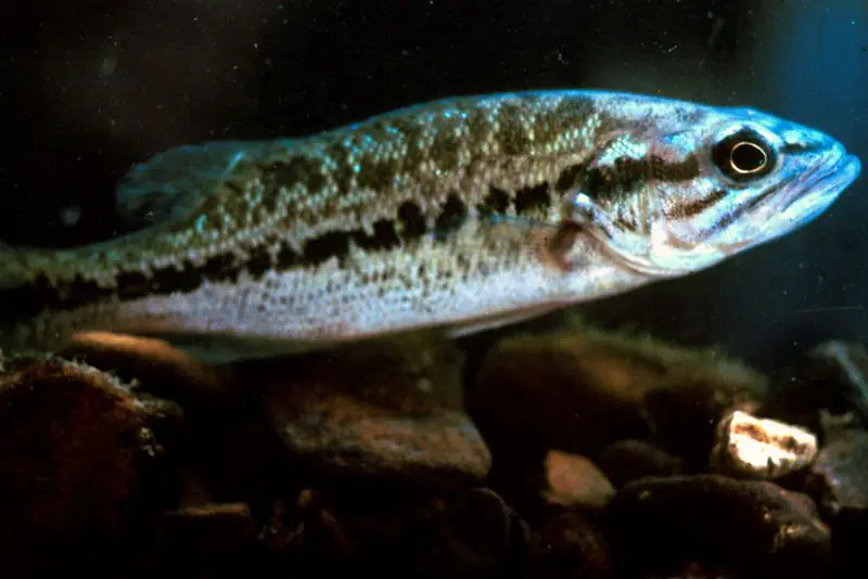
Cherokee holds black bass, crappie, sauger, walleye and sunfish, and it is known for a dense fish population. Bassmaster ranked it among the top 25 bass lakes in the Southeast in 2019, and it hosted a Bassmaster Eastern Open in October 2020. The lake is also stocked with striped bass and hybrid striped bass. Stripers struggle in the warm summer water, and for years the biggest fish got through by gathering around the lines TVA uses to pump oxygen into the reservoir so the water released through the dam meets its standards. That cool, oxygen-rich pocket was never the goal, but it became the key summer refuge for large stripers. In 2025 the Tennessee Wildlife Resources Agency warned that TVA's plan to replace the oxygen lines with new turbine technology would remove that refuge and likely raise summer losses of big stripers, while stocking of both fish continued unchanged.
Written by Lake by Lake from National Park Service, National Register of Historic Places, The Living New Deal, Tennessee Wildlife Resources Agency (via Hellbender Press), Southern Fishing News (Tennessee Valley Authority) and Wikipedia. Checked November 2026.
Cherokee Dam is a concrete dam 122 feet high and 6,760 feet long on the Holston River, completed in 1941. It belongs to the Tennessee Valley Authority and is run for flood control, navigation, recreation, hydropower and water supply. At its normal level the reservoir holds 1.42 million acre-ft, drained from 3,428 square miles of land.
From the National Inventory of Dams (U.S. Army Corps of Engineers), NID ID TN08903. Lake or reservoir: what’s the difference?
Where the level comes from: Holston River above Cherokee Dam (NOAA National Water Prediction Service).
| Lake | Miles | Level (ft) | vs full | 7 days |
|---|---|---|---|---|
| Douglas Lake Well below full | 14 | 960.48 | −33.52 | −2.10 |
| Norris Lake Well below full | 34 | 1001.02 | −18.98 | −0.56 |
| Martins Fork Lake Below full | 42 | 1302.44 | −7.56 | −0.74 |
| Melton Hill Lake At or near full pool | 49 | 793.89 | −0.61 | −0.11 |
| Fort Loudoun Lake Slightly below full | 49 | 809.76 | −3.24 | −0.97 |
| Fontana Lake Well below full | 52 | 1659.70 | −43.30 | −3.20 |
Compare Cherokee Lake with Douglas Lake, Norris Lake, Martins Fork Lake or Melton Hill Lake: size, level, ramps and fish side by side.
Cherokee Lake is about 29 mi from Knoxville, TN. See all the lakes near each city.
Cherokee Lake is at 1,046.94 feet above sea level — 24.06 ft below summer pool, as of Nov 19, 2026, 1:00 AM EST. It has dropped 1.34 ft in the past 7 days.
Cherokee Lake's summer pool is 1,071.00 ft, according to Tennessee Valley Authority. Today the lake is 24.06 ft below that mark.
Cherokee Lake has 39 boat ramps on our map, including Boat ramp at Black Oak Marina, Boat ramp at Cedar Hill Boat Dock, Boat ramp at Lakeshore Marina, and 9 marinas. Low water can close ramps, so check today's level above and the operator before you go.
Yes. There are 29 campgrounds and RV parks within about a mile of the shore, such as Cherokee Dam Park, Webb's Lakefront Campground, May Springs.
Game fish recorded in Cherokee Lake include smallmouth bass, bluegill, channel catfish, spotted bass, largemouth bass, striped bass. In all, 40 fish species have open records inside the lake on GBIF.
The surface of Cherokee Lake was about 59°F on November 16, estimated from a satellite pass on a clear day. It is the top layer of the water, a few degrees either way; coves and shallows run warmer in the sun.
Anglers 13 and older need a Tennessee fishing license, sold online by the Tennessee Wildlife Resources Agency. Free fishing days: Free Fishing Day, one Saturday in June; children 15 and under fish free that whole week. Size and bag limits can be set lake by lake: check the current regulations.
Cherokee Lake averages about 48 ft deep. Depth changes with the lake level.
boating (39 boat ramps and 9 marinas), kayaks, boats & jet skis (2 rental outfits on or near the water), fishing (13 game fish, 1 fishing pier or spot and 1 fishing guide), hiking & walking (1 trail along the shore, the longest Point Lookout Loop Trail (1.7 mi)), camping (29 campgrounds) and cabins & lodging (16 places to stay close to the water), according to our map of the shore.
EPA's CyAN satellite rated cyanobacteria in Cherokee Lake high on November 9. The satellite sees open water only; blooms can be patchy, so avoid water that looks like spilled paint or pea soup and keep dogs out of scum. Swimming advisories come from Tennessee health and environment agencies.
Yes. A trail runs along or near the shore, including Point Lookout Loop Trail (1.7 mi), according to OpenStreetMap.
Cherokee Lake is held back by Cherokee Dam, completed in 1941 and 122 ft high, according to the National Inventory of Dams.
From the NOAA National Water Prediction Service (Holston River above Cherokee Dam). Lake by Lake checks it every hour; the agency's own figure is always the reference, and provisional readings can be revised.
Lake levels are refreshed every hour. Texas and California reservoirs report once a day; most USGS and NOAA gauges report every 15 to 60 minutes.
Cookies for analytics With your OK we use Google Analytics and Microsoft Clarity to count visits and see how the site is used, so we can make it better. No advertising cookies. Privacy policy