Sun
- Sunrise
- 7:09 AM
- Sunset
- 5:17 PM
- First light
- 6:42 AM
- Last light
- 5:45 PM
Reservoir · Carter County, Tennessee
A reservoir on the Watauga River in Carter County, Tennessee, held back by Watauga Dam since 1948.

Watauga Lake is at 1,947.80 feet above sea level — 11.20 ft below summer pool, as of Nov 19, 2026, 2:00 AM EST. It has dropped 0.29 ft in the past 7 days.
9th lowest of 23 Tennessee lakes today against full pool · See the ranking
A notification from this browser, once, when the level crosses the line (checked every hour). No account and no email. On an iPhone, add Lake by Lake to your home screen first (Share → Add to Home Screen) and open it from there. Or follow the lake in a feed reader: RSS feed.
Watauga Lake is down 0.29 ft over the last 7 days, at 1,947.80 ft today.
Daily values from the NOAA National Water Prediction Service.
Watauga Lake is down 1.36 ft over the last 30 days, at 1,947.80 ft today.
Daily values from the NOAA National Water Prediction Service. Why lake levels rise and fall
Solunar periods for Watauga Lake, local time. How they work
Not detected · as of Nov 9, 2026
The satellite found no cyanobacteria at the surface.
Week of Aug 16Week of Nov 1
Each bar is one week, colored by the worst reading of that week.
From the U.S. EPA's Cyanobacteria Assessment Network (CyAN), which reads the color of lakes from the Sentinel-3 satellites; it sees open water only, not coves or the shoreline. Blooms can be patchy: what you see on the water matters more. Swimming closures and health advisories come from Tennessee health and environment agencies. How to read it
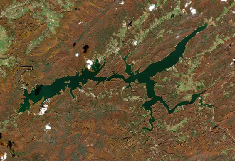
Surface water temperature
58°F on Nov 16, 2026
79°F · Aug 2058°F · Nov 16
21°F cooler than on Aug 20, 2026.
Estimated from Landsat 8/9 (USGS) passes on clear days: the top layer of the water, a few degrees either way. Coves and the shallows can be warmer.
Watauga Lake water temperature: trend, swimming and the fish →
On or near the shore of Watauga Lake: 9 boat ramps, 7 marinas, 11 campgrounds, 1 beach, 1 fishing pier and 3 trails. The lake has about 104 miles of shoreline, counting its islands.
Tap an icon for details; use two fingers (or Ctrl + scroll) to move the map. Tap a dot for details. Map and lake outline © OpenStreetMap contributors. Places from OpenStreetMap, Overture Maps and Recreation.gov. Not for navigation.
What you’ll find on the shore
← AllBoating 16
← AllFishing spots 2
← AllBeaches 1
← AllCamping 11
← AllLodging 7
← AllTrails 3
← AllParks 1
← AllDining 5
No aquatic invasive species are on record for Watauga Lake in the USGS database. Keep it that way: clean, drain and dry your boat between lakes.
Tennessee: Tennessee has no statewide clean-drain-dry law; TWRA urges you to remove plants, animals and mud, drain all water, and dry the boat for five days (or hot-wash it) before moving to another lake. Moving live invasive carp is illegal. State rules
Records: USGS Nonindigenous Aquatic Species database. A species not listed may still be present.
Species with open-licensed records inside Watauga Lake's outline, from GBIF.org (surveys, museum collections and angler reports). A record shows a fish was found here, not how many there are now.
Rocky points, gravel and current breaks; deeper rock piles in summer.
Rocky shorelines, boulders and docks; the same cover smallmouth bass use.
Water temperature sets off each spawn; the bars show the usual months at this latitude and elevation, and move with a warm or cold spring. The water is about 58°F now.
Watauga Lake is a Tennessee Valley Authority reservoir in the mountains of northeast Tennessee, spread across Carter and Johnson counties east of Elizabethton. At full pool it sits higher than any other lake in the TVA system. More than half of its shore lies in the Cherokee National Forest, so most of it is wooded ridge rather than houses and docks.
The river takes its name from the Watauga Old Fields, a Cherokee settlement near present-day Elizabethton. In 1940 the Watauga flooded around Elizabethton with heavy loss of life and property, and people in the valley pushed hard for a TVA dam. With war plants hungry for power, Congress funded the project even though the President and TVA itself had advised against starting it. Construction began on February 16, 1942, but that October the War Production Board ruled it not essential to the war, and crews shut the site down in December. Work resumed on July 22, 1946, the first time TVA's dam program returned to construction after the war. At its peak about 1,400 workers were employed here and at nearby Wilbur Dam. The dam was closed and the lake began filling on December 1, 1948, and the two generators went into service in August and September 1949. It is built mostly of earth and rock, with a morning-glory spillway, and it was added to the National Register of Historic Places in 2017.
TVA bought 11,700 acres and moved 761 families. Many of them farmed, but 60 percent of the households also had someone working in the factories of Bristol, Kingsport or Elizabethton, and land here cost TVA more per acre than at any of its earlier projects. The biggest loss was Butler, a trade town of about 600 people with a post office, Masonic lodge, schools, stores and doctors' offices. TVA bought every parcel in town, the first time it had purchased a whole incorporated town, and the state dissolved Butler by act of the legislature. Most residents moved on their own, while a few founded a new planned community called Carderview, named for the Reverend M. H. Carder. A new Butler grew up on higher ground and is now the closest town, about 5 miles upstream from the dam. Crews also moved 1,281 graves and rebuilt nearly 55 miles of roads, with three new bridges across the reservoir.
The Appalachian Trail crosses the top of Watauga Dam and follows the northwestern side of the lake through the Big Laurel Branch Wilderness, where it is the only trail. The Pond Mountain Wilderness lies to the south. The Forest Service runs Cardens Bluff Campground on a peninsula above the water, the Shook Branch swim area and the Rat Branch boat launch, and so much public land means plenty of room for bank fishing. As a tributary reservoir, it holds back winter and spring rain to protect towns downstream, and the level usually moves about 9 feet over a year.
The water is notably clean. Its best-known fish are smallmouth bass, walleye and trout, and the state manages it to improve its bass, lake trout and crappie fishing. Below the dam, the Watauga River is popular for rafting, kayaking and trout fishing.
Written by Lake by Lake from National Park Service, National Register of Historic Places, Recreation.gov, Tennessee Department of Tourist Development and Wikipedia (Watauga Dam, Watauga Lake). Checked November 2026.
Watauga Dam is a rockfill dam 332 feet high and 900 feet long on the Watauga River, completed in 1948. It belongs to the Tennessee Valley Authority and is run for flood control, recreation, hydropower and water supply. At its normal level the reservoir holds 569,121 acre-ft, drained from 468 square miles of land.
From the National Inventory of Dams (U.S. Army Corps of Engineers), NID ID TN01903. Lake or reservoir: what’s the difference?
Where the level comes from: Watauga River above Watauga Dam (NOAA National Water Prediction Service).
| Lake | Miles | Level (ft) | vs full | 7 days |
|---|---|---|---|---|
| South Holston Lake Well below full | 14 | 1709.96 | −19.04 | −1.01 |
| Boone Lake Below full | 19 | 1368.05 | −14.20 | −1.89 |
| Fort Patrick Henry Lake At or near full pool | 25 | 1261.24 | −0.76 | +0.01 |
| Lake James Slightly below full | 43 | 96.73* | −3.27 | −0.27 |
| W. Kerr Scott Reservoir At or near full pool | 52 | 1030.29 | +0.29 | −0.39 |
| Lake Rhodhiss Slightly below full | 54 | 97.26* | −2.74 | +0.35 |
* Local gauge datum: 100 ft = full pond (Duke Energy lakes).
Compare Watauga Lake with South Holston Lake, Boone Lake, Fort Patrick Henry Lake or Lake James: size, level, ramps and fish side by side.
Watauga Lake is at 1,947.80 feet above sea level — 11.20 ft below summer pool, as of Nov 19, 2026, 2:00 AM EST. It has dropped 0.29 ft in the past 7 days.
Watauga Lake's summer pool is 1,959.00 ft, according to Tennessee Valley Authority. Today the lake is 11.20 ft below that mark.
Watauga Lake has 9 boat ramps on our map, including Butler Ramp, Little Milligan Boat Ramp, Watauga Dam Boat Ramp, and 7 marinas. Low water can close ramps, so check today's level above and the operator before you go.
Yes. There are 11 campgrounds and RV parks within about a mile of the shore, such as Camp Watauga, Still Waters - Watauga Lake Cabins, Bayview Family Campground and Marina.
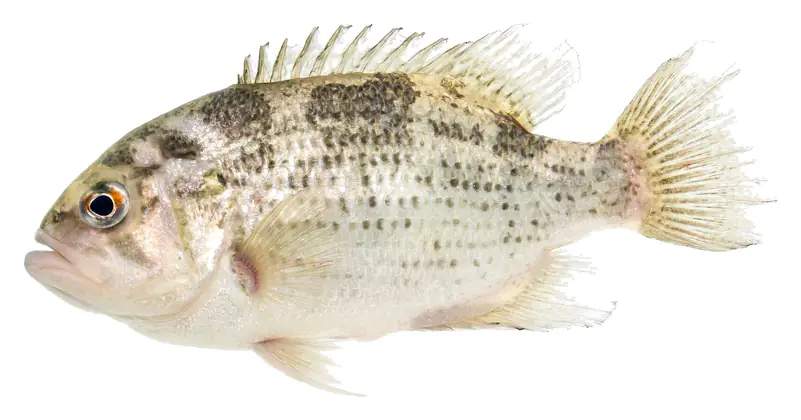
Game fish recorded in Watauga Lake include smallmouth bass, rock bass. In all, 19 fish species have open records inside the lake on GBIF.
The surface of Watauga Lake was about 58°F on November 16, estimated from a satellite pass on a clear day. It is the top layer of the water, a few degrees either way; coves and shallows run warmer in the sun.
Anglers 13 and older need a Tennessee fishing license, sold online by the Tennessee Wildlife Resources Agency. Free fishing days: Free Fishing Day, one Saturday in June; children 15 and under fish free that whole week. Size and bag limits can be set lake by lake: check the current regulations.
Watauga Lake averages about 88 ft deep. Depth changes with the lake level.
boating (9 boat ramps and 7 marinas), fishing (2 game fish and 1 fishing pier or spot), swimming (1 beach or swimming area), hiking & walking (3 trails along the shore, the longest Old Homestead Trail (1.4 mi)), camping (11 campgrounds, 2 bookable on Recreation.gov) and cabins & lodging (7 places to stay close to the water), according to our map of the shore.
EPA's CyAN satellite rated cyanobacteria in Watauga Lake not detected on November 9. The satellite sees open water only; blooms can be patchy, so avoid water that looks like spilled paint or pea soup and keep dogs out of scum. Swimming advisories come from Tennessee health and environment agencies.
Yes. 3 trails run along or near the shore, including Appalachian Trail, Cardens Bluff Trail (0.9 mi) and Old Homestead Trail (1.4 mi), according to OpenStreetMap.
Watauga Lake is held back by Watauga Dam, completed in 1948 and 332 ft high, according to the National Inventory of Dams.
From the NOAA National Water Prediction Service (Watauga River above Watauga Dam). Lake by Lake checks it every hour; the agency's own figure is always the reference, and provisional readings can be revised.
Lake levels are refreshed every hour. Texas and California reservoirs report once a day; most USGS and NOAA gauges report every 15 to 60 minutes.
Cookies for analytics With your OK we use Google Analytics and Microsoft Clarity to count visits and see how the site is used, so we can make it better. No advertising cookies. Privacy policy